Search “poorest cities in Laos” and you hit a wall fast: Laos barely has cities. Vientiane, the capital, holds maybe 700,000 people. After that the numbers fall off a cliff. So the honest answer to the question isn’t a list of cities at all. It’s a list of districts and provinces, where poverty in Laos actually concentrates, and the data is sharper than most overview articles let on.
The clearest picture comes from the 2015 Population and Housing Census poverty map produced by the Lao Statistics Bureau. It measured poverty district by district across the country. That’s the source worth trusting here, and it’s the one most listicles skip.
Table of Contents
- The short version
- A note on “cities” vs. districts
- The poorest districts in Laos, ranked
- The richest contrast: Vientiane
- Why these places are poor
- The national picture
- What this means if you’re traveling
The short version
If you want the bottom line without scrolling: the poorest places in Laos are rural, mountainous districts in the south and east — Toumlan in Saravan province tops the list, with roughly 73% of people living below the national poverty line. The poverty clusters in highland areas dominated by ethnic-minority farming communities, far from the Mekong corridor where the money is. Vientiane’s wealthiest district sits around 5%. That’s a fifteen-fold gap inside one small country.
A note on “cities” vs. districts
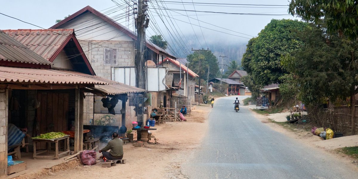
Laos is one of the least urbanized countries in Southeast Asia. The administrative unit that actually matters here is the muang, the district, and above it the province. When people abroad picture a poor Lao “city,” they’re usually picturing what is, on the ground, a district capital — a small market town surrounded by villages and rice paddies.
So this list is built the way the census is built: by district and province. It’s the only framing that maps onto real data instead of a Google query that doesn’t fit the country.
The poorest districts in Laos, ranked
These figures come from the Lao Statistics Bureau’s 2015 census poverty map, which measured the share of each district’s population living below the national poverty line.
| Rank | District | Province | Share below poverty line |
|---|---|---|---|
| 1 | Toumlan | Saravan | ~73% |
| 2 | Xaychamphone | Borikhamxay | ~64% |
| 3 | Xepon | Savannakhet | high (60%+) |
| 4 | Highland districts | Sekong | among the highest provincial rates |
| 5 | Highland districts | Phongsaly | among the highest provincial rates |
A few things jump out. Toumlan, in southern Saravan province, is the poorest single district in the country — nearly three out of four residents fall below the poverty line. It’s remote, mountainous, and almost entirely agricultural.
Xaychamphone in Borikhamxay, in central Laos, runs around 64%. Xepon in Savannakhet sits along the old Ho Chi Minh Trail near the Vietnamese border, an area that carries a specific, brutal legacy you’ll see explained below.
At the provincial level, the poorest provinces cluster in two zones: the far north (Phongsaly, Houaphanh) and the southern highlands (Sekong, Saravan, Attapeu). Open Development Mekong and the underlying census data both put these provinces consistently at the top of the poverty rankings, year after year.
The richest contrast: Vientiane
To see how steep the gap is, look at the other end. Chanthabouly, a central district of the capital Vientiane, registers a poverty rate near 5%. It’s where the government ministries, embassies, and most of the formal economy sit.
The wealth in Laos hugs the Mekong River. Vientiane, Savannakhet town, Pakse, Luang Prabang — the places with roads, electricity, tourism, and trade with Thailand and Vietnam. Step away from the river and into the hills, and the economy thins out to subsistence farming within a few hours’ drive.
Why these places are poor
The poverty here isn’t random. Four forces show up again and again in the poorest districts.
Unexploded ordnance. Laos is the most heavily bombed country per capita in history. Between 1964 and 1973, the U.S. dropped over two million tons of ordnance, much of it cluster bombs. The HALO Trust and other clearance organizations estimate that up to a third of those submunitions failed to detonate. Districts like Xepon along the eastern border are still riddled with UXO, which makes farmland dangerous to work and discourages investment decades later.
Agriculture dependence. The poorest districts run on subsistence rice and livestock. One bad harvest, one flood, one drought, and a household has no buffer. There’s little wage work to fall back on.
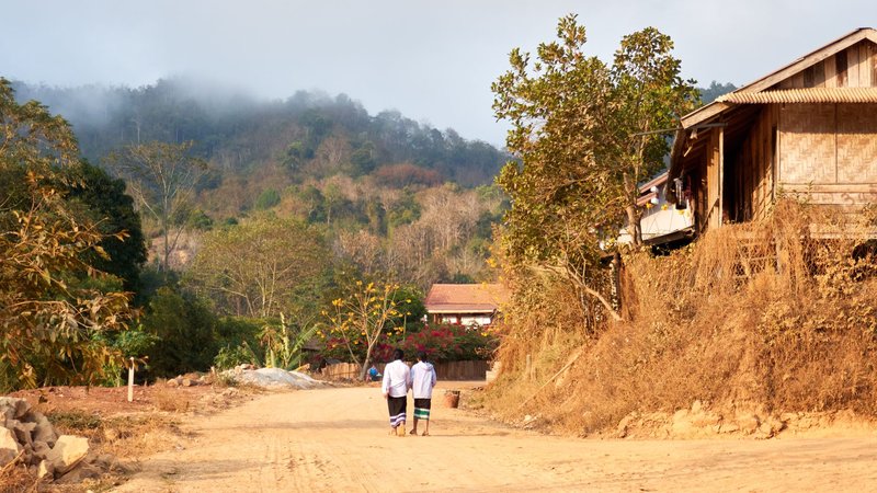
Highland geography. Poverty in Laos correlates almost perfectly with elevation and distance from the Mekong. Mountains mean no roads, no roads mean no markets, no markets mean no cash economy. The highland districts are simply harder and more expensive to reach.
Ethnic minority concentration. The upland districts are home to many of Laos’s ethnic-minority groups — Hmong, Khmu, and others — who have historically had less access to Lao-language education, government services, and the lowland economy. The poverty map and the ethnic map of Laos overlap closely.
The national picture
Zoom out and the country’s overall poverty rate runs around 23% nationally, down sharply from the 1990s — real progress, driven mostly by growth along the Mekong corridor and Chinese-financed infrastructure like the Vientiane–Boten railway.
But that headline number hides the spread. A national average of 23% that contains a 5% district and a 73% district isn’t really describing anyone’s life. The averaging is exactly why the district-level map matters: it’s where the gap becomes visible. Laos also remains one of the lower-income countries in the region, with GDP per capita well below neighboring Thailand and Vietnam.
What this means if you’re traveling
If you’re researching Laos for a trip, the poorest districts aren’t places you’d typically pass through, and that’s part of the point — they’re remote by definition. The southern provinces around Saravan, Sekong, and Attapeu (the “Bolaven Plateau loop” runs through this zone) are some of the most rewarding and least-visited parts of the country precisely because they’re underdeveloped.
Two practical notes. First, if you wander off main roads in eastern districts like Xepon, the UXO risk is real — stick to marked paths and don’t pick anything metal up. Second, tourism is one of the few cash sources that reaches these areas directly, so eating and sleeping at locally-run places does more good here than almost anywhere else in Southeast Asia.
The “poorest cities in Laos” don’t exist as cities. But the poorest places are knowable, mappable, and explainable — and the gap between Toumlan and Vientiane tells you more about Laos than any single national statistic ever could.