Equatorial Guinea doesn’t have rivers full of lakes. What it has are volcanoes, and volcanoes leave behind craters, and craters fill with water. Almost every lake worth your time here sits inside an old eruption — a circle of cloud forest or jungle wrapped around still, dark water that most travelers never see.
There are four that matter. Two on Bioko, the island where the capital Malabo sits. Two on Annobón, a speck of volcanic rock 350 kilometers out in the Atlantic that ranks among the hardest places to reach on the continent. None of them has a snack bar or a parking lot. Getting to the best of them means hours in the trees with a guide.
Here’s where each one is, how it formed, what you’ll see, and exactly how hard it is to stand on the rim.
Table of Contents
- The lakes at a glance
- Lake Biao (Lago Moka) — Bioko
- Lake Loreto — Bioko
- Lago á Pot — Annobón
- Lake Mazafim — Annobón
- How to actually get there
- What to bring
The lakes at a glance {#at-a-glance}
| Lake | Island | Type | Reaching it | Swimming |
|---|---|---|---|---|
| Lake Biao (Moka) | Bioko | Caldera lake | 3-hr forest trek from Moka, or to the viewpoint | Not really — it’s a crater pool, guides discourage it |
| Lake Loreto | Bioko | Maar (explosion crater) | 30–40 min walk | Yes, outside rainy season |
| Lago á Pot | Annobón | Central crater lake | Short jungle hike from San Antonio de Palé | Yes |
| Lake Mazafim | Annobón | Crater lake | Hiking trail | Calm, swimmable |
Two things jump out. The Bioko lakes sit high — over a kilometer up, in permanent cloud forest. The Annobón lakes sit low on a tiny island you’ll have to fight to get to. The trade-off is access for solitude: Loreto is the easy one, Annobón’s pair are the prizes for people who don’t mind that the cargo flight runs maybe twice a month.
Lake Biao (Lago Moka) — Bioko {#lake-biao}
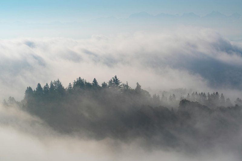
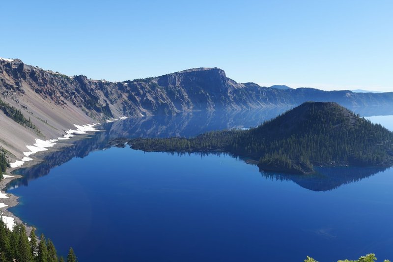
This is the famous one, and the one people mean when they talk about the crater lake on Bioko. It fills a caldera in the south of the island, ringed by the green amphitheater of the Moca Valley, and it’s deep — soundings put it around 18.5 meters, sitting high in the southern highlands at roughly 1,750 meters. The water is dark and flat, the kind of surface that mirrors the forest wall above it because almost nothing disturbs it.
You start in Moka, a small highland town that doubles as the base for the Bioko Biodiversity Protection Program, the conservation outfit that’s run research here for over two decades. From the town it’s roughly three hours of jungle walking to reach the lake itself — steady climbing through cloud forest, often wet, frequently muddy. Many visitors stop at the Mirador del Lago Biao, the viewpoint on the rim, which gives you the full crater from above without the final descent.
The forest is the point as much as the water. This is prime territory for Bioko’s endemic birds — you’ll likely hear turacos and blue plantain-eaters before you see them, and palm-nut vultures work the ridges. Little egrets and dabchicks patrol the shallows. Monkeys move through the canopy; Bioko has one of the densest primate communities in Central Africa, which is exactly why the conservation station sits where it does. Swimming isn’t the move here. Guides treat it as a crater pool to look at, not a swimming hole, and the water is cold.
Lake Loreto — Bioko {#lake-loreto}
If Biao is the full-day commitment, Loreto is the lake you can fit into a morning. It sits closer to the center of Bioko and fills what’s almost certainly a maar — an explosion crater blasted out by a single violent steam-driven eruption rather than a slow collapse. A limnological study of Biao and Loreto measured Loreto at about 82 meters deep, which is startling for its modest surface size. That’s a narrow, deep funnel of water — a hole punched into the island.
The walk in is short, 30 to 40 minutes from the trailhead, which makes Loreto the most realistic lake for a traveler who isn’t building their whole trip around hiking. The reward at the top is the classic crater view: a ring of forest dropping straight to the waterline. Outside the rainy season the air clears and people camp on the rim or swim. During the heavy rains the cloud sits low and you can lose the view entirely, so timing matters more here than at most places.
Lago á Pot — Annobón {#lago-a-pot}
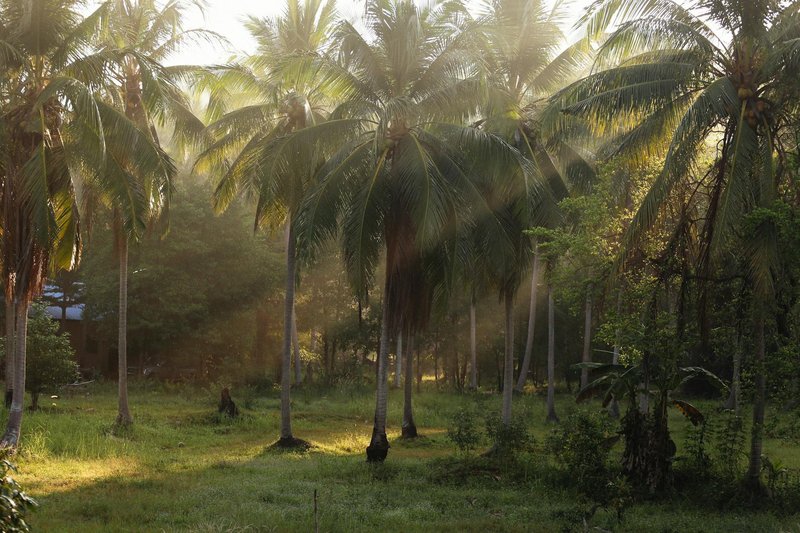
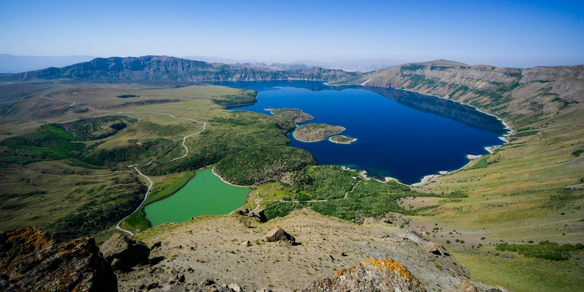
Now the lakes get genuinely remote. Annobón is a volcanic island in the Gulf of Guinea, part of the Cameroon Volcanic Line chain that runs from the mainland out into the Atlantic. The whole island is the eroded body of a dormant stratovolcano, Mount Quioveo, topping out near 600 meters. Lago á Pot — “Pot Lake” in the island’s Portuguese-creole tongue — sits in the central crater of that volcano, jungle pressing right to the shore.
This is the island’s signature sight, and it earns it. The lake fills the heart of the crater, walled by thick tropical forest, with a stillness that the remoteness only amplifies. You reach it on foot from San Antonio de Palé, the island’s only real town, on a hike through dense interior bush — not long, but humid and overgrown. Unlike the Bioko lakes, Lago á Pot is genuinely swimmable, and given the heat you’ll want to. Annobón gets so few outside visitors that on most days the lake is yours alone.
The catch is the island itself. Annobón is one of the least-visited corners of an already rarely-visited country, served irregularly by a small plane and by ship. People who make it here describe a place where Portuguese creole is still the daily language — a curiosity in a nation that is otherwise the only Spanish-speaking country in Africa — and where the outside world feels very far away.
Lake Mazafim — Annobón {#lake-mazafim}
Annobón’s second crater lake is smaller and quieter, sitting in its own extinct volcanic crater roughly 600 meters long and 400 wide. Lake Mazafim doesn’t have Lago á Pot’s drama, but it has the same ingredients in miniature: still water in a bowl of green, reachable on a walking trail, calm enough to swim.
Realistically, if you’ve gone to the enormous trouble of reaching Annobón, you do both lakes — they’re close, and the island is small enough to cross. Mazafim is the gentler bookend to á Pot’s centerpiece, the kind of place you sit beside for an hour because there’s genuinely nowhere you need to be. On an island this isolated, that’s the whole appeal.
How to actually get there {#getting-there}
Bioko (Biao and Loreto): Fly into Malabo, the capital. The lakes are a drive south into the highlands — Moka is the hub for Biao, and you arrange a guide there. Going with a guide isn’t a nicety; the trails through cloud forest are unmarked and the weather turns fast. Many travelers fold the lakes into a wider Bioko trip that includes Pico Basile, the island’s 3,011-meter volcano and the country’s high point.
Annobón (á Pot and Mazafim): This is the hard part. Annobón is reached by an irregular flight from Malabo (sometimes via the mainland) or by sea, and schedules are not reliable — build in buffer days. Distances are short once you arrive, since Equatorial Guinea is one of the smallest countries in Africa by area, but the isolation of this particular island is the real obstacle. You’ll also need the right paperwork; Equatorial Guinea’s entry requirements are strict, so check your government’s current travel advice, such as the U.S. State Department’s Equatorial Guinea page, well before you go.
The dry season — broadly the cooler, less-rainy stretch of the year — gives you the clearest crater views and the most reliable trail conditions. The rainy months bury the high Bioko lakes in cloud.
What to bring {#what-to-bring}
- Real hiking shoes with grip. The Biao trail is three hours of slick forest floor. Trainers won’t cut it.
- Rain shell and a dry bag. Cloud forest means you’ll get wet even on a “clear” day.
- A guide arranged in advance. Especially for Biao and anything on Annobón.
- Cash in local currency (CFA franc). Card infrastructure is thin to nonexistent outside Malabo.
- Water and snacks. There’s nothing to buy at any of these lakes.
- Patience for Annobón. Treat the flight schedule as a suggestion and your trip will go much better.
The lakes of Equatorial Guinea aren’t a checklist you knock out in an afternoon. They’re four volcanic craters scattered across two islands, two of them genuinely difficult to reach. But that difficulty is the reason they look the way they do — quiet, forested, almost entirely yours. Start with Loreto if you want the easy win. Save Annobón’s Lago á Pot for when you’ve got the time, the patience, and the willingness to wait on a plane that runs when it runs.
Sources: