Suriname sits on the northeastern coast of South America, where rivers and rainforest shape how people and goods move around the country. Air travel links the capital, regional towns and remote river communities, making local airstrips important for everyday life, tourism and cargo.
There are exactly 25 Airports in Suriname, ranging from Albina to Zorg en Hoop. For each entry I list IATA/ICAO, Location (city) / Coordinates (lat, lon), and Runway & service — you’ll find below.
Which airports handle regular commercial flights in Suriname?
Most scheduled international and domestic services operate through Paramaribo’s main airport (the country’s primary international gateway); smaller regional airstrips and bush fields handle domestic, charter and cargo flights, so check current airline schedules and local operators for up-to-date service information.
How should I use the IATA/ICAO, coordinates and runway info in the list?
Use the IATA/ICAO codes to identify airports quickly, coordinates to map or plug into navigation tools, and runway & service notes to assess aircraft suitability and available ground services for trip planning or logistical decisions.
Airports in Suriname
| Name | IATA/ICAO | Location (city) / Coordinates (lat, lon) | Runway & service |
|---|---|---|---|
| Johan Adolf Pengel Intl | PBM/SMJP | Zanderij / 5.452, -55.188 | Asphalt; 3,480 m; International carriers like KLM, Surinam Airways, Copa. |
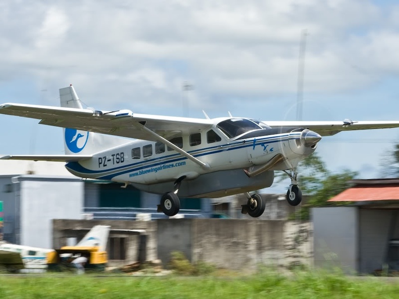
| Zorg en Hoop | ORG/SMZO | Paramaribo / 5.811, -55.191 | Asphalt; 650 m; Main domestic hub for Gum Air, Blue Wing. |
| Albina | ABN/SMBN | Albina / 5.498, -54.053 | Laterite; 650 m; Domestic charter service. |
| Botopasi | BTO/SMBO | Botopasi / 4.225, -55.450 | Grass; 500 m; Domestic charter service. |
| Coeroeni | -/SMCI | Coeroeni / 3.364, -57.341 | Grass; 1,200 m; Military and charter use. |
| Cottica | -/SMCT | Lantiwei / 4.416, -54.887 | Grass; 600 m; Domestic charter service. |
| Djoemoe | DOE/SMDJ | Djoemoe / 4.013, -55.698 | Grass; 550 m; Domestic charter service. |
| Drietabbetje | DRJ/SMDA | Drietabbetje / 4.108, -54.673 | Laterite; 650 m; Domestic charter service. |
| Gakaba | -/SMGA | Gakaba / 4.516, -54.750 | Grass; 470 m; Domestic charter service. |
| Godo Olo | GDO/SMDO | Godo Olo / 4.172, -55.279 | Grass; 600 m; Domestic charter service. |
| Kabalebo | -/SMKA | Kabalebo Nature Resort / 4.398, -57.433 | Laterite; 1,500 m; Tourist charter flights. |
| Kayser | -/SMKE | Kayser Gebergte / 3.167, -56.483 | Laterite; 1,000 m; Remote charter flights. |
| Kwamalasamutu | -/SMSM | Kwamalasamutu / 2.355, -56.786 | Laterite; 1,250 m; Domestic charter service. |
| Laduani | -/SMLD | Laduani / 4.230, -55.773 | Grass; 520 m; Domestic charter service. |
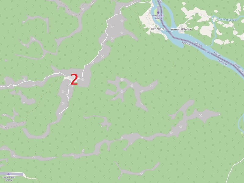
| Lawa Antino | -/SMAN | Benzdorp / 3.733, -54.167 | Grass; 600 m; Domestic charter service. |
| Lawa Tabiki | -/SMTB | Lawa Tabiki / 3.700, -54.100 | Grass; 500 m; Domestic charter service. |
| Moengo | MOJ/SMMO | Moengo / 5.617, -54.400 | Laterite; 670 m; Domestic charter service. |
| Nieuw Nickerie | ICK/SMNI | Nieuw Nickerie / 5.922, -56.985 | Asphalt; 600 m; Limited or no scheduled service. |
| Paloemeu | OEM/SMVE | Paloemeu / 3.350, -55.441 | Laterite; 1,200 m; Domestic charter service. |
| Poesoegroenoe | -/SMPG | Poesoegroenoe / 4.267, -55.800 | Grass; 610 m; Domestic charter service. |
| Sipaliwini | -/SMSI | Sipaliwini Savanna / 2.033, -56.117 | Laterite; 1,000 m; Remote charter flights. |
| Stoelmans Eiland | -/SMST | Stoelmans Eiland / 4.350, -54.483 | Laterite; 670 m; Domestic charter service. |
| Tafelberg | -/SMTBG | Tafelberg Nature Reserve / 3.917, -56.167 | Laterite; 850 m; Tourist and research charters. |
| Totness | TOT/SMTO | Totness / 5.874, -56.324 | Grass; 800 m; No scheduled service. |
| Wageningen | AGI/SMWA | Wageningen / 5.767, -56.650 | Asphalt; 1,200 m; Mostly inactive; charters possible. |
Images and Descriptions

Johan Adolf Pengel Intl
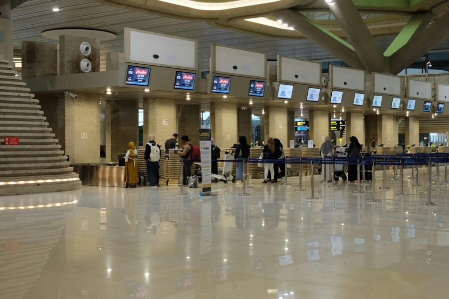
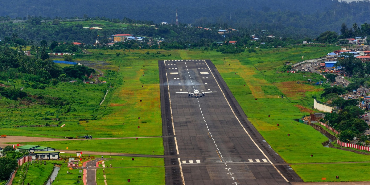
Serves as Suriname’s main international airport near Paramaribo. Hosts scheduled international and domestic flights and full airport services. Features a long paved runway for jet aircraft and customs and immigration facilities.
Zorg en Hoop
Operates as Paramaribo’s city airport within the capital. Handles domestic flights, charters, and general aviation. Uses a short paved runway and links the city to many interior airstrips.
Albina
Sits on the Marowijne River at the border with French Guiana. Functions as a regional airstrip with scheduled small-aircraft service. Uses a short paved or compacted surface for local connections.
Botopasi
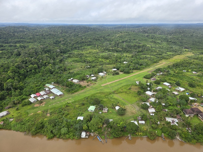
Serves the Botopasi village on the Upper Suriname River. Operates as an unpaved interior airstrip for charters and tourist transfers. Provides essential access to riverside lodges and communities.
Coeroeni
Forms a remote airstrip in southern Suriname near the Coeroeni area. Functions for supply flights, medevacs, and charter traffic. Uses a basic unpaved runway for small planes.
Cottica
Acts as a small local airstrip near the Cottica River. Supports charters, community transport, and occasional medevac flights. Uses an unpaved surface suited to light aircraft.
Djoemoe
Serves a small community with a basic grass or dirt runway. Functions for charter flights, medical evacuations, and cargo drops. Provides vital access where road links are limited.
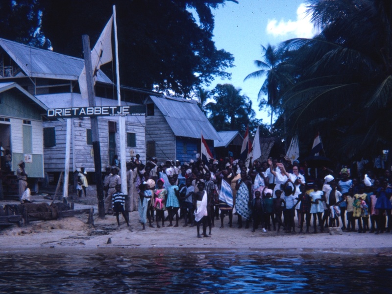
Drietabbetje
Sits near the Marowijne River in eastern Suriname. Operates as a regional airstrip used by scheduled small planes and charters. Uses a short unpaved runway for cross-border and river-town access.

Gakaba
Forms a remote interior airstrip with a grass or dirt runway. Serves small charter operators and local communities. Supports tourism and supply flights into the interior.
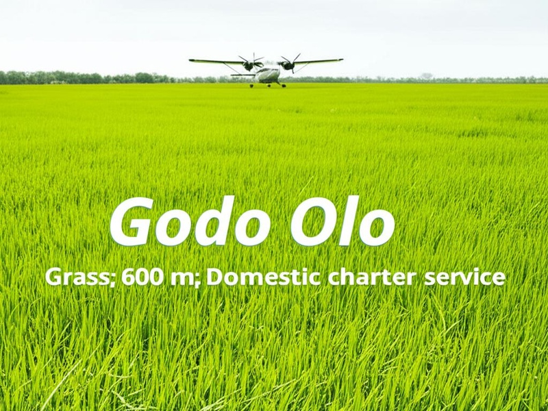
Godo Olo
Serves an indigenous community with a small unpaved runway. Handles light aircraft for passenger service, cargo, and medevacs. Provides essential links to larger towns.
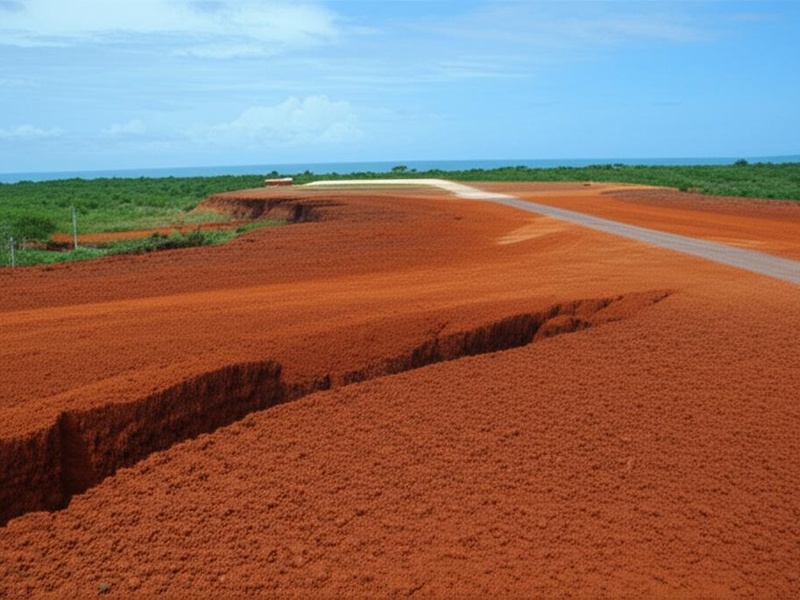
Kabalebo
Operates as an airstrip in the west interior near the Kabalebo River. Supports charter flights and occasional larger turboprops on a compacted or grass runway. Historically used for mining and expeditions.
Kayser
Serves a remote mountain or mining area with a short unpaved runway. Handles small charter planes and supply flights. Provides access to isolated camps and sites.

Kwamalasamutu
Serves the Kwamalasamutu village in southern Suriname near Brazil. Operates as an unpaved community airstrip for passengers and cargo. Acts as a lifeline for supplies and health services.
Laduani
Forms a small interior airstrip used by charters and river communities. Uses an unpaved runway suitable for light aircraft. Supports tourism to nearby lodges.
Lawa Antino
Sits on the Lawa River near gold-mining activity. Operates as a basic unpaved airstrip for miners and local travel. Provides access where river travel is slow or seasonal.
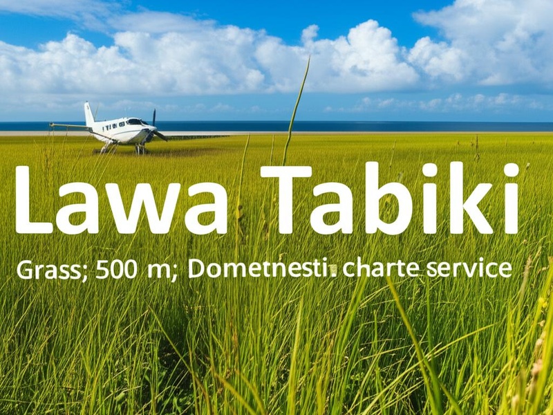
Lawa Tabiki
Serves as a tiny island airstrip on the Lawa River. Uses a very short grass runway for light aircraft. Offers quick river-border access and local transport.
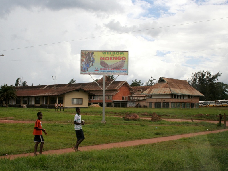
Moengo
Serves the town of Moengo with a small airstrip. Handles regional charters and occasional scheduled flights. Uses a short paved or compacted surface for local connections.
Nieuw Nickerie
Acts as the main airport for Nieuw Nickerie in western Suriname. Provides scheduled domestic flights and general aviation services. Features a paved runway and serves the rice-growing region and border traffic.
Paloemeu
Serves the Palumeu village near the Central Suriname Nature Reserve. Operates as an unpaved airstrip used by tourists, researchers, and local residents. Acts as the main gateway to remote jungle lodges.
Poesoegroenoe
Serves a central Suriname community with scheduled regional flights. Operates on an unpaved runway for small turboprops. Provides regular links to Paramaribo and other interior posts.
Sipaliwini
Forms a remote airstrip in the Sipaliwini Savanna region. Handles supply flights, scientific teams, and charter traffic. Uses a basic unpaved surface and connects scattered settlements.
Stoelmans Eiland
Sits on Stoelmanseiland at the river confluence in the south-east. Operates as a short unpaved runway serving regional flights and river transport. Acts as a local hub for nearby interior communities.
Tafelberg
Serves the area around Tafelberg mountain and tableland. Functions as an unpaved strip for tourism, research, and occasional emergency use. Provides access to remote upland nature sites.
Totness
Operates as a small airstrip near Totness in the Coronie district. Supports local charters, agricultural operations, and light cargo. Uses a short grass or paved surface for regional travel.
Wageningen
Serves the Wageningen area in the Nickerie district near the coast. Functions as a small airstrip for agricultural flights and local charters. Provides quick access to the rice belt and nearby towns.