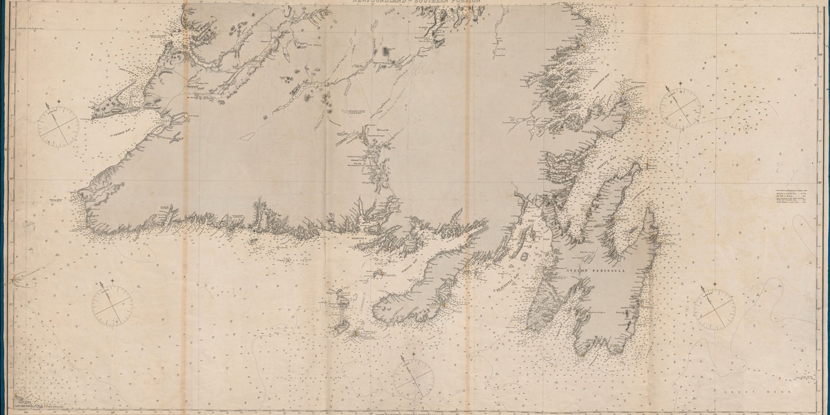
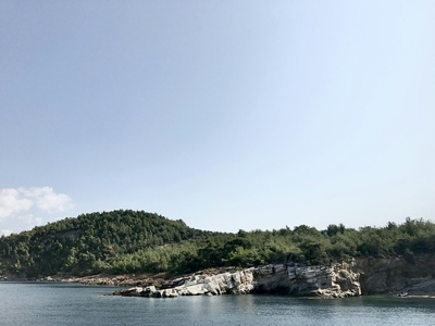
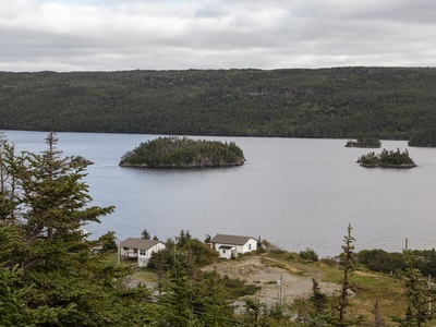
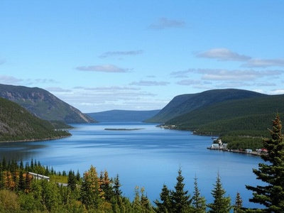
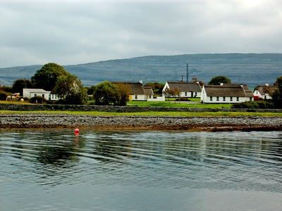
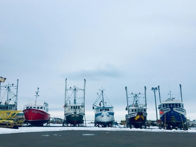
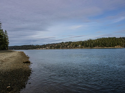
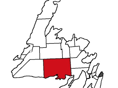
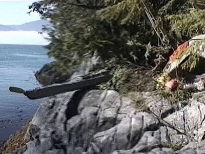
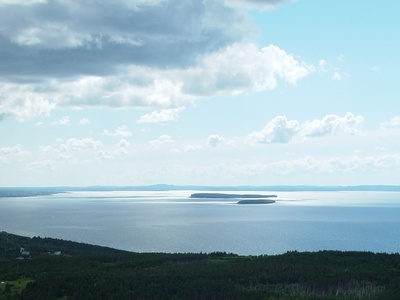
Newfoundland’s coastline is a patchwork of rocky headlands, sheltered inlets and small harbors that have shaped communities and wildlife for generations. The bays here mark fishing grounds, scenic drives and quiet spots for birdwatching, making them useful reference points whether you’re researching or planning a visit.
There are 40 Bays in Newfoundland, ranging from Badger Bay to White Bear Bay. For each bay, Coordinates (lat, long °),Region,Nearby towns (max 15 words) are provided so you can map locations, compare regions and check local access—you’ll find them below.
How can I use the coordinates and nearby towns to plan a trip?
Use the coordinates to drop pins on a map and the nearby towns field to judge where services, launch points or accommodations are located; combine that with regional info for weather and road access before you go.
Are all bays accessible by road or do some require a boat?
Accessibility varies: many bays have road access or nearby settlements, while others are remote and easier to reach by boat or on foot—check the nearby towns and regional notes to determine likely access and plan accordingly.
Bays in Newfoundland
| Name | Coordinates (lat, long °) | Region | Nearby towns (max 15 words) |
|---|---|---|---|
| Trinity Bay | 48.012°N, 53.487°W | Avalon Peninsula / Eastern Newfoundland | Trinity, Bonavista, Heart’s Content, Dildo, New Harbour |
| Conception Bay | 47.733°N, 53.112°W | Avalon Peninsula | St. John’s, Conception Bay South, Carbonear, Bay Roberts, Bell Island |
| Bonavista Bay | 48.691°N, 53.535°W | Bonavista Peninsula / Eastern Newfoundland | Bonavista, Glovertown, Gambo, Greenspond |
| Notre Dame Bay | 49.623°N, 54.755°W | Central Newfoundland | Twillingate, Fogo Island, Lewisporte, Change Islands |
| White Bay | 50.155°N, 56.577°W | Great Northern Peninsula | Baie Verte, Englee, Jackson’s Arm, Sops Arm |
| Bay of Islands | 49.124°N, 58.241°W | West Coast | Corner Brook, Lark Harbour, York Harbour, Cox’s Cove |
| St. George’s Bay | 48.336°N, 58.821°W | West Coast | Stephenville, Port au Port, St. George’s, Cape St. George |
| Placentia Bay | 47.388°N, 54.498°W | Avalon Peninsula / Burin Peninsula | Placentia, Marystown, Burin, Argentia, Come By Chance |
| Fortune Bay | 47.375°N, 55.534°W | South Coast / Burin Peninsula | Fortune, Grand Bank, St. Jacques-Coombs Cove, Harbour Breton |
| St. Mary’s Bay | 46.901°N, 53.693°W | Avalon Peninsula | St. Vincent’s, St. Mary’s, Riverhead, Gaskiers |
| Bay d’Espoir | 47.747°N, 56.021°W | South Coast | St. Alban’s, Conne River, Milltown-Head of Bay d’Espoir |
| Hermitage Bay | 47.589°N, 56.103°W | South Coast | Hermitage-Sandyville, Gaultois, McCallum |
| Bonne Bay | 49.512°N, 57.899°W | West Coast | Woody Point, Trout River, Norris Point, Rocky Harbour |
| Hare Bay | 51.311°N, 55.702°W | Great Northern Peninsula | Main Brook, St. Anthony, St. Lunaire-Griquet |
| Pistolet Bay | 51.523°N, 55.855°W | Great Northern Peninsula | Raleigh, St. Lunaire-Griquet |
| Canada Bay | 50.718°N, 56.143°W | Great Northern Peninsula | Englee, Roddickton-Bide Arm |
| Baie Verte | 49.957°N, 56.183°W | Baie Verte Peninsula | Baie Verte, Fleur de Lys |
| Green Bay | 49.635°N, 56.039°W | Central Newfoundland | Springdale, King’s Point, Triton, Pilley’s Island |
| Bay of Exploits | 49.387°N, 55.071°W | Central Newfoundland | Botwood, Norris Arm, Leading Tickles, Cottlesville |
| Gander Bay | 49.344°N, 54.432°W | Central Newfoundland | Gander Bay South, Victoria Cove, Clarke’s Head |
| Trepassey Bay | 46.702°N, 53.344°W | Avalon Peninsula | Trepassey, Biscay Bay |
| Bay de Verde | 48.109°N, 52.902°W | Avalon Peninsula | Bay de Verde, Old Perlican, Grates Cove |
| Spaniard’s Bay | 47.625°N, 53.189°W | Avalon Peninsula | Spaniard’s Bay, Bay Roberts, Harbour Grace |
| Mortier Bay | 47.195°N, 55.083°W | Burin Peninsula | Marystown, Creston North |
| Badger Bay | 49.522°N, 55.671°W | Central Newfoundland | Triton, Brighton, Pilley’s Island |
| Hall’s Bay | 49.508°N, 56.079°W | Central Newfoundland | Springdale, South Brook |
| Freshwater Bay | 47.531°N, 52.684°W | Avalon Peninsula | St. John’s, Cape Spear |
| Blackhead Bay | 47.675°N, 52.705°W | Avalon Peninsula | Blackhead, St. John’s, Cape Spear |
| Bay Roberts | 47.601°N, 53.242°W | Avalon Peninsula | Bay Roberts, Spaniard’s Bay, Port de Grave |
| White Bear Bay | 47.749°N, 57.311°W | South Coast | Grey River (via boat) |
| Grey River Bay | 47.585°N, 57.101°W | South Coast | Grey River |
| La Hune Bay | 47.561°N, 56.845°W | South Coast | La Hune (resettled) |
| Burin Bay | 47.042°N, 55.158°W | Burin Peninsula | Burin, Epworth |
| Clode Sound | 48.495°N, 53.901°W | Bonavista Peninsula | Port Blandford, Charlottetown, Bunyan’s Cove |
| Random Sound | 48.163°N, 53.744°W | Eastern Newfoundland | Clarenville, Hickman’s Harbour, Elliott’s Cove |
| Smith Sound | 48.175°N, 53.511°W | Eastern Newfoundland | Trinity East, Port Rexton, Champney’s West |
| Holyrood Bay | 47.411°N, 53.125°W | Avalon Peninsula | Holyrood, Harbour Main |
| Great St. Lawrence Harbour | 46.918°N, 55.377°W | Burin Peninsula | St. Lawrence |
| Come By Chance Bay | 47.818°N, 54.024°W | Isthmus of Avalon | Come By Chance, Sunnyside |
| Long Harbour | 47.447°N, 53.844°W | Avalon Peninsula | Long Harbour-Mount Arlington Heights |
Images and Descriptions
Trinity Bay
One of Newfoundland’s largest bays, famous for its historic towns like Trinity. It’s a prime destination for whale watching, iceberg viewing, and exploring classic outport culture along its scenic shoreline.
Conception Bay
A bustling bay bordering the St. John’s metro area, known for Bell Island’s mining history and beautiful coastal communities. Its shores host some of the oldest settlements in North America.
Bonavista Bay
Dotted with countless islands and rugged coastlines, this bay is where John Cabot is said to have landed in 1497. It is home to Terra Nova National Park and excellent puffin viewing.
Notre Dame Bay
Famous as part of “Iceberg Alley,” this vast bay is renowned for its dramatic coastal scenery, hundreds of islands, and exceptional opportunities to see icebergs and migrating whales in late spring and summer.

White Bay
A deep, fjord-like bay that cuts into the Great Northern Peninsula. It is known for its dramatic cliffs, remote communities, and the Baie Verte Peninsula mining district on its eastern shore.
Bay of Islands
A stunning bay on the west coast resembling a Norwegian fjord, with large arms extending deep inland. It’s framed by the Long Range Mountains and is a popular spot for boating and hiking.
St. George’s Bay
A large, crescent-shaped bay on the west coast with many sandy beaches. The unique Port au Port Peninsula, known for its French heritage, forms its western boundary and is a geological marvel.
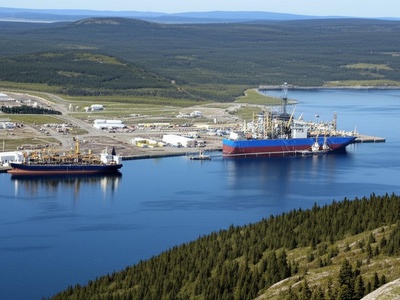
Placentia Bay
A huge, strategically important bay with a rich history of French and English conflict. Today, it is a hub for industry, including the Argentia ferry terminal and the Come By Chance oil refinery.
Fortune Bay
A large bay on the south coast, separating the Burin Peninsula from the main part of the island. It serves as the gateway to the French islands of Saint-Pierre and Miquelon via the ferry from Fortune.
St. Mary’s Bay
Located on the southern Avalon, this bay is famous for the Cape St. Mary’s Ecological Reserve, a seabird colony with thousands of gannets. It is also known for the annual capelin roll on its beaches.
Bay d’Espoir
A long, fjord-like bay system on Newfoundland’s south coast, translating to “Bay of Hope.” It’s home to a major hydroelectric generating station and the Miawpukek First Nation community at Conne River.
Hermitage Bay
A scenic bay on the south coast, known for its deep waters and the isolated, ferry-serviced outports of Gaultois and McCallum. It’s a great example of traditional Newfoundland coastal life.
Bonne Bay
A stunning fjord in the heart of Gros Morne National Park, dividing the park into two sections. Its dramatic cliffs and deep waters offer some of the most spectacular scenery in Eastern Canada.
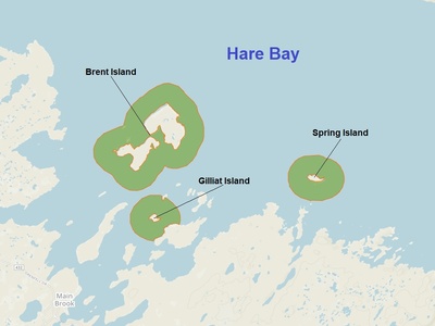
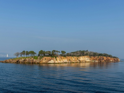
Hare Bay
A large, island-filled bay near the northern tip of the Great Northern Peninsula. It’s close to L’Anse aux Meadows, the only authenticated Norse settlement in North America, making it historically significant.
Pistolet Bay
Situated at the very northern tip of the Great Northern Peninsula, this bay is home to Pistolet Bay Provincial Park. Its subarctic landscape, coastal barrens, and shallow waters make it a unique stop for travelers.
Canada Bay
A significant indentation on the eastern side of the Great Northern Peninsula. It’s known for its historical ties to French fishing fleets and the logging industry that once thrived in the area.
Baie Verte
The namesake bay of the Baie Verte Peninsula, an area rich in mining history for copper, asbestos, and gold. The bay itself provides a sheltered harbour for the region’s main service town.
Green Bay
A large inlet within Notre Dame Bay, home to many picturesque communities. It is a popular area for boating and is known for its giant squid interpretation centre in Glover’s Harbour.
Bay of Exploits
A massive bay fed by the Exploits River, historically the domain of the Beothuk people. Dotted with islands, it was once a vital hub for the pulp and paper industry based in Grand Falls.
Gander Bay
The estuary of the mighty Gander River, one of Newfoundland’s best Atlantic salmon fishing rivers. The bay offers a mix of river and marine environments, attracting anglers and nature lovers from all over.
Trepassey Bay
Located at the southeastern tip of the Avalon Peninsula, this historic bay was the departure point for Amelia Earhart’s transatlantic flight in 1932. It’s often shrouded in fog and has a wild, windswept beauty.
Bay de Verde
Situated at the northern tip of the Bay de Verde Peninsula, this bay is a classic fishing outport. It offers stunning views of the turbulent waters where Trinity and Conception Bays meet the Atlantic Ocean.
Spaniard’s Bay
A well-sheltered bay within Conception Bay, home to the vibrant town of the same name. It’s a place rich in folklore and history, with stories of pirates and early European fishermen.
Mortier Bay
A deep, ice-free harbour on the Burin Peninsula, making it an important industrial site. The bay is home to a major shipyard that has serviced oil rigs and other large marine vessels.
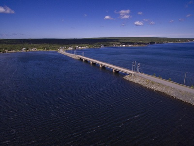
Badger Bay
A large inlet off Notre Dame Bay, characterized by its many islands and sheltered coves. The communities here are connected by a series of causeways and bridges, creating a scenic island-hopping drive.
Hall’s Bay
Located at the western end of Green Bay, this bay is fed by Indian River. It is the service hub for the area, with Springdale on its shores, and a gateway to the region’s hiking trails and rivers.
Freshwater Bay
A scenic bay located just south of the entrance to St. John’s Harbour, near Cape Spear. It’s a popular spot for hikers on the East Coast Trail, offering dramatic cliffside views of the Atlantic Ocean.
Blackhead Bay
A small, picturesque bay on the Avalon’s northeast coast, home to the charming outport of Blackhead. It is a classic stop on the scenic route from St. John’s to Cape Spear, known as “The Cribbies.”
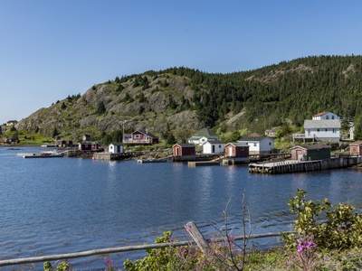
Bay Roberts
A large, well-protected harbour in Conception Bay, central to a populated area. It’s known for its rich fishing heritage, historic cable building, and vibrant community festivals.
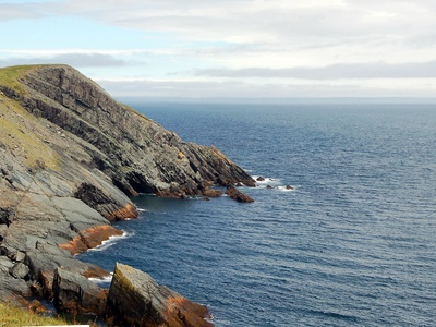
White Bear Bay
A remote and dramatic fjord on the south coast, accessible only by boat. It is known for its towering cliffs, pristine wilderness, and being a prime example of Newfoundland’s untouched natural beauty.
Grey River Bay
The small bay that shelters the isolated outport of Grey River, a community nestled between steep hills and accessible only by ferry. The bay is the heart of this unique and traditional settlement.
La Hune Bay
A stunning, fjord-like bay on the rugged south coast, notable for the now-resettled community of La Hune. It represents the profound beauty and isolation that defined much of outport Newfoundland life.
Burin Bay
Part of the larger Placentia Bay system, this bay provides a sheltered harbour for the historic town of Burin. Its intricate coves and arms were ideal for both legitimate fishing and smuggling in centuries past.
Clode Sound
A long, fjord-like arm of Bonavista Bay that forms the southern boundary of Terra Nova National Park. Its deep, sheltered waters are ideal for boating and kayaking, with stunning views of the boreal forest.
Random Sound
A major inlet between Trinity Bay and Bonavista Bay, almost separating the Bonavista Peninsula from the mainland. The town of Clarenville sits at its westernmost point, making it a regional economic hub.
Smith Sound
An arm of Trinity Bay famous for the Skerwink Trail, which offers breathtaking coastal views. It is also near the historic community of Trinity and is a popular area for hiking, photography, and whale watching.
Holyrood Bay
A prominent bay at the southern end of Conception Bay, known for its beautiful beaches and the Holyrood Thermal Generating Station. It is a popular summer destination for residents of the St. John’s area.

Great St. Lawrence Harbour
A sheltered bay on the southern tip of the Burin Peninsula. It is tragically known for the 1942 shipwreck of two US naval ships, the USS Truxtun and USS Pollux, where local residents rescued many survivors.
Come By Chance Bay
Located in Placentia Bay, this bay is a major industrial harbour, home to the North Atlantic oil refinery. Its name is a point of curiosity, reflecting the unique place names found throughout the island.
Long Harbour
An ice-free, deep-water port in Placentia Bay, making it ideal for year-round industry. It is the site of a major nickel processing plant, representing the modern industrial side of the province.