Indiana’s quiet crossroads and abandoned rail sidings still hold traces of the communities that once kept them alive — storefronts shuttered, cemeteries by overgrown lanes, foundations half-hidden in fields. Exploring these sites is a way to read local history in place rather than page.
There are 68 Ghost Towns in Indiana, ranging from Aboite to Zion. For each entry you’ll find below County,Country,Coordinates (lat, long),Description (30-50 words), so you can scan locations, context and basic directions before planning a visit — you’ll find below.
Are these ghost towns open for visitors?
Some sites are public and easy to access, while others sit on private land or in fragile conditions; always check ownership and local rules, respect posted signs, and avoid entering unsafe structures. Use the provided coordinates as a starting point, but confirm access before you go.
How reliable are the locations and short descriptions?
The coordinates and brief descriptions are drawn from historical records, maps, and field reports and are meant as general guides; accuracy varies by site and some coordinates are approximate, so cross-check with recent maps or local sources if precise navigation is required.
Ghost Towns in Indiana
| Name | County | Country | Coordinates (lat, long) | Description (30-50 words) |
|---|---|---|---|---|
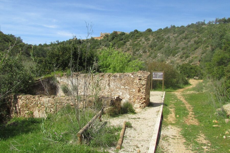
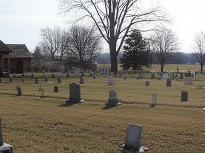
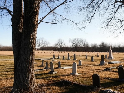
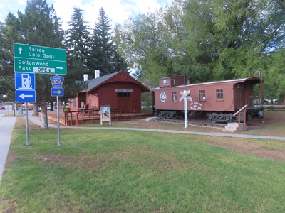
| Hindostan | Martin | US | 38.6212, -86.7642 | Once a bustling county seat of 2,000 people in the 1820s, it was wiped out by a mysterious epidemic and completely abandoned by 1830. Today, only a cemetery and some foundations remain in the Hindostan Falls Public Fishing Area. |
| Elkinsville | Brown | US | 39.0492, -86.3094 | A small community in the hills of Brown County, Elkinsville was abandoned in the early 1960s when the land was acquired for the creation of Monroe Lake. Only a cemetery and submerged foundations remain near the Peninsula Trail. |
| Baltimore | Warren | US | 40.4000, -87.4111 | An ambitious town on the Wabash River, Baltimore was abandoned after the Panic of 1837 and repeated flooding. Today, the overgrown site is marked only by the Baltimore Cemetery, a lonely reminder of the pioneer dream. |
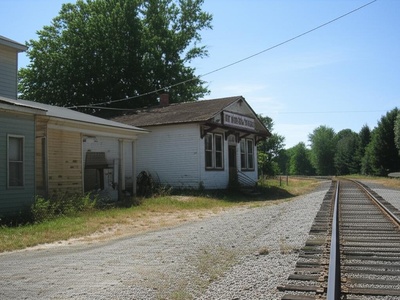
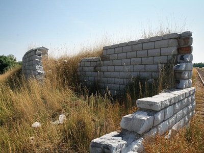
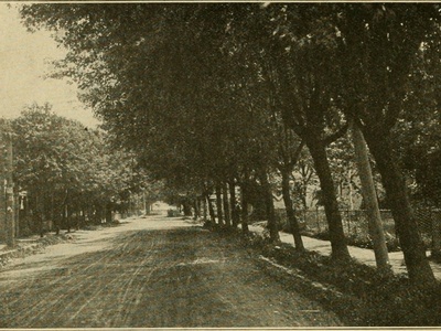
| Alida | LaPorte | US | 41.5298, -86.8203 | A 19th-century railroad town that thrived with a depot, grain elevator, and school. It declined after the railroad consolidated stops and a fire destroyed its businesses. A historic church and a few homes are all that remain. |
| Dunn | Benton | US | 40.5403, -87.4092 | A small grain elevator town established along the railroad in the late 1800s. The community faded away during the 20th century as agriculture became more mechanized and the railroad stop closed. The site is now farmland. |
| Corwin | Tippecanoe | US | 40.5289, -86.7417 | A planned town site that was bypassed by the railroad in the 1850s, sealing its fate. The few families and businesses that had settled there moved away, and the town plat was officially vacated, leaving only farmland. |
| Beaver City | Newton | US | 40.9419, -87.3592 | The first county seat of Newton County, Beaver City was established in 1843. It lost the county seat designation to Kentland in 1860 after a contentious vote, causing its rapid abandonment. Nothing remains of the original town. |
| Brisco | Warren | US | 40.3347, -87.1264 | A small station and settlement along the Peoria and Eastern Railway line. The community, which consisted of a few houses and a general store, faded after the railroad ceased to be a major factor in local life. |
| Barbersville | Jefferson | US | 38.6219, -85.5891 | A small 19th-century village on the Ohio River that was frequently damaged by floods. After the great flood of 1937, most remaining residents left for higher ground, and the town was never rebuilt. |
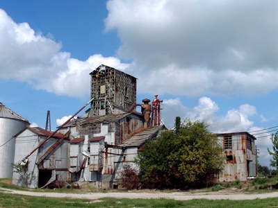
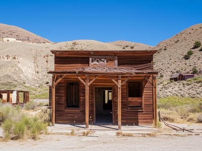
| Mier | Grant | US | 40.5898, -85.7958 | A boomtown during the Indiana Gas Boom of the late 1800s, Mier once had a bank, hotel, and several glass factories. When the gas ran out, the industry left, and the town slowly withered to a few remaining structures. |
| Prairieville | Tipton | US | 40.3542, -86.1308 | Selected as the original county seat of Tipton County, it was abandoned when the seat was moved to the more central location of Canton (now Tipton) in 1844. The site reverted to farmland, with only a historical marker nearby. |
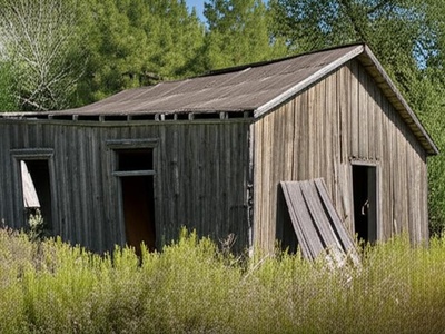
| Dickeyville | Warrick | US | 38.1364, -87.2183 | A coal mining town established in the early 20th century to house miners and their families. The town was abandoned after the local mine closed down in the 1930s, leaving behind only scattered foundations in the woods. |
| Fleener | Monroe | US | 39.1120, -86.5381 | A small community built around the limestone quarries south of Bloomington. It housed workers for the local industry but faded away as the quarries closed or modernized, requiring fewer local workers. A cemetery marks the former location. |
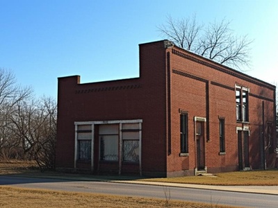
| Granville | Delaware | US | 40.2311, -85.5139 | One of the earliest settlements in Delaware County, this pioneer village on the White River was a rival to Muncie. It declined and was eventually abandoned after losing the county seat contest and being bypassed by transportation routes. |
| Sloan | Warren | US | 40.4853, -87.5217 | A small village that grew up around a stop on the Chicago and Eastern Illinois Railroad. It featured a grain elevator and a general store but declined throughout the 20th century, and now only a few foundations remain. |
| Yeddo | Fountain | US | 40.1656, -87.3614 | A small village platted in 1837 that once had a post office, stores, and a church. It slowly declined after being bypassed by the railroad, and by the mid-20th century, little remained besides a cemetery. |
| Springville | LaPorte | US | 41.6706, -86.8181 | Not to be confused with the town in Lawrence County, this Springville was an early rival to LaPorte for the county seat. After losing the vote, its importance waned, and the settlement was eventually abandoned. |
| Standish | Knox | US | 38.8284, -87.2803 | A coal mining camp that was active in the early 20th century. Like many single-industry towns, once the mine became unprofitable and closed, the workers moved on, and the settlement was quickly abandoned. |
| Mollie | Blackford | US | 40.5409, -85.3411 | A classic Indiana Gas Boom town that sprang up quickly in the 1890s with homes, a post office, and businesses. When the natural gas supply dwindled, the town busted just as fast, vanishing from the landscape. |
| Spurgeon (Old Town) | Pike | US | 38.2889, -87.2881 | The original site of Spurgeon was abandoned and relocated to its present location in the 1920s due to ground subsidence from underlying coal mines. The old town site has now been reclaimed by nature. |
| Moscow (Old Town) | Rush | US | 39.4683, -85.5908 | The historic village of Moscow was almost completely destroyed by an EF3 tornado in 2008. While a few residents rebuilt, most of the original town site along the Flat Rock River was abandoned and turned into a memorial park. |
| Lockport | Carroll | US | 40.7936, -86.5447 | A bustling port on the Wabash and Erie Canal, Lockport thrived in the 1840s and 50s. The town died when the canal system failed and was superseded by the railroads, which bypassed the town. |
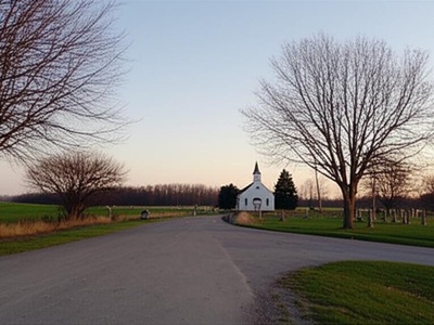
| Santa Fe | Miami | US | 40.6406, -86.0719 | A prosperous town on the Wabash and Erie Canal, Santa Fe declined rapidly after the canal ceased operations and the new railroad was built to the south. Today, only a church, a cemetery, and a few houses remain. |
| Dudleytown | Jackson | US | 38.9056, -86.0500 | A small farming settlement founded in the 1830s that slowly declined and was gone by the early 1900s. It is now famous in local folklore for being cursed, though its demise was likely due to poor, swampy farmland. |
| Cerro Gordo | Randolph | US | 40.3164, -85.1097 | Platted in 1848, this small village had a steam-powered mill and several businesses. It failed to attract a railroad line and was unable to compete with nearby towns, leading to its eventual abandonment by the early 20th century. |
| Granville | Tippecanoe | US | 40.5186, -86.9936 | An important port on the Wabash and Erie Canal, this town thrived until the canal’s demise in the 1870s. Bypassed by the railroad, its population left, and today only a cemetery remains on a bluff overlooking the Wabash River. |
| Heath | Tippecanoe | US | 40.3236, -87.0708 | A small community that developed around a station on the Clover Leaf Railroad. It consisted of a grain elevator, a store, and a few homes but disappeared after the railroad depot was removed and businesses closed. |
| Metea | Cass | US | 40.8931, -86.2944 | Named for Potawatomi chief Metea, this was an early 19th-century trading post and village. The settlement declined after the removal of Native American populations and was bypassed by later development, leaving only a cemetery. |
| Unionport | Randolph | US | 40.1256, -85.2014 | A once-promising village platted along a proposed extension of the Whitewater Canal that was never built. Hopes for prosperity faded with the canal project, and the town slowly reverted to farmland. |
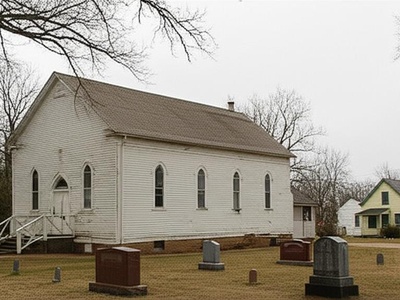
| Cana | Jennings | US | 38.8809, -85.7369 | A small crossroads village that was platted in 1837. It had a post office and a few shops but never grew significantly. By the mid-20th century, it had faded away, with a church and cemetery as the main remnants. |
| Retreat | Jackson | US | 38.8687, -85.7950 | A small farming community that once had its own post office, church, and school. It declined throughout the 20th century as small farms were consolidated. A few homes and a historic church still mark the location. |
| Barren | Harrison | US | 38.1587, -86.0108 | Aptly named, this small 19th-century farming community in a region of poor soil never thrived. The post office closed in 1907, and the handful of families that lived there eventually moved away, leaving little trace. |
| Glen Hall | Tippecanoe | US | 40.2317, -86.9089 | A small settlement that grew around a stop on the Big Four railroad. It served as a shipping point for local farms but faded into obscurity after the depot closed and road transportation became dominant. |
| Judson (Old) | Parke | US | 39.8164, -87.1250 | This early settlement withered after the railroad was built a mile away, prompting most residents and businesses to move to the new site, now known as Judson. The original location was completely abandoned. |
| Quaker Point | Jefferson | US | 38.7495, -85.3211 | An early 19th-century Quaker settlement that was eventually abandoned as families moved west for better opportunities or to join larger communities. A historic cemetery is the primary remnant of this pioneer outpost. |
| Fincastle | Putnam | US | 39.8106, -86.9208 | Platted in 1830, Fincastle was a stagecoach stop and a lively village. Its importance declined sharply after it was bypassed by the National Road and later the railroads, causing a slow exodus of its population. |
| Gilead | Miami | US | 40.9250, -86.0028 | A small village that was a local center of commerce in the late 19th century, with a mill and several shops. Economic changes and population shifts in the 20th century led to its gradual decline into a quiet hamlet. |
| Octagon | Tippecanoe | US | 40.4578, -87.0983 | A small post office community that existed from 1870 to 1901. It served the surrounding farms but never developed into a substantial village and vanished from the map after the post office was discontinued. |
| Service | Wabash | US | 40.9328, -85.7600 | A whistle-stop on the Erie Railroad line, this small community had a grain elevator and served local farmers. It was abandoned after the railroad ceased to be a primary mode of transport for the area’s goods. |
| Wildcat | Carroll | US | 40.6381, -86.6358 | One of the first pioneer settlements in the area, located on Wildcat Creek. It was short-lived, as settlers soon moved to more advantageous locations like the newly established town of Delphi, leaving the original site behind. |
| Palo | Owen | US | 39.3664, -86.8203 | A small mill town founded on the west fork of the White River in the 1850s. The town’s fortunes were tied to its mill, and when it ceased operations, the community was slowly abandoned. |
| Aboite | Allen | US | 41.0567, -85.2975 | An early settlement dating to the 1830s that was the original center of Aboite Township. It was eventually superseded by the growth of Fort Wayne, and its identity was lost as the area became a modern suburb. |
| Alpha | Scott | US | 38.7412, -85.9008 | Platted in 1851, Alpha was a small farming village with a general store, a blacksmith, and a post office. It declined in the early 20th century due to rural depopulation, with only a cemetery left to mark its location. |
| Brouilletts Creek | Vermillion | US | 39.7348, -87.4950 | A coal mining settlement that thrived in the early 1900s. The town, which included company-owned housing for miners, was dismantled and abandoned after the nearby Universal Coal Mine closed in the 1930s. |
| Cresswell | Jefferson | US | 38.5639, -85.5039 | A small 19th-century mill town situated on a creek near the Ohio River. Like many small water-powered communities, it became obsolete with the advent of steam power and was eventually abandoned. |
| Harness | Greene | US | 39.0967, -86.9283 | A small coal camp that existed to support a specific mine in the early 20th century. Once the coal seam was exhausted and the mine shut down, the temporary community was quickly abandoned by the miners and their families. |
| Lick Skillet | Crawford | US | 38.3845, -86.5333 | A colloquially named crossroads community that reportedly earned its name from hungry travelers. The settlement never grew beyond a few homes and a schoolhouse and has since faded completely into the surrounding forest. |
| Marmont | Marshall | US | 41.2181, -86.4103 | The original name for the town of Culver. The initial settlement was located east of the current town but was moved to be closer to the shores of Lake Maxinkuckee and the railroad line, abandoning the first site. |
| Mount Etna | Huntington | US | 40.7511, -85.6269 | A prosperous port on the Wabash and Erie Canal. After the canal failed, the town was bypassed by the railroad and fell into a steep decline. Today, it exists as a semi-ghost town with only a handful of residents. |
| Newville | DeKalb | US | 41.3414, -84.8711 | Once a thriving mill town on the St. Joseph River, its population peaked in the 1870s. A series of devastating floods and changing economics led to its decline. A few residents remain among the historic, weathered buildings. |
| Raglesville | Daviess | US | 38.8359, -86.9639 | A significant town in northern Daviess County in the 19th century. Its decline began after it was bypassed by the railroad. Today, it’s a quiet cluster of homes, a shadow of the bustling town it once was. |
| Saluda | Jefferson | US | 38.6534, -85.6480 | A small farming village established in the 1820s. It slowly depopulated over the 20th century as residents moved to larger towns for work. The preserved Saluda Presbyterian Church is the most prominent landmark. |
| Vera Cruz (Old) | Wells | US | 40.7711, -85.1786 | The original town site was platted in 1848 but was largely abandoned when the railroad was built a mile to the north in 1871. Most businesses and residents moved to the new location, now the current town of Vera Cruz. |
| Zion | Grant | US | 40.4286, -85.6714 | A rural community established in the mid-1800s, centered around the Zion Methodist Church and a school. The school closed long ago, and the community dissolved, leaving the church and cemetery as its only legacy. |
| Trenton | Blackford | US | 40.4800, -85.4200 | A town that boomed overnight during the Indiana Gas Boom in the 1890s. It had a hotel, stores, and over 1,000 residents at its peak. When the gas ran out, the town vanished almost as quickly as it appeared. |
| Waverly | Morgan | US | 39.5406, -86.3075 | A flourishing 1840s port on the Central Canal. The town was devastated by a flood in 1848, then bypassed by the railroad. The site is now a historic park with a few remaining buildings and archaeological remnants. |
| Benville | Jennings | US | 39.0600, -85.6139 | A rural post office community founded in 1850. The village served local farmers but never grew substantially and disappeared after its post office was discontinued in 1904, with the area returning to farmland. |
| Boxley | Hamilton | US | 40.1706, -86.2086 | An important early Quaker settlement and a documented stop on the Underground Railroad. The community declined after the Civil War, and today only a historic cemetery and a Friends church remain. |
| Brunerstown | Putnam | US | 39.6642, -86.8361 | The first, temporary county seat of Putnam County, established in 1823. It was abandoned just two years later when the more central location of Greencastle was chosen as the permanent seat, and the site reverted to nature. |
| Buena Vista | Gibson | US | 38.3817, -87.8286 | One of several “lost” towns along the Wabash and Erie Canal. It thrived briefly as a canal port but was quickly abandoned after the canal ceased operations in the 1860s, leaving no visible trace today. |
| Cataract | Owen | US | 39.4292, -86.8042 | The village near scenic Cataract Falls was once a popular resort destination with mills and hotels. As water power became obsolete and tourism patterns changed, the village dwindled to just a few scattered homes. |
| Connerstown | Hamilton | US | 40.0050, -86.0150 | The early 19th-century trading post and village founded by William Conner, which included his brick home and several Lenape log cabins. The settlement site is now preserved and recreated as part of the Conner Prairie living history museum. |
| Fairplay | Greene | US | 39.1111, -86.9906 | Platted in 1837 with ambitious plans, the town grew briefly but began to decline after failing to secure a railroad connection. It was mostly abandoned by the Civil War, with only the Fairplay Cemetery remaining. |
| Farmington | Jackson | US | 38.9881, -86.0969 | A small rural community that once had a post office and a few businesses in the late 19th century. Improved transportation and rural depopulation led to its decline, and it has since faded from modern maps. |
| Gosport (Old) | Owen | US | 39.3514, -86.6719 | The original settlement of Gosport was located on the White River. When the railroad was built on higher ground a mile away in the 1850s, the entire town gradually relocated to be near the depot, abandoning the old river site. |
| Jerome | Howard | US | 40.4161, -85.9419 | A once-thriving town that began a steep decline after a major fire in 1913 destroyed its business district. Compounded by being bypassed by major highways, the town slowly dwindled to a small cluster of homes and a church. |
| Lancaster | Jefferson | US | 38.7842, -85.6214 | One of the oldest towns in its county, Lancaster was a bustling center of trade in the early 19th century. It was bypassed by the railroad in the 1850s, leading to a slow, steady decline into the tiny hamlet it is today. |
| Americus | Tippecanoe | US | 40.5289, -86.7900 | A once-thriving port on the Wabash and Erie Canal, Americus boasted mills, warehouses, and hotels. After the canal era ended, it was bypassed by the railroad, and it shrank to the small, quiet riverside community it is today. |
Images and Descriptions
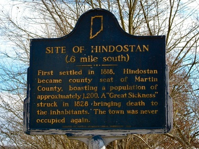
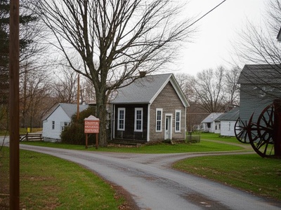
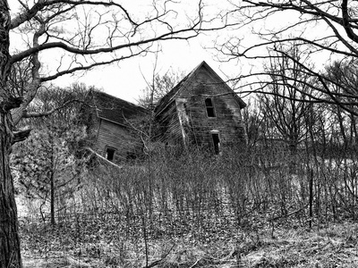
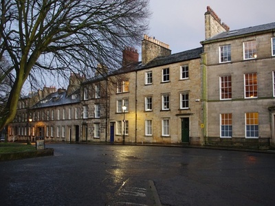
Hindostan
Once a bustling county seat of 2,000 people in the 1820s, it was wiped out by a mysterious epidemic and completely abandoned by 1830. Today, only a cemetery and some foundations remain in the Hindostan Falls Public Fishing Area.
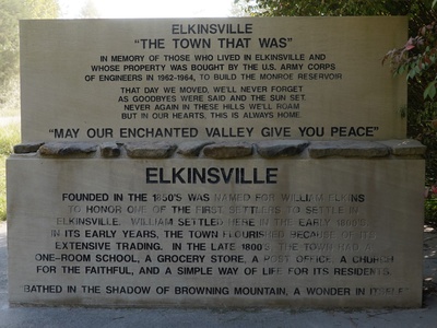
Elkinsville
A small community in the hills of Brown County, Elkinsville was abandoned in the early 1960s when the land was acquired for the creation of Monroe Lake. Only a cemetery and submerged foundations remain near the Peninsula Trail.
Baltimore
An ambitious town on the Wabash River, Baltimore was abandoned after the Panic of 1837 and repeated flooding. Today, the overgrown site is marked only by the Baltimore Cemetery, a lonely reminder of the pioneer dream.

Alida
A 19th-century railroad town that thrived with a depot, grain elevator, and school. It declined after the railroad consolidated stops and a fire destroyed its businesses. A historic church and a few homes are all that remain.
Dunn
A small grain elevator town established along the railroad in the late 1800s. The community faded away during the 20th century as agriculture became more mechanized and the railroad stop closed. The site is now farmland.
Corwin
A planned town site that was bypassed by the railroad in the 1850s, sealing its fate. The few families and businesses that had settled there moved away, and the town plat was officially vacated, leaving only farmland.
Beaver City
The first county seat of Newton County, Beaver City was established in 1843. It lost the county seat designation to Kentland in 1860 after a contentious vote, causing its rapid abandonment. Nothing remains of the original town.
Brisco
A small station and settlement along the Peoria and Eastern Railway line. The community, which consisted of a few houses and a general store, faded after the railroad ceased to be a major factor in local life.
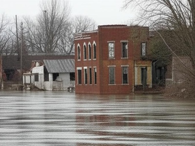
Barbersville
A small 19th-century village on the Ohio River that was frequently damaged by floods. After the great flood of 1937, most remaining residents left for higher ground, and the town was never rebuilt.
Mier
A boomtown during the Indiana Gas Boom of the late 1800s, Mier once had a bank, hotel, and several glass factories. When the gas ran out, the industry left, and the town slowly withered to a few remaining structures.
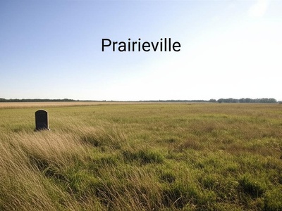
Prairieville
Selected as the original county seat of Tipton County, it was abandoned when the seat was moved to the more central location of Canton (now Tipton) in 1844. The site reverted to farmland, with only a historical marker nearby.
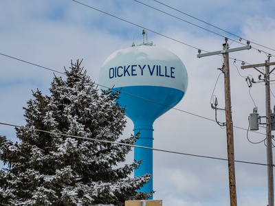
Dickeyville
A coal mining town established in the early 20th century to house miners and their families. The town was abandoned after the local mine closed down in the 1930s, leaving behind only scattered foundations in the woods.
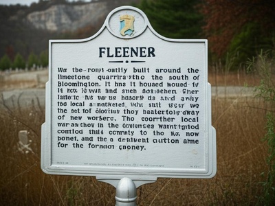
Fleener
A small community built around the limestone quarries south of Bloomington. It housed workers for the local industry but faded away as the quarries closed or modernized, requiring fewer local workers. A cemetery marks the former location.
Granville
One of the earliest settlements in Delaware County, this pioneer village on the White River was a rival to Muncie. It declined and was eventually abandoned after losing the county seat contest and being bypassed by transportation routes.
Sloan
A small village that grew up around a stop on the Chicago and Eastern Illinois Railroad. It featured a grain elevator and a general store but declined throughout the 20th century, and now only a few foundations remain.
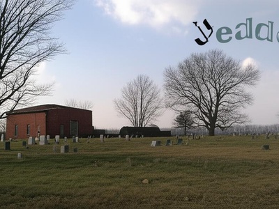
Yeddo
A small village platted in 1837 that once had a post office, stores, and a church. It slowly declined after being bypassed by the railroad, and by the mid-20th century, little remained besides a cemetery.
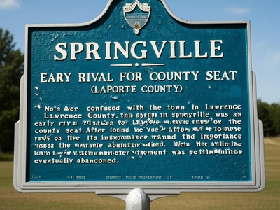
Springville
Not to be confused with the town in Lawrence County, this Springville was an early rival to LaPorte for the county seat. After losing the vote, its importance waned, and the settlement was eventually abandoned.
Standish
A coal mining camp that was active in the early 20th century. Like many single-industry towns, once the mine became unprofitable and closed, the workers moved on, and the settlement was quickly abandoned.
Mollie
A classic Indiana Gas Boom town that sprang up quickly in the 1890s with homes, a post office, and businesses. When the natural gas supply dwindled, the town busted just as fast, vanishing from the landscape.
Spurgeon (Old Town)
The original site of Spurgeon was abandoned and relocated to its present location in the 1920s due to ground subsidence from underlying coal mines. The old town site has now been reclaimed by nature.
Moscow (Old Town)
The historic village of Moscow was almost completely destroyed by an EF3 tornado in 2008. While a few residents rebuilt, most of the original town site along the Flat Rock River was abandoned and turned into a memorial park.

Lockport
A bustling port on the Wabash and Erie Canal, Lockport thrived in the 1840s and 50s. The town died when the canal system failed and was superseded by the railroads, which bypassed the town.
Santa Fe
A prosperous town on the Wabash and Erie Canal, Santa Fe declined rapidly after the canal ceased operations and the new railroad was built to the south. Today, only a church, a cemetery, and a few houses remain.
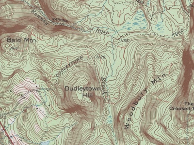
Dudleytown
A small farming settlement founded in the 1830s that slowly declined and was gone by the early 1900s. It is now famous in local folklore for being cursed, though its demise was likely due to poor, swampy farmland.
Cerro Gordo
Platted in 1848, this small village had a steam-powered mill and several businesses. It failed to attract a railroad line and was unable to compete with nearby towns, leading to its eventual abandonment by the early 20th century.
Granville
An important port on the Wabash and Erie Canal, this town thrived until the canal’s demise in the 1870s. Bypassed by the railroad, its population left, and today only a cemetery remains on a bluff overlooking the Wabash River.
Heath
A small community that developed around a station on the Clover Leaf Railroad. It consisted of a grain elevator, a store, and a few homes but disappeared after the railroad depot was removed and businesses closed.
Metea
Named for Potawatomi chief Metea, this was an early 19th-century trading post and village. The settlement declined after the removal of Native American populations and was bypassed by later development, leaving only a cemetery.
Unionport
A once-promising village platted along a proposed extension of the Whitewater Canal that was never built. Hopes for prosperity faded with the canal project, and the town slowly reverted to farmland.
Cana
A small crossroads village that was platted in 1837. It had a post office and a few shops but never grew significantly. By the mid-20th century, it had faded away, with a church and cemetery as the main remnants.
Retreat
A small farming community that once had its own post office, church, and school. It declined throughout the 20th century as small farms were consolidated. A few homes and a historic church still mark the location.

Barren
Aptly named, this small 19th-century farming community in a region of poor soil never thrived. The post office closed in 1907, and the handful of families that lived there eventually moved away, leaving little trace.
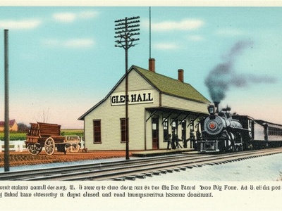
Glen Hall
A small settlement that grew around a stop on the Big Four railroad. It served as a shipping point for local farms but faded into obscurity after the depot closed and road transportation became dominant.
Judson (Old)
This early settlement withered after the railroad was built a mile away, prompting most residents and businesses to move to the new site, now known as Judson. The original location was completely abandoned.

Quaker Point
An early 19th-century Quaker settlement that was eventually abandoned as families moved west for better opportunities or to join larger communities. A historic cemetery is the primary remnant of this pioneer outpost.
Fincastle
Platted in 1830, Fincastle was a stagecoach stop and a lively village. Its importance declined sharply after it was bypassed by the National Road and later the railroads, causing a slow exodus of its population.
Gilead
A small village that was a local center of commerce in the late 19th century, with a mill and several shops. Economic changes and population shifts in the 20th century led to its gradual decline into a quiet hamlet.

Octagon
A small post office community that existed from 1870 to 1901. It served the surrounding farms but never developed into a substantial village and vanished from the map after the post office was discontinued.
Service
A whistle-stop on the Erie Railroad line, this small community had a grain elevator and served local farmers. It was abandoned after the railroad ceased to be a primary mode of transport for the area’s goods.
Wildcat
One of the first pioneer settlements in the area, located on Wildcat Creek. It was short-lived, as settlers soon moved to more advantageous locations like the newly established town of Delphi, leaving the original site behind.
Palo
A small mill town founded on the west fork of the White River in the 1850s. The town’s fortunes were tied to its mill, and when it ceased operations, the community was slowly abandoned.
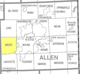
Aboite
An early settlement dating to the 1830s that was the original center of Aboite Township. It was eventually superseded by the growth of Fort Wayne, and its identity was lost as the area became a modern suburb.
Alpha
Platted in 1851, Alpha was a small farming village with a general store, a blacksmith, and a post office. It declined in the early 20th century due to rural depopulation, with only a cemetery left to mark its location.
Brouilletts Creek
A coal mining settlement that thrived in the early 1900s. The town, which included company-owned housing for miners, was dismantled and abandoned after the nearby Universal Coal Mine closed in the 1930s.
Cresswell
A small 19th-century mill town situated on a creek near the Ohio River. Like many small water-powered communities, it became obsolete with the advent of steam power and was eventually abandoned.

Harness
A small coal camp that existed to support a specific mine in the early 20th century. Once the coal seam was exhausted and the mine shut down, the temporary community was quickly abandoned by the miners and their families.
Lick Skillet
A colloquially named crossroads community that reportedly earned its name from hungry travelers. The settlement never grew beyond a few homes and a schoolhouse and has since faded completely into the surrounding forest.
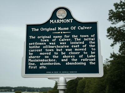
Marmont
The original name for the town of Culver. The initial settlement was located east of the current town but was moved to be closer to the shores of Lake Maxinkuckee and the railroad line, abandoning the first site.

Mount Etna
A prosperous port on the Wabash and Erie Canal. After the canal failed, the town was bypassed by the railroad and fell into a steep decline. Today, it exists as a semi-ghost town with only a handful of residents.
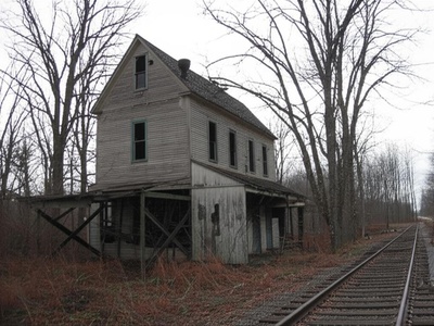
Newville
Once a thriving mill town on the St. Joseph River, its population peaked in the 1870s. A series of devastating floods and changing economics led to its decline. A few residents remain among the historic, weathered buildings.
Raglesville
A significant town in northern Daviess County in the 19th century. Its decline began after it was bypassed by the railroad. Today, it’s a quiet cluster of homes, a shadow of the bustling town it once was.

Saluda
A small farming village established in the 1820s. It slowly depopulated over the 20th century as residents moved to larger towns for work. The preserved Saluda Presbyterian Church is the most prominent landmark.
Vera Cruz (Old)
The original town site was platted in 1848 but was largely abandoned when the railroad was built a mile to the north in 1871. Most businesses and residents moved to the new location, now the current town of Vera Cruz.
Zion
A rural community established in the mid-1800s, centered around the Zion Methodist Church and a school. The school closed long ago, and the community dissolved, leaving the church and cemetery as its only legacy.
Trenton
A town that boomed overnight during the Indiana Gas Boom in the 1890s. It had a hotel, stores, and over 1,000 residents at its peak. When the gas ran out, the town vanished almost as quickly as it appeared.
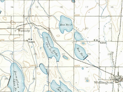
Waverly
A flourishing 1840s port on the Central Canal. The town was devastated by a flood in 1848, then bypassed by the railroad. The site is now a historic park with a few remaining buildings and archaeological remnants.
Benville
A rural post office community founded in 1850. The village served local farmers but never grew substantially and disappeared after its post office was discontinued in 1904, with the area returning to farmland.
Boxley
An important early Quaker settlement and a documented stop on the Underground Railroad. The community declined after the Civil War, and today only a historic cemetery and a Friends church remain.

Brunerstown
The first, temporary county seat of Putnam County, established in 1823. It was abandoned just two years later when the more central location of Greencastle was chosen as the permanent seat, and the site reverted to nature.
Buena Vista
One of several “lost” towns along the Wabash and Erie Canal. It thrived briefly as a canal port but was quickly abandoned after the canal ceased operations in the 1860s, leaving no visible trace today.

Cataract
The village near scenic Cataract Falls was once a popular resort destination with mills and hotels. As water power became obsolete and tourism patterns changed, the village dwindled to just a few scattered homes.
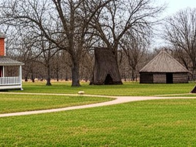
Connerstown
The early 19th-century trading post and village founded by William Conner, which included his brick home and several Lenape log cabins. The settlement site is now preserved and recreated as part of the Conner Prairie living history museum.
Fairplay
Platted in 1837 with ambitious plans, the town grew briefly but began to decline after failing to secure a railroad connection. It was mostly abandoned by the Civil War, with only the Fairplay Cemetery remaining.
Farmington
A small rural community that once had a post office and a few businesses in the late 19th century. Improved transportation and rural depopulation led to its decline, and it has since faded from modern maps.
Gosport (Old)
The original settlement of Gosport was located on the White River. When the railroad was built on higher ground a mile away in the 1850s, the entire town gradually relocated to be near the depot, abandoning the old river site.
Jerome
A once-thriving town that began a steep decline after a major fire in 1913 destroyed its business district. Compounded by being bypassed by major highways, the town slowly dwindled to a small cluster of homes and a church.
Lancaster
One of the oldest towns in its county, Lancaster was a bustling center of trade in the early 19th century. It was bypassed by the railroad in the 1850s, leading to a slow, steady decline into the tiny hamlet it is today.
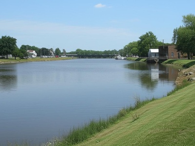
Americus
A once-thriving port on the Wabash and Erie Canal, Americus boasted mills, warehouses, and hotels. After the canal era ended, it was bypassed by the railroad, and it shrank to the small, quiet riverside community it is today.