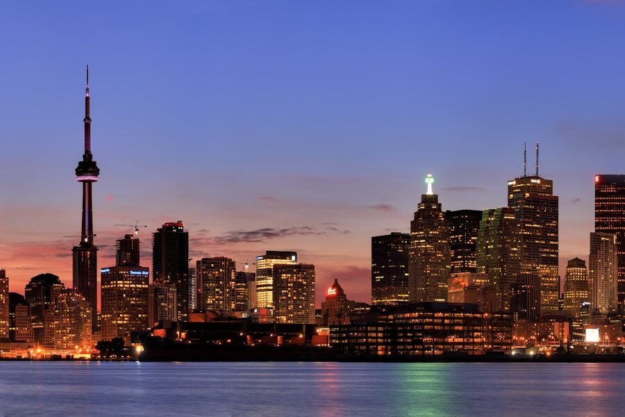
Cities can feel big for different reasons — some spread across wide plains or include large bodies of water, while others stay compact but densely populated. Looking at area instead of population highlights how geography, annexation and local governance shape the footprint of American cities.
There are 96 Largest Cities in the US by Area, ranging from Akron to Yakutat. For each city, State,Country,Total area (sq mi / km²) are shown so you can compare sizes at a glance — you’ll find below.
How is a city’s “total area” typically defined?
Total area usually combines land and inland water within official city limits as recorded by sources like the U.S. Census Bureau; measurements depend on municipal boundaries, so a large area can include significant lakes, rivers, or undeveloped land.
Why do some cities have much larger areas than others?
Differences come from historical annexation, city–county consolidation, and planning choices: some municipalities expanded boundaries to include suburbs or rural land, while others remained compact, so large area doesn’t necessarily mean large population.
Largest Cities in the Us by Area
| City | State | Country | Total area (sq mi / km²) |
|---|---|---|---|
| Yakutat | Alaska | United States | 9,462.6 sq mi / 24,508 km² |
| Sitka | Alaska | United States | 4,811.4 sq mi / 12,461.5 km² |
| Wrangell | Alaska | United States | 3,473.8 sq mi / 8,997 km² |
| Juneau | Alaska | United States | 3,253.9 sq mi / 8,427.6 km² |
| Anchorage | Alaska | United States | 1,961.1 sq mi / 5,079.2 km² |
| Jacksonville | Florida | United States | 875.2 sq mi / 2,266.7 km² |
| Anaconda | Montana | United States | 741.4 sq mi / 1,920.2 km² |
| Butte | Montana | United States | 718.9 sq mi / 1,861.9 km² |
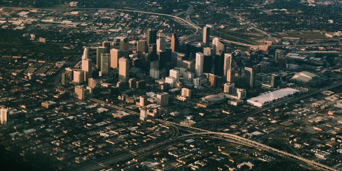
| Houston | Texas | United States | 671.7 sq mi / 1,739.7 km² |
| Oklahoma City | Oklahoma | United States | 620.3 sq mi / 1,606.5 km² |
| Phoenix | Arizona | United States | 517.9 sq mi / 1,341.4 km² |
| Nashville | Tennessee | United States | 526 sq mi / 1,362.3 km² |
| Kansas City | Missouri | United States | 319 sq mi / 826.2 km² |
| New Orleans | Louisiana | United States | 350.2 sq mi / 907 km² |
| Louisville | Kentucky | United States | 397.7 sq mi / 1,030 km² |
| Indianapolis | Indiana | United States | 368.1 sq mi / 953.4 km² |
| Suffolk | Virginia | United States | 429.1 sq mi / 1,111.4 km² |
| Chesapeake | Virginia | United States | 350.9 sq mi / 908.8 km² |
| Buckeye | Arizona | United States | 642.4 sq mi / 1,663.8 km² |
| Los Angeles | California | United States | 501.5 sq mi / 1,299 km² |
| San Antonio | Texas | United States | 505 sq mi / 1,307.9 km² |
| Dallas | Texas | United States | 384.7 sq mi / 996.4 km² |
| San Diego | California | United States | 372.4 sq mi / 964.5 km² |
| Huntsville | Alabama | United States | 220.6 sq mi / 571.4 km² |
| Augusta | Georgia | United States | 306.5 sq mi / 793.8 km² |
| Fort Worth | Texas | United States | 355 sq mi / 919.4 km² |
| Memphis | Tennessee | United States | 324 sq mi / 839.2 km² |
| Lexington | Kentucky | United States | 285.5 sq mi / 739.4 km² |
| Virginia Beach | Virginia | United States | 497.4 sq mi / 1,288.3 km² |
| Austin | Texas | United States | 325.5 sq mi / 843 km² |
| Charlotte | North Carolina | United States | 310.2 sq mi / 803.4 km² |
| El Paso | Texas | United States | 259.3 sq mi / 671.6 km² |
| Columbus | Georgia | United States | 220.9 sq mi / 572.1 km² |
| Chicago | Illinois | United States | 234 sq mi / 606.1 km² |
| Columbus | Ohio | United States | 226.3 sq mi / 586.1 km² |
| San Jose | California | United States | 181.3 sq mi / 469.6 km² |
| Denver | Colorado | United States | 155 sq mi / 401.4 km² |
| Corpus Christi | Texas | United States | 503.7 sq mi / 1,304.6 km² |
| Philadelphia | Pennsylvania | United States | 142.7 sq mi / 369.6 km² |
| Detroit | Michigan | United States | 143 sq mi / 370.4 km² |
| New York | New York | United States | 472.4 sq mi / 1,223.5 km² |
| Athens | Georgia | United States | 118.2 sq mi / 306.1 km² |
| Tucson | Arizona | United States | 241.2 sq mi / 624.7 km² |
| Raleigh | North Carolina | United States | 148.8 sq mi / 385.4 km² |
| Fort Wayne | Indiana | United States | 110.8 sq mi / 286.9 km² |
| Macon | Georgia | United States | 255.4 sq mi / 661.5 km² |
| Laredo | Texas | United States | 104.9 sq mi / 271.7 km² |
| Colorado Springs | Colorado | United States | 195.8 sq mi / 507.1 km² |
| Bakersfield | California | United States | 151.3 sq mi / 391.9 km² |
| Frisco | Texas | United States | 70.1 sq mi / 181.6 km² |
| Irvine | California | United States | 66.5 sq mi / 172.2 km² |
| McKinney | Texas | United States | 68.3 sq mi / 176.9 km² |
| Fremont | California | United States | 92.2 sq mi / 238.8 km² |
| Scottsdale | Arizona | United States | 184.4 sq mi / 477.6 km² |
| North Las Vegas | Nevada | United States | 101.4 sq mi / 262.6 km² |
| Greensboro | North Carolina | United States | 133.7 sq mi / 346.3 km² |
| Port St. Lucie | Florida | United States | 120.9 sq mi / 313.1 km² |
| Cape Coral | Florida | United States | 120.3 sq mi / 311.6 km² |
| Henderson | Nevada | United States | 107.7 sq mi / 278.9 km² |
| Gilbert | Arizona | United States | 72.6 sq mi / 188 km² |
| Winston-Salem | North Carolina | United States | 133.8 sq mi / 346.5 km² |
| Durham | North Carolina | United States | 114 sq mi / 295.2 km² |
| Mesa | Arizona | United States | 139.6 sq mi / 361.6 km² |
| Reno | Nevada | United States | 114.7 sq mi / 297.1 km² |
| Palm Bay | Florida | United States | 101.9 sq mi / 263.9 km² |
| Madison | Wisconsin | United States | 103.5 sq mi / 268.1 km² |
| Tampa | Florida | United States | 175.7 sq mi / 455.1 km² |
| Lexington | North Carolina | United States | 18.1 sq mi / 46.9 km² |
| Arlington | Texas | United States | 99.5 sq mi / 257.7 km² |
| Topeka | Kansas | United States | 62.7 sq mi / 162.4 km² |
| Montgomery | Alabama | United States | 162.3 sq mi / 420.3 km² |
| St. Paul | Minnesota | United States | 56.2 sq mi / 145.6 km² |
| Portland | Oregon | United States | 145 sq mi / 375.5 km² |
| Shreveport | Louisiana | United States | 122.9 sq mi / 318.3 km² |
| Springfield | Missouri | United States | 82.4 sq mi / 213.4 km² |
| Columbia | South Carolina | United States | 137.2 sq mi / 355.3 km² |
| Grand Rapids | Michigan | United States | 45.3 sq mi / 117.3 km² |
| Wichita | Kansas | United States | 166.1 sq mi / 430.2 km² |
| Lincoln | Nebraska | United States | 99.4 sq mi / 257.4 km² |
| Gainesville | Florida | United States | 62.4 sq mi / 161.6 km² |
| Little Rock | Arkansas | United States | 122.6 sq mi / 317.5 km² |
| Mobile | Alabama | United States | 180.1 sq mi / 466.5 km² |
| Tallahassee | Florida | United States | 103.7 sq mi / 268.6 km² |
| Chattanooga | Tennessee | United States | 151.2 sq mi / 391.6 km² |
| Fayetteville | North Carolina | United States | 150.3 sq mi / 389.3 km² |
| Baton Rouge | Louisiana | United States | 89.5 sq mi / 231.8 km² |
| Olathe | Kansas | United States | 62.3 sq mi / 161.4 km² |
| Birmingham | Alabama | United States | 148.6 sq mi / 384.9 km² |
| Greensboro | Georgia | United States | 6.9 sq mi / 17.9 km² |
| Jackson | Mississippi | United States | 113.2 sq mi / 293.2 km² |
| Akron | Ohio | United States | 62.4 sq mi / 161.6 km² |
| Knoxville | Tennessee | United States | 104.3 sq mi / 269.9 km² |
| Aurora | Colorado | United States | 160.8 sq mi / 416.5 km² |
| Overland Park | Kansas | United States | 75.6 sq mi / 195.8 km² |
| Plano | Texas | United States | 71.6 sq mi / 185.4 km² |
| St. Louis | Missouri | United States | 66.2 sq mi / 171.5 km² |
Images and Descriptions
Yakutat
As a unified city-borough, Yakutat’s boundaries encompass a vast and sparsely populated Alaskan wilderness, including glaciers and coastline. This governmental structure makes it the largest incorporated city in the U.S. by an immense margin, though its population is very small.
Sitka
Like other massive Alaskan cities, Sitka is a consolidated city-borough. Its official area includes vast stretches of wilderness on Baranof Island and is mostly uninhabited national forest, making its land area immense despite a small urban core.
Wrangell
Wrangell’s enormous size comes from its status as a unified city-borough, a common governance structure in Alaska. The municipal boundaries cover a huge, sparsely populated area of islands and mainland, with most of the land being Tongass National Forest.
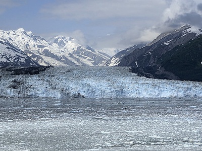
Juneau
The state capital of Alaska is a unified city-borough whose boundaries extend over a vast, rugged wilderness. Most of its area is undeveloped and includes mountains, ice fields, and forests, accessible primarily by boat or plane.
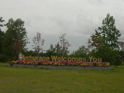
Anchorage
The Municipality of Anchorage is a consolidated city-borough that covers a large area of south-central Alaska. While it’s the state’s most populous city, much of its land area is comprised of the Chugach Mountains and is sparsely populated or uninhabited.
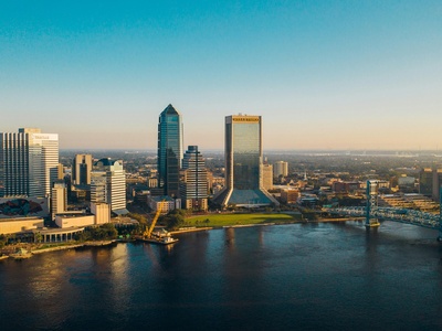
Jacksonville
Jacksonville became the largest city by area in the contiguous U.S. after it consolidated its government with Duval County in 1968. This merger absorbed most of the county’s land into the city’s official boundaries, creating a vast metropolitan footprint.
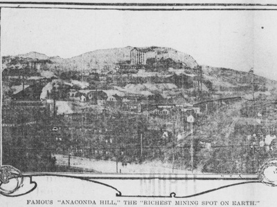
Anaconda
Anaconda’s large area is a result of its 1977 consolidation with Deer Lodge County. This former copper smelting boomtown now governs a vast, mountainous, and sparsely populated county, retaining its historic name for the consolidated government.

Butte
The full name of this entity is Butte-Silver Bow, reflecting the 1977 consolidation of the city of Butte with Silver Bow County. This historic mining city now administers a large, rugged county area in the Rocky Mountains.
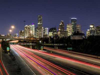
Houston
Houston’s massive size is a result of decades of aggressive annexation of unincorporated lands to expand its tax base and prevent the creation of suburban enclaves. This has resulted in a sprawling city with a vast and diverse geographic footprint.

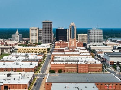
Oklahoma City
Known for its sprawling geography, Oklahoma City grew to its enormous size through a long history of annexing surrounding rural and suburban land. This strategy prevented it from being landlocked by independent suburbs and expanded its municipal control.
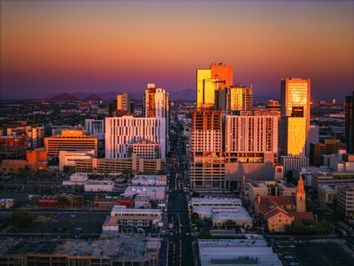
Phoenix
Phoenix’s large area is a product of post-World War II growth and aggressive annexation of the surrounding Sonoran Desert land. This expansion allowed the city to accommodate its rapid population boom and develop its characteristic sprawling, car-centric layout.
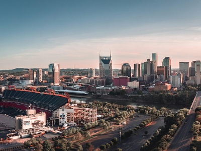
Nashville
Nashville’s large size is due to the 1963 consolidation of its city government with that of Davidson County. This move created the first metropolitan government in the U.S. and expanded the city’s official boundaries to cover nearly the entire county.
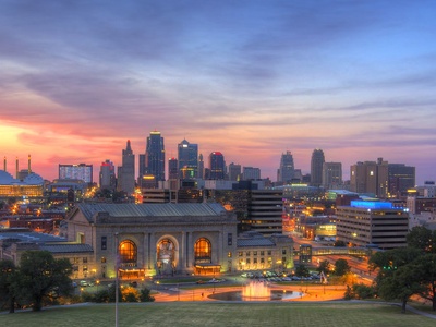
Kansas City
Kansas City’s significant land area is the result of numerous annexations throughout the 20th century, particularly northward into Platte and Clay counties. This expansion incorporated vast tracts of undeveloped land, giving the city room for suburban growth and the airport.
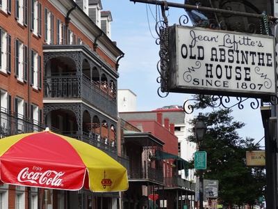
New Orleans
While its inhabited land area is relatively small, New Orleans’s total municipal area is vastly inflated by water. Its official boundaries include large portions of Lake Pontchartrain, Lake Borgne, and surrounding wetlands, contributing to its high ranking on this list.
Louisville
In 2003, Louisville merged with Jefferson County, creating the Louisville/Jefferson County Metro Government. This city-county consolidation dramatically increased the city’s official population and land area, absorbing numerous smaller communities into one unified entity.
Indianapolis
Indianapolis’s large size is due to the 1970 Unigov act, which consolidated the city’s government with that of Marion County. This innovative move merged most municipal services and expanded the city’s boundaries to cover almost the entire county.

Suffolk
Suffolk is an independent city in Virginia, a unique political subdivision. Its vast area resulted from a 1974 merger with the former Nansemond County, making it the largest city by land area in Virginia and one of the largest in the U.S.

Chesapeake
Like other large cities in Virginia, Chesapeake owes its size to a political consolidation. It was formed in 1963 through the merger of the city of South Norfolk with the surrounding Norfolk County, incorporating large suburban and rural areas.
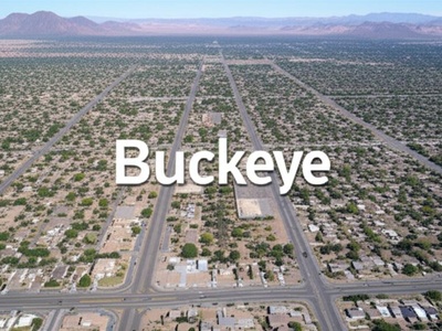
Buckeye
Located on the fast-growing fringe of the Phoenix metro area, Buckeye has become one of the nation’s largest cities by area through massive annexations of undeveloped desert land. This prepares the city for decades of future suburban development.

Los Angeles
Los Angeles grew to its enormous size by annexing dozens of neighboring communities and vast tracts of land in the early 20th century. This expansion was largely driven by the need to secure water rights from the Owens Valley.
San Antonio
San Antonio’s significant land area is the result of a deliberate and ongoing annexation policy. By annexing unincorporated land, especially around its military bases, the city has expanded its footprint to accommodate rapid population and suburban growth.
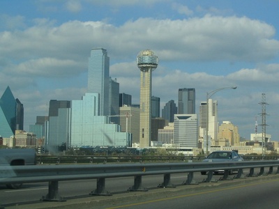
Dallas
Dallas has a large footprint due to annexations that occurred primarily in the mid-20th century. The city expanded to include land for major projects like the Dallas/Fort Worth International Airport and to accommodate its sprawling suburban growth.
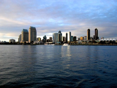
San Diego
San Diego’s large area is a result of annexing neighboring communities over time, including San Ysidro in 1957. The city’s geography is also expansive, stretching from the Pacific Ocean to inland valleys and mesas, encompassing diverse terrain.
Huntsville
Huntsville has grown dramatically in area through strategic annexation, particularly to the west and north. This expansion has been driven by its role as a hub for aerospace and defense, including NASA’s Marshall Space Flight Center and Redstone Arsenal.
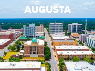
Augusta
In 1996, the city of Augusta consolidated its government with Richmond County, creating the new entity of Augusta-Richmond County. This merger expanded the city’s boundaries to encompass nearly the entire county, greatly increasing its area and population.
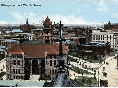
Fort Worth
Fort Worth’s substantial size is due to a long history of aggressive annexation, similar to other major Texas cities. This has allowed it to control its suburban growth, expand its tax base, and incorporate major developments within its city limits.

Memphis
Memphis has expanded its city limits over the years through annexation of unincorporated parts of Shelby County. This has been a key strategy to maintain its tax base as the population shifted toward suburban areas, although recent laws have curtailed this practice.
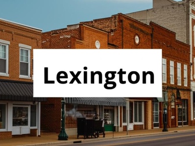
Lexington
In 1974, Lexington merged with Fayette County, forming the Lexington-Fayette Urban County Government. This consolidation was a pioneering move in local governance that unified the city and county, expanding Lexington’s boundaries to cover the entire county.

Virginia Beach
Virginia Beach’s vast size comes from the 1963 merger of the small resort city with the surrounding Princess Anne County. A significant portion of its total area is water, including parts of the Atlantic Ocean and Chesapeake Bay.
Austin
Austin’s growth in area is a story of continuous annexation. The city has systematically expanded its boundaries to manage its rapid population boom and tech-driven development, incorporating surrounding land to prevent being hemmed in by suburbs.
Charlotte
Charlotte’s large land area is the result of annexing unincorporated areas of Mecklenburg County over several decades. This strategy allowed the city to manage regional growth and maintain a strong tax base as it developed into a major financial hub.
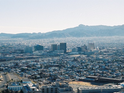
El Paso
El Paso’s area is notable for its unique geography, constrained by the Franklin Mountains and the U.S.-Mexico border. The city has expanded north and east into the desert, annexing land to accommodate its growing population and Fort Bliss.
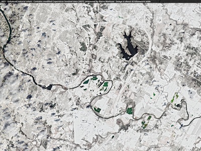
Columbus
Columbus has a large area because it was one of the first cities in the U.S. to consolidate with its county. The 1971 merger with Muscogee County created the “Consolidated Government of Columbus, Georgia,” expanding its boundaries significantly.

Chicago
While it hasn’t annexed land in over 50 years, Chicago grew to its large size in the 19th and early 20th centuries. A significant portion of its area is Lake Michigan, and its footprint was established by absorbing neighboring towns.
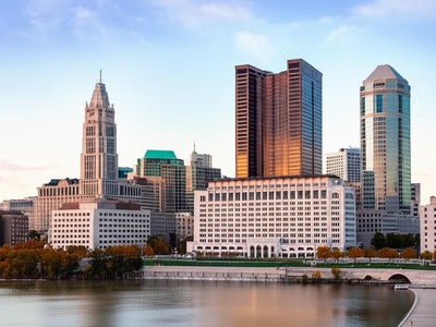
Columbus
As the capital of Ohio, Columbus has pursued a policy of annexation to become one of the largest cities by area in the state. By providing water and sewer services to townships in exchange for annexation, it has steadily grown its footprint.
San Jose
San Jose’s growth from a small farming town into a sprawling tech metropolis was fueled by aggressive annexation from the 1950s to the 1970s. This rapid expansion gave the city its large, suburban-style layout in the heart of Silicon Valley.
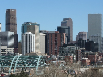
Denver
Denver is a consolidated city and county, a unique political entity in Colorado. Its boundaries have been largely fixed since the early 20th century, but it notably annexed a large corridor of land to incorporate Denver International Airport.
Corpus Christi
Corpus Christi’s ranking is heavily influenced by its massive water area. The city limits include huge portions of Corpus Christi Bay, Nueces Bay, and the Laguna Madre, making its water area more than double its land area.
Philadelphia
Philadelphia’s boundaries have been fixed since 1854 when the Act of Consolidation made the city coterminous with Philadelphia County. This historic move merged the city with surrounding townships and districts, establishing its current large area.
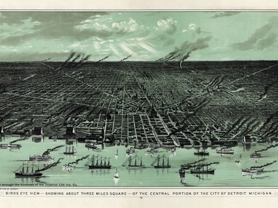
Detroit
Detroit’s current size was largely established through a series of annexations in the early 20th century as the auto industry boomed. Though its population has declined, the city’s physical footprint remains one of the largest in the nation.
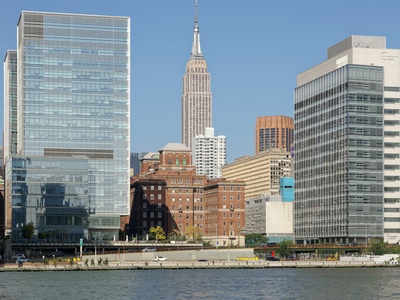
New York
New York City’s enormous area is the result of the 1898 consolidation of five counties into boroughs: Manhattan, Brooklyn, Queens, the Bronx, and Staten Island. A significant portion of its total area is water, including rivers, bays, and the Atlantic.

Athens
The city of Athens has a consolidated government with Clarke County, known as Athens-Clarke County. This merger, approved in 1990, unified the two governments and expanded the city’s official area to encompass most of the county.
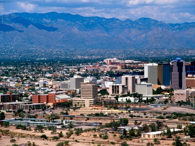
Tucson
Tucson’s expansion has been driven by annexing patches of unincorporated Pima County, often in a checkerboard pattern. This growth accommodated its post-war population boom and established its large, sprawling presence in the Sonoran Desert.
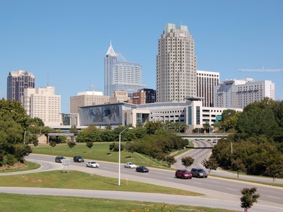
Raleigh
Raleigh’s significant size is a product of North Carolina’s liberal annexation laws in the 20th century. The city expanded its boundaries to manage rapid growth driven by the Research Triangle Park, ensuring a stable tax base for services.

Fort Wayne
Fort Wayne has significantly increased its area through several large annexations, most notably in the 2000s. This strategy was aimed at managing suburban growth and ensuring that new developments contributed to the city’s tax base.
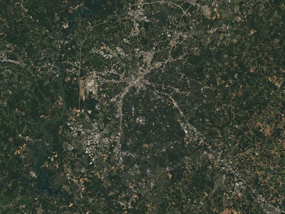
Macon
In 2012, voters approved the consolidation of the city of Macon and Bibb County, creating the unified government of Macon-Bibb County. This merger greatly expanded the city’s official boundaries, making it one of Georgia’s largest cities by area.
Laredo
Situated on the U.S.-Mexico border, Laredo has grown by annexing land to accommodate its expansion as a major hub for international trade. Its growth has been largely linear, following major transportation corridors north from the Rio Grande.

Colorado Springs
Colorado Springs has a large footprint due to annexations of land for development and to incorporate military installations like Fort Carson and the Air Force Academy. Its location at the foot of the Rocky Mountains gives it a sprawling north-south layout.
Bakersfield
Bakersfield has grown substantially by annexing surrounding agricultural land in Kern County. This expansion has accommodated its growth as a major center for oil production and farming, leading to a sprawling and less densely populated city area.
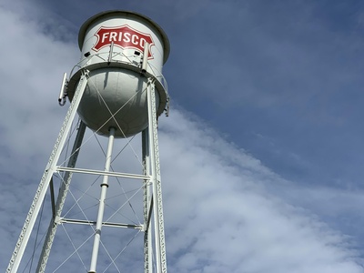
Frisco
Frisco is a prime example of a rapidly growing exurb. Its large area for a suburban city is due to aggressive planning and development, annexing land to control its destiny as a major corporate and entertainment hub north of Dallas.
Irvine
Irvine’s large size is not from annexing other towns, but from being meticulously master-planned on a massive parcel of land formerly owned by the Irvine Company. This allowed for a unified, large-scale design incorporating villages, open space, and commercial centers.
McKinney
Another fast-growing suburb in the Dallas-Fort Worth metroplex, McKinney’s size is a result of annexing land for master-planned communities. The city has managed its explosive growth by expanding its footprint to accommodate new residential and commercial development.
Fremont
Fremont was formed in 1956 through the incorporation and merger of five smaller agricultural communities. This consolidation created a large city in the East Bay area, with significant land reserved for both industrial development and hillside parks.

Scottsdale
Scottsdale is known for its long, narrow shape, stretching over 30 miles. Its large area is a result of annexing land northward into the Sonoran Desert, which included large, low-density residential areas and vast natural preserves.
North Las Vegas
North Las Vegas has expanded its area significantly through annexation to accommodate rapid residential growth. Much of this annexed land was undeveloped desert, planned for the sprawling master-planned communities that characterize the Las Vegas valley.
Greensboro
Greensboro’s size is the result of steady annexation throughout the 20th century. This allowed the city to manage its growth as a transportation and manufacturing hub and prevent being constrained by independent suburban towns.
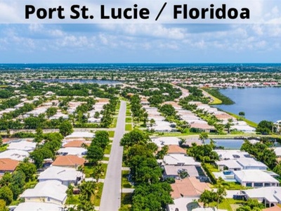
Port St. Lucie
Port St. Lucie was developed as a massive master-planned community. Its large area was platted by developers in the 1950s, creating tens of thousands of residential lots over a vast tract of land, much of which is still being built out.
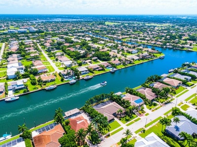
Cape Coral
Known for having over 400 miles of canals, Cape Coral’s large area was carved out of undeveloped land by developers in the 1950s. The city’s footprint was pre-planned to be enormous, with a grid layout for residential lots and waterways.
Henderson
As a fast-growing suburb of Las Vegas, Henderson has expanded its boundaries by annexing large swaths of the surrounding desert. This has facilitated the development of large-scale master-planned communities and made it Nevada’s second-largest city.
Gilbert
Once the “Hay Shipping Capital of the World,” Gilbert transformed into a major suburb of Phoenix. Its large area is the result of annexing former farmland to accommodate one of the fastest residential growth rates in the nation.
Winston-Salem
Winston-Salem’s significant area is a result of its 1913 merger between the towns of Winston and Salem, followed by decades of annexing surrounding unincorporated areas of Forsyth County to manage its growth as an industrial and commercial center.

Durham
Durham has grown by annexing surrounding unincorporated areas in Durham County and even parts of Wake County. This expansion was driven by the growth of the Research Triangle Park and the need to provide services to new residential developments.
Mesa
As a major suburb of Phoenix, Mesa grew by annexing adjacent land, expanding from its small historic downtown into a massive, sprawling city. Its grid layout and large area are characteristic of the region’s post-war, car-oriented development.
Reno
Reno has expanded its footprint through annexation of surrounding valleys and foothills. This growth accommodates new housing developments and commercial centers, solidifying its role as the economic hub of northern Nevada.
Palm Bay
Palm Bay’s large area is a result of its origins as a massive residential development project by the General Development Corporation. The city was incorporated over a huge tract of land, much of which was platted into small lots for future homes.
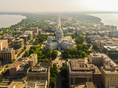
Madison
Madison’s total area is significantly enlarged by its surrounding lakes. The city is situated on an isthmus between Lake Mendota and Lake Monona, and its municipal boundaries include large portions of these and other nearby bodies of water.
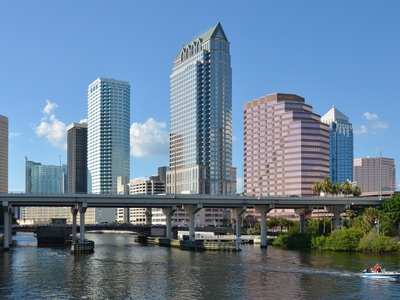
Tampa
Tampa’s large total area is heavily influenced by water, as the city almost completely surrounds Tampa Bay. While its land area is smaller, its municipal boundaries extend into the bay, contributing significantly to its overall size.
Lexington
Lexington has maintained a more traditional footprint, growing through modest annexations over time. Its size reflects its history as a more contained industrial and manufacturing center in the Piedmont region of North Carolina, famous for its barbecue.
Arlington
Located between Dallas and Fort Worth, Arlington grew by annexing unincorporated land to avoid being absorbed by its larger neighbors. This strategy allowed it to become a major city in its own right, home to major sports stadiums and theme parks.
Topeka
As the capital of Kansas, Topeka expanded its boundaries over the years to accommodate government offices and residential growth. Its area reflects a steady, but not explosive, pattern of annexation and development common for Midwestern state capitals.
Montgomery
The capital of Alabama, Montgomery has a large land area due to annexation of surrounding communities and land in Montgomery County. This expansion has been part of a strategy to manage suburban growth and maintain a robust tax base.
St. Paul
St. Paul’s size is defined by its location on the Mississippi River, across from its “twin city,” Minneapolis. Its growth was constrained by surrounding incorporated suburbs, resulting in a more compact but still sizable footprint for a major city.
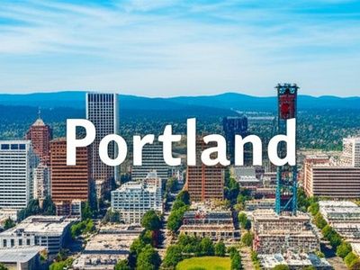
Portland
Portland’s size is managed by a regional urban growth boundary, which limits outward sprawl. The city has focused on density, but its area is still significant, encompassing a diverse landscape from the Willamette River to the West Hills.
Shreveport
Shreveport’s area has expanded through annexation, particularly across the Red River. This growth has allowed the city to develop as a commercial and cultural hub for the Ark-La-Tex region, encompassing both urban and suburban areas.
Springfield
As a regional hub in the Ozarks, Springfield has grown steadily by annexing surrounding land. This has allowed it to accommodate its expanding healthcare, education, and retail sectors without being constrained by smaller suburban municipalities.
Columbia
The capital of South Carolina, Columbia’s size is a result of annexing surrounding unincorporated areas, particularly to the northeast. This expansion has been driven by population growth and the development of suburban communities like those around Fort Jackson.
Grand Rapids
Grand Rapids grew to its current size by annexing surrounding township land in the late 19th and 20th centuries. It is now largely landlocked by independent suburbs, resulting in a stable and relatively dense urban footprint for the region.
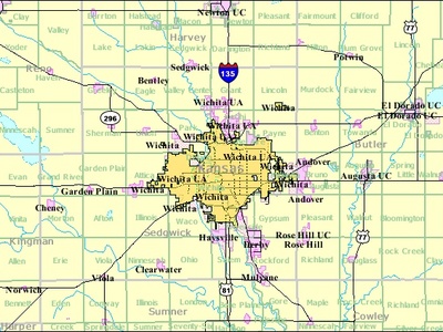
Wichita
Wichita’s large land area is a legacy of its history as the “Air Capital of the World.” The city annexed land to support its sprawling aircraft manufacturing plants and related development, creating a wide, flat urban expanse.
Lincoln
As the state capital, Lincoln has steadily grown by annexing adjacent land to accommodate its university and government-driven expansion. The city’s planned growth has prevented it from being surrounded by incorporated suburbs.

Gainesville
Home to the University of Florida, Gainesville has expanded its city limits over time to manage the growth associated with the university and its related industries. Annexation has allowed it to provide services to newly developed residential and commercial areas.

Little Rock
Little Rock’s size has increased through annexation, particularly westward. This expansion followed population and development trends, incorporating suburban areas and ensuring the city maintained its status as the region’s primary economic and governmental hub.
Mobile
Mobile’s large total area includes a significant amount of water from Mobile Bay and the Mobile River delta. The city’s recent annexations have also expanded its land footprint, aiming to increase its population and tax base.

Tallahassee
As Florida’s state capital, Tallahassee has expanded its boundaries through annexation to manage growth. Its area includes a mix of dense urban cores around the universities and government centers, as well as sprawling suburban and semi-rural land.
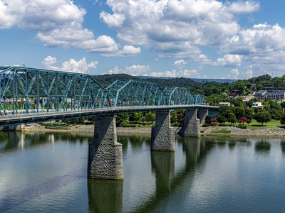
Chattanooga
Chattanooga has expanded its city limits through several key annexations of surrounding communities. This has allowed the city to manage regional growth, revitalize its riverfront, and incorporate major suburban and industrial areas under its jurisdiction.
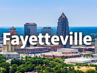
Fayetteville
Fayetteville’s large area is closely tied to the presence of Fort Bragg (now Fort Liberty). The city has annexed significant territory to provide housing and services for military personnel and their families, leading to a sprawling municipal footprint.
Baton Rouge
In 1947, Baton Rouge voters approved a plan to merge the city with East Baton Rouge Parish, creating a consolidated city-parish government. While the city proper is smaller, this structure governs a much larger area and is often cited in discussions of size.
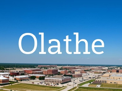
Olathe
Olathe has experienced rapid suburban growth as part of the Kansas City metropolitan area. Its significant land area is the result of annexing farmland to make way for new residential subdivisions and commercial development.
Birmingham
Birmingham’s size was largely defined by the “Greater Birmingham” movement in 1910, which merged the city with numerous industrial suburbs. While now mostly landlocked, this historic consolidation established its large footprint in central Alabama.
Greensboro
Located between Atlanta and Augusta, Greensboro, Georgia is a small but historic city. Its modest area is typical of older, rural county seats in the South that have not experienced the explosive annexation-fueled growth of larger metropolitan centers.
Jackson
As the state capital, Jackson grew by annexing surrounding areas throughout the 20th century. This expansion was aimed at capturing suburbanizing populations and tax base, though recent growth has been slower.
Akron
Once the “Rubber Capital of the World,” Akron grew to its current size by annexing neighboring areas during its industrial boom in the early 20th century. The city’s footprint has been relatively stable since, now surrounded by suburbs.

Knoxville
Knoxville’s land area grew through annexation of surrounding unincorporated parts of Knox County. This strategy was common for Tennessee cities seeking to manage suburban growth and expand their service areas before state laws changed.
Aurora
Aurora’s vast, sprawling area is a result of decades of eastward annexation across the high plains. This has allowed the city to accommodate new housing developments, commercial centers, and the large Denver International Airport, part of which lies within its borders.
Overland Park
As a major suburb of Kansas City, Overland Park’s size is the result of aggressive annexation during its period of rapid growth. This incorporated vast areas of Johnson County for corporate campuses and master-planned residential communities.
Plano
Plano grew from a small farming town into a major corporate hub by annexing land to control its development. Now fully built out and landlocked by other suburbs, its large, uniform area is a testament to its period of rapid, planned expansion.
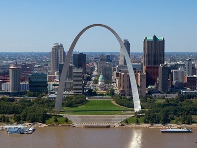
St. Louis
St. Louis is an independent city, having separated from St. Louis County in 1876. This “Great Divorce” fixed its boundaries permanently, and while it prevented annexation, it preserved a large and historically significant municipal area.