Table of Contents
- The Border at a Glance
- Complete Border Town Reference
- Brattleboro, VT: The Cultural Anchor
- Greenfield, MA: The Gateway City
- The Towns Worth a Detour
- A Brief History of the Line Itself
- Getting Around the Border Region
The Massachusetts-Vermont border runs roughly 40 miles through some of the most underrated countryside in New England. No dramatic mountains slice it in two, no major river enforces it — mostly it’s farm fields, forested ridgelines, and small towns that feel halfway interchangeable with their neighbors across the line.
Most people pass through on I-91, counting down the miles between Hartford and Burlington. That’s a mistake. The Connecticut River valley on both sides of this border has been quietly productive since the 1700s, and several of these towns repay even a single afternoon stop.
The Border at a Glance
The border runs east to west — or more precisely, west-northwest to east-southeast — from the New York tripoint near Pownal, VT to the New Hampshire tripoint near Northfield, MA. Franklin County, Massachusetts runs the full length on the south side. Windham County, Vermont anchors the north side in the west; Windsor County picks it up as you move east.
I-91 is the main corridor, threading directly through the valley and crossing the state line just south of Brattleboro. That interchange is the functional center of the border region — within a few miles of it you have the largest town on either side.
Complete Border Town Reference
The table below lists towns touching or sitting within a few miles of the Massachusetts-Vermont state line, organized west to east.
| Town | State | County | Notes |
|---|---|---|---|
| Pownal | VT | Bennington | Westernmost Vermont town on the border; tripoint with NY |
| Stamford | VT | Bennington | Small, heavily forested; near Harriman Reservoir |
| Whitingham | VT | Windham | Birthplace of Brigham Young; sits on Lake Sadawga |
| Halifax | VT | Windham | Rural farming community; no traffic lights in the whole town |
| Guilford | VT | Windham | Agricultural; covered bridges; just north of Brattleboro |
| Brattleboro | VT | Windham | Largest border town; strong arts scene; exit on I-91 |
| Vernon | VT | Windham | Site of a former nuclear plant; quirky placement on the border |
| Northfield | MA | Franklin | East anchor; Connecticut River; near Gill |
| Gill | MA | Franklin | Thin strip along the river; Barton Cove canoe launch |
| Bernardston | MA | Franklin | I-91 corridor town; Huckleberry Hill area |
| Leyden | MA | Franklin | Tiny, rural; one of the least-populated towns in MA |
| Colrain | MA | Franklin | Known for its covered bridge and back roads |
| Heath | MA | Franklin | Hilltop farming community; Heath Fair is an institution |
| Rowe | MA | Franklin | Former nuclear plant site; Harriman Reservoir |
| Monroe | MA | Franklin | One of the smallest towns in Massachusetts by population |
| Charlemont | MA | Franklin | Deerfield River; whitewater rafting |
| Florida | MA | Berkshire | Western anchor; Mohawk Trail corridor |
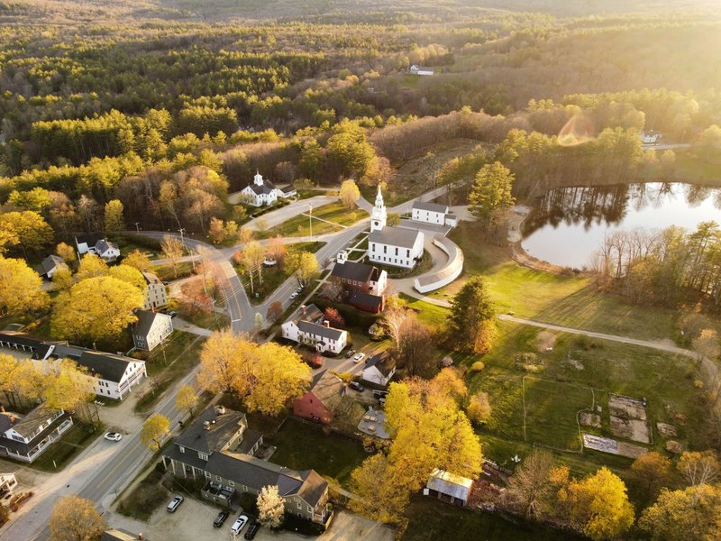
Brattleboro, VT: The Cultural Anchor
Brattleboro is the biggest thing on this stretch of border, with around 12,000 people and a downtown that punches above its weight. It has indie bookstores, a serious farmers market, a food co-op that draws people from 30 miles out, and more gallery openings per capita than most Vermont cities three times its size.
The town sits right on the Connecticut River, with the state line about two miles south. That proximity means Brattleboro effectively serves both sides — it’s where Franklin County residents drive when they need something more than a general store.
For travelers on I-91, the Brattleboro exit (Exit 3 northbound, Exit 1 from the north) drops you straight onto Putney Road and into the commercial strip. The downtown proper is a five-minute drive along the river. Parking is easy, the main street is walkable, and Mocha Joe’s on Main Street has been the local coffee institution for decades.
One thing that makes Brattleboro stand out in the border context: it’s genuinely multiuse. People live here, work here, and visit here for different reasons. It doesn’t feel like a destination manufactured for leaf-peepers.
Greenfield, MA: The Gateway City
Greenfield is Franklin County’s shire town — the seat of the county government and the commercial hub for a wide swath of rural western Massachusetts. Population sits around 18,000, making it modestly larger than Brattleboro, but it lacks the cultural density. What it has instead is infrastructure: a regional hospital, a community college, a decent restaurant scene by small-city standards, and I-91 access that makes it the logical base for exploring the border region.
The town is about 12 miles south of the Vermont line. Travelers heading north on I-91 pass through without stopping, but those who do stop find a downtown that’s been quietly rebounding — a few good spots on Federal Street, a renovated train station building, and the Brick House Bakery if you’re arriving early.
Greenfield is also the start of the Mohawk Trail (Route 2), one of the oldest designated scenic byways in the country. That road heads west through Charlemont, Florida, and into North Adams — it’s one of the better drives in Massachusetts on a clear autumn day.
The Towns Worth a Detour
Most of the smaller towns along this border won’t appear on any “must-see” list, but a few earn a stop:
Guilford, VT has a higher density of covered bridges than almost anywhere else in Windham County. The Scott Covered Bridge on Guilford Center Road is the longest single-span covered bridge in Vermont — 276 feet. It’s accessible, photogenic, and ten minutes from downtown Brattleboro.
Charlemont, MA on Route 2 sits in the Deerfield River gorge and is the takeout point for some of the best commercial whitewater in New England. Zoar Outdoor has run guided raft trips on the river since 1989. Even if you’re not rafting, the gorge itself is worth the drive through.
Whitingham, VT is Brigham Young’s birthplace, which you’d never guess from looking at it — it’s a quiet lakeside town with a population under 1,200. There’s a monument on Route 100, and Lake Sadawga has public access for swimming and kayaking.
Leyden, MA has a population under 800 and sees almost no tourist traffic. It’s worth knowing about if you’re cycling or driving back roads — Route 10 through town is scenic and completely unpressured.
A Brief History of the Line Itself
The Massachusetts-Vermont border wasn’t drawn cleanly. When Massachusetts Bay Colony received its original charter, the northern boundary was defined as a line three miles north of the Merrimack River — a definition that was geographically ambiguous once you moved west of the river’s headwaters.
The actual survey didn’t happen until 1741, when a joint commission ran the line from east to west. The survey had problems. The instruments of the era introduced errors, local landowners disputed placements, and the Connecticut River valley’s topography made precise measurement difficult. As Encyclopedia Britannica notes, Vermont itself was a contested territory for decades — New Hampshire, New York, and Massachusetts all had claims on it at various points.
Vernon, Vermont is the clearest artifact of this messy history. The town juts south into Massachusetts on the west bank of the Connecticut River, surrounded on three sides by the Massachusetts town of Northfield. Historically, the area was part of a border dispute that went back to colonial-era land grants. The placement still looks odd on a map.
The current boundary was formally established and confirmed through subsequent surveys in the 19th and 20th centuries. For practical purposes, it’s been stable for generations — but the historical weirdness is still visible in how some towns sit on the line.
Getting Around the Border Region
By car: I-91 is the backbone. It runs directly north-south through the Connecticut River valley and crosses the Massachusetts-Vermont state line between Bernardston, MA and Guilford/Brattleboro, VT. Route 2 (the Mohawk Trail) handles east-west movement through the Massachusetts side. Route 9 in Vermont provides the east-west link through Brattleboro.
By train: Amtrak’s Vermonter service stops in Brattleboro and Greenfield. It connects New York City to St. Albans, VT with a travel time of about four hours from NYC to Brattleboro. For a car-free visit to the border region, the train is genuinely viable — both Brattleboro and Greenfield have enough walkable amenities to make it worthwhile.
Timing: Fall foliage in this region typically peaks in early to mid-October, and the Connecticut River valley sees slightly later color than the higher elevations. The region draws visitors from across New England and beyond during peak weeks. Summer and early fall are also strong for outdoor activities. Winter is quiet, road conditions vary on the back roads, and some services close seasonally.
The Massachusetts-Vermont border doesn’t have a single blockbuster attraction — that’s part of the point. What it has is a stretch of river valley that’s been working land and small-town culture for 300 years, two modest cities that serve the region without overwhelming it, and enough side roads to fill a weekend if you’re willing to get off the interstate.