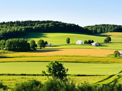
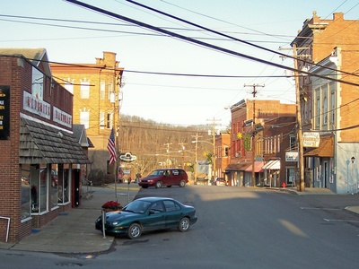
The New York–Pennsylvania border is a mix of rivers, ridges and small towns that shape local travel, commerce and weekend plans. Knowing which communities sit right on the line can help with everything from genealogy searches to choosing a scenic drive or locating the nearest official crossing.
There are 73 New York – Pennsylvania Bordering Towns, ranging from Allegany to Windsor. For each entry the data are organized as State,Country,Nearest crossing (road; km); you’ll find below.
How accurate are the “Nearest crossing (road; km)” distances?
The distances are measured along the most direct drivable route and are intended as approximate guides; actual mileage can vary with chosen roads or rerouting. Use the listed crossing as a starting point, then confirm with a current map app or official transportation site before traveling.
Can I rely on this list to plan a cross-border drive or trip?
Yes for planning basics—town names and nearby crossings give a quick overview—but check crossing hours, road conditions, and any seasonal or regulatory closures first. Pair the list with live maps and local DOT updates for safe, up-to-date routing.
New York – Pennsylvania Bordering Towns
| Name | State | Country | Nearest crossing (road; km) |
|---|---|---|---|
| Ripley | New York | United States | Interstate 90; 0 |
| North East | Pennsylvania | United States | Interstate 90; 0 |
| Mina | New York | United States | NY-426 / PA-426; 0 |
| French Creek | New York | United States | Kingsbury St; 0 |
| Clymer | New York | United States | NY-474; 0 |
| Freehold | Pennsylvania | United States | US Route 62; 0 |
| Sugar Grove | Pennsylvania | United States | PA Route 957; 0 |
| Farmington | Pennsylvania | United States | PA Route 957; 0 |
| Pine Grove | Pennsylvania | United States | Akeley-Russell Rd; 0 |
| South Valley | New York | United States | Onoville Rd (NY-280); 0 |
| Red House | New York | United States | Allegany State Park Rd 2; 0 |
| Carrollton | New York | United States | US Route 219; 0 |
| Bradford | Pennsylvania | United States | US Route 219; 0 |
| Bradford | Pennsylvania | United States | Kendall Ave; 0 |
| Foster | Pennsylvania | United States | US Route 219; 0 |
| Otto | Pennsylvania | United States | US Route 219; 0 |
| Allegany | New York | United States | Five Mile Rd; 0 |
| Olean | New York | United States | NY Route 16; 0 |
| Portville | New York | United States | NY-305 / PA-446; 0 |
| Eldred | Pennsylvania | United States | PA Route 446; 0 |
| Ceres | Pennsylvania | United States | PA Route 44; 0 |
| Genesee | New York | United States | NY-417 / PA-44; 0 |
| Willing | New York | United States | Yorks Corners Rd; 0 |
| Alma | New York | United States | Alma Hill Rd; 0 |
| Sharon | Pennsylvania | United States | PA Route 244; 0 |
| Independence | New York | United States | NY Route 248; 0 |
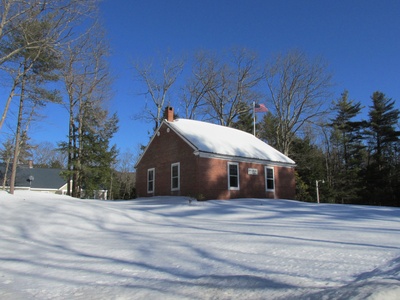
| Bingham | Pennsylvania | United States | Ulysses-Genesee Rd; 0 |
| Harrison | Pennsylvania | United States | PA Route 49; 0 |
| West Union | New York | United States | County Rd 84; 0 |
| Troupsburg | New York | United States | NY Route 36; 0 |
| Jasper | New York | United States | County Route 21; 0 |
| Tuscarora | New York | United States | Tuscarora-Woodhull Rd; 0 |
| Lindley | New York | United States | US Route 15 / I-99; 0 |
| Lawrence | Pennsylvania | United States | US Route 15 / I-99; 0 |
| Lawrenceville | Pennsylvania | United States | US Route 15; 0 |
| Southport | New York | United States | NY Route 328 / PA Route 287; 0 |
| Ashland | New York | United States | NY Route 14; 0 |
| Chemung | New York | United States | Chemung Center-Owen Hollow Rd; 0 |
| South Creek | Pennsylvania | United States | PA Route 14; 0 |
| Ridgebury | Pennsylvania | United States | Berwick Turnpike; 0 |
| Athens | Pennsylvania | United States | US Route 220; 0 |
| Sayre | Pennsylvania | United States | Keystone Ave; 0 |
| Waverly | New York | United States | Spaulding St; 0 |
| South Waverly | Pennsylvania | United States | Bradford St; 0 |
| Barton | New York | United States | Waverly St; 0 |
| Litchfield | Pennsylvania | United States | Litchfield Rd; 0 |
| Nichols | New York | United States | NY Route 282; 0 |
| Little Meadows | Pennsylvania | United States | PA Route 858; 0 |
| Apolacon | Pennsylvania | United States | PA Route 858; 0 |
| Choconut | Pennsylvania | United States | Choconut Rd; 0 |
| Binghamton | New York | United States | Interstate 81; 0 |
| Silver Lake | Pennsylvania | United States | PA Route 4004; 0 |
| Conklin | New York | United States | Conklin Rd (NY-7); 0 |
| Kirkwood | New York | United States | US Route 11; 0 |
| Great Bend | Pennsylvania | United States | Interstate 81; 0 |
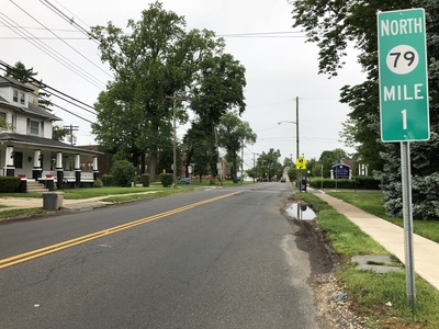
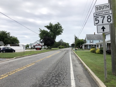
| Windsor | New York | United States | NY Route 79; 0 |
| Sanford | New York | United States | NY Route 41; 0 |
| Harmony | Pennsylvania | United States | PA Route 2031; 0 |
| Lanesboro | Pennsylvania | United States | Depot St; 0 |
| Deposit | New York | United States | NY Route 8; 0 |
| Hancock | New York | United States | NY Route 97; 0 |
| Scott | Pennsylvania | United States | River Rd; 0 |
| Damascus | Pennsylvania | United States | Cochecton-Damascus Bridge (PA-371); 0 |
| Cochecton | New York | United States | Cochecton-Damascus Bridge (NY-17B); 0 |
| Tusten | New York | United States | Skinners Falls-Milanville Bridge; 0 |
| Highland | New York | United States | Roebling’s Delaware Aqueduct; 0 |
| Lackawaxen | Pennsylvania | United States | Roebling’s Delaware Aqueduct; 0 |
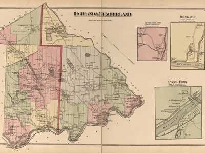
| Lumberland | New York | United States | Barryville-Shohola Bridge (NY-55); 0 |
| Shohola | Pennsylvania | United States | Barryville-Shohola Bridge; 0 |
| Deerpark | New York | United States | Interstate 84; 0 |
| Westfall | Pennsylvania | United States | Interstate 84; 0 |
| Port Jervis | New York | United States | Mid-Delaware Bridge (US 6); 0 |
| Matamoras | Pennsylvania | United States | Mid-Delaware Bridge (US 6); 0 |
Images and Descriptions
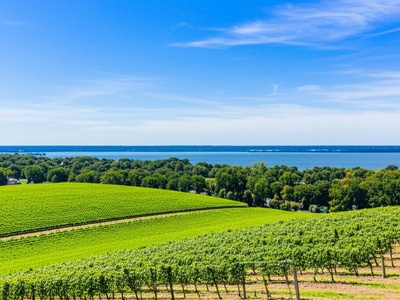
Ripley
A town whose southern boundary is the Pennsylvania state line. A major grape-growing region in the Lake Erie AVA, it is the first town travelers enter in New York when driving eastbound on Interstate 90 from Pennsylvania.
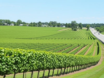
North East
A township whose northwestern corner touches the New York state line near Lake Erie. It is the heart of Pennsylvania’s wine country and is famous for its extensive vineyards and annual wine festival.
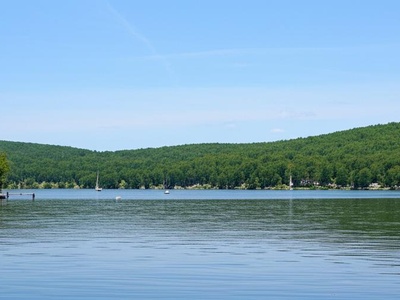
Mina
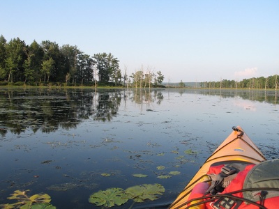
A rural town in Chautauqua County whose southern border runs along the Pennsylvania state line. The town surrounds Findley Lake, a popular destination for boating, fishing, and summer recreation for residents of both states.
French Creek
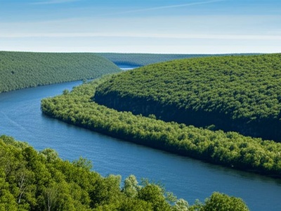
A sparsely populated town whose southern boundary is the state line. It is named for French Creek, which flows south into Pennsylvania and eventually into the Allegheny River, representing a very rural part of the border region.
Clymer
A town whose southern limit is the Pennsylvania border. It is home to a large and well-established Old Order Amish community, whose farms and horse-drawn buggies characterize the local landscape and culture.
Freehold
A township in Warren County whose northern boundary is the New York state line. It is a quiet, rural area known for its farmland and forests, containing the small village of Bear Lake near the border.
Sugar Grove
A small borough in Warren County whose northern boundary directly touches the New York state line. The community is closely tied to its surrounding rural township and is known for its historic homes and quiet atmosphere.
Farmington
A rural township whose northern edge forms the state line with New York. It is characterized by rolling hills, farmland, and forests, part of the scenic landscape of the upper Allegheny River watershed.
Pine Grove
A township whose northern border is the New York state line, partially formed by the Allegheny Reservoir. It’s a key access point to the Allegheny National Forest, offering extensive outdoor recreational opportunities.
South Valley
A town in Cattaraugus County almost entirely within the Allegany Indian Reservation. Its southern border is with Pennsylvania, much of it running through Allegany State Park and the Allegheny Reservoir.

Red House
A town located entirely within Allegany State Park, its southern boundary meeting the Pennsylvania state line. It is a hub for park administration and recreation, with minimal permanent residents.
Carrollton
A town whose southern border is the state line. It includes part of the Allegany Indian Reservation and the village of Limestone. The area is a gateway to Allegany State Park and has a history tied to the oil industry.
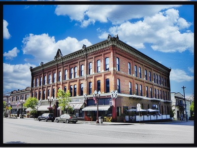
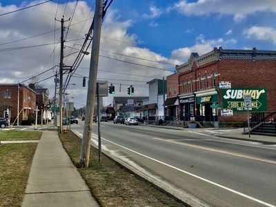
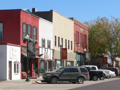
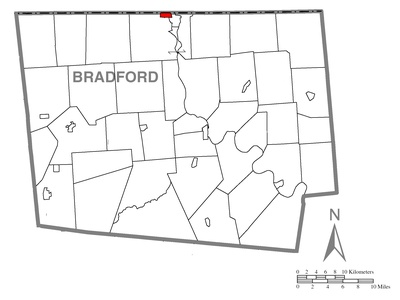
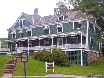
Bradford
A city whose northern municipal limits touch the New York state line. Known as the “High-Grade Oil Metropolis,” Bradford is famous for being the home of Zippo lighters and Case knives, with a rich industrial heritage.
Bradford
A township that surrounds the City of Bradford, with its northern boundary forming the New York state line. It is a mix of residential areas, commercial development, and woodlands, and hosts the University of Pittsburgh at Bradford.

Foster
A township north of Bradford whose boundary is the state line. The area was historically significant during the Pennsylvania oil rush and today is a mix of forest and rural communities.
Otto
A township in McKean County that borders New York to the north. It is a largely rural and forested area, characteristic of the “Pennsylvania Wilds” region, with a history tied to lumber and oil.
Allegany
A town whose southern boundary is the Pennsylvania state line. It is home to St. Bonaventure University and features a mix of suburban and rural landscapes along the Allegheny River.
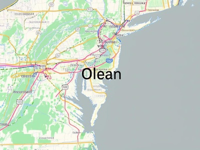
Olean
A town surrounding the City of Olean, with its southern edge on the Pennsylvania border. It serves as a commercial hub for the region and has a long history associated with the oil and railroad industries.
Portville
A town on the Pennsylvania border whose main village sits just north of the state line. The area is defined by the Allegheny River valley and features a blend of agriculture and small-town community life.
Eldred
A township on the New York border, located in the Allegheny River valley. It was once home to a World War II munitions plant and remains a small, rural community with strong ties to its industrial past.
Ceres
A rural township that shares a border with the Town of Genesee, New York. The unincorporated community of Ceres famously straddles the state line, with some buildings and properties divided between both states.
Genesee
A town in Allegany County whose southern border is with Pennsylvania. The community is best known for the hamlet of Ceres, which sits directly on the state line and shares a Main Street with its Pennsylvania counterpart.
Willing
A rural town whose southern boundary is the Pennsylvania state line. It is characterized by farmland, forests, and rolling hills, with a few small hamlets serving the agricultural community.
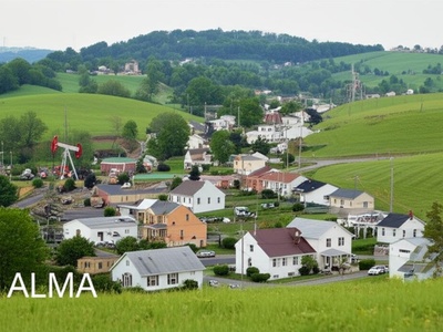
Alma
A small, hilly town on the Pennsylvania border, once a boomtown during the 19th-century oil rush. Today, it is a quiet, rural community with many active oil and gas wells still dotting the landscape.
Sharon
A township in Potter County whose northern boundary is the New York state line. A largely forested and agricultural area, it contains the borough of Shinglehouse and is part of the Pennsylvania Wilds region.
Independence
A rural town in Allegany County bordering Pennsylvania. It is known for its scenic beauty within the Appalachian uplands and is home to the small hamlet of Whitesville.
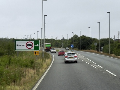
Bingham
A township in Potter County sharing a border with New York. It is a very remote and rural area, part of the high plateau region of north-central Pennsylvania, with a landscape dominated by state forest lands and farms.
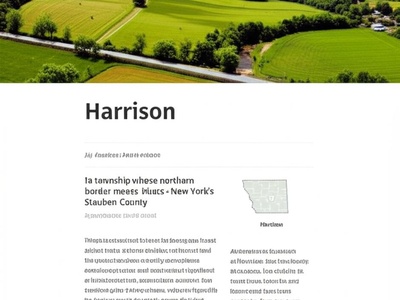
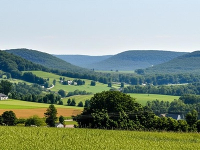
Harrison
A township whose northern border meets New York’s Steuben County. It is a rural area known for its agriculture and proximity to Harrison Valley, serving as a gateway to Pennsylvania’s scenic northern tier.
West Union
A sparsely populated, hilly town in Steuben County that borders Pennsylvania. It is one of the most rural towns in the region, characterized by its dense forests and limited development.
Troupsburg
A town in southern Steuben County sharing a border with Pennsylvania. The community is centered around agriculture and is named after Robert Troup, an agent of the Pulteney Estate which once owned the land.
Jasper
A rural town on the Pennsylvania border, known for its rolling hills and agricultural landscape. The area is primarily dedicated to dairy farming and is typical of the scenic Southern Tier region.
Tuscarora
A town in Steuben County whose southern boundary is the Pennsylvania state line. It is named for the Tuscarora people and features a rugged, forested landscape with small creeks and valleys.
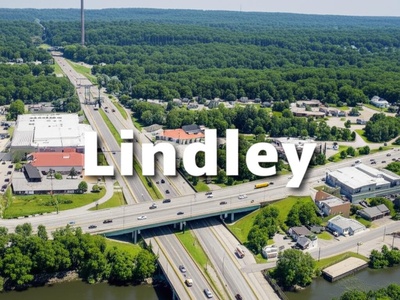
Lindley
A town on the Pennsylvania border, situated along the Tioga River. The construction of the I-99 corridor has made it a key transportation point, with the community of Lindley located right at the state line.
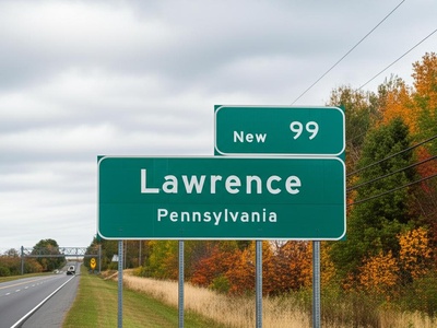
Lawrence
A township whose northern border is the New York state line. It contains the village of Lawrenceville, which sits directly on the border and serves as a key entry point into Pennsylvania along the I-99 corridor.
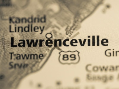
Lawrenceville
A populated place directly on the New York state line at the confluence of the Cowanesque and Tioga Rivers. It serves as a sister community to Lindley, NY, connected by the US-15/I-99 highway.
Southport
A town that forms a southern suburb of Elmira, with its southern edge on the Pennsylvania border. It is a mix of residential neighborhoods, commercial areas, and rural hillsides.
Ashland
A small town in Chemung County whose southern boundary is the Pennsylvania state line. It is primarily a residential community and serves as a suburb for the nearby city of Elmira.
Chemung
A historic town bordering Pennsylvania, known for being the site of the 1779 Battle of Chemung. It is a rural community with a rich Revolutionary War history and fertile farmland along the Chemung River.
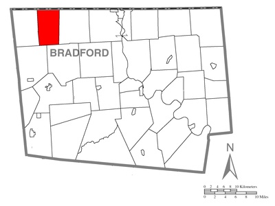
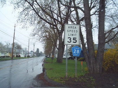
South Creek
A township in Bradford County that borders New York to the north. It is a quiet, agricultural area with rolling hills and dairy farms, representing a classic slice of the northern Pennsylvania landscape.
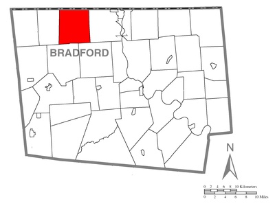
Ridgebury
A rural township whose northern border is the New York state line. The area is characterized by its agricultural heritage, with numerous farms and a landscape of wooded hills and open valleys.
Athens
A township surrounding the boroughs of Athens and Sayre, with its northern border on the New York state line. It serves as a commercial and transportation hub for “The Valley” region, which spans both states.
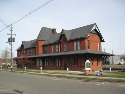
Sayre
A borough whose northern boundary is the New York state line. Historically a major railroad hub for the Lehigh Valley Railroad, it forms a continuous community with Athens, PA, and Waverly, NY.
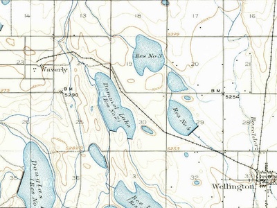
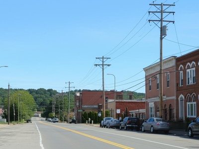
Waverly
A village whose southern boundary directly meets the Pennsylvania state line, abutting Sayre and South Waverly. It is the economic center of the tri-town “Valley” community, with its main street just feet from Pennsylvania.
South Waverly
A very small borough wedged between Sayre and the New York state line. The border runs along local streets, creating a seamless neighborhood with Waverly, NY, in a classic example of a border town.
Barton
A town in Tioga County that contains the village of Waverly. Its southern boundary is the Pennsylvania state line, making it the administrative entity for one of the most prominent cross-border communities.
Litchfield
A rural township in Bradford County that borders New York. It is a sparsely populated area with a landscape dominated by farms and forests, crossed by the Susquehanna River in its southern portion.
Nichols
A town whose southern boundary is the Pennsylvania state line, with the Susquehanna River flowing through it. It is known for the Tioga Downs Casino Resort, a major regional entertainment destination.
Little Meadows
A small borough in Susquehanna County located directly on the New York state line. It is a quiet residential community whose northern streets mark the official border with the Town of Nichols, NY.
Apolacon
A rural township bordering New York along its northern edge. The area is known for its rolling hills and farmland, with the Susquehanna River forming part of its southern border.
Choconut
A township in Susquehanna County sharing a border with New York’s Broome County. It is a very rural and hilly area, noted for its agriculture and the historic Choconut Union Church.
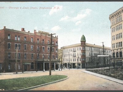
Binghamton
A town that surrounds the City of Binghamton, its southern boundary forming the Pennsylvania state line. It is a mix of suburban development and rural landscapes, serving as a gateway into New York along I-81.
Silver Lake
A township whose northern border is the New York state line. It is named for the picturesque Silver Lake, a popular spot for summer homes and recreation for residents of both states.
Conklin
A town on the Pennsylvania border just southeast of Binghamton. It has a history of industry along the Susquehanna River and is now a mix of residential communities and industrial parks.
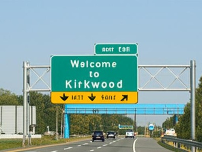
Kirkwood
A town whose southern boundary is the Pennsylvania state line. It is a primary travel corridor, with both Interstate 81 and US Route 11 passing through it just after crossing from Pennsylvania.
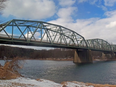
Great Bend
A borough nestled in a sharp bend of the Susquehanna River, with its northern tip touching the New York state line. It’s a key crossing point on I-81, just south of Binghamton, NY.
Windsor
A large, rural town whose southern border runs along the Pennsylvania state line. The area is characterized by dairy farms, small hamlets, and state forests, with the Susquehanna River flowing through its western part.
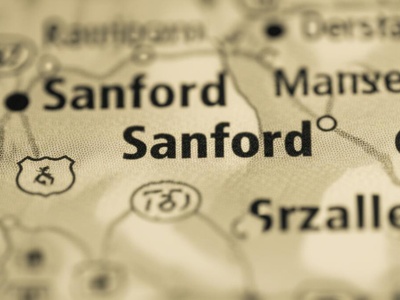
Sanford
A town in the eastern part of Broome County, sharing a long border with Pennsylvania. It contains the village of Deposit (which also straddles the Delaware County line) and is largely rural and forested.
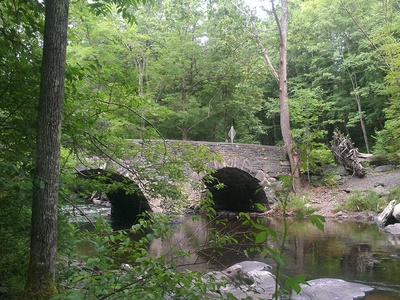
Harmony
A township bordering New York that is home to the famous Starrucca Viaduct, a massive 19th-century stone arch railroad bridge. The landscape is rural and features the meeting of Starrucca Creek and the Susquehanna River.
Lanesboro
A small borough directly on the New York state line, located just north of the Starrucca Viaduct. Its position on the Susquehanna River made it an important railroad town during the 19th century.
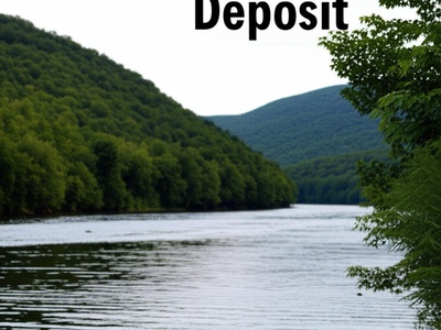
Deposit
A town whose southern boundary is the Pennsylvania state line. It is named for the “deposits” of lumber that were floated down the Delaware River from the area during the logging era.
Hancock
A large town where the East and West Branches of the Delaware River meet. The main river trunk forms its southern border with Pennsylvania, making it a premier destination for fishing and river sports.
Scott
A township in Wayne County whose northern boundary is formed by the West Branch of the Delaware River, which is the New York state line. It is a sparsely populated area known for its scenic river views.
Damascus
A large township whose northern and eastern borders are formed by the Delaware River, separating it from New York. It is known for its scenic beauty and the historic Roebling’s Delaware Aqueduct nearby.
Cochecton
A town in Sullivan County whose western boundary is the Delaware River, the state line with Pennsylvania. It is known for its rural charm and the historic Cochecton–Damascus Bridge connecting the two states.
Tusten
A town on the Delaware River, which forms its border with Pennsylvania. It is a popular area for rafting and canoeing, and is known for the scenic hamlet of Narrowsburg and the Big Eddy, a deep section of the river.
Highland
A town whose western border with Pennsylvania is the Delaware River. It is famous for being the site of Roebling’s Delaware Aqueduct, the oldest existing wire suspension bridge in the United States, now a pedestrian walkway.
Lackawaxen
A township on the Delaware River that borders New York. It is home to the Zane Grey Museum and the Roebling Aqueduct, a National Historic Landmark that connects it to Minisink Ford, NY.
Lumberland
A forested, rural town whose western boundary is the Delaware River, marking the Pennsylvania state line. It is a popular destination for outdoor recreation, including fishing, hunting, and eagle watching along the river.
Shohola
A township bordering New York along the Delaware River. It is known for the impressive Shohola Falls and its location within a popular recreational area for hiking, fishing, and boating.
Deerpark
A town in western Orange County that borders Pennsylvania along the Delaware River. It contains the city of Port Jervis and is a historic transportation corridor, once vital for the D&H Canal.
Westfall
A township in Pike County that borders New York. It contains the borough of Matamoras and is a major commercial hub for the tri-state area, situated directly across the Delaware River from Port Jervis, NY.
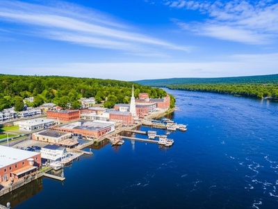
Port Jervis
A city at the confluence of the Delaware and Neversink rivers. Its western boundary is the Delaware River, forming the border with Pennsylvania’s Matamoras, at the tri-point of New York, New Jersey, and Pennsylvania.
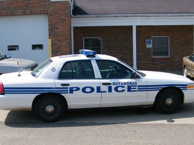
Matamoras
The easternmost borough in Pennsylvania, located directly across the Delaware River from Port Jervis, NY. It sits at the tri-state junction, serving as a busy gateway between the three states.