Colorado sits at the crossroads of the American West, where high plains meet the Rockies and routes between neighboring states have shaped travel, trade and regional identity. Knowing which states touch Colorado helps with planning road trips, understanding weather patterns and tracing historical borders.
There are 7 states that border colorado, ranging from Arizona to Wyoming; for each, you’ll find below the Border type,Direction,Shared border length (km) organized to show how they connect. The list covers Arizona, New Mexico, Oklahoma, Kansas, Nebraska, Wyoming and Utah, and you’ll find below the specific details for each border.
Which states border Colorado and where are they located around the state?
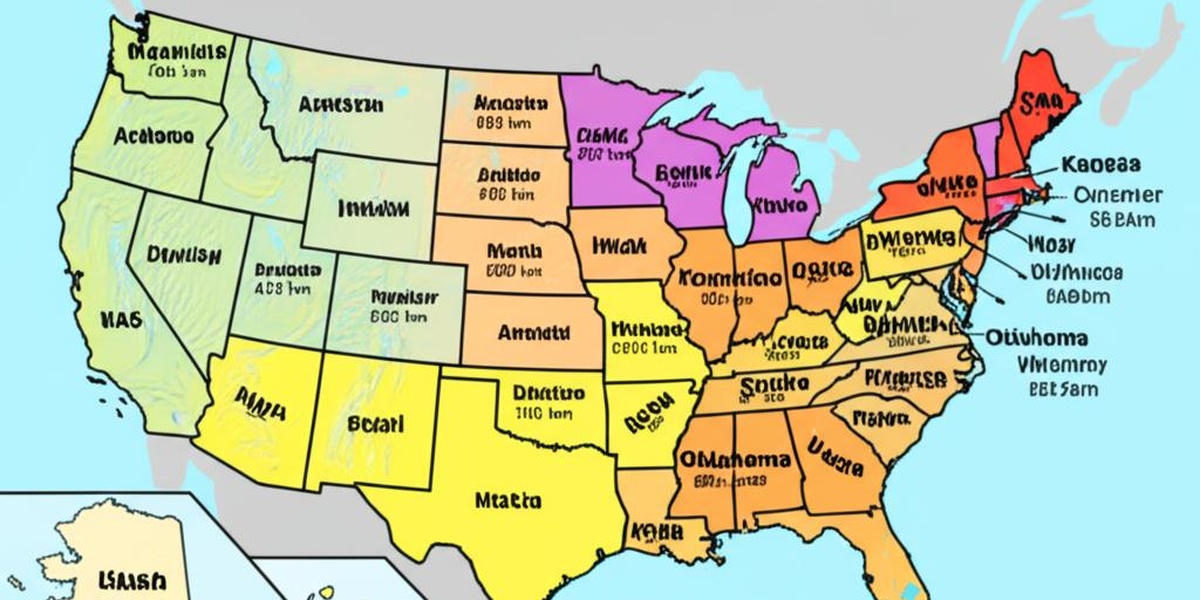
The seven neighbors are Arizona (southwest corner at the Four Corners), New Mexico (south), Oklahoma (southeast), Kansas (east), Nebraska (northeast), Wyoming (north), and Utah (west); their positions follow the compass around Colorado and explain common travel routes and regional ties.
Where do the border length numbers come from and how accurate are they?
Shared border lengths come from geographic surveys and state or federal mapping agencies; measurements can vary slightly by method (straight-line vs. surveyed boundary), so the table below uses standard sources but you may see small differences in other references.
States that Border Colorado
| State | Border type | Direction | Shared border length (km) |
|---|---|---|---|
| Wyoming | Line | north | 588 |
| Nebraska | Line | northeast | 111 |
| Kansas | Line | east | 334 |
| Oklahoma | Line | southeast | 84 |
| New Mexico | Line | south | 538 |
| Arizona | Point | southwest | 0 |
| Utah | Line | west | 445 |
Descriptions
Wyoming
Wyoming sits directly north of Colorado along the 41st parallel, sharing a long, straight border. This line runs across high plains and mountain ranges; it’s the route many travelers use to reach Colorado’s northern ski areas and national forests.
Nebraska
Nebraska touches Colorado at the northeast corner along a short stretch of the 102°03′ meridian. The border is mostly flat prairie; it marks a transition from Colorado’s foothills to Nebraska’s agricultural plains and is a subtle, straight line on the map.
Kansas
Kansas forms Colorado’s eastern border for several hundred kilometers, a mostly straight meridian line across prairie and farmland. This boundary traces survey lines and marks a shift from Colorado’s higher elevations to Kansas’s broad Great Plains.
Oklahoma
Oklahoma meets Colorado along a short southeastern boundary of roughly 84 kilometers, where Colorado’s southern edge touches the Oklahoma panhandle. It’s a brief, flat stretch—many visitors don’t realize Colorado actually borders Oklahoma.
New Mexico
New Mexico runs along Colorado’s long southern border, stretching across plateaus and desert mesas. The line includes the famous Four Corners point at its western end; the two states share extensive cultural and geographic ties across this boundary.
Arizona
Arizona touches Colorado only at the Four Corners point, a single survey point where four states meet. Visitors can stand in all four states simultaneously; there’s no shared line, just this famous corner and monument.
Utah
Utah forms Colorado’s long western boundary along the 109°03′ meridian, crossing high plateaus and mountain country. The straight, survey-defined line stretches for hundreds of kilometers and connects parks, canyons, and backcountry access between the two states.

