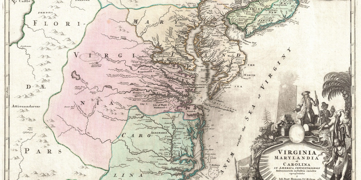
The Virginia–North Carolina line threads through rolling foothills, farmland and small historic towns that each carry a different local character. Whether you’re planning a road trip, researching family history, or just curious about nearby communities, a compact list makes it easy to see where each place sits on the map.
There are 18 Virginia – North Carolina Bordering Towns, ranging from Ararat to Whitetop. The list is organized with Country,State,Coordinates (lat, long) so you can quickly map locations, compare distances, or export the data for navigation — you’ll find below.
How were the towns chosen for this list?
Towns and communities included are those located on or immediately adjacent to the Virginia–North Carolina state line, using official place names and verified geographic coordinates; unincorporated communities are listed alongside incorporated towns to reflect the practical border crossings and local settlements.
Can I visit several of these towns in one trip?
Yes — many cluster in short driving ranges, but distances and road types vary; use the provided Coordinates to plot a route, group nearby stops, and check local services and road conditions ahead of time for a smoother, realistic day or multi-day itinerary.
Virginia – North Carolina Bordering Towns
| Name | Country | State | Coordinates (lat, long) |
|---|---|---|---|
| Carova Beach | USA | NC | 36.5499, -75.8502 |
| Knotts Island | USA | NC | 36.5293, -75.9222 |
| Moyock | USA | NC | 36.5163, -76.1722 |
| South Mills | USA | NC | 36.4446, -76.3155 |
| Northwest | USA | VA | 36.5682, -76.1913 |
| Corapeake | USA | NC | 36.5492, -76.4780 |
| Somerton | USA | VA | 36.5504, -76.6202 |
| Como | USA | NC | 36.5057, -76.9536 |
| Boykins | USA | VA | 36.5501, -77.1989 |
| Pleasant Hill | USA | NC | 36.5499, -77.3875 |
| Skippers | USA | VA | 36.5500, -77.6744 |
| Virgilina | USA | VA | 36.5505, -78.7842 |
| Virgilina | USA | NC | 36.5505, -78.7842 |
| Ararat | USA | VA | 36.5564, -80.5284 |
| Cana | USA | VA | 36.5612, -80.7015 |
| Mount Airy | USA | NC | 36.5051, -80.6081 |
| Corinth | USA | VA | 36.5505, -81.0965 |
| Whitetop | USA | VA | 36.5529, -81.5976 |
Images and Descriptions
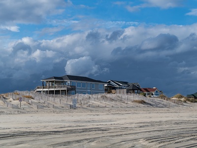
Carova Beach
Located in Currituck County, this remote Outer Banks community is only accessible by 4×4 vehicle. Its northern edge is the Virginia state line, marked by a fence. It’s famously home to herds of wild Colonial Spanish mustangs that roam the beaches.

Knotts Island
This Currituck County community (pop. ~2,100) is a geographical oddity, accessible by road only through Virginia Beach. Its northern edge touches the Virginia line. The island is known for its peaceful rural character, vineyards, and the Mackay Island National Wildlife Refuge.
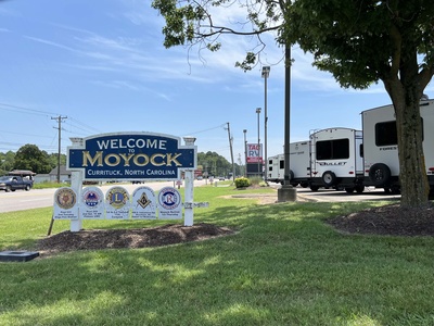
Moyock
A rapidly growing census-designated place in Currituck County with a population of about 5,159. Its northern boundary is the Virginia state line, making it a popular bedroom community for the nearby military and civilian centers of Hampton Roads, Virginia.
South Mills
This Camden County census-designated place (pop. ~454) sits directly on the Virginia border. It is historically significant as the southern terminus of the Dismal Swamp Canal, a waterway that crosses the state line and is on the National Register of Historic Places.

Northwest
A census-designated place (pop. ~1,072) in the independent city of Chesapeake, whose southern boundary is the North Carolina line. This rural community is home to the expansive Northwest River Park, a popular spot for camping, boating, and equestrian trails.
Corapeake
Located in Gates County, the northern boundary of this small census-designated place (pop. ~471) is the Virginia state line. It is a quiet agricultural community situated just south of the Great Dismal Swamp National Wildlife Refuge, which straddles the border.
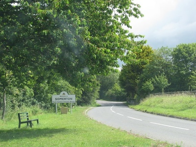
Somerton
An unincorporated village in the independent city of Suffolk, whose recognized center lies directly on the North Carolina border. Once a stop on the historic Seaboard and Roanoke Railroad, it remains a small, quiet agricultural community with deep roots.
Como
A tiny incorporated town in Hertford County with a population of just 77. Its northern town limit is the Virginia state line, across from which lies rural Southampton County. The town is a quiet example of a historic eastern North Carolina rail community.
Boykins
An incorporated town in Southampton County with a population of about 516. The town’s southern municipal boundary is the North Carolina state line. It is a traditional farming community known for its small-town charm and the annual Virginia Pork Festival.
Pleasant Hill
The northern boundary of this Northampton County census-designated place (pop. ~150) is the Virginia state line. The rural community is notable for its collection of well-preserved historic homes and plantations, reflecting the area’s rich agricultural history.
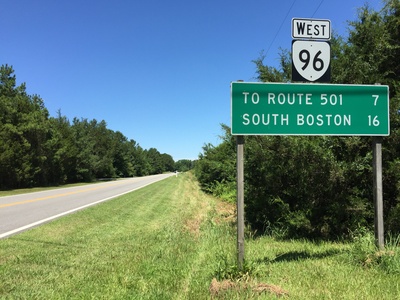
Skippers
This Greensville County census-designated place (pop. ~500) has a southern boundary that directly follows the North Carolina state line. Located just off I-95, it serves as a gateway community and is known for its proximity to the Meherrin River.
Virgilina
The Virginia half of a unique town that straddles the state line, located in Halifax County with a population of about 154. The state line runs down the middle of Florence Avenue, a feature celebrated by a prominent border marker.
Virgilina
Located in Granville County, this is the North Carolina portion of the town of Virgilina. The community shares a single identity with its Virginia counterpart, with the state line on its main street serving as a popular photo-op and a testament to its bi-state heritage.
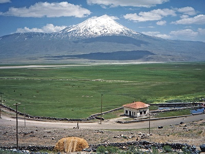
Ararat
A census-designated place in Patrick County (pop. ~800) whose southern boundary is the North Carolina state line. Nestled in the foothills of the Blue Ridge Mountains and named for the nearby Ararat River, the area is known for its stunning rural scenery.
Cana
A census-designated place in Carroll County (pop. ~1,200) located directly on the North Carolina border, adjacent to Mount Airy. The area is a hub for old-time and bluegrass music and sits at the foot of the beautiful Blue Ridge Parkway.
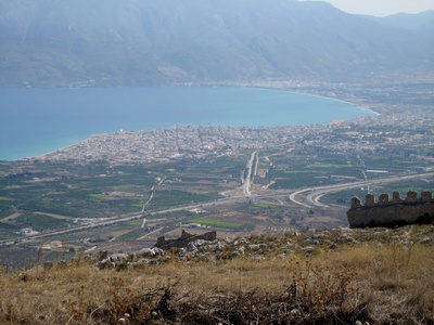
Mount Airy
A city of 10,676 in Surry County whose northern corporate limits physically touch the Virginia state line. It is world-famous as the birthplace of actor Andy Griffith and the inspiration for the fictional town of Mayberry, drawing tourists to its charming downtown.
Corinth
A small, unincorporated crossroads community in Grayson County whose populated center is situated directly on the Virginia–North Carolina state line. It’s a quiet, rural outpost deep in the scenic Blue Ridge Mountains, bordering Alleghany County, NC.
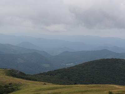
Whitetop
A mountain census-designated place in Grayson County (pop. ~300) located right on the North Carolina border. The community is named for Virginia’s second-highest peak and is renowned for its old-time music heritage, hosting the annual Whitetop Mountain Molasses Festival.