Alabama’s shorelines and inland waterways are dotted with bays that shape local fishing, wildlife habitats, and coastal communities. From sleepy estuaries to busy harbor inlets, these bays tell the story of the state’s maritime geography and seasonal rhythms.
There are 20 Bays in Alabama, ranging from Arnica Bay to Wolf Bay. For each entry you’ll find below the key facts organized by County, Coordinates (lat, long), Area (km2) so you can compare locations, map them quickly, or plan visits — you’ll find below the full list and details.
How can I use this list to plan a visit to a specific bay?
Use the county and coordinate fields to map exact access points and see which bays are nearest roads, parks, or boat ramps; the area figure helps set expectations for size and likely activities (fishing, birding, paddling). Combine these entries with local park or marina resources for up-to-date access info.
How reliable are the coordinates and area figures provided here?
The coordinates and area values are intended as a practical reference for mapping and comparison; for navigation or legal purposes consult official nautical charts or county GIS layers, which will have the most current, authoritative measurements.
Bays in Alabama
| Name | County | Coordinates (lat, long) | Area (km2) |
|---|---|---|---|
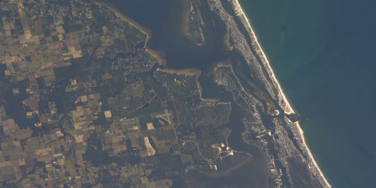
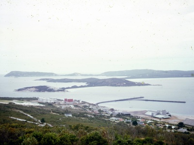
| Mobile Bay | Mobile / Baldwin | 30.43, -87.95 | 1,070 |
| Perdido Bay | Baldwin | 30.34, -87.43 | 130 |
| Bon Secour Bay | Baldwin | 30.30, -87.80 | 180 |
| Grand Bay | Mobile | 30.38, -88.37 | 60 |
| Portersville Bay | Mobile | 30.35, -88.27 | 25 |
| Wolf Bay | Baldwin | 30.30, -87.60 | 21 |
| Weeks Bay | Baldwin | 30.41, -87.83 | 13 |
| Little Lagoon | Baldwin | 30.25, -87.77 | 11 |
| Bay Minette Bay | Baldwin | 30.73, -87.88 | 8 |
| Arnica Bay | Baldwin | 30.30, -87.54 | 6 |
| Oyster Bay | Baldwin | 30.27, -87.73 | 5 |
| Bayou La Batre Bay | Mobile | 30.38, -88.25 | 4 |
| Little Bay | Mobile | 30.35, -88.13 | 3 |
| Chacaloochee Bay | Baldwin | 30.82, -87.89 | 2.5 |
| Terry Cove | Baldwin | 30.26, -87.65 | 2 |
| Big Bateau Bay | Baldwin | 30.86, -87.90 | 1.5 |
| Justin’s Bay | Baldwin | 30.77, -87.90 | 1.2 |
| Delvan Bay | Baldwin | 30.78, -87.89 | 1 |
| Bay Grass | Baldwin | 30.30, -87.52 | unknown |
| Old Woman’s Bay | Baldwin | 30.34, -87.48 | unknown |
Images and Descriptions
Mobile Bay
Alabama’s largest estuary, a vital hub for shipping, fishing, and recreation. It’s fed by the Mobile-Tensaw River Delta and empties into the Gulf of Mexico, flanked by historic forts and diverse wildlife habitats. Public access is abundant.
Perdido Bay
A beautiful estuary forming the border between Alabama and Florida. Known for its clear waters and excellent fishing, it’s a popular spot for boating and watersports. Several parks and boat ramps provide public access to its scenic shoreline.
Bon Secour Bay
The southeastern portion of Mobile Bay, named for the French phrase for “safe harbor.” It’s a shallow, productive area crucial for shrimp and oysters, bordered by the Bon Secour National Wildlife Refuge and the Fort Morgan peninsula.
Grand Bay
A large, shallow bay on the Alabama-Mississippi border, part of the Mississippi Sound. It is a critical habitat for birds and marine life, protected by the Grand Bay National Estuarine Research Reserve and known for its undisturbed salt marshes.

Portersville Bay
A shallow bay in the Mississippi Sound, located north of Dauphin Island. It’s a historically significant area for oystering and is popular with local anglers targeting speckled trout and redfish. Its extensive marshes provide a rich nursery for marine life.
Wolf Bay
Located just north of Orange Beach, this bay connects to the Intracoastal Waterway. It’s a popular destination for fishing and boating, with several marinas and waterfront restaurants. The bay is recognized for its improving water quality and seagrass beds.
Weeks Bay
A small, pristine estuary fed by the Fish and Magnolia rivers. As a National Estuarine Research Reserve, it’s a key site for scientific study and environmental education. Visitors can explore via kayak or visit the interpretive center for exhibits.
Little Lagoon
A long, shallow coastal lagoon in Gulf Shores, separated from the Gulf by a narrow strip of sand. It is a popular spot for fishing, kayaking, and paddleboarding in calmer waters, with several public access points along its northern shore.
Bay Minette Bay
A large, shallow bay in the upper Mobile-Tensaw Delta where Bay Minette Creek widens. It’s a prime destination for freshwater fishing and duck hunting, characterized by its extensive aquatic vegetation and marshlands, accessible primarily by boat from nearby launches.
Arnica Bay
A serene tributary of the Perdido Bay system, accessible via the Intracoastal Waterway. Popular for its calm waters, it’s an ideal spot for paddleboarding, kayaking, and fishing away from the more crowded main channels.
Oyster Bay
A sheltered embayment off the Intracoastal Waterway near Gulf Shores. It’s a calm haven for boaters and kayakers, surrounded by residential areas and part of the Bon Secour National Wildlife Refuge, providing important habitats for coastal birds.
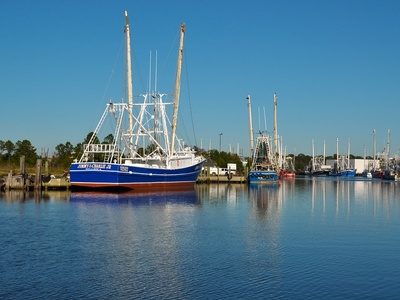
Bayou La Batre Bay
The wide mouth of Bayou La Batre as it enters the Mississippi Sound. As the “Seafood Capital of Alabama,” this bay is the heart of a bustling commercial fishing industry, filled with shrimp boats and processing facilities along its shores.
Little Bay
A small, protected bay on the northern side of Dauphin Island, separating the main island from Little Dauphin Island. It offers calm waters perfect for kayaking, birdwatching, and fishing, with access to the Audubon Bird Sanctuary nearby.
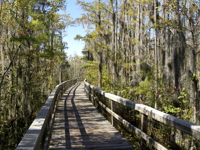
Chacaloochee Bay
A riverine bay within the vast Mobile-Tensaw River Delta. This remote, scenic bay is surrounded by cypress swamps and marshes, offering an authentic delta experience for boaters and anglers seeking bass, bream, and solitude in a wild setting.
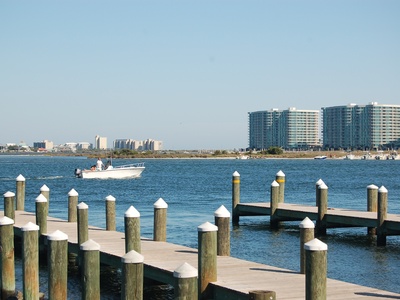
Terry Cove
A busy, well-protected cove in Orange Beach, offering direct access to Perdido Pass and the Gulf of Mexico. It’s lined with marinas, charter fishing fleets, and restaurants, making it a central hub for boating and marine activities in the area.
Big Bateau Bay
Located deep within the wilderness of the Mobile-Tensaw Delta, this bay is a secluded spot known to local anglers and boaters. Its cypress-lined shores and quiet waters make it an excellent place to observe wildlife and enjoy peaceful freshwater fishing.
Justin’s Bay
A quiet embayment off the Blakeley River in the Mobile-Tensaw Delta. This bay provides a sheltered area for fishing and wildlife viewing. It’s a favorite spot for kayakers exploring the delta’s intricate waterways, offering a glimpse of its rich biodiversity.
Delvan Bay
A small, remote bay in the heart of the Mobile-Tensaw Delta, accessible by boat via the Blakeley River. It is surrounded by dense bottomland forest and is a serene location for freshwater fishing, particularly for largemouth bass and various panfish species.
Bay Grass
A smaller, marshy embayment on the northern edge of Arnica Bay, within the greater Perdido Bay system. It is a crucial nursery area for juvenile fish and crustaceans, characterized by extensive salt marshes and shallow waters ideal for kayak fishing.

Old Woman’s Bay
A small, secluded inlet off Perdido Bay near the Florida line. This quiet spot is surrounded by marshland and is best explored by kayak or small boat. It offers a peaceful escape for birdwatching and fishing in a natural setting.