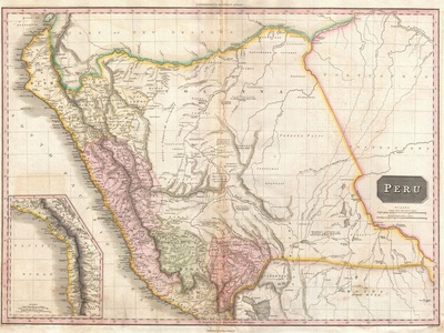
South America’s coastline is a study in contrasts — long Atlantic stretches, Caribbean shores and the jagged Pacific edge each host coastal inlets that shape local weather, shipping lanes and fisheries. These gulfs connect inland waterways to the open sea and play a practical role for ports and regional economies.
There are 12 Gulfs in South America, ranging from Gulf Nuevo to Gulf of Venezuela; for each you’ll find below Country(s), Coordinates (lat,long), and Area (km2) presented so you can quickly compare location and size at a glance.
How should I use the Country(s), Coordinates (lat,long), and Area (km2) columns when planning research or travel?
Use Country(s) to identify jurisdiction and nearby ports, Coordinates to map exact positions for navigation or fieldwork, and Area (km2) to gauge scale — larger gulfs often imply broader ecological zones and different weather patterns. Combine these fields with nautical charts and local notices for safe planning.
How reliable are the coordinates and area figures in such lists?
Coordinates and area measurements are generally derived from maritime charts and geographic databases and are useful for comparison, but boundaries and methods vary; for precision tasks (navigation, legal claims, environmental assessments) confirm with official hydrographic services or recent satellite data.
Gulfs in South America
| Name | Country(s) | Coordinates (lat,long) | Area (km2) |
|---|---|---|---|
| Gulf of Venezuela | Venezuela, Colombia | 10.50,-71.80 | 40,000 |
| Gulf of Paria | Venezuela, Trinidad and Tobago | 10.30,-61.80 | 6,500 |
| Gulf of Guayaquil | Ecuador | -2.00,-80.00 | 6,000 |
| Gulf of San Jorge | Argentina | -46.00,-66.00 | 11,000 |
| Gulf of San Matías | Argentina | -41.50,-65.10 | 3,500 |
| Gulf Nuevo | Argentina | -42.75,-64.95 | 2,000 |
| Gulf of Ancud | Chile | -41.90,-73.80 | 5,000 |
| Gulf of Corcovado | Chile | -43.50,-73.60 | 10,000 |
| Gulf of Arauco | Chile | -37.05,-73.22 | 1,400 |
| Gulf of Penas | Chile | -47.50,-74.50 | 6,000 |
| Gulf of Urabá | Colombia | 8.80,-77.40 | 1,800 |
| Gulf of Cariaco | Venezuela | 10.80,-63.80 | 1,200 |
Images and Descriptions
Gulf of Venezuela
Large Caribbean gulf at Venezuela’s northwest coast, notable for fisheries, oil shipping and proximity to Lake Maracaibo. Historically disputed maritime boundary, important for regional trade and ecology with mangroves and productive coastal waters.
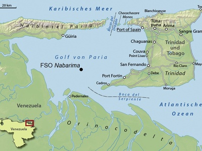
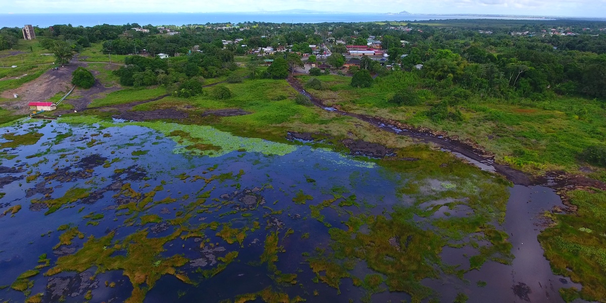
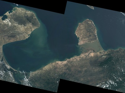
Gulf of Paria
Sheltered gulf between northeastern Venezuela and the island of Trinidad, vital for fishing, local shipping and petroleum terminals. Shallow waters host mangroves and seagrass beds and support dense coastal communities and biodiversity.
Gulf of Guayaquil
Broad Pacific gulf around Ecuador’s largest port, Guayaquil. A key economic zone for shipping, shrimp aquaculture and mangrove ecosystems; it influences regional climate and supports important fisheries and coastal industries.
Gulf of San Jorge
Patagonian gulf along Argentina’s central-southern Atlantic coast, known for rich fisheries, oilfields and wildlife on nearby coasts. Broad, cool waters and exposed shores shape productive marine ecosystems and support regional ports and industry.

Gulf of San Matías
Atlantic gulf in northern Patagonia with wide beaches and breeding grounds for marine birds and mammals. Notable for fisheries, tourism (beaches and wildlife viewing) and a mix of sandy and rocky coastal habitats.
Gulf Nuevo
Small, sheltered bay-like gulf near Península Valdés, famous for whale watching (southern right whales) and coastal wildlife. Important for tourism, local fisheries and as a protected marine area for marine mammals and seabirds.
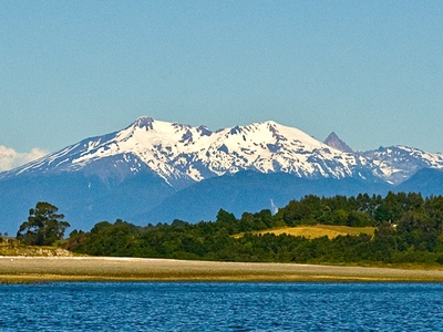
Gulf of Ancud
Inner gulf off Chiloé Island with complex islands, channels and rich fjord-like habitats. Important for aquaculture, artisanal fisheries and cultural coastal communities; scenic waterways attract boating and tourism.
Gulf of Corcovado
Large Chilean coastal gulf separating mainland and Chiloé archipelago, characterized by fjords and islands. Productive fisheries, salmon farming, and diverse marine life including whales and seabirds make it ecologically and economically important.
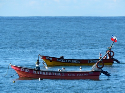
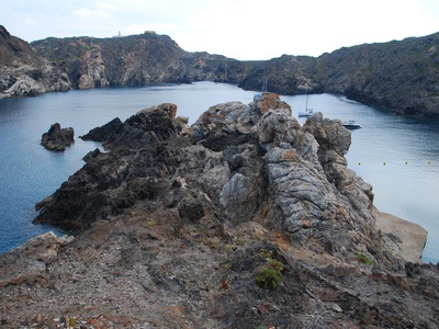
Gulf of Arauco
Small Pacific gulf near Concepción, historically important for shipping, timber and fisheries. Industrial ports and nearby cities shape its economy; coastal wetlands and estuaries support local biodiversity despite urban impacts.
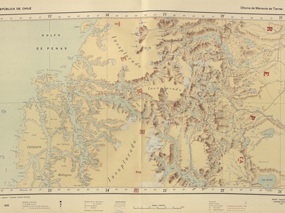
Gulf of Penas
Remote, windswept gulf on Chile’s southern coast opening to the Pacific. Known for complex navigation, rugged islands and rich marine ecosystems; historically challenging for shipping and valued for fisheries and natural wilderness.
Gulf of Urabá
Caribbean gulf at Colombia’s northwest coast near the Panama border, forming the southern end of the Gulf of Darién region. Important for local fisheries, ports and coastal communities with mangroves and tropical marine habitats.
Gulf of Cariaco
Narrow gulf on Venezuela’s northeastern coast, noted for productive upwelling, fisheries and the Cariaco Basin oceanographic observatory. Its unique circulation creates high biological productivity and supports local fishing communities.