Most people who’ve stared at a U.S. map their whole lives have no idea Missouri and Tennessee share a border. They do. It’s short, it’s weird, and it exists because of a stubborn 19th-century landowner and a river that kept changing its mind. The two states meet for roughly 30 miles along the bottom edge of Missouri’s Bootheel, where cotton fields run right up to the Tennessee line.
This is the guide to that border: the towns that sit on it, the one highway that crosses it, and the geography that put it there in the first place.
Table of Contents
- Quick Answer
- Why the Border Even Exists
- The Missouri-Side Border Towns
- The Tennessee-Side Towns
- Crossing the Line: I-155 from Hayti to Dyersburg
- Border Towns at a Glance
- Fun Facts and Trivia
Quick Answer
Yes, Missouri borders Tennessee. The shared boundary is short — about 30 miles — and runs along the southern edge of Missouri’s Bootheel, the rectangular spur that hangs off the bottom-right corner of the state. On the Missouri side, the closest towns are tiny farming communities in Pemiscot and Dunklin counties: places like Cooter, Marston, and Cottonwood Point. On the Tennessee side, you’re looking at rural Lake and Dyer county locales such as Bessie. The only major road crossing is Interstate 155, which jumps the Mississippi River between Hayti, Missouri and Dyersburg, Tennessee.
Why the Border Even Exists
The Bootheel is the reason. Without it, Missouri’s southern edge would be a clean horizontal line at 36°30′ latitude, and the state would never touch Tennessee at all. Arkansas would be the southern neighbor, full stop.
The story usually credited for the Bootheel is John Hardeman Walker, a wealthy landowner who lobbied hard to keep his holdings inside Missouri rather than Arkansas Territory when Missouri’s boundaries were being drawn in 1820. Whether one man really bent a state line is debated, but the result is undeniable: a rectangular chunk of land drops below the 36°30′ line, extending Missouri south to roughly 36° latitude. That extension is the Missouri Bootheel, and its eastern edge butts up against the Mississippi River — which is where Tennessee starts.
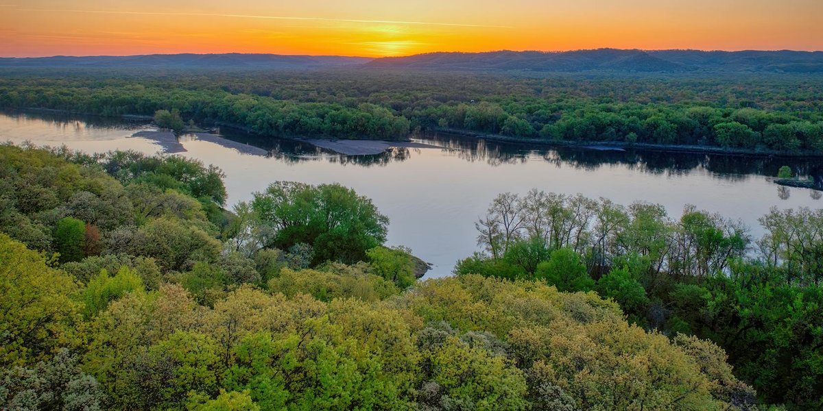
So the Missouri–Tennessee border isn’t a surveyed straight line like most state boundaries out here. For much of its length it’s the Mississippi River itself. And because the Mississippi has shifted course repeatedly over the centuries, the legal boundary and the current riverbank don’t always agree. There are spots where a sliver of “Tennessee” sits on the Missouri side of the water, and vice versa, left behind when the river jumped its banks.
This is also flat, fertile, hard-farmed country. The Bootheel sits in the alluvial plain of the Mississippi, drained and cleared in the early 1900s. Today it’s some of the most productive cotton, rice, and soybean land in Missouri — which is why the “towns” along this border are small. People here grow things.
The Missouri-Side Border Towns
The Missouri communities nearest the Tennessee line sit in Pemiscot, Dunklin, and New Madrid counties. None of them are big. Most won’t show up unless you zoom way in.
Cooter is about as close as a named Missouri town gets to Tennessee. It’s a village in Pemiscot County with a population in the low hundreds, surrounded by farmland, a few miles from the river that forms the state line. The name alone earns it a place on this list.
Cottonwood Point is a tiny unincorporated spot in Pemiscot County that historically had a ferry landing on the Mississippi. It’s about as far southeast as you can go and still be in Missouri.
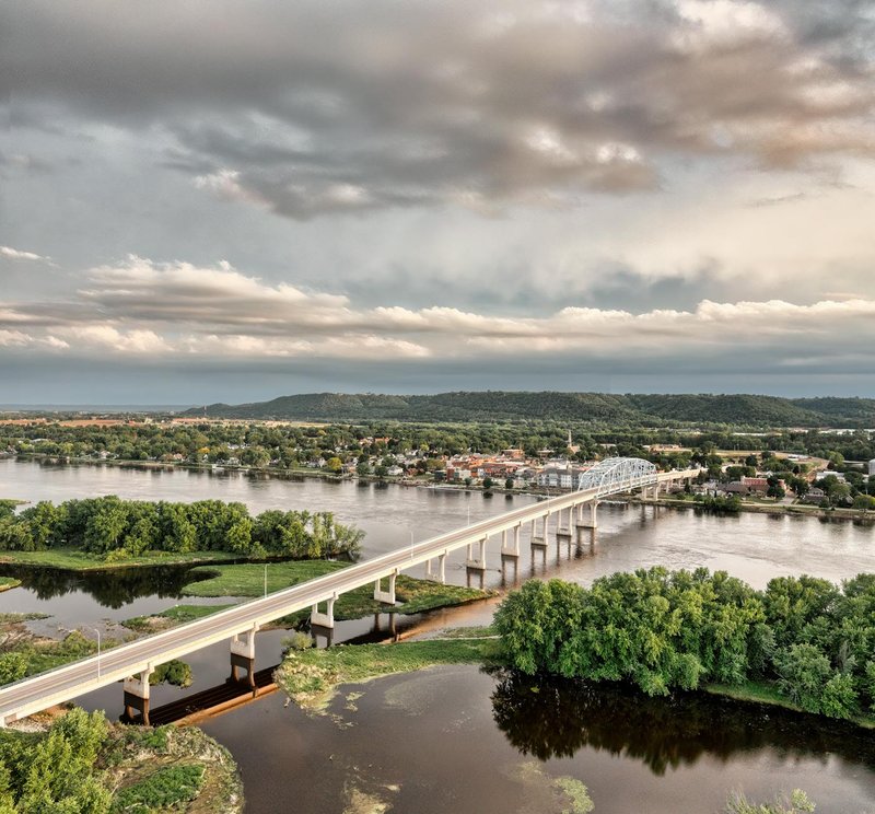
Marston and Hayti sit a little farther north along the Bootheel’s eastern flank. Hayti is the practical anchor of the area — it’s the Missouri-side town where Interstate 155 begins its run toward the river crossing, and it has the gas stations, the exit, and the services you’d actually stop for.
Steele and Caruthersville round out the Pemiscot County communities near the border. Caruthersville is the county seat and sits right on the Mississippi, making it one of the larger riverside towns in the Bootheel, with a riverboat casino and a real downtown.
The pattern is consistent: small populations, big fields, and a relationship to the Mississippi that’s both economic and geographic. These same river communities also sit just upstream from where Missouri meets its other southeastern neighbor — if you keep following the water north, you run into the Missouri–Kentucky bordering towns strung along the same stretch of the Mississippi.
The Tennessee-Side Towns
Cross the river and you’re in northwest Tennessee, in Lake and Dyer counties. This corner of Tennessee is just as rural as the Bootheel, and for the same reasons — it’s part of the same flat Mississippi floodplain.
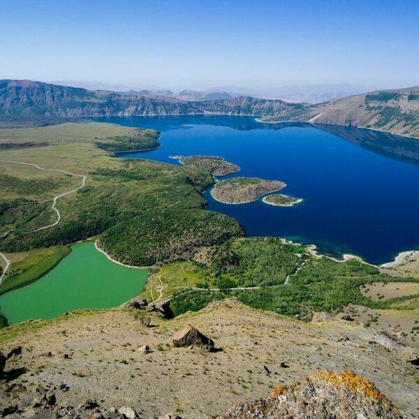
Bessie is one of the nearest named Tennessee communities to the Missouri line, an unincorporated spot in Lake County. Nearby Tiptonville, the Lake County seat, sits close to Reelfoot Lake, a flooded forest created by the New Madrid earthquakes of 1811–1812 — the same seismic zone that runs right through this border region.
Dyersburg, in Dyer County, is the largest town on the Tennessee side and the eastern terminus of the I-155 crossing. With around 16,000 people, it’s the real city of this border area — the place with hotels, restaurants, and a hospital. If you’re crossing from Missouri, Dyersburg is where you actually land.
So the asymmetry is striking. The Missouri side is all villages and farm crossroads. The Tennessee side, thanks to Dyersburg, has an actual urban anchor.
Crossing the Line: I-155 from Hayti to Dyersburg
There’s exactly one Interstate that connects the two states directly, and it’s a short one. Interstate 155 runs about 32 miles total, beginning at I-55 near Hayti, Missouri, crossing the Mississippi on the Caruthersville Bridge, and ending at Dyersburg, Tennessee, where it meets U.S. 51.
The Caruthersville Bridge — officially carrying I-155 over the Mississippi — is the only Interstate-grade river crossing for a long stretch in either direction. Drive it and you’ll cover the entire Missouri-to-Tennessee connection in under 40 minutes, river included.
If you’re routing a road trip, that’s the move: take I-55 down through the Bootheel to Hayti, then peel off onto I-155 east. You’ll cross the Mississippi, leave Missouri, and roll into Dyersburg before you’ve finished your coffee. From Dyersburg, U.S. 51 carries you south toward Memphis, about 80 miles on.
For anyone chasing the “I touched the Missouri–Tennessee border” trivia stamp, this bridge is the cleanest way to do it. And if you’re the kind of traveler who collects state-line crossings, it’s worth bookmarking our broader guide to bordering towns between US states, which maps out crossings like this one all over the country.
Border Towns at a Glance
| Town | State | County | Notes |
|---|---|---|---|
| Cooter | Missouri | Pemiscot | Tiny village near the river line |
| Cottonwood Point | Missouri | Pemiscot | Former ferry landing, far southeast corner |
| Hayti | Missouri | Pemiscot | Western start of I-155 |
| Caruthersville | Missouri | Pemiscot | County seat, riverside, casino |
| Steele | Missouri | Pemiscot | Bootheel farming town |
| Marston | Missouri | New Madrid | Small Bootheel community |
| Bessie | Tennessee | Lake | Rural community near the line |
| Tiptonville | Tennessee | Lake | County seat, near Reelfoot Lake |
| Dyersburg | Tennessee | Dyer | Largest town, eastern end of I-155 |
Fun Facts and Trivia
A few things worth knowing if border geography is your thing:
- Both states are tied for the most neighbors in the country. Missouri and Tennessee each border eight other states — the joint record. Missouri’s eight are Iowa, Illinois, Kentucky, Tennessee, Arkansas, Oklahoma, Kansas, and Nebraska. Tennessee’s are Kentucky, Virginia, North Carolina, Georgia, Alabama, Mississippi, Arkansas, and Missouri. They count each other.
- The border is mostly water, not survey line. Unlike the ruler-straight boundaries of the Plains states, much of the Missouri–Tennessee line is the Mississippi River, which means it has drifted over time and created legal oddities where the bank no longer matches the boundary.
- It almost didn’t exist. Strip away the Bootheel and Missouri never touches Tennessee. The whole border hangs on that one rectangular extension of land below the 36°30′ line.
- It’s earthquake country. This is the heart of the New Madrid Seismic Zone, source of the massive 1811–1812 quakes that reshaped the land and reportedly made the Mississippi appear to run backward for a short time.
The Missouri–Tennessee border is the kind of geographic footnote that’s more interesting than the famous stuff. Thirty miles of river, a handful of farm towns, one bridge, and a state line that exists only because someone refused to be drawn into Arkansas. Next time someone insists the two states don’t touch, you’ll know exactly where to send them.