Gambia has two UNESCO World Heritage Sites, and most pages online will tell you that much, then stop. They’ll list Kunta Kinteh Island and the Stone Circles of Senegambia, drop the inscription years, and leave you no closer to actually standing on either one. That’s the gap this guide fills. You get the history that makes these places matter, and the logistics — ferries, fees, tour options, timing — that get you there.
Both sites sit within day-trip range of the coast, but they pull in opposite directions: one upriver into Gambia’s deep interior, one a short boat ride from the capital. Plan accordingly.
Quick Reference
| Site | Inscribed | UNESCO Criteria | Location |
|---|---|---|---|
| Kunta Kinteh Island and Related Sites | 2003 | (iii), (vi) | Lower Gambia River, near Albreda/Juffureh, ~30 km from Banjul |
| Stone Circles of Senegambia | 2006 | (i), (iii) | Central River Region (Wassu, Kerbatch) + two sites in Senegal |
The Stone Circles inscription is shared with Senegal and covers four megalithic complexes total — two on each side of the border. In Gambia, the ones you visit are Wassu and Kerbatch.
Table of Contents
- Kunta Kinteh Island and the Slave Trade
- How to Visit Kunta Kinteh Island
- The Stone Circles of Senegambia
- How to Visit the Stone Circles
- Best Time to Go
- What Else to See Nearby
Kunta Kinteh Island and the Slave Trade {#kunta-kinteh-island}
The island is small — barely the size of a few tennis courts now, and shrinking as the river eats at it. That smallness is the first thing that hits you, because for roughly 300 years this scrap of land was one of the most strategically fought-over points on the West African coast.
It guarded the mouth of the Gambia River, the only navigable route deep into the interior for hundreds of miles. Whoever held the island controlled the trade moving up and down that water: gold, ivory, beeswax, and people. The Portuguese reached it first in the 1450s. After that it passed through the hands of the Duchy of Courland (a Baltic state most people have never heard of), the Dutch, the British, and French raiders, changing flags repeatedly as European powers fought for the river. The British held it longest and called it James Island, after the Duke of York. Gambia renamed it Kunta Kinteh Island in 2011, after the ancestor Alex Haley traced in Roots to the nearby village of Juffureh.
The island didn’t operate alone. The UNESCO inscription bundles it with the related mainland sites that made the trade work: the village of Juffureh, the Maurel Frères building (now a small museum), the ruins of the Portuguese chapel and colonial warehouse at Albreda, and the “Freedom Flagpole” marking where the slave trade was declared abolished on the British side. Walk the island and the mainland together and you get the whole machinery — the holding point, the trading posts, the church that blessed it all.
The criteria UNESCO cited, (iii) and (vi), point to exactly why it’s listed: it’s a direct, physical testimony to the encounter between Africa and Europe along the river, and to one of the most consequential and brutal chapters in human history. The remaining baobab trees and a few cannon and foundation stones are most of what’s left standing. The river takes a little more of the island every year, which is part of why getting there now, rather than later, is the honest advice.
How to Visit Kunta Kinteh Island {#how-to-visit-kunta-kinteh}
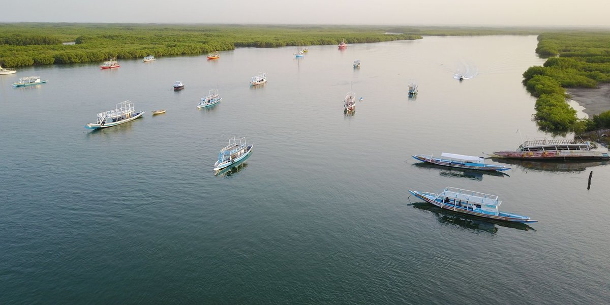
You reach the island by boat, and you reach the boat from Albreda or Juffureh on the north bank of the river. Getting to that north bank is the part people underestimate.
The classic route is the Banjul–Barra ferry. It crosses the river mouth from Banjul to the town of Barra in roughly 45 minutes to an hour, though waits on either side can stretch the whole crossing past two hours when it’s busy. From Barra you continue overland — by bush taxi or arranged car — about 30 km west to Albreda and Juffureh. The Gambia ferry service has a reputation for breakdowns and long queues, so build slack into your day and don’t make it your only plan if you’re on a tight schedule.
The easier route is a guided river cruise or tour that leaves directly from the coastal resort areas (Banjul, Bakau, the tourist strip around Kololi) and takes you upriver to the island by boat, skipping the ferry entirely. Most of these are full-day trips that bundle the island, Albreda, Juffureh, and the Maurel Frères museum into one circuit, usually with lunch and a local guide. It costs more than doing it independently, but on a single day it’s the difference between seeing the site relaxed and spending half your day staring at a ferry queue.
A few practical notes:
- Entry and fees: Expect a site/museum entrance fee plus a separate charge for the short pirogue (canoe) crossing to the island itself. These are modest and usually collected in cash (Gambian dalasi), so carry small bills.
- Guides: Local guides at Juffureh are part of the experience and provide the oral history — including the Roots connection — that the bare ruins can’t. Agree on a price before you start.
- Time needed: Half a day minimum from the coast on a tour; a full day if you’re doing the ferry independently.
- Footing: The island has uneven ground, exposed sun, and a small jetty. Wear shoes you can walk on rough ground in, and bring water and a hat — there’s almost no shade out there.
The Stone Circles of Senegambia {#stone-circles}
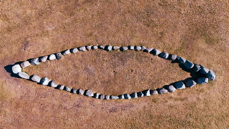
This is the site Gambia’s tourism barely talks about, and it’s the one that genuinely stops you. Spread along a band of the Gambia River valley running into Senegal sit more than 1,000 stone circles, grouped across roughly 90 sites — the largest concentration of stone circles anywhere in the world.
The Gambian half of the listing covers Wassu and Kerbatch. The stones are laterite pillars, quarried from the ground, shaped with iron tools, and stood upright in rings — most circles holding eight to fourteen stones, some pillars reaching over two metres and weighing several tons. They were raised by a sophisticated and well-organized society of the Serer people over a long span, roughly between the 3rd century BC and the 16th century AD. Beneath and around them are burial grounds, which is what the rings appear to mark.
The reason they earn criteria (i) and (iii) is partly the achievement and partly the consistency. Across hundreds of kilometres and many centuries, the construction method, the proportions, the alignment of the rings stays remarkably uniform — evidence of a continuous, organized culture with the engineering knowledge and social structure to quarry, move, and erect thousands of tons of stone over generations. At Wassu you’ll also see the distinctive “lyre” or bifurcated stones — pillars split at the top into a V — which are rare and specific to this complex.
There’s a quiet local tradition still alive here: visitors and locals leave small stones balanced on top of the pillars as a mark of respect. It’s the kind of detail that tells you the site was never really abandoned, just left standing. Wassu has a small museum on-site that puts the archaeology in context, which is worth the few minutes before you walk the field, because the stones themselves give up almost nothing without it.
How to Visit the Stone Circles {#how-to-visit-stone-circles}
Be honest with yourself about distance. Wassu sits in the Central River Region, deep in Gambia’s interior, around 300 km from the coast by road. This is not a casual afternoon outing from the beach hotels.
Realistic options:
- As part of an up-country tour. The most common way people see Wassu is on a multi-day “up-river” or “river safari” trip that also takes in the Janjanbureh (Georgetown) area, the River Gambia National Park and its chimpanzee islands, and rural Gambian life. Two to three days is a sensible window. Operators run these out of the coastal resorts.
- Self-drive or hired car with driver. Doable, but it’s a long haul on roads that vary in quality. Allow a full day each way unless you break the journey at Janjanbureh, which most people do.
- Kerbatch is the smaller, less-visited of the two Gambian sites, further along the same region. If circles are your reason for the trip, hit both; if you’re passing through, Wassu alone delivers.
Practical notes:
- Entry: A small entrance fee covers the site and the on-site museum at Wassu, paid in cash.
- Time needed: Wassu itself takes under an hour to walk, but the journey is the commitment. Treat it as the centerpiece of an interior trip, not a standalone target.
- Etiquette: Don’t climb on or move the stones. The balanced-stone tradition is the way you “add” to the site, not by rearranging it.
Best Time to Go {#best-time}
The window that matters is the dry season, roughly November through May. This is when the up-country roads are reliable, the river is easiest to navigate, and the humidity is bearable for a day of walking exposed sites with no shade.
The rainy season (June to October) makes the interior roads to Wassu slow or impassable in stretches and turns the Kunta Kinteh crossing into a wetter, choppier affair. The trade-off is that the wet season is greener, quieter, and cheaper. According to Gambia’s national tourism information, the peak visitor season tracks the dry months for exactly these reasons — so if you want the sites without crowds, the shoulder months of November and May are the sweet spot.
What Else to See Nearby {#nearby}
If you’ve gone to the effort of reaching either site, don’t treat it as a single tick.
Around Kunta Kinteh Island, the mainland sites are the rest of the story: spend time at Juffureh and Albreda for the museums and the ruins, and the day rounds out naturally.
Around Wassu, the interior opens up. Janjanbureh (formerly Georgetown) is the historic river town nearby with its own colonial-era buildings and trading history. The River Gambia National Park protects the chimpanzee rehabilitation islands of the Gambia River — viewable only by boat, no landing — and the riverbanks here are some of the best birdwatching in West Africa. A trip built around the Stone Circles can easily become a three-day loop through the parts of Gambia that day-trippers never see.
Two sites, two completely different journeys. One is a short crossing into a dark and pivotal piece of Atlantic history; the other a long road into the deep interior to stand among a thousand stones nobody fully explains. Neither is hard to reach if you plan around the ferry and the dry season — and both are far more rewarding in person than any list of inscription dates lets on.