Ask someone to name Nantucket’s beaches and you’ll get a fast, confident answer — Surfside, Jetties, Madaket, Cisco, maybe Sconset if they’re being thorough. Ask them to name its bays and harbors, and most people stall out after one.
That’s strange, because the calm-water side of this island does more work than the surf side does. It’s where the moorings sit, where the scallops grow, where the ospreys nest, and where a kid can wade out fifty yards and still touch bottom. Every search for “bays in Nantucket” currently routes you to beach listicles organized by shore, or to charter-boat blogs trying to sell you a sunset cruise. None of them actually map the water. This does.
In This Guide
- Nantucket Harbor
- Madaket Harbor
- Polpis Harbor
- Coatue and Coskata Pond
- Nantucket Sound
- Bay Scalloping
- Tides, Access, and Timing
TLDR
Five bodies of water do the real work around Nantucket. Nantucket Harbor is the working harbor on the north shore, guarded by Brant Point Light. Madaket Harbor is the shallow, wind-scoured basin on the west end, better known for sunsets than boat traffic. Polpis Harbor is the quiet inner cove off Wauwinet, mostly shellfishing and kayaks. Coatue and Coskata Pond are the barrier spit and lagoon that make Nantucket Harbor possible in the first place, now a wildlife refuge. Nantucket Sound is the much larger stretch of water the whole island sits inside, shared with Martha’s Vineyard and Cape Cod. If you’re planning to scallop, paddle, or just want the map straight before you land, that’s the list.

Nantucket Harbor
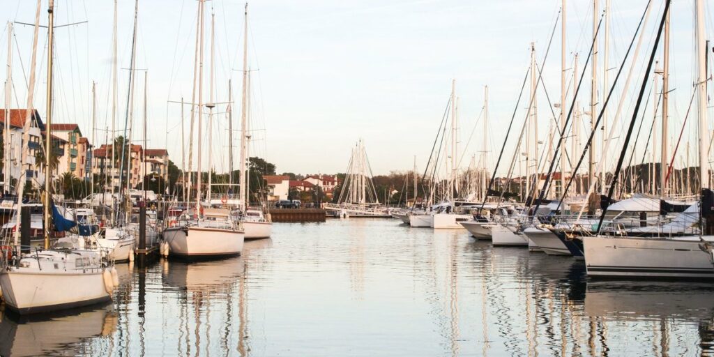
Nantucket Harbor is the one most visitors already know without realizing it’s a distinct body of water — it’s the harbor the ferry sails into, past Brant Point Lighthouse, before you ever set foot on cobblestones. It’s a deep, sheltered basin on the island’s north side, protected almost entirely by the long curving arm of Coatue, and it holds the bulk of the island’s moorings, its commercial fishing fleet, and its yacht traffic every summer.
What most people miss is that the harbor isn’t one uniform depth or character. The mouth, near Brant Point, runs deep enough for ferries and large sailboats. Head south toward town and it stays busy and boat-heavy. But push further in, toward what locals call the Head of the Harbor, and it turns shallow and marshy fast — flats that go dry at low tide, thick with eelgrass, and exactly the kind of habitat that makes the harbor a scalloping ground come fall. The same water that floats a 40-foot sloop in July is ankle-deep mud two miles inland.
If you only see one part of the harbor, make it Brant Point. It’s a five-minute walk from downtown, the lighthouse is the second-oldest in continuous use in the country, and you’ll watch everything from dinghies to the Hy-Line ferry funnel through the same narrow channel.
Madaket Harbor
Drive to the far west end of the island and the character of the water changes completely. Madaket Harbor is shallow — genuinely shallow, not “watch the tide charts” shallow but the kind where boats with any real draft simply don’t bother. It’s exposed to wind in a way Nantucket Harbor isn’t, which is exactly why it’s not a mooring field so much as a launch point for small skiffs, kayaks, and paddleboards.
Madaket’s real reputation, though, has nothing to do with boating. The harbor faces almost due west across open water, with nothing between it and the horizon, which makes it the spot islanders point out-of-towners to when they want an actual sunset — not the postcard version, the kind where the whole basin goes copper and the outbound boats turn into silhouettes. Madaket Beach sits right alongside it, so you can watch the sun drop over the harbor and the ocean in the same turn of your head.
Polpis Harbor
Polpis Harbor is the one nobody puts on a map, which is more or less the point. It’s a smaller, inner harbor branching off the eastern side of Nantucket Harbor, reached by Polpis Road out past Wauwinet — no ferry terminal, no fleet of charter boats, just a scatter of private docks and a lot of quiet water.
The name attaches to more than the harbor itself; Wauwinet, at its edge, sits on a strip of land once called the Haulover, because boats used to be hauled overland there between the harbor side and the open ocean rather than sailing all the way around. It’s a small detail, but it says something about how thin this part of the island actually is — a few hundred yards of sand separating a sheltered harbor from the Atlantic.
Polpis today is mostly shellfishing water and a put-in point for kayaks headed toward Coskata Pond. It’s shallow, muddy-bottomed in places, and rich with the shellfish beds that make this whole stretch of coastline valuable to more than just boaters.

Coatue and Coskata Pond
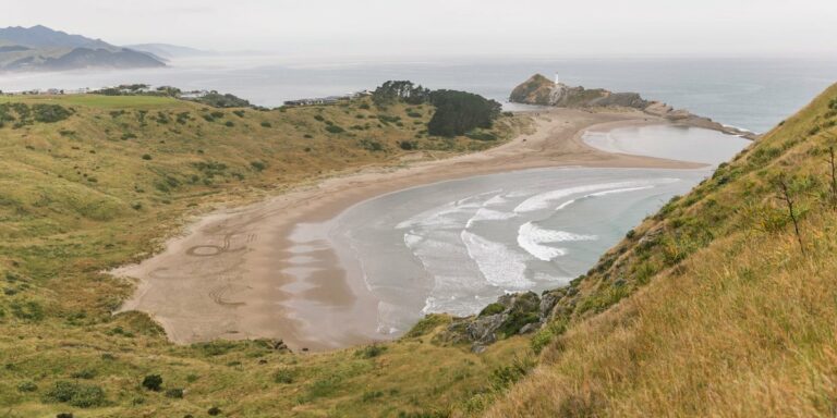
None of the harbors above would exist in their current form without Coatue — the long, narrow barrier beach that curls around Nantucket Harbor’s northern edge like a protective arm. It’s not a bay itself; it’s the landform that creates one, absorbing the open water of Nantucket Sound so the harbor behind it stays calm enough to moor a boat in.
Behind Coatue, tucked against its inner curve, sits Coskata Pond — a shallow, marshy lagoon connected to the harbor system and largely closed off from serious boat traffic. The whole area, Coatue through Coskata to the Great Point peninsula, is managed today as a wildlife refuge, and it earns that status. Ospreys nest along the spit, oystercatchers work the tide flats, and the salt marsh edges are dense enough with juvenile fish and shellfish that researchers studying coastal barrier systems — including teams from the nearby Woods Hole Oceanographic Institution — treat places like this as a working case study in how a barrier beach protects the water behind it.
You can’t drive here. Access is by foot from Wauwinet, by kayak across the harbor, or by four-wheel-drive vehicle with the right permit along the outer beach toward Great Point. That inconvenience is a large part of why it’s stayed wild — no docks, no houses, just sand, marsh, and birds.
Nantucket Sound
Technically, Nantucket Sound isn’t a bay at all — it’s the open, semi-enclosed body of water separating Nantucket from Cape Cod and Martha’s Vineyard, and it’s what every one of the island’s harbors ultimately opens into. But it belongs in this list because it’s the water everything else sits inside, and it behaves differently depending on where you’re standing.
On Nantucket’s north shore, the Sound is relatively sheltered, which is why Nantucket Harbor’s entrance and the calmer north-facing beaches sit here rather than on the ocean side. Currents can still run strong through the harbor mouth and around Coatue’s tip, strong enough that NOAA maintains tide and current stations specifically to track them; the NOAA Tides and Currents data for the area is the same information the harbor pilots and ferry captains check before they move.
It’s worth knowing the difference between the Sound and the open Atlantic if you’re planning anything on the water. The south shore beaches face the Atlantic directly — bigger surf, no protection, no ferry route. The Sound side is the sheltered side, and it’s where nearly all of the harbor life described above actually happens.
Bay Scalloping
If Nantucket’s bays have a signature use, it’s this. Bay scalloping is a genuine island tradition, not a tourist add-on — families have been raking scallops out of Nantucket Harbor, Madaket Harbor, and the Polpis shellfish beds for generations, and the practice is tied directly to the eelgrass beds that grow in these shallow, protected waters.
The season runs in the cooler months rather than summer. Recreational scalloping typically opens in early fall, with the commercial fleet following a few weeks later once family harvesters have had a head start — timing and limits are set and adjusted seasonally by the Massachusetts Division of Marine Fisheries, so it’s worth checking current regulations before you head out with a rake and a basket. What you’re looking for are the bay scallops themselves — smaller and sweeter than the sea scallops sold at most mainland markets, and genuinely difficult to find fresh anywhere off-island.
You don’t need a boat. Most scalloping happens by wading the shallow flats at low tide, which is exactly why Nantucket Harbor’s inner reaches and Polpis Harbor’s shellfish beds matter as much as anywhere with a view.
Tides, Access, and Timing
A few practical notes that apply across all five:
- Low tide changes everything. Flats that look like open water at high tide can be ankle-deep mud two hours later, especially in the Head of the Harbor and around Coskata Pond. Check tide tables before you paddle somewhere you plan to walk back from.
- Kayaks and paddleboards are the best way to see the quieter harbors. Polpis and the inner reaches of Nantucket Harbor are calm enough for beginners; Madaket can get windy by afternoon, so mornings are the better window.
- Coatue requires planning, not just enthusiasm. On foot from Wauwinet is the simplest approach for most visitors; the four-wheel-drive route needs an over-sand permit from the Nantucket Conservation Foundation.
- Brant Point is the easiest win. No boat, no permit, no drive — just a walk from downtown, and you’ll see more of Nantucket Harbor’s daily traffic than most week-long visitors do.
Nantucket’s beaches get the postcards. Its bays and harbors are where the island actually functions — where the boats moor, the scallops grow, and the birds that don’t care about any of it just keep nesting.