Table of Contents
- TLDR
- Bay, Bight, Lagoon: Nigeria’s Coast Mixes Them All
- Tarkwa Bay, Lagos: The One True Bay
- The Bight of Benin: A Coastline, Not a Cove
- Niger Delta Creeks: Bayelsa and Rivers State
- Kuramo Waters, Lagos: A Lagoon With a Reputation
- Calabar and the Cross River Estuary
- Getting There and Staying Safe
TLDR
Search “bays in Nigeria” and you’ll mostly get beach listicles, because true, named bays are rare on this coast. Here’s what’s actually out there:
- Tarkwa Bay (Lagos) — the only feature Nigerians actually call a bay by habit, though it’s technically a sheltered anchorage created by a harbor breakwater. Boat-only access.
- The Bight of Benin — not a bay at all. A 640-km stretch of Gulf of Guinea coastline running through Ghana, Togo, Benin, and southwest Nigeria.
- Niger Delta creeks (Bayelsa, Rivers) — technically distributaries and tidal channels, not bays, but they behave like a maze of small ones.
- Kuramo Waters (Lagos) — a lagoon, not a bay, cut off from the Atlantic by a sand spit.
- Calabar’s Cross River estuary — a river mouth, where fresh water meets tidal saltwater on its way to the Bight of Biafra.
None of this is pedantry for its own sake. Knowing which is which tells you what kind of trip you’re planning — a calm swim, a mangrove cruise, or a historical river town.
Bay, Bight, Lagoon: Nigeria’s Coast Mixes Them All
Every “beaches in Nigeria” list uses bay, beach, bight, and lagoon interchangeably, and that’s the actual reason bays in Nigeria is such a confusing search. The words describe different landforms, and Nigeria’s coast happens to have all four crammed into a few hundred kilometers.
A bay, per National Geographic’s definition, is a body of water partly enclosed by land with a mouth open to the sea — usually smaller and less enclosed than a gulf. A bight is looser still: a gentle, shallow curve in the coastline, open enough that NOAA marks bights on nautical charts mainly as a navigation hazard rather than a destination. A lagoon, by contrast, is water cut off from the ocean by a barrier — a sandbar, a reef, a spit of land — with only a narrow inlet keeping it connected, according to NOAA’s lagoon primer. A beach isn’t a body of water at all. It’s the shoreline itself, and it can sit inside a bay, a bight, or a lagoon without being any of them.
Bay vs. beach, quickly: a beach is the sand you stand on. A bay is the water it curves around. Tarkwa Bay has a beach. The beach is not the bay.
Nigeria’s coast runs about 850 km along the Gulf of Guinea, and almost none of it forms the tidy, semicircular indentation that “bay” implies. What it has instead is a bight (Benin), a delta full of creeks that aren’t bays but get called that anyway, a couple of lagoons, and one genuine, small, boat-only bay that everyone actually visits.
Tarkwa Bay, Lagos: The One True Bay
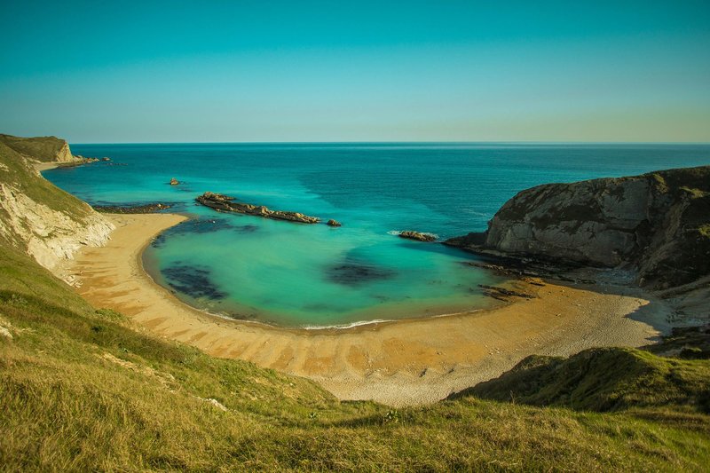
Tarkwa Bay sits behind the West Mole, the breakwater Lagos built to keep silt out of the harbor entrance. The construction effectively carved a sheltered pocket of water out of what used to be open Atlantic coastline — so while it reads as a natural cove, it’s a byproduct of port engineering, not tectonics or river deposition.
That engineering is the whole appeal. Everywhere else along this stretch of coast, Atlantic swells hit the shore hard enough to make swimming a gamble. Behind the breakwater, Tarkwa Bay’s water goes flat. Families swim here. Boats anchor here. It’s the one beach near Lagos where you’re not fighting the ocean to enjoy it.
There’s no road in. You get to Tarkwa Bay by boat, full stop, from jetties at CMS Marina, Falomo, or Victoria Island, and the crossing runs 15 to 30 minutes depending on where you start and what kind of boat you’re on. A resident fishing community lives on the sand dunes year-round, running the informal economy of grilled fish and drinks that keeps day-trippers fed. Colonial-era history is baked into the ground, too — Frederick Lugard, the administrator who unified Nigeria’s northern and southern protectorates, kept a bunker here.
Lagos State has floated redevelopment plans to formalize Tarkwa Bay as a tourism destination, which means the current mix of fishing shacks, plastic chairs, and unpaved sand might not last in its present form. If that undeveloped, working-beach texture is the draw for you, that’s a reason to go sooner.
The Bight of Benin: A Coastline, Not a Cove
Calling the Bight of Benin a bay undersells its scale and overstates its enclosure. It runs roughly 640 km from Cape St. Paul in Ghana to the Nun River outlet in Nigeria’s Niger Delta, cutting through Togo and Benin along the way — four countries share this one stretch of Gulf of Guinea shoreline. That’s not a cove you paddle across. It’s a regional coastline with a name.
The shape matches the definition: low, sandy, and fringed by lagoons running parallel to the ocean, separated from the open sea by narrow sand barriers. It’s the textbook shallow, open curve that makes a bight a bight rather than a bay.
Its history is heavier than its geography. Between the 16th and 19th centuries, this coast was the center of the transatlantic slave trade, earning the region the name Slave Coast — a history that Calabar, further east, memorializes directly (more on that below). Trade shifted to palm oil by the 1830s, and by the late 1950s, petroleum discovered in the Niger Delta at the bight’s eastern edge became the resource that still defines Nigeria’s economy today.
For a traveler, the Bight of Benin isn’t a single stop — it’s the frame around several. Lagos sits near its eastern reach, and the lagoons that line it are where most of the region’s actual beach and boat tourism happens.
Niger Delta Creeks: Bayelsa and Rivers State
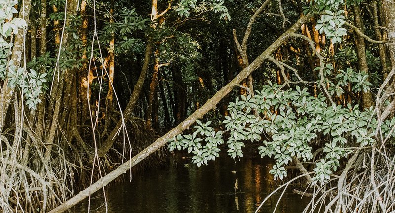
East of the Bight of Benin, the coast stops behaving like a coast and starts behaving like a wetland. The Niger Delta spans roughly 36,000 sq km of low-lying swamp, cut through by so many distributary channels and tidal creeks that a map of it looks less like a river mouth and more like a root system. None of these individual channels is a bay in the geographic sense — they’re creeks and estuarine inlets — but functionally, they’re what most people picture when they imagine “hidden Nigerian bays”: narrow, calm, tree-lined water you reach only by boat.
Bayelsa and Rivers states sit at the heart of this. Speedboats are the primary transport here, not roads, because for many communities there simply isn’t a road option. The delta holds the third-largest mangrove forest on Earth and the largest in Africa, and it’s shrinking fast — research tracking the loss puts it at over 2,500 sq km gone in 38 years, driven mostly by oil spills and artisanal refining. What’s left, close to 7,000 sq km, still supports stilt villages, active fishing fleets, and mangrove tunnels narrow enough that boat guides duck branches on the way through.
In Yenagoa, Bayelsa’s capital, the Swali Jetty is the standard jumping-off point for a guided cruise into the inner delta creeks. Guides here are registered marine operators, not freelancers, which matters given how easy it is to get turned around in channels that all look the same. One practical note that doesn’t show up on most travel sites: flood risk in the lower delta peaks between August and October, when the Niger and Benue rivers crest simultaneously. Interior creek trips scheduled outside that window are a meaningfully safer bet.
Kuramo Waters, Lagos: A Lagoon With a Reputation
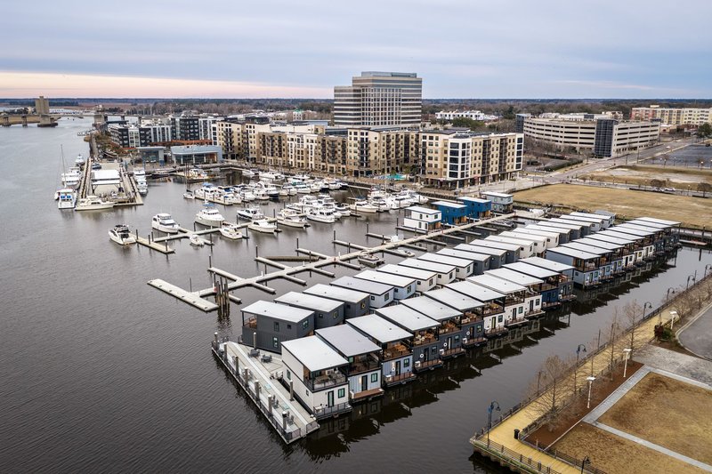
Kuramo Waters sits on the south side of Victoria Island, immediately east of Bar Beach, and it’s a lagoon in the strict sense — separated from the open Atlantic by a strip of sand rather than opening directly onto it. Hotels, including the Protea Lagos Kuramo Waters, line its edge, which has made it one of Lagos’s more visible waterfront addresses.
It’s also had a rough decade. In August 2012, a storm surge hit Kuramo Beach hard enough to destroy shacks and kill 16 people, prompting authorities to evacuate and demolish what remained of the informal settlement there. More recently, Lagos State has pushed back against a federal land reclamation project along the Lagos-Calabar Coastal Highway corridor that would alter the Kuramo shoreline further, citing environmental concerns about the water body.
The takeaway for visitors: Kuramo Waters today is a hospitality strip, not a swimming beach with a fishing-village feel like Tarkwa Bay. Go for the hotel view and the lagoon setting, not for open water.
Calabar and the Cross River Estuary
Calabar sits where the Cross River widens into its estuary on the way to the Bight of Biafra, the bight that picks up where the Bight of Benin ends at the Niger Delta. The Efik people who settled here called it Akwa Akpa, and the river remains the reason the city exists — it carried palm oil, timber, and rubber out to the coast for more than a century before oil took over as Nigeria’s export story.
The estuary connects onward to the Rio del Rey, which opens directly onto the Atlantic — a detail that’s given Cross River State standing as a littoral state under maritime law, not just a river-adjacent one. Locally, the water is used for boating and swimming rather than treated as a shipping lane exclusively; Marina Resort, built in 2007 on the Calabar riverfront, packs a beach, an amusement park, a slave-history museum, and boat cruises into one waterfront complex, a pointed pairing given the coast’s Slave Coast history further west.
Calabar rewards travelers who want river town over ocean beach — museums and market history alongside the water, rather than sand and swimming as the main event.
Getting There and Staying Safe
A few things are true across every one of these spots that generic beach roundups skip:
Almost everything here is boat-only. Tarkwa Bay has no road. Most Niger Delta communities have no road. Budget for jetty transport as part of the trip, not an afterthought, and confirm return times before you leave — the last boat back isn’t always late.
Registered guides matter more here than at a typical beach destination. In the delta creeks especially, hire operators through an official jetty (Swali in Yenagoa is the standard) rather than an informal dock arrangement. The channels genuinely look alike, and getting lost in a mangrove tunnel at dusk is a real risk, not a scare story.
Timing is a safety variable, not just a comfort one. Skip interior Niger Delta creek trips during peak flood season, August through October, when the Niger and Benue rivers crest together. Tarkwa Bay and Kuramo Waters, both in Lagos, don’t carry that same flood exposure, but Atlantic swell conditions still vary enough that it’s worth checking locally before you swim outside a sheltered bay.
Development is actively reshaping this list. Tarkwa Bay has redevelopment plans in motion, and Kuramo Waters is at the center of an ongoing reclamation dispute. What you find on the ground in a year or two may not match what’s described here or anywhere else — a good reason to check current conditions before you book, and not to treat any of this coast as static.