Table of Contents
- Sépaq vs. Parks Canada: The Distinction That Matters
- Parks Canada National Parks in Quebec
- Forillon National Park
- La Mauricie National Park
- Mingan Archipelago National Park Reserve
- The Best Sépaq Provincial Parks
- Parc National de la Gaspésie
- Parc National du Mont-Tremblant
- Parc National de la Jacques-Cartier
- Parc National des Hautes-Gorges-de-la-Rivière-Malbaie
- Parc National du Fjord-du-Saguenay
- Parc National d’Aiguebelle
- Parc National de Miguasha
- Quick Comparison Table
- Planning Logistics
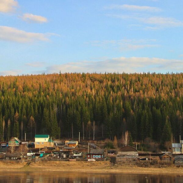
Quebec has more protected land than most travelers realize — over 22 million hectares of boreal forest, river valleys, mountain plateaus, and coastline. The parks sit inside it. If you’re trying to figure out which ones to visit and how to actually get there and book a site, here’s what you need to know.
Sépaq vs. Parks Canada: The Distinction That Matters {#sepaq-vs-parks-canada}
Quebec has two distinct park systems, and the confusion between them trips up most travel planning.
Parks Canada operates three national parks in Quebec — Forillon, La Mauricie, and Mingan Archipelago. These are federally managed, covered by the Parks Canada Discovery Pass, and fall under Canadian national park regulations.
Sépaq (Société des établissements de plein air du Québec) operates 24 provincial parks across the province. They’re Quebec’s parks, not Canada’s. Reservations go through sepaq.com, fees are separate from the Parks Canada pass, and the experience varies considerably by park.
Neither system is superior. They’re just different, and which one you visit depends on where you’re going and what you want to do.
Parks Canada National Parks in Quebec {#parks-canada-national-parks}
Forillon National Park {#forillon}
Forillon sits at the eastern tip of the Gaspé Peninsula, where the Appalachian Mountains drop into the Gulf of St. Lawrence. It’s the kind of park where you can hike through boreal forest in the morning and watch beluga whales offshore in the afternoon.
The land end of the peninsula — Cap Gaspé — is the park’s signature hike: 16 km round trip through forest to a clifftop lighthouse with open ocean on three sides. Harbor seals haul out on the rocks below. In late summer, you might spot fin or minke whales from the headland without binoculars.
The park splits into two distinct zones, north and south, with different character. The south side (Grande-Grave) has a reconstructed historic fishing village and calmer beach access. The north side is wilder.
Best season: Late June through September. Black flies are bad in early June — bring bug protection or wait them out.
La Mauricie National Park {#la-mauricie}
La Mauricie is the Quebec national park closest to population centers — roughly 170 km from Montreal and 60 km from Trois-Rivières. That proximity makes it one of the most-visited, but it’s large enough that you can still find quiet on weekdays.
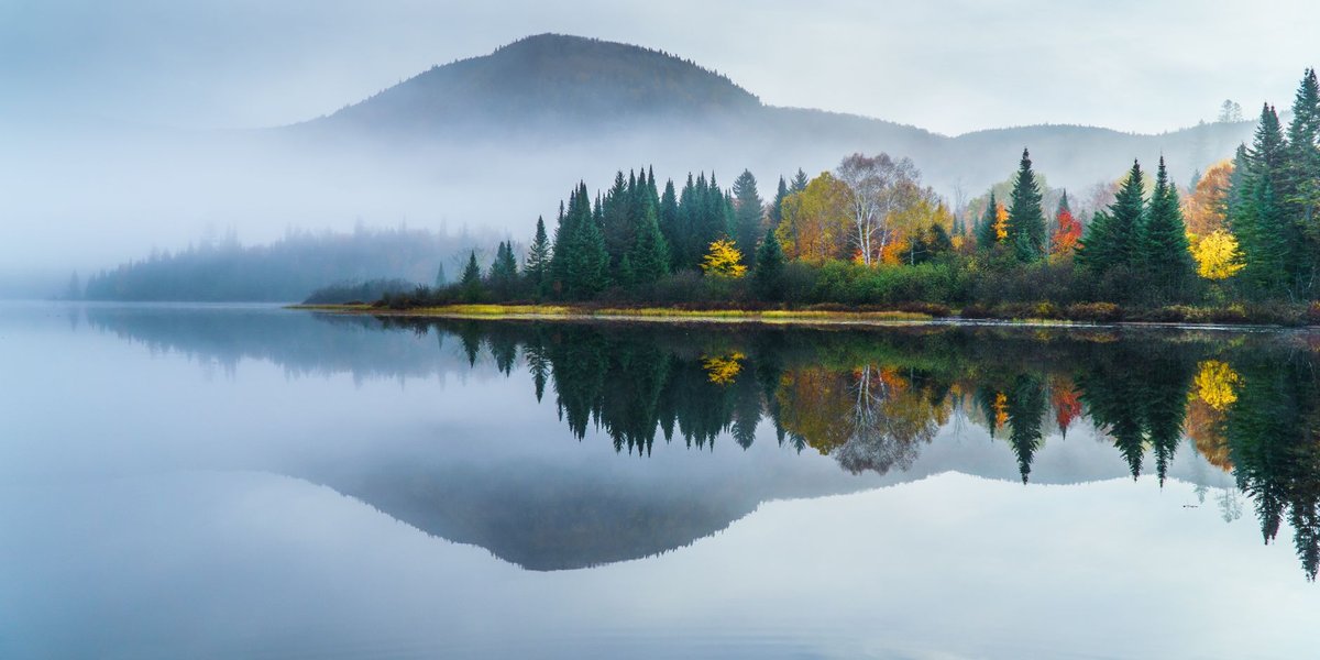
The park is a mosaic of lakes (over 150 of them) connected by portage trails. Canoe touring is what La Mauricie does best. The Canoe Route covers 83 km of linked lakes and rivers, requires multi-day commitment, and rewards it. The fishing is good for brook trout and walleye. In fall, the hardwood forest goes scarlet and orange in a way that justifies the drive even if you’re not paddling.
The park has no entry from the west — access is from two gates on the east side. Know this before navigating.
Best season: September for foliage. July and August for canoeing. Cross-country skiing in winter is underrated.
Mingan Archipelago National Park Reserve {#mingan}
Mingan doesn’t get mentioned enough. It’s a chain of roughly 1,000 islands and islets along the north shore of the Gulf of St. Lawrence, known for its monoliths — limestone formations carved by wind and water into shapes that look genuinely otherworldly. Some top 10 meters. The official name is “flower pots,” and once you see them you understand why.
It’s remote. The reserve is accessible from Longue-Pointe-de-Mingan or Havre-Saint-Pierre, both small towns reachable by car (a long drive from Quebec City) or regional flight. A boat is required to reach most islands. Parks Canada operates scheduled excursions, or you can rent a kayak.
Seabird colonies are the other draw — Atlantic puffins nest here in numbers, along with common murres and razorbills.
Best season: Mid-June through September. The reserve is closed outside those months.
The Best Sépaq Provincial Parks {#sepaq-parks}
Parc National de la Gaspésie {#gaspesie}
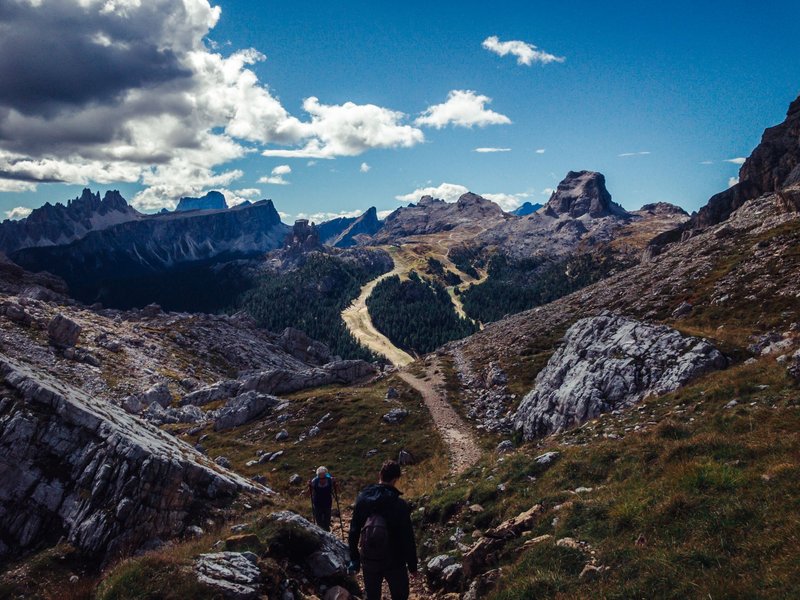
Gaspésie is where you go to hike above treeline in Quebec. The Chic-Choc Mountains — the only alpine zone east of the Rockies — top out at Mont Jacques-Cartier (1,268 m) and support a woodland caribou herd that’s been living on these plateaus since before European contact. A permit system governs access to the caribou zone: you go with a guide, and the encounter, if you find the herd, is surreal.
The long hike here is the traverse of the Chic-Chocs — a multi-day route along exposed ridgelines. Day hikers can reach the summit of Mont Albert (1,154 m) on a 17 km loop through subalpine meadows. The park has a comfortable auberge if camping isn’t your mode.
Best season: Late July through September for alpine hiking. The caribou are most often seen on the high plateaus in September.
Parc National du Mont-Tremblant {#mont-tremblant}
Quebec’s oldest provincial park. Most people know Tremblant as a ski resort — the park is adjacent but separate, and considerably wilder. Over 400 lakes, 600 km of trails, and the headwaters of seven rivers.
The eastern sector is the accessible one (close to the resort village), with well-maintained trails and frontcountry camping. The western sector requires more commitment and rewards it with solitude. Multi-day canoe routes cross from one lake to the next via portages; you can go five days without a road crossing.
Fall draws the biggest crowds because the mixed-wood forest — maple, yellow birch, red oak — is spectacular. Book camping in advance for October.
Best season: Fall for foliage (late September, early October). Summer for canoeing. Winter for snowshoeing on groomed trails.
Parc National de la Jacques-Cartier {#jacques-cartier}
Forty-five minutes from Quebec City, and it feels nothing like it. The Jacques-Cartier valley is a deep glacial trough — walls rise 550 meters on both sides, and the river at the bottom is cold enough to swim in even in August.
The descent into the valley is part of the experience: the park entrance is at the rim, and you drop in. Kayaking the river from the park’s canoe rental is the most popular activity, and the park is well set up for it — gear available, clear sections, no whitewater that requires experience.
Moose are common at dusk and dawn. Walk quietly on the valley trails and you’ll probably see one.
Best season: Year-round. The valley collects snow and is excellent for cross-country skiing in winter. Summer hiking and paddling from June to October.
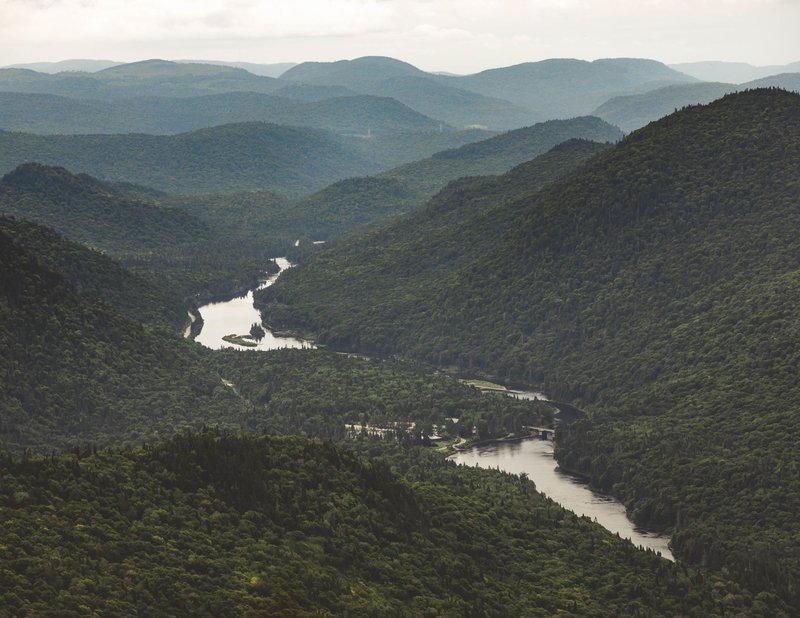
Parc National des Hautes-Gorges-de-la-Rivière-Malbaie {#hautes-gorges}
The gorges here are the deepest in eastern Canada. The Malbaie River has cut a canyon with walls that rise 800 meters in some sections — for context, that puts it in the company of serious gorge landscapes anywhere in North America.
Access into the canyon floor is via a shuttle boat, which runs from the park’s entry point. You can also hike the rim trails for the overhead view. The Acropole-des-Draveurs trail is the classic: steep, technically undemanding, and culminating in a panoramic view of the gorge and the Laurentian plateau beyond.
The park is in the Charlevoix region, about 2.5 hours from Quebec City, and pairs well with a Charlevoix itinerary.
Best season: July through September. Snow lingers on the canyon walls into June.
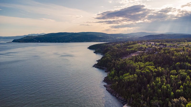
Parc National du Fjord-du-Saguenay {#fjord-saguenay}
The Saguenay Fjord is a geological accident — one of the few true fjords in North America, carved by glaciers and fed by Arctic-chilled water that runs 270 meters deep. Beluga whales use the fjord year-round; minke, fin, and blue whales come in summer where the Saguenay meets the St. Lawrence.
The park lines both sides of the fjord and is best explored by sea kayak. The Fjord trail (Sentier du fjord) runs 42 km along the north bank — a multi-day hike with refuges, no camping gear required. The cliff views looking down at the fjord’s green water are the best photo opportunities in Quebec.
The town of Tadoussac sits at the fjord’s mouth and makes a logical base.
Best season: July and August for whale watching and kayaking. The trail is hikeable from June to October.
Parc National d’Aiguebelle {#aiguebelle}
Most Quebec visitors skip Aiguebelle because it’s in Abitibi-Témiscamingue, a region that doesn’t show up in typical travel itineraries. That’s precisely the reason to go. The park is geologically old — some of the exposed rock is 2.8 billion years old, among the oldest visible bedrock on the continent.
The landscape is quieter and wilder than the Laurentian parks. Suspension bridges span lakes and wetlands; the Crest Trail gives long views over boreal forest that runs unbroken to the horizon. Wildlife density is high — moose, beaver, osprey, and in the north sector, occasional wolf sign.
Best season: Late August and September, before the hunting season draws people to the surrounding crown land. Summer for paddling.
Parc National de Miguasha {#miguasha}
Miguasha is the smallest park on this list but the only one with a specific scientific claim that makes it worth a detour: it contains one of the world’s most important fossil records of the Devonian Period. A stretch of sea cliff along the Restigouche estuary holds hundreds of specimens of early tetrapods — animals that were, 380 million years ago, in the process of becoming land-dwellers. The transition from fish to four-limbed vertebrate is documented here better than almost anywhere on Earth.
Miguasha is a UNESCO World Heritage Site for this reason. The museum on-site is worth the visit even if you’re not a fossil enthusiast — it’s well done and the scale of evolutionary time it covers is difficult to find anywhere else.
Best season: Late May through October. Guided cliff walks run in summer.
Quick Comparison Table {#comparison-table}
| Park | System | Region | Best For | Best Season |
|---|---|---|---|---|
| Forillon | Parks Canada | Gaspésie | Coastal hiking, whales | July–Sept |
| La Mauricie | Parks Canada | Mauricie | Canoe touring, fall foliage | Sept (foliage), July–Aug (paddling) |
| Mingan Archipelago | Parks Canada | North Shore | Geology, puffins | July–Sept |
| Gaspésie | Sépaq | Gaspésie | Alpine hiking, caribou | Late July–Sept |
| Mont-Tremblant | Sépaq | Laurentians | Canoe, foliage, backcountry | Fall, Summer |
| Jacques-Cartier | Sépaq | Laurentians | Families, day trips, kayaking | Year-round |
| Hautes-Gorges | Sépaq | Charlevoix | Gorge hiking, scenery | July–Sept |
| Fjord-du-Saguenay | Sépaq | Saguenay | Kayaking, whale watching, hiking | July–Sept |
| Aiguebelle | Sépaq | Abitibi | Solitude, geology, wildlife | Late Aug–Sept |
| Miguasha | Sépaq | Gaspésie | Fossils, UNESCO history | June–Oct |
Planning Logistics {#planning-logistics}
Booking Sépaq parks: All reservations go through sepaq.com. Campsites for popular parks (Jacques-Cartier, Tremblant, Gaspésie) open for booking in late winter and fill fast. The Sépaq annual pass covers day-use entry for most parks and pays for itself in two or three visits.
Booking Parks Canada: National park entry is covered by the Parks Canada Discovery Pass, which also covers national parks across Canada. Camping at La Mauricie and Forillon requires separate reservation through the Parks Canada reservation system.
Distances from major cities:
- Jacques-Cartier, Hautes-Gorges: within 2 hours of Quebec City
- La Mauricie, Mont-Tremblant: 1.5–2.5 hours from Montreal
- Gaspésie, Forillon: 5–6 hours from Quebec City (the Gaspé Peninsula is a destination trip, not a day drive)
- Mingan, Fjord-du-Saguenay: 5–6 hours from Quebec City
Camping reservations: Book early for anything in July or August — Sépaq parks fill up. Shoulder season (May–June, late September) gives you more flexibility and often better hiking conditions.
Bug season: May and June bring black flies across Quebec. They peak in late May and are largely gone by early July. If you’re sensitive, plan accordingly or bring a head net.
Quebec’s parks stretch across a province the size of Western Europe. You’re not going to see them all in one trip — and that’s fine. Pick a region, go deep, and you’ll leave with a better trip than if you tried to cover the map.