
Table of Contents
- The Quick Picture
- Kura River
- Aras River
- Samur River
- Ganikh (Alazani) River
- Tartar River
- Vilash River
- How Azerbaijan’s Major Rivers Compare
- Where to Actually See These Rivers
- The Water Problem Nobody Puts on a Postcard
- Why So Many Rivers Start Somewhere Else
The Quick Picture
Azerbaijan sits at the bottom of a drainage funnel. Nearly every river in the country — over 8,000 of them, though the vast majority are seasonal streams under 25 kilometers — eventually empties into the Caspian Sea, the largest enclosed body of water on Earth. Only 24 rivers in the country run longer than 100 kilometers, and just a handful matter if you’re trying to actually understand the landscape rather than memorize a list.
Here’s the part most reference pages skip: almost none of Azerbaijan’s major rivers actually start in Azerbaijan. The Kura begins in Turkey. The Aras begins in Turkey too, brushing past Armenia and Iran before it ever touches Azerbaijani soil. The Samur starts in Russia. Azerbaijan is less a river source and more a river destination — a low, flat basin where water from three neighboring mountain ranges converges on its way to the sea.
That matters for more than trivia. It means Azerbaijan has almost no control over what happens upstream, and as you’ll see further down, that’s becoming a real problem.
Kura River
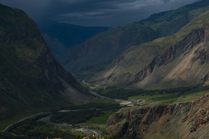
The Kura is the country’s defining river, and it’s not close. It runs 1,515 kilometers total, rising in the mountains of northeastern Turkey before crossing into Georgia, cutting through Tbilisi, and finally entering Azerbaijan, where it picks up roughly 900 of its kilometers. It’s the third-longest river to feed the Caspian Sea, trailing only the Volga and the Ural — both of which drain entire regions of Russia, which puts the Kura’s scale in perspective for a country the size of Maine.
Inside Azerbaijan, the Kura’s defining feature is the Mingachevir Reservoir, the largest artificial lake in the South Caucasus, built in the 1950s to tame the river’s floods and generate hydropower. Below the dam, the Kura slows into the wide, brown, working river that irrigates the Kura-Aras lowlands — Azerbaijan’s agricultural heartland — before it merges with the Aras and rolls into the Caspian near the town of Neftçala.
If you want to see the Kura at its most dramatic, skip the delta. Head to the stretch near Mingachevir city, where the river opens into the reservoir against a backdrop of low hills — it’s the closest thing Azerbaijan has to a proper lake-and-mountain view.
Aras River
The Aras is the river that draws the border. For over 1,000 kilometers of its roughly 1,072-kilometer length, it forms the line between Azerbaijan and Iran, and further west, between Armenia and both Turkey and Iran. It rises near Erzurum in Turkey, the same general highlands that feed the Euphrates, then arcs southeast through four countries before joining the Kura near the town of Sabirabad. Like Azerbaijan, Armenia’s river system is defined by Caucasus geography and political borders, with its own major rivers serving similar roles in the regional landscape.
Because the Aras is a border river, most of it isn’t accessible for casual sightseeing — there are military restrictions along long stretches, particularly near the Nakhchivan exclave, where the river is the only thing separating Azerbaijani territory from Iran and Armenia at once. The exception is the Aras Reservoir near Nakhchivan City, a shared Azerbaijani-Iranian hydro project where the river widens into a lake ringed by stark, dry mountains — one of the more surreal landscapes in the country, closer in feel to eastern Anatolia than to the green Caucasus foothills further north.
Samur River
The Samur starts in Russia’s Dagestan region and spends its final stretch forming the northern border between Russia and Azerbaijan before reaching the Caspian. It’s shorter than the Kura or Aras — around 213 kilometers — but its delta matters more than its length suggests. The Samur Delta is one of the last surviving lowland riparian forests in the Caucasus, a tangle of liana-draped trees more reminiscent of a subtropical floodplain than anything else in the region, and it’s protected as a state nature reserve.
The two countries split the river’s flow by agreement, and that split has been a genuine source of friction — Azerbaijani environmentalists have argued for years that upstream diversion on the Russian side is starving the delta forest of the water it needs to survive.
Ganikh (Alazani) River
Known as the Alazani in Georgia and the Ganikh (Qanıx) once it crosses into Azerbaijan, this river rises on the southern slopes of the Greater Caucasus and runs through Georgia’s Kakheti wine region before entering Azerbaijan and eventually joining the Kura. It’s a tributary, not a headline river, but it’s worth knowing because it explains the lush, vine-covered landscape of northwestern Azerbaijan around Zaqatala and Balakan — the Ganikh valley is one of the greenest, wettest corners of the country, a sharp contrast to the semi-arid plains further south.
Tartar River
The Tartar rises in the Karabakh mountain range and flows east through Nagorno-Karabakh and the surrounding lowlands before joining the Kura. It feeds the Sarsang Reservoir, one of the largest water bodies in the region and, since the Nagorno-Karabakh conflict, a genuine strategic asset — control over the reservoir has direct implications for irrigation water reaching towns on the Azerbaijani side of the former contact line. It’s not a river most travelers will visit, but it’s one of the more geopolitically loaded waterways in the country.
Vilash River
The Vilash (also transliterated Viləş) is a shorter river in Azerbaijan’s southeast, in the Lankaran region near the Iranian border. It’s fed by the wet, subtropical climate of the Talysh Mountains — the only part of Azerbaijan that gets genuine rainforest-level precipitation — and it’s a good example of how different the country’s hydrology gets outside the arid center. Where the Kura basin worries about drought, the Lankaran rivers occasionally worry about flash floods.
How Azerbaijan’s Major Rivers Compare
| River | Length (total) | Length in Azerbaijan | Source Country | Empties Into |
|---|---|---|---|---|
| Kura | 1,515 km | ~900 km | Turkey | Caspian Sea |
| Aras | ~1,072 km | Forms much of the southern border | Turkey | Kura River |
| Samur | ~213 km | Forms much of the northern border | Russia | Caspian Sea |
| Ganikh (Alazani) | ~390 km | Partial (tributary) | Georgia | Kura River |
| Tartar | ~200 km | Full | Azerbaijan (Karabakh mountains) | Kura River |
| Vilash | ~40 km | Full | Azerbaijan (Talysh mountains) | Caspian Sea |
Where to Actually See These Rivers
If you’re visiting rather than researching from a desk, the two rivers worth building a trip around are the Kura, around Mingachevir and Şəki, and the Ganikh valley near Zaqatala and Balakan, which doubles as Azerbaijan’s best hiking and wine country. Guided rafting outfits occasionally run short sections of the upper Kura and its tributaries near the Greater Caucasus foothills, though nothing approaching the commercial rafting scenes you’d find in Georgia’s Rioni valley just across the border — Azerbaijan’s rivers are more scenic backdrop than adventure sport.
The Aras and Samur, by contrast, are border rivers first and scenery second. You’ll see them from a distance, often through a fence, rather than get close.
The Water Problem Nobody Puts on a Postcard
Every travel-blog rundown of Azerbaijan’s rivers describes them like they’re static geographic features. They’re not. The Kura’s flow has dropped by roughly 9% over the past three decades, with summer flow down closer to 19% and the stretch below the Mingachevir dam down as much as 28%, according to hydrological monitoring cited by Eurasianet. Part of that is climate — less snowpack in the Turkish and Georgian highlands means less water reaching the plains. Part of it is upstream dam building in Turkey and Georgia, which Azerbaijan has no authority over since both the Kura and the Aras originate outside its borders.
Pollution compounds the problem. Azerbaijan lacks waste-management infrastructure across much of its rural territory, and the World Bank’s water security assessment flags the Kura-Aras basin as facing compounding pressure from agricultural runoff, industrial discharge, and reduced dilution capacity as flows shrink. None of this shows up in the standard “top rivers of Azerbaijan” list, but it’s the context that actually explains why water security is a live political topic in the region — including in the water-sharing disputes tied to the Nagorno-Karabakh conflict, where control of reservoirs like Sarsang has real irrigation consequences downstream.
Why So Many Rivers Start Somewhere Else
It’s worth sitting with the geography for a second, because it explains almost everything above. Azerbaijan is a lowland country wedged between two mountain systems it doesn’t own — the Greater Caucasus to the north, shared with Russia and Georgia, and the Lesser Caucasus and Talysh ranges to the west and south, shared with Armenia, Georgia, and Iran. Water falls as snow and rain on those ranges, then drains downhill into Azerbaijan on its way to the Caspian, which has no outlet to any ocean and simply absorbs everything that reaches it.
That’s the real answer to “why is Azerbaijan’s river map so confusing.” It’s not confusing — it’s a basin. Nearly every major river either starts outside the country, ends at the border, or exists because a neighbor’s mountains happen to drain in this direction. Understanding that one fact makes the rest of the list click into place faster than any table of lengths and coordinates.