Honduras runs about 19 major river systems, and roughly 87% of that water ends up in the Caribbean rather than the Pacific. That single lopsided fact explains a lot about the country: the mountains tilt the wrong way for the short Pacific coast, so the big rivers all march north and east toward the Atlantic, carving out the broad lowlands and the dense Mosquito Coast on the way.
Most lists of Honduran rivers just hand you names and numbers in a column and walk away. This one does the table too, because you came for it, but it also tells you which river floods Tegucigalpa, which one nearly forms a national border, and which one carries the country’s bananas to the sea.
Table of Contents
- The Big Picture: Two Oceans, One Lopsided Split
- Major Rivers of Honduras at a Glance
- The Patuca: Longest in the Country
- The Ulúa: The Economic Workhorse
- The Coco: A River That Draws a Border
- The Choluteca: The One That Floods the Capital
- The Aguán and Chamelecón: The Banana Lowlands
- Why These Rivers Matter
- Frequently Asked Questions
The Big Picture: Two Oceans, One Lopsided Split {#the-big-picture}
Honduras sits on the Central American isthmus with a long Caribbean coast to the north and a short, pinched Pacific frontage on the Gulf of Fonseca to the south. The continental divide runs much closer to that Pacific shore than the Atlantic one, which is the whole reason the drainage is so uneven.
The result: somewhere between 83% and 87% of the country’s surface water flows north into the Caribbean, and only the remaining 13–17% drains south to the Pacific. Caribbean-bound rivers — the Patuca, Ulúa, Aguán, Coco, Chamelecón — are long, wide, and slow. Pacific rivers like the Choluteca and Goascorán are shorter and steeper because they have so little distance to cover.
One more piece of the picture: Honduras has almost no natural lakes. Lake Yojoa, tucked between San Pedro Sula and Tegucigalpa, is the only significant natural one. Everything else holding still water is a reservoir behind a dam.
Major Rivers of Honduras at a Glance {#major-rivers-table}
Here are the headline rivers, sorted longest to shortest. Lengths come from standard hydrographic surveys; where sources disagree, see the note below the table.
| River | Length | Mouth / Outlet | Drainage Basin |
|---|---|---|---|
| Patuca | ~500 km | Caribbean Sea | Caribbean |
| Coco (Segovia) | ~680 km (shared) | Caribbean Sea | Caribbean |
| Ulúa | ~400 km | Caribbean Sea | Caribbean |
| Aguán | ~240 km | Caribbean Sea | Caribbean |
| Choluteca | ~250 km | Gulf of Fonseca | Pacific |
| Chamelecón | ~200 km | Caribbean Sea | Caribbean |
| Goascorán | ~130 km | Gulf of Fonseca | Pacific |
A note on the numbers: the Patuca’s length is genuinely disputed. You’ll see it cited anywhere from about 500 km to 523 km depending on where the survey starts measuring its headwater tributaries. The Coco is longer overall but it’s a shared river — only part of its course and basin belong to Honduras, since it forms much of the border with Nicaragua. If you count rivers wholly inside Honduras, the Patuca wins, and most Honduran sources call it the longest river in the country.
The Patuca: Longest in the Country {#patuca}
The Patuca is the giant. It forms where the Guayape and Guayambre rivers meet in the central highlands, then runs roughly 500 km east and north through the Department of Olancho and into La Mosquitia — the vast, road-light rainforest region on the Caribbean coast. It’s commonly ranked the second-largest river in Central America by drainage, behind only the Coco.
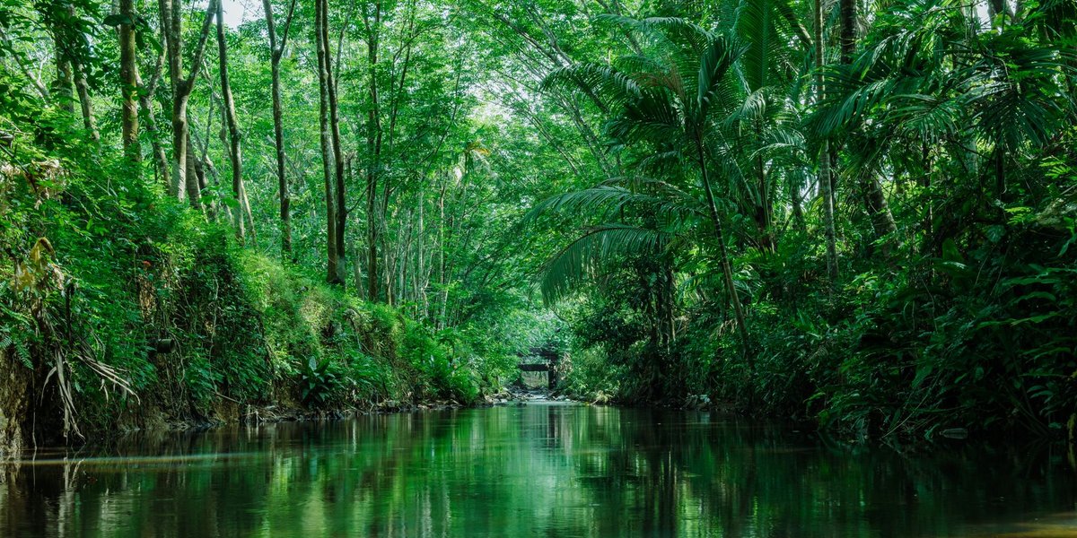
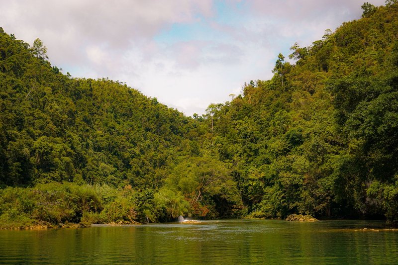
What makes the Patuca distinct isn’t a statistic, it’s where it goes. The lower river threads through Patuca National Park and the edge of the Río Plátano Biosphere Reserve, one of the last big stretches of intact lowland rainforest in Central America. For the Tawahka, Miskito, and Pech communities of the interior, the river is the road — there are stretches where a dugout canoe is the only practical way in or out.
The Patuca also carries the country’s most debated dam. The Patuca III hydroelectric project, in the upper basin, generates power but reroutes flow that downstream Indigenous communities depend on — a tension between energy and ecology that the river hasn’t stopped negotiating.
The Ulúa: The Economic Workhorse {#ulua}
If the Patuca is the wilderness river, the Ulúa is the working one. At roughly 400 km, it drains the fertile Sula Valley in northwestern Honduras — the agricultural and industrial heart of the country, anchored by San Pedro Sula, the nation’s economic capital.
The Ulúa valley is banana, sugarcane, and palm-oil country, and the river’s floodplain is what makes that soil so productive. It’s also what makes it dangerous. When Hurricane Mitch stalled over Honduras in 1998, the Ulúa and its neighbor the Chamelecón burst their banks and turned the whole Sula Valley into an inland sea, a catastrophe the region is still building flood defenses against decades later.
So the Ulúa is a study in trade-offs: the same flooding that periodically wrecks the valley is what laid down the rich alluvial soil the valley’s economy is built on.
The Coco: A River That Draws a Border {#coco}
The Coco River — known as the Segovia in parts of its course — is the longest river in Central America at roughly 680 km, and for much of its lower length it does diplomatic work: it forms the border between Honduras and Nicaragua.
That border role isn’t just a line on a map. The Coco was the subject of a genuine territorial dispute that went all the way to the International Court of Justice in 1960, which confirmed the river boundary in Honduras’s favor. Today the river still divides communities of the same Miskito culture between two countries — people who share a language and kinship but wake up on different sides of an international line. It’s worth remembering that Nicaragua is one of only two countries that border Nicaragua’s northern neighbor, and the Coco draws much of that very frontier.
The Choluteca: The One That Floods the Capital {#choluteca}
The Choluteca is the rare major river that drains to the Pacific, and it’s famous for one reason: it runs straight through Tegucigalpa, the capital. The city grew up on its banks, which means the river’s moods are the capital’s problem.
During Hurricane Mitch, the Choluteca did something hydrologists still cite as a textbook case. The Mallorca Bridge — engineered specifically to survive flooding — held perfectly while the river simply carved itself a new channel around it, leaving the bridge spanning dry ground with the water flowing elsewhere. It became a global symbol of how thoroughly Mitch rewrote the landscape.
From Tegucigalpa the river continues south to the city of Choluteca and empties into the Gulf of Fonseca, the shallow Pacific inlet shared by Honduras, El Salvador, and Nicaragua. That shared shoreline links it to the rivers of El Salvador, whose own drainage feeds the same gulf.
The Aguán and Chamelecón: The Banana Lowlands {#aguan-chamelecon}
Two more Caribbean rivers round out the picture, and both run through prime agricultural land on the north coast.
The Aguán, around 240 km, drains a long valley in the northeast that’s been one of Honduras’s most contested pieces of ground — the Bajo Aguán region has seen years of land conflict over its palm-oil plantations. The river itself remains the lifeline that makes the valley farmable.
The Chamelecón is the Ulúa’s smaller neighbor in the Sula Valley, roughly 200 km long. It shares the same floodplain and the same flood risk; during Mitch, the two rivers’ overflow merged into a single disaster. In normal years it’s just another quiet artery feeding the banana and sugar lands of the north.
Why These Rivers Matter {#why-they-matter}
Strip away the lengths and the basins, and Honduran rivers do three jobs that shape the country.
They feed the economy. The Sula Valley’s bananas, sugar, and palm oil — a huge slice of national exports — exist because the Ulúa and Chamelecón built and water that floodplain. The country’s agriculture is, in a real sense, a gift of its rivers.
They generate power. Honduras leans on hydroelectricity, and the dams that produce it sit on these rivers. The Francisco Morazán dam (better known as El Cajón), on a tributary of the Ulúa system, created one of Central America’s largest reservoirs and remains a backbone of the national grid. The Patuca III project does similar work in the east, with the ecological friction that comes with it.
They sustain the wild interior. In La Mosquitia, the Patuca and Coco aren’t economic abstractions — they’re the highways, the fisheries, and the cultural center of gravity for Indigenous communities. The Río Plátano Biosphere Reserve, a UNESCO World Heritage Site, exists because these river systems kept a corner of Central American rainforest intact.
That’s the throughline the list-style references tend to skip: in Honduras, the rivers aren’t just geography. They’re the economy, the power supply, and the last wilderness, all flowing the same direction — north, toward the Caribbean.
Frequently Asked Questions {#faq}
What is the longest river in Honduras? The Patuca, at roughly 500 km, is the longest river contained entirely within Honduras and the second-largest in Central America by drainage. The Coco is longer overall (~680 km) but it’s shared, forming the border with Nicaragua rather than flowing wholly inside the country.
Which way do most rivers in Honduras flow? North and east, into the Caribbean Sea. Around 83–87% of the country’s surface water drains to the Caribbean because the continental divide sits close to the short Pacific coast. Only rivers like the Choluteca and Goascorán flow south to the Pacific’s Gulf of Fonseca.
Which river flows through Tegucigalpa? The Choluteca River runs directly through the capital. It’s one of the few major Honduran rivers that drains to the Pacific, and it was at the center of the catastrophic flooding during Hurricane Mitch in 1998.
Does Honduras have any natural lakes? Just one of significance — Lake Yojoa, between San Pedro Sula and Tegucigalpa. Every other large body of still water in the country is a reservoir created by a hydroelectric dam, such as the El Cajón reservoir on the Ulúa system.
Which river is most important to Honduras’s economy? The Ulúa. Its floodplain in the Sula Valley is the agricultural and industrial heart of the country, growing the bananas, sugarcane, and palm oil that drive a large share of national exports.