Table of Contents
- Norway’s Rivers at a Glance
- Glomma: Norway’s Longest River
- The Other Major Rivers
- Quick Reference: Norway’s Longest Rivers
- River Activities: Fishing and Rafting
- Seasonal Conditions
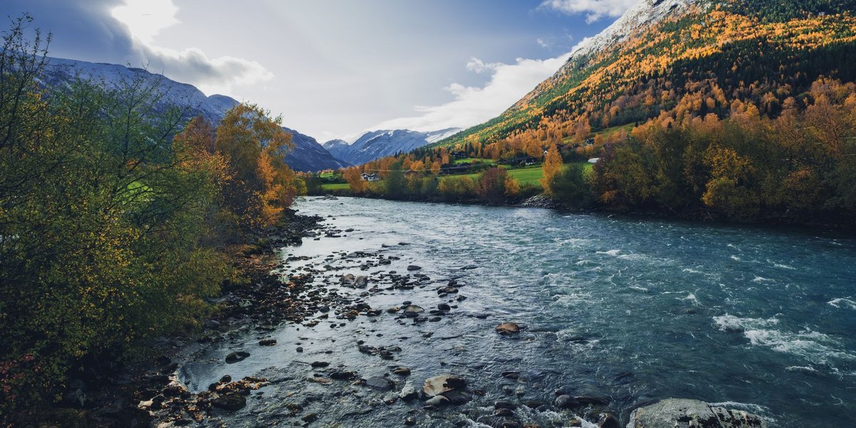
Norway is a country carved by water. Glaciers shaped the terrain over millennia, and when they retreated, they left behind a network of rivers that drain some of the most dramatic landscapes in Europe. These aren’t slow, meandering lowland rivers — most drop steeply from highland plateaus to fjords and sea, which is exactly why Norway generates around 90% of its electricity from hydropower.
Most travel content focuses on fjords. The rivers deserve more attention.
Norway’s Rivers at a Glance
Norway has over 400 rivers, but they’re not evenly distributed. The eastern half of the country — particularly the broad valleys running north-south — holds the longest and most ecologically significant waterways. The western fjord region has shorter, faster rivers fed directly by snowmelt and rain, which is why the hydropower infrastructure is concentrated there.
The rivers also vary dramatically by season. In late spring and early summer, snowmelt turns even modest rivers into serious currents. By late summer, the same stretches become calm enough for swimming. Norway’s water geography extends well beyond its rivers — the country is also home to thousands of glacial lakes, many of which serve as the headwaters or reservoirs feeding these river systems. A full picture of that side of the landscape is covered in this list of lakes in Norway.
Glomma: Norway’s Longest River
Glomma (also spelled Glåma) is Norway’s longest river at 604 km, draining roughly 42,000 km² of southeastern Norway — the largest drainage basin in the country. It rises near Røros, runs south through Østfold, and empties into the Oslofjord at Fredrikstad.
What makes Glomma historically significant isn’t just its size. For centuries it served as the main artery for Norway’s timber industry, with logs floated downstream to sawmills at the coast. The last commercial timber float on Glomma took place in 1985, but the infrastructure from that era — loading bays, holding pools — is still visible along the banks in several places.
Today, Glomma is used for hydropower, irrigation, and recreational fishing. Pike, perch, and various species of trout populate its lower stretches.
The Other Major Rivers
Numedalslågen (354 km) runs south from Numedal to Larvik on the Vestfold coast. It’s consistently ranked among Norway’s best salmon rivers — the Numedalslågen Salmon Fishing Association has managed the population here since the 1800s, and the river produces some of the largest Atlantic salmon caught in Norway each season.
Gudbrandsdalslågen (250 km) drains the long Gudbrandsdalen valley, running through Lillehammer before joining the Vorma near Minnesund. This river is famous for Hunderørret — the Hunder trout — a strain of brown trout that migrates upstream from Lake Mjøsa and grows to exceptional sizes. Fish over 10 kg are not unheard of, which draws dedicated anglers from across Europe every summer.
Drammenselva (303 km including the Hallingdalselva headwater) drains from Hallingdalen and the Numedal region before emptying into the Drammensfjord. The city of Drammen sits at its mouth, and the lower stretch of the river runs through an industrial corridor that has been progressively cleaned up since the 1980s — salmon returned to the lower Drammenselva in the early 2000s after decades of absence.
Otra (245 km) rises in the high country of Setesdal and runs south to Kristiansand. It’s the main river of the Setesdalen valley and one of Norway’s more significant salmon rivers for its size. The upper reaches pass through remote highland terrain that’s largely untouched.
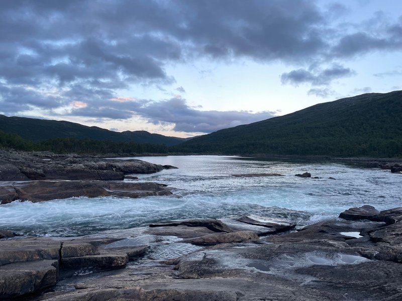
Pasvikelva (145 km in Norway) is a border river shared between Norway, Finland, and Russia in the far north of Finnmark. It drains Lake Inari and flows into the Varangerfjord. Pasvikelva is one of Norway’s most intensively hydropower-developed rivers — a series of dams and power stations step down its entire length. It’s also significant ecologically: the wetlands along the river form part of the Øvre Pasvik National Park, one of Norway’s most important habitats for brown bear.
Reisa (210 km) in Troms is less well-known but worth a mention for travelers. It runs through the Reisa National Park, and its lower canyon section — with waterfalls dropping into narrow gorges — is some of the most dramatic river scenery in the north. The Reisa is also a serious salmon river; the fish run up from the Reisafjord and have to navigate significant waterfalls to reach the upper pools.
Gaula (145 km) in Trøndelag drains into the Trondheimsfjord near Trondheim. It has a reputation among fly fishers disproportionate to its length — Norwegian Environment Agency data consistently shows Gaula among the top five salmon rivers in Norway by total annual catch. The river passes through Gauldalen and has decent road access, which makes it more accessible than many competing salmon destinations.
Quick Reference: Norway’s Longest Rivers
| River | Length (km) | Empties into | Notable for |
|---|---|---|---|
| Glomma | 604 | Oslofjord | Longest in Norway, historic timber floats |
| Drammenselva | ~303 | Drammensfjord | Salmon recovery, industrial history |
| Numedalslågen | 354 | Vestfold coast | Atlantic salmon fishing |
| Otra | 245 | Kristiansand | Setesdalen valley, salmon |
| Gudbrandsdalslågen | 250 | Lake Mjøsa / Vorma | Hunder trout |
| Reisa | 210 | Reisafjord | National park, canyon scenery |
| Gaula | 145 | Trondheimsfjord | Top-ranked fly fishing |
| Pasvikelva | ~145 | Varangerfjord | Hydropower, brown bear habitat |
Note: Lengths vary by source depending on which headwater tributaries are included.
River Activities: Fishing and Rafting
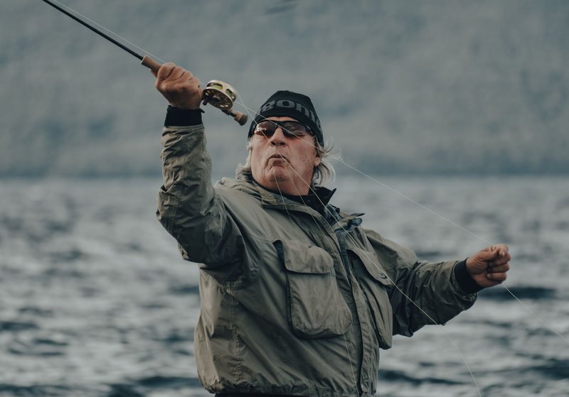
Fly Fishing
Norway’s rivers are among the best Atlantic salmon fisheries in Europe, and the competition for beats (the specific stretches you’re licensed to fish) is real. Gaula, Numedalslågen, and the Alta River in Finnmark are the most coveted — Alta in particular has been a destination for serious salmon anglers since the 19th century, and beats on the river can cost several thousand euros per week during peak season in July.
For brown trout, Gudbrandsdalslågen and its connection to Lake Mjøsa produces fish that generate genuine internet debates about what qualifies as a trout versus a salmon equivalent in terms of fighting weight. The Hunder trout strain is genetically distinct from standard brown trout populations and has been specifically managed to preserve its characteristics.
Day licenses for many rivers are available locally and through the Norwegian fishing license portal, though the best beats on premium salmon rivers book out months or years in advance.
White Water Rafting
The steep gradient of many Norwegian rivers makes them natural rafting venues. The Sjoa River in Oppland — a tributary of Gudbrandsdalslågen — is the most developed rafting destination in Norway, with rapids ranging from class III to class V. Several operators run guided trips from the village of Sjoa throughout summer.
Driva in Møre og Romsdal and Raumavassdraget near Andalsnes are also used for rafting, with Rauma in particular passing through some dramatic valley scenery below the Trollveggen cliff face. If you’re drawn to Scandinavia’s waterways more broadly, the rivers in Sweden offer a useful comparison — many share similar glacial origins and salmon-run characteristics, though on a flatter gradient overall.
Kayaking is popular on gentler stretches of the major valleys, and river swimming spots exist on most accessible rivers during the July–August window when water temperatures climb above 15°C in the southern regions.
Seasonal Conditions
Norway’s river hydrology is driven almost entirely by snowmelt and precipitation rather than groundwater. This creates a predictable annual cycle:
April–June: Snowmelt flood season. Rivers run high, fast, and cold. Rafting operators in the Sjoa area specifically target this period for the most dramatic whitewater. Not suitable for casual swimming or wading.
July–August: Water levels drop and warm. Prime fishing season for most rivers. The Gaula salmon run peaks in July. Brown trout fishing is best in August when water temperatures stabilize.
September–October: Water temperatures fall and autumn rains can cause secondary flooding. Brown trout spawn in October–November, so fishing restrictions apply on many rivers during this period.
November–March: Rivers in the far north can freeze partially or fully. Southern rivers like Glomma slow dramatically but rarely freeze completely in their lower reaches.
Flood monitoring for Norwegian rivers is managed by the Norwegian Water Resources and Energy Directorate (NVE), which publishes real-time water levels and flood warnings — useful if you’re planning any activity along a specific river and want to check conditions before you go.