TLDR
Suriname has no real road network past the coast, so its rivers do the work highways do everywhere else. The Courantyne is the longest at 724 kilometers and forms the entire disputed border with Guyana. The Suriname River is the most important economically and historically — it’s the reason Paramaribo exists where it does, and the Afobaka Dam turned a chunk of it into one of the largest reservoirs in the world. Eight rivers matter most: Courantyne, Marowijne, Suriname, Saramacca, Coppename, Nickerie, Coeroeni, and Kabalebo. Full breakdown below, plus where to actually see river dolphins and caimans.
Table of Contents
- Why Rivers Run This Country
- Suriname’s Rivers at a Glance
- The Suriname River
- The Courantyne River and the Guyana Border
- The Marowijne River
- The Saramacca and Coppename Rivers
- The Nickerie, Coeroeni, and Kabalebo Rivers
- Getting on the Water
Why Rivers Run This Country
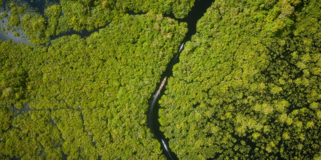
More than 90% of Suriname is unbroken rainforest, and almost none of it has roads. If you want to reach a village in the interior, you don’t drive — you take a korjaal, the long wooden dugout canoes that Maroon and Indigenous communities have used for generations, and you go by river. That single fact explains almost everything about how Suriname is organized: its capital sits where two rivers meet, its energy grid runs off a dammed river, its national border with Guyana is a river rather than a line on a map, and its interior tourism industry is built entirely around boat access.
Eight rivers do most of that work. Here’s how they stack up, and what each one is actually good for.
Suriname’s Rivers at a Glance
| River | Length | Location | Notable Feature |
|---|---|---|---|
| Courantyne | 724 km | Suriname–Guyana border | Longest river in the country; unresolved border dispute |
| Marowijne | ~725 km (with Lawa/Litani headwaters) | Suriname–French Guiana border | Historic Maroon river towns; border crossing at Albina |
| Suriname | 480 km | Central Suriname to Paramaribo | Afobaka Dam and Van Blommestein Lake |
| Nickerie | ~320 km | Western Suriname | Rice country; Blanche Marie Falls |
| Saramacca | 255 km | Central Suriname | Historic Maroon settlement route |
| Coppename | Basin: 21,700 km² | Central/western Suriname | Ramsar wetland reserve at its mouth |
| Kabalebo | 52 km | West Suriname, interior | Eco-lodge and waterfall country |
| Coeroeni | Tributary | Far south, near Brazil | One of the least-visited watersheds in South America |
The Suriname River

The Suriname River is the one that matters most day to day, even though it’s not the longest. It rises in the Guiana Highlands, where it’s known as the Gran Rio, inside the watershed protected by the Central Suriname Nature Reserve — a 1.6-million-hectare UNESCO World Heritage site that also happens to be jaguar and giant otter habitat. From there it runs roughly 480 kilometers north, picking up the name “Suriname River” partway down, until it splits Paramaribo from Meerzorg and empties into the Atlantic at the sandspit Braamspunt.
The river carries the country’s colonial history with it. Dutch plantation owners moved enslaved labor and sugar along it for two centuries, and Jodensavanne — one of the earliest Jewish settlements in the Americas — sits on its bank south of the capital, its ruins now accessible only by boat or a long dirt track. Upriver, at Afobaka, the government dammed the river between 1961 and 1964 to power the bauxite industry, flooding forest to create Brokopondo Reservoir (officially Van Blommestein Lake), one of the largest artificial lakes in the world at roughly 1,560 square kilometers. Villages were relocated, and the reservoir still supplies most of Suriname’s electricity today.
The Courantyne River and the Guyana Border
At 724 kilometers, the Courantyne (also spelled Corentyne or Corantijn) is Suriname’s longest river, and it’s the entire western border with Guyana — not a border that crosses the river, the river itself. That distinction is the source of a dispute that’s technically still unresolved. Colonial-era Dutch treaties assigned the whole river, right up to the Guyanese bank, to Suriname, which means Guyana’s own citizens use a river they don’t legally own a share of. Guyana has never accepted that reading and continues to raise it, most recently over fees Suriname charges Guyanese boat operators to cross.
The dispute has flared into something sharper than paperwork before. In 2000, Suriname sent a naval gunboat to order a Canadian-operated oil rig out of contested waters near the river’s mouth, an incident that pushed both countries to the Permanent Court of Arbitration in The Hague, which settled the maritime boundary in 2007. The land border along the river itself never went through the same process, so it stays a live irritant between two countries that otherwise cooperate closely.
The Marowijne River
The Marowijne (French: Maroni) is the mirror image of the Courantyne on the other side of the country — a border river, this time with French Guiana, running close to 725 kilometers if you count its Lawa and Litani headwaters up in the Tumuc-Humac Mountains. Where the Courantyne border is a legal fight, the Marowijne border is more of a shared community: Maroon towns sit on both banks, families cross routinely, and the river ports of Albina (Suriname) and Saint-Laurent-du-Maroni (French Guiana) function almost as one settlement split by a currency change. Upriver, the Marowijne’s tributaries thread through the territory of the Ndyuka and Aluku Maroon peoples, descendants of Africans who escaped Suriname’s plantations in the 17th and 18th centuries and built independent societies in the forest — one of the reasons this stretch of river shows up in cultural travel writing far more than in geography textbooks.
The Saramacca and Coppename Rivers
The Saramacca River runs 255 kilometers through central Suriname and gave its name to the Saramaka Maroon people, whose ancestors settled along its upper reaches after fleeing enslavement. It’s a quieter, less-trafficked river than the Suriname or Courantyne, historically used more for internal transport between Maroon villages than for commerce or border crossings.
The Coppename, which the Saramacca eventually joins near the coast, drains a basin of about 21,700 square kilometers and starts inside the same Central Suriname Nature Reserve watershed as the Suriname River’s Gran Rio headwaters. Its real claim to fame is at the mouth, not the source: the Coppenamemonding Nature Reserve is Suriname’s only Ramsar-listed wetland, a stretch of mangrove and mudflat that hosts hundreds of thousands of migratory shorebirds and one of the largest scarlet ibis colonies in the region.
The Nickerie, Coeroeni, and Kabalebo Rivers
The Nickerie River, at around 320 kilometers, runs through Suriname’s rice belt in the far west — the Nickerie District grows most of the country’s rice for export, largely irrigated off this river’s polders. Upriver, it drops over the Blanche Marie Falls, a set of rapids that’s become a modest domestic tourism stop, reachable by road unlike most of Suriname’s interior.
The Coeroeni and Kabalebo are the two you’ve probably never heard of, and for good reason: they’re deep interior rivers with almost no permanent settlement along them. The Coeroeni rises near the Brazilian border in the Tumuc-Humac range and feeds into the Courantyne, draining some of the least-visited rainforest in South America. The Kabalebo is short, just 52 kilometers, but it’s built an outsized reputation as the base for Kabalebo Nature Resort, an eco-lodge accessible only via one of Suriname’s remote airstrips or by boat, known for waterfalls, tapir sightings, and river stretches that see maybe a handful of visitors a year.
Getting on the Water

If you’re planning an actual trip to Suriname rather than reading for reference, the rivers you can realistically get on without a chartered bush flight are the Suriname and Commewijne, both accessible from Paramaribo. Evening boat trips out of Leonsberg head into the river’s brackish lower stretch to find Guiana dolphins — a pink-bellied species that feeds right up to the boat at sunset — before continuing into the swamp channels after dark to spot caiman with a spotlight. Further upriver, past the Afobaka Dam, Maroon-run guesthouses on the Upper Suriname River offer multi-day stays built around swimming holes, river rapids, and villages that still travel almost exclusively by korjaal. For the interior rivers, Kabalebo and the western nature reserves, you’re looking at a fly-in lodge and several days minimum — but they’re also the stretches of river where you have a real shot at giant river otters and harpy eagles rather than just dolphins.
Whichever river you end up on, the pattern holds across all eight: in Suriname, the water isn’t scenery. It’s the road.