Thirteen U.S. states share a border with Canada — and if you didn’t know that, you’re probably forgetting Alaska. The full list, in alphabetical order: Alaska, Idaho, Maine, Michigan, Minnesota, Montana, New Hampshire, New York, North Dakota, Ohio, Pennsylvania, Vermont, and Washington.
Two of those — Ohio and Pennsylvania — share only a water border along Lake Erie, which surprises most people. Alaska, meanwhile, has the longest international land border of any U.S. state. There’s more going on here than a simple list.
Below is everything you actually need to know: which Canadian provinces each state touches, how long the border runs, and where most of the traffic crosses.
Table of Contents
- Quick Reference Table
- The Western States
- The Midwest and Great Plains States
- The Northeast States
- The Great Lakes States
- Alaska: A Special Case
- What to Expect at the Border
Quick Reference Table
| State | Canadian Province(s) | Border Length (miles) | Busiest Crossing |
|---|---|---|---|
| Alaska | British Columbia, Yukon | ~1,538 (land) | Skagway / Haines |
| Idaho | British Columbia | ~45 | Porthill |
| Maine | New Brunswick, Quebec | ~611 | Calais / St. Stephen |
| Michigan | Ontario | ~721 (water) | Detroit / Windsor |
| Minnesota | Manitoba, Ontario | ~547 | International Falls |
| Montana | Alberta, British Columbia, Saskatchewan | ~545 | Sweetgrass / Coutts |
| New Hampshire | Quebec | ~58 | Pittsburg |
| New York | Ontario, Quebec | ~445 | Buffalo / Niagara Falls |
| North Dakota | Manitoba, Saskatchewan | ~310 | Portal |
| Ohio | Ontario (Lake Erie) | ~0 (water only) | N/A |
| Pennsylvania | Ontario (Lake Erie) | ~0 (water only) | N/A |
| Vermont | Quebec | ~90 | Derby Line / Rock Island |
| Washington | British Columbia | ~427 | Blaine / Peace Arch |
The Western States
Washington
Washington’s 427-mile border with British Columbia is one of the busiest in the country. The Peace Arch crossing at Blaine — where Highway 99 on the U.S. side meets BC-99 heading north into Surrey — processes millions of crossings per year and is one of the most photographed border posts in North America. The arch straddles the line itself, with a small park on each side that’s technically accessible to citizens of both countries without crossing formally.
Vancouver is only about 30 miles north of Blaine, which makes Washington a common gateway for people doing day trips across the border in both directions.
Idaho
Idaho’s border with British Columbia is short — about 45 miles — and sees relatively light traffic. The main crossing is at Porthill, a quiet entry point used mostly by people traveling between northern Idaho and the Kootenay region of BC. Not much drama here, but it’s a legitimate international boundary.
The Midwest and Great Plains States
Montana
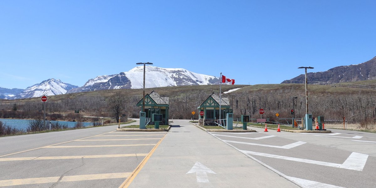
Montana shares borders with three Canadian provinces: Alberta, British Columbia, and Saskatchewan — more provinces than any other contiguous U.S. state. Its 545-mile border includes the Sweetgrass / Coutts crossing, the busiest port of entry along the Montana-Alberta line and a key route for commercial trucking between the two countries.
The stretch of border through Glacier National Park and Waterton Lakes, which together form Waterton-Glacier International Peace Park — the world’s first international peace park — is one of the more dramatic border landscapes anywhere.
North Dakota
North Dakota’s border with Manitoba and Saskatchewan runs 310 miles, almost entirely flat prairie. The main crossing at Portal (connecting to Northgate, Saskatchewan) is the busiest entry point in the state and handles significant agricultural trade. For travelers, the Pembina crossing on Interstate 29 is the more practical option — it’s 24/7 and connects directly to Winnipeg, about an hour north.
Minnesota
Minnesota’s 547-mile border touches both Manitoba and Ontario, with a significant chunk running through lake country along the Boundary Waters. International Falls, on the Rainy River, is the primary crossing and one of the colder inhabited places in the continental United States — it’s regularly cited in weather reports as the “icebox of the nation.”
The Northeast States
Maine
Maine is the northeastern extreme of the contiguous U.S., and its 611-mile border with New Brunswick and Quebec is the longest of any northeastern state. The Calais / St. Stephen crossing on the St. Croix River is the busiest in Maine, popular with people crossing into New Brunswick for daily commutes, shopping, and tourism. Maine also has several remote crossings in the northern interior that process very little traffic.
New Hampshire
New Hampshire’s border with Quebec is only 58 miles long, mostly running through the remote North Country. The main crossing at Pittsburg — yes, one “h,” different from Pennsylvania — sits at the headwaters of the Connecticut River and sees moderate traffic from Quebec snowmobilers in winter and leaf-peepers in fall.
Vermont
Vermont’s 90-mile border with Quebec includes Derby Line, one of the more unusual crossings anywhere: the Haskell Free Library and Opera House straddles the border, with the entrance on the U.S. side and the stage on the Canadian side. It’s exactly as odd as it sounds.
The Derby Line / Rock Island crossing is the main port of entry and connects to Sherbrooke and Montreal via Route 55 on the Canadian side.
New York
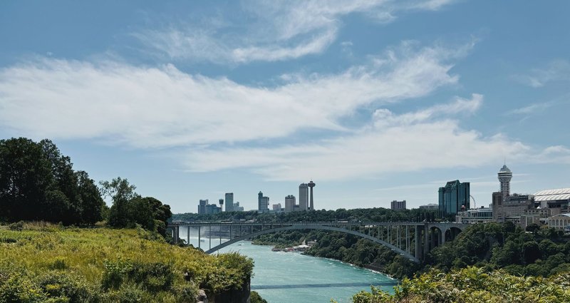
New York shares 445 miles of border with Ontario and Quebec. The Buffalo / Niagara Falls crossing is the busiest in the state and one of the highest-traffic border crossings in North America — the Rainbow Bridge handles passenger vehicles, and the Peace Bridge handles commercial traffic. Crossing from Niagara Falls, New York to Niagara Falls, Ontario takes about 20 minutes when it’s quiet. During summer weekends, budget more.
Further north, the Thousand Islands crossing on the St. Lawrence River connects Alexandria Bay to Kingston, Ontario and is worth it for the scenery alone.
The Great Lakes States
Michigan
Michigan’s 721 miles of border with Ontario runs almost entirely along water — the Detroit River, Lake St. Clair, the St. Clair River, and Lake Huron. The Ambassador Bridge between Detroit and Windsor is the busiest international land border crossing in North America by trade volume, handling a significant portion of Canada-U.S. automotive trade. According to the U.S. Department of Transportation, roughly 25–30% of all U.S.-Canada trade crosses here.
The only land border Michigan shares with Ontario is a short stretch at Sault Ste. Marie, where two cities of the same name sit across the St. Marys River from each other.
Ohio
Ohio does not share a land border with Canada. It does sit along the southern shore of Lake Erie, which means that on a clear day in Cleveland, you can technically see Ontario across the water — but there’s no official crossing in Ohio. The border is a maritime boundary through the lake.
Pennsylvania
Same situation as Ohio. Pennsylvania’s northern edge touches Lake Erie for about 50 miles, near Erie city, but there’s no land boundary and no crossing. The inclusion of Ohio and Pennsylvania on lists of “states that border Canada” is technically accurate in an international law sense — they share a water boundary — but practically speaking, you can’t drive from Pennsylvania into Canada without going through New York first.
Alaska: A Special Case
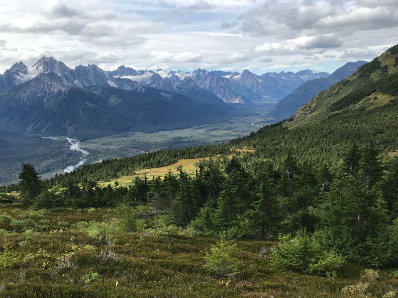
Alaska’s border situation is unlike any other state’s. It shares approximately 1,538 miles of land border with two Canadian jurisdictions: Yukon and British Columbia. The Alaska Panhandle — that narrow strip of coastline running southeast — borders British Columbia along its entire length, while the main body of Alaska borders Yukon to the east.
The primary road crossing is at Beaver Creek / Tok, where the Alaska Highway connects Fairbanks to the lower 48 through Yukon. Getting from Alaska to the rest of the United States by road requires driving through Canada — there’s no land route that stays entirely in U.S. territory. This makes Alaska uniquely dependent on the Canadian highway system for ground transportation.
The border between Alaska and Yukon/BC is also remote in a way the continental borders aren’t. Much of it runs through wilderness with no towns, roads, or crossings for hundreds of miles.
What to Expect at the Border
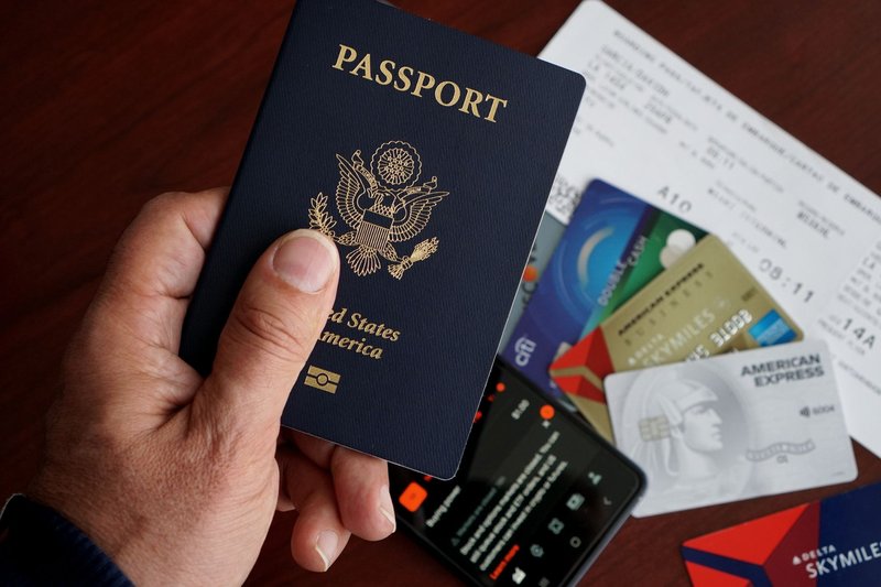
For most crossings, you need a valid U.S. passport or passport card. NEXUS cards work at staffed crossings and trusted traveler lanes. Enhanced Driver’s Licenses (available in a few states, including Washington, Michigan, and New York) are accepted for land and sea crossings but not air travel.
A few things most guides skip:
Alcohol limits vary by province. You can bring alcohol across in limited quantities duty-free, but the limit depends on the Canadian province, not U.S. rules. Alberta’s limit differs from Quebec’s.
Firearms are heavily restricted. Most handguns are prohibited in Canada. If you’re traveling with any firearm, research the specific rules before crossing — the consequences of getting it wrong are serious.
Fresh produce and meat can be flagged. Canada’s CBSA inspects food items carefully. Fruits, vegetables, and meats from certain regions may be confiscated.
Smaller crossings close overnight. Several lower-traffic crossings operate on limited hours. The Canada Border Services Agency website lists hours for every port of entry.
Of the 13 states, only 11 share an actual land or river border with Canada — Ohio and Pennsylvania are the outliers, touching only Lake Erie’s water boundary. The rest run the full geographic gamut: Montana’s wide-open prairie crossings, Maine’s forested river borders, New York’s bridge-heavy crossings, and Alaska’s wilderness frontier with Yukon. Each one is a different kind of international boundary.