
Quick Answer
Iowa borders six states: Minnesota to the north, Wisconsin and Illinois to the east, Missouri to the south, and Nebraska and South Dakota to the west. Four of those six borders follow rivers — the Mississippi on the east, the Missouri and Big Sioux on the west — while the northern line with Minnesota is a straight survey border.
Table of Contents
- Iowa’s Six Neighboring States
- Minnesota — North
- Wisconsin — Northeast
- Illinois — East
- Missouri — South
- Nebraska — West
- South Dakota — Northwest
- Quick Reference Table
- Common Questions About Iowa’s Borders
Iowa’s Six Neighboring States
Iowa sits almost dead center in the Midwest, which is exactly why it touches so many neighbors. Pull up a map and you’ll notice something odd: Iowa is one of only a handful of states whose eastern and western edges are both defined by major rivers — the Mississippi on one side, the Missouri on the other. That’s not a coincidence of geography so much as a leftover from how 19th-century surveyors drew state lines: rivers were easy to agree on, straight lines needed a compass and a lot of patience.
Going clockwise from the north: Minnesota, Wisconsin, Illinois, Missouri, Nebraska, and South Dakota. Two of those borders are pure river (Illinois, Nebraska), two are river-plus-land (Missouri, South Dakota), one is river-only-briefly (Wisconsin), and one is a straight land line (Minnesota).
Minnesota — North
Iowa’s entire northern border with Minnesota is a straight line — no river, no natural feature, just a boundary drawn along roughly the 43rd parallel. It runs about 210 miles from the Big Sioux River in the west to the Mississippi in the east. Towns like Albert Lea, Minnesota, and Northwood, Iowa, sit close enough to the line that locals cross it for groceries without thinking twice.
The border became official in 1858 when Minnesota joined the Union, using the line already set for the Iowa Territory two decades earlier. Unlike most of Iowa’s other borders, this one never had a serious dispute attached to it — surveyors just ran the line and both sides accepted it.
Wisconsin — Northeast
This is Iowa’s shortest and least-known border, a stretch of the Mississippi River barely 20 miles long in the state’s far northeastern corner. The two states technically touch near the town of Lansing, Iowa, across from Wisconsin’s Crawford County. Because the border is entirely water, there’s no land crossing — you’d need a bridge or a boat.
Most people forget Wisconsin borders Iowa at all, since the shared edge is so short compared to Iowa’s line with Illinois just downstream on the same river.
Illinois — East
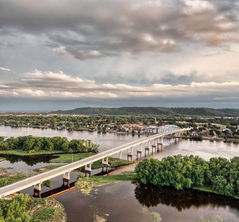
The Mississippi River forms the entire 328-mile border between Iowa and Illinois, and it’s one of the more heavily traveled state lines in the Midwest. The Quad Cities — Davenport and Bettendorf in Iowa, Rock Island and Moline in Illinois — straddle the river as a single connected metro area, with commuters crossing multiple bridges daily.
Because the border follows the river’s channel, and rivers shift over decades, a few small parcels of land have technically swapped states over time as the Mississippi meandered. Iowa also grabs a sliver of “east bank” territory near Sabula, Iowa’s only island city, where the river bends around it.
Missouri — South
Iowa’s southern border with Missouri runs roughly along a straight east-west line, but it’s not perfectly straight — and that’s on purpose, sort of. In 1839, the two territories nearly went to war over a few miles of disputed boundary in what’s remembered as the Honey War, a bloodless standoff triggered by a Missouri sheriff trying to collect taxes from Iowa residents by cutting down their honey trees. The U.S. Supreme Court settled it in 1849, fixing the line where it sits today.
The border stretches about 200 miles and runs through mostly farmland, with towns like Lamoni, Iowa, sitting just a few miles north of the Missouri line.
Nebraska — West
The Missouri River separates Iowa from Nebraska for most of their shared border, running about 150 miles from the South Dakota line down to the Missouri state line. Council Bluffs, Iowa, and Omaha, Nebraska, anchor the busiest crossing point, connected by multiple interstate bridges across the river.
Like the Illinois border, this one has shifted slightly over the decades as the Missouri River’s channel moved, occasionally leaving small tracts of Iowa land technically on the Nebraska side of the current riverbed, and vice versa.
South Dakota — Northwest
Iowa’s shortest western border, and its most recently finalized one, runs along the Big Sioux River for about 40 miles in the state’s extreme northwest corner. Sioux City, Iowa, sits right where the Big Sioux meets the Missouri River — close enough that it’s genuinely a three-state intersection, with South Dakota and Nebraska both a short drive away.
South Dakota didn’t become a state until 1889, decades after Iowa, so this border was one of the last pieces to lock into place on the map.
Quick Reference Table
| Neighboring State | Direction | Border Type | Approx. Length |
|---|---|---|---|
| Minnesota | North | Land (straight line) | 210 miles |
| Wisconsin | Northeast | River (Mississippi) | ~20 miles |
| Illinois | East | River (Mississippi) | 328 miles |
| Missouri | South | Land (surveyed line) | 200 miles |
| Nebraska | West | River (Missouri) | 150 miles |
| South Dakota | Northwest | River (Big Sioux) | 40 miles |
Common Questions About Iowa’s Borders
How many states border Iowa? Six: Minnesota, Wisconsin, Illinois, Missouri, Nebraska, and South Dakota.
Which of Iowa’s borders are rivers, and which are land? Four are rivers — Wisconsin and Illinois via the Mississippi, Nebraska via the Missouri, and South Dakota via the Big Sioux. Two are land borders drawn by survey — Minnesota to the north and Missouri to the south.
Does Iowa border Nebraska and Missouri at the same time? Yes. Iowa’s southwestern corner comes close to a three-state meeting point where Nebraska, Missouri, and Iowa nearly converge, though the exact tripoint sits just across the Missouri River.
What’s the longest state border Iowa has? The Illinois border, at 328 miles along the Mississippi River, is Iowa’s longest.
Iowa’s shape — that near-rectangle bounded by two of the country’s major rivers — is why so many of its border towns feel like small transit hubs. Cross a bridge in Council Bluffs or the Quad Cities and you’ve changed states without really leaving the neighborhood. That’s the quiet upside of being surrounded by six neighbors: nowhere in Iowa is really that far from somewhere else.