Table of Contents
- TLDR
- The Mbini (Benito): the country’s spine
- The Ntem: a border written in water
- The Muni Estuary: where five rivers become one
- Bioko Island’s volcanic streams
- Why so little of this reaches a map
TLDR
Equatorial Guinea is small, split across a mainland region (Río Muni) and several Gulf of Guinea islands, and its rivers reflect that split geography. The longest is the Mbini (Benito), at 248 km, running roughly through the middle of the mainland from its source in Gabon to the Atlantic. The Ntem forms much of the northern border with Cameroon. In the south, the Muni Estuary gathers a cluster of smaller rivers — the Utamboni, Mitong, Mandyani, Congue, and Mven — into one of the region’s densest mangrove systems. Bioko Island, volcanic and separate from the mainland, has no major rivers at all, just short, fast streams draining straight off the slopes of Pico Basilé.
The Mbini (Benito): the country’s spine
If you’re looking for the one river that defines Equatorial Guinea’s map, it’s the Mbini. It rises in Gabon, crosses into Río Muni, and cuts the mainland roughly in half on its way west to the Atlantic — 248 km end to end, the longest river entirely associated with the country. Locally, and on older colonial maps, you’ll also see it labeled the Benito, and the stretch running through Monte Alén National Park sometimes appears as the Uoro.
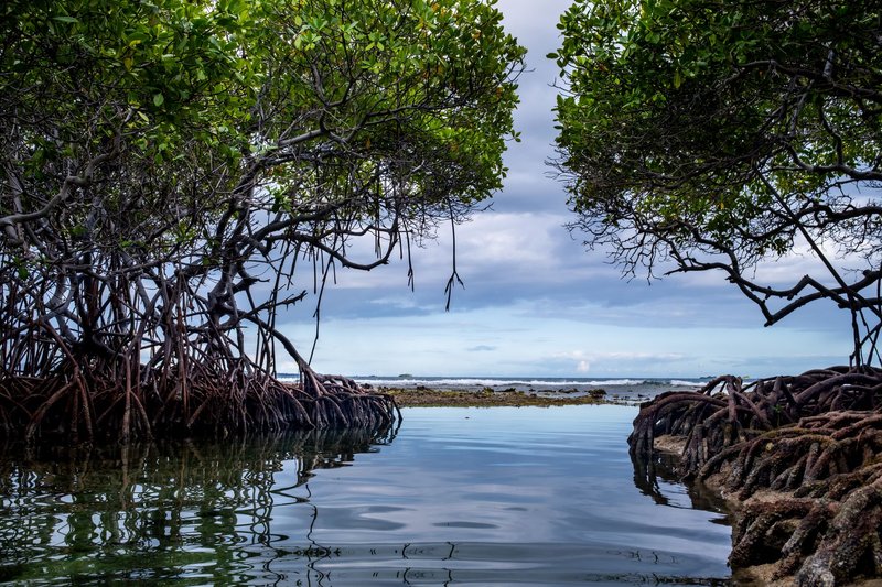
Only the final 20 km or so, near the coastal town that shares the river’s name, is navigable — the rest runs too shallow and too broken by rapids for anything beyond a canoe. That last stretch matters more than its length suggests. It’s flanked by mangrove stands that reach roughly 20 km inland from the coast, and those mangroves are working habitat, not scenery. Coastal mangrove systems worldwide function as nursery grounds for juvenile fish and crustaceans, sheltering them in root systems too tangled for larger predators to hunt effectively, and the Mbini’s estuary does the same job for the species that sustain small-scale fishing communities along this stretch of coast.
Upstream, the Mbini corridor has also been a de facto logging route for decades. Central Africa’s timber economy has always leaned on its rivers where roads don’t reach, floating felled logs downstream toward processing points near the coast — a pattern the region’s forestry monitoring programs, including FAO-backed timber-tracking efforts, have spent years trying to formalize so that legally sourced wood doesn’t get mixed in with the rest.
The Ntem: a border written in water
North of the Mbini, the Ntem does double duty as both a river and a boundary line. For most of its lower course it separates Río Muni from Cameroon, and its thalweg — the deepest channel, the line international boundary law actually follows — was fixed by colonial-era treaties that neither country has bothered to renegotiate since. On Cameroonian maps you’ll sometimes see it called the Campo instead, same river, different name depending on which bank you’re standing on.
Unlike the Mbini, the Ntem barely features in Equatorial Guinea’s own tourism or development narrative, mostly because the country’s side of the river is sparsely populated rainforest with no real port infrastructure. That obscurity is exactly why it doesn’t show up in general audience content about the country — most sources mention it only in the context of border disputes or colonial boundary-drawing, never as a river in its own right.
The Muni Estuary: where five rivers become one
South of the Mbini, the geography changes completely. Instead of one long river running to a single mouth, you get a braided estuary system where several short rivers converge before reaching the sea. The Muni Estuary is fed from the north by the Congue and Mandyani rivers, and from the east by the Mitong, Mven, and Utamboni (also called the Timboni or Mitimele in its upper reaches). The Utamboni itself does border duty too — its channel marks part of the line between Río Muni and Gabon, a boundary drawn in 1900 that follows the estuary’s own thalweg rather than any surveyed straight line.
Two smaller tributaries worth naming if you’re going deep: the Komo River, which threads through this same southern drainage, and its own tributary, the Mbeya. Neither is long or dramatic, but together with the Utamboni they make the Muni Estuary the most hydrologically complex corner of the country — more river mouths per kilometer of coastline than anywhere else in Equatorial Guinea.
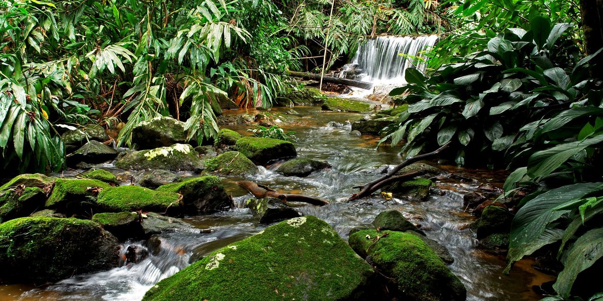
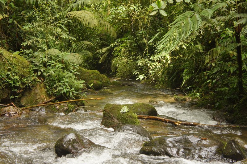
The payoff is ecological. This is one of the richest mangrove and estuarine habitats on the Central African coast, and researchers cataloging the region’s freshwater biodiversity have flagged it as a hotspot for species found nowhere else nearby — the Academy of Natural Sciences’ recent survey work on Equatorial Guinea’s freshwater fishes singles out this stretch of coast specifically for how little of its fish fauna has been formally described. The Muni Estuary Nature Reserve protects a chunk of it, but the reserve’s boundaries don’t cover the full estuary system, which sprawls across both Equatorial Guinea and Gabon.
Bioko Island’s volcanic streams
Everything above is mainland geography. Bioko — the island where the capital, Malabo, sits — plays by different rules entirely. It’s volcanic, dominated by Pico Basilé at just over 3,000 meters, and its rainfall is extreme: the island’s southwest corner catches over ten meters of rain a year, among the wettest spots on the continent.
That rainfall has to go somewhere, and on a young volcanic island it doesn’t have time to organize into anything resembling a proper river system — unlike the crater lakes that form elsewhere in Equatorial Guinea’s volcanic terrain. Instead, water drains straight off the slopes in short, steep, fast-moving streams that run for a few kilometers before hitting the Gulf of Guinea. None of them carry a name most maps bother to print. What they do carry is fish life found almost nowhere else — killifish of the genus Aphyosemion, small enough to fit in your palm, adapted to exactly this kind of short-lived volcanic stream habitat. Aphyosemion volcanum, in particular, turns up on Bioko and on the slopes of Mount Cameroon and essentially nowhere in between, a distribution pattern that tracks the volcanic soil these fish seem to need rather than any connected waterway.
Why so little of this reaches a map
Put the pieces together and Equatorial Guinea’s river system tells a coherent story: one long river (the Mbini) splitting the mainland roughly in two, one border river (the Ntem) doing geopolitical work in the north, one tangled estuary (the Muni system) doing ecological heavy lifting in the south, and an island (Bioko) that skips the whole river concept in favor of short volcanic streams. It’s a small country, but its water geography isn’t simple — it’s just under-documented, which is a different problem entirely.