Nobody publishes a clean list of the smallest cities in Oceania by area. Wikipedia’s Oceania city list sorts by population and stops at 80,000 people. Urban-area charts start at one million. The capital listicles quote an area for a few Pacific capitals and skip the rest.
This post fills the gap. It ranks the Pacific’s smallest cities, capitals and towns by land area, shows the source and year behind each figure, and says plainly where the numbers are soft.
TLDR
- Smallest capital in Oceania, and one of the smallest in the world: Ngerulmud, Palau, at roughly 0.07 km² (0.03 sq mi).
- Smallest by area, counting towns: Ngerulmud, then Ebeye in the Marshall Islands (about 0.35 km²), then Yaren, Nauru (1.5 km²), then Funafuti, Tuvalu (about 2.4 km²).
- Biggest caveat: most Pacific capitals have no legal city boundary, so the “area” is a convention, not a measurement. Ngerulmud’s figure is the least reliable of all.
Contents
- What counts as a city here
- Smallest cities in Oceania by area: the ranking
- The profiles
- Capitals that can’t be ranked
- How small is small? A scale check
- Why the numbers disagree
What counts as a city here
Most Pacific states have no formal cities. Nauru has no capital named in its constitution. Tuvalu’s government sits in a village. Palau’s capital is a government compound built from scratch in the 2000s.
So “city” in this list means one of three things: a national capital or seat of government, a formally recognised city such as Honiara, or the main urban settlement of an atoll. Where a place is a town and not a capital, the table says so.
Figures are land area only. Lagoons are excluded, which matters a lot for atolls: Majuro’s lagoon is about 30 times larger than its land.
Smallest cities in Oceania by area: the ranking
| Rank | Place | Country | Area (km²) | Area (sq mi) | Population | Note |
|---|---|---|---|---|---|---|
| 1 | Ngerulmud | Palau | ~0.07 | ~0.03 | A few hundred | Capital since 2006. Area is an unverified estimate. |
| 2 | Ebeye | Marshall Islands | ~0.35 | ~0.14 | ~9,600 (2011 census) | Town, not capital. Among the densest places in the Pacific. |
| 3 | Yaren | Nauru | ~1.5 | ~0.58 | 747 (2011 census) | De facto capital, a district of Nauru. |
| 4 | Funafuti | Tuvalu | ~2.4 (2.3 to 2.8) | ~0.93 | ~6,300 (2017 census) | Atoll land area, spread over many islets. |
| 5 | Majuro | Marshall Islands | ~9.7 | ~3.7 | ~27,800 (2011 census) | Atoll land area. Capital of the Marshall Islands. |
| 6 | South Tarawa | Kiribati | ~15.8 | ~6.1 | ~63,400 (2020 census) | Government is based on Bairiki islet. |
| 7 | Honiara | Solomon Islands | ~22 | ~8.5 | ~92,300 (2019 census) | The only formal city in the ranking. |
Ranks 3 to 5 are solid to within a few tenths of a square kilometre. Ranks 1 and 2 are estimates. Ranks 6 and 7 are comfortably larger and rarely contested.
The profiles
1. Ngerulmud, Palau
Palau moved its capital from Koror to Ngerulmud in 2006. The site sits in Melekeok State on Babeldaob, the country’s big island, and it’s mostly government buildings: a neoclassical capitol that borrows heavily from Washington’s, a few ministries, and very few homes. Palau’s real life still happens in Koror, about 20 km south.
The area of about 0.07 km² circulates across sources, but we couldn’t trace it to a survey, and Ngerulmud has no gazetted municipal boundary. Treat it as “a campus, not a town”. At that size it’s smaller than Vatican City (0.49 km²).
2. Ebeye, Marshall Islands
Ebeye isn’t a capital, but it belongs on any honest small-places list. It’s an island on Kwajalein Atoll of roughly 0.35 km² (estimates run from about 0.3 to 0.4), holding around 9,600 people at the 2011 census. That works out to more than 25,000 people per km². Many residents commute by ferry to work at the US Army base on Kwajalein, which is why the island is so crowded.
3. Yaren, Nauru
Yaren is a district of 1.5 km² on a country of 21 km² in total, per the CIA World Factbook. That’s about 7% of the nation. The census counted 747 residents in 2011. Nauru is also one of the smallest countries in Oceania by population.
Nauru’s constitution names no capital, but parliament sits in Yaren, so everyone treats it as one. The country’s only airport is in the district, which takes a large share of the flat land.
4. Funafuti, Tuvalu
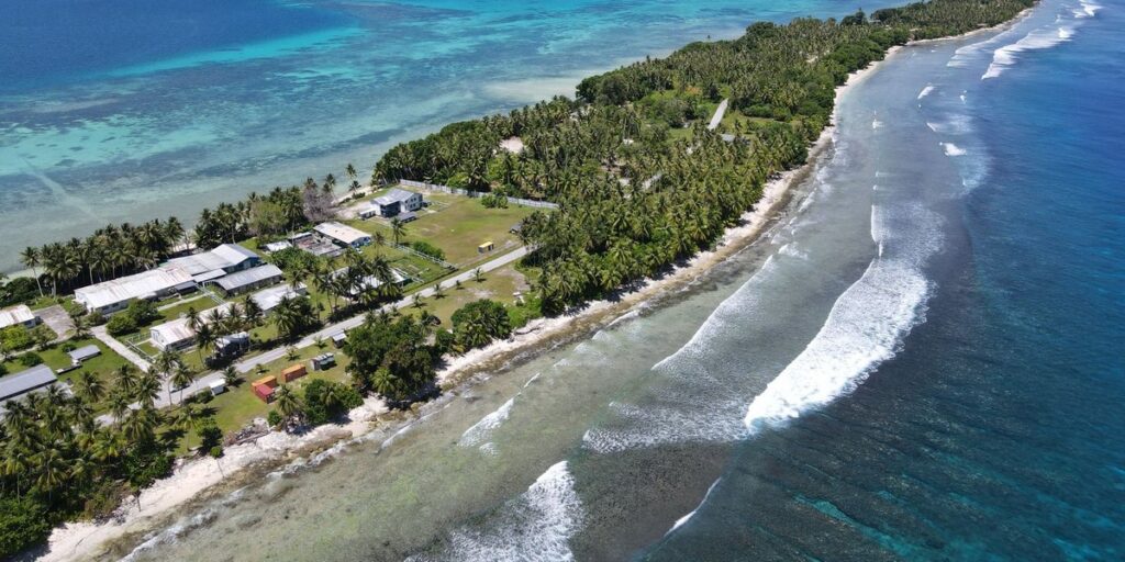
Funafuti is where sources diverge. WorldAtlas lists 0.9 sq mi (about 2.3 km²). Other references give up to roughly 2.8 km² depending on which islets they include. We use 2.4 km² as the middle value. Tuvalu’s total land is about 26 km² according to the CIA World Factbook.
Almost everyone lives on Fongafale, the main islet, which is a narrow strip with the lagoon on one side and the ocean on the other. The airstrip runs straight through it and doubles as the town’s open space when no plane is due. About 6,300 people live here, which is more than half the country.
5. Majuro, Marshall Islands
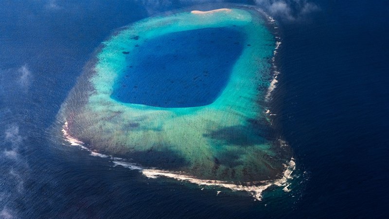
Majuro’s land area is about 9.7 km², across an atoll whose lagoon is roughly 295 km². The capital district runs together as Delap, Uliga and Djarrit, usually shortened to DUD. A single main road runs most of the atoll’s length, and nearly half the country’s population lives along it.
6. South Tarawa, Kiribati
South Tarawa is about 15.8 km² and had around 63,400 residents in 2020. Betio, the islet at the western tip, is only about 2 km² and holds roughly a quarter of the population. It’s where the 1943 battle was fought, and today it’s one of the most crowded places in the central Pacific. The government works from Bairiki islet.
7. Honiara, Solomon Islands
Honiara covers about 22 km² on the north coast of Guadalcanal and had about 92,300 residents in 2019. It’s the one entry here that’s a proper city with its own city council. It has about 15 times Funafuti’s population on less than 10 times the land, which shows how much denser a Melanesian capital is than a typical atoll town.
Capitals that can’t be ranked
Some capitals have no agreed boundary, so any area we gave you would be invented. They’re listed here instead of being slotted into the table with a guess.
- Palikir, Federated States of Micronesia. Built as a purpose-made government centre on Pohnpei to replace Kolonia, and a few thousand people live in the area. Its boundaries aren’t published separately from the surrounding municipality.
- Nukuʻalofa, Tonga. The urban area sits on Tongatapu (about 260 km²) with roughly 23,000 people in the wider built-up zone. Where the town stops and the villages begin is a matter of definition.
- Avarua, Cook Islands. Rarotonga is about 67 km², with a coastal road of roughly 32 km circling it. Avarua is the main town along that road, with a few thousand residents, and the island is small enough that its town limits are informal.
- Alofi, Niue. Niue’s whole population is around 1,600, and Alofi holds a few hundred. Niue is about 260 km².
- Adamstown, Pitcairn Islands. The only settlement on an island of roughly 4.6 km², with about 40 residents. Pitcairn is a British Overseas Territory, so Adamstown is an administrative centre, not a national capital.
If you need a number for any of these, the better route is the national statistics office or the Pacific Data Hub, which hosts census tables for most island states.
How small is small? A scale check
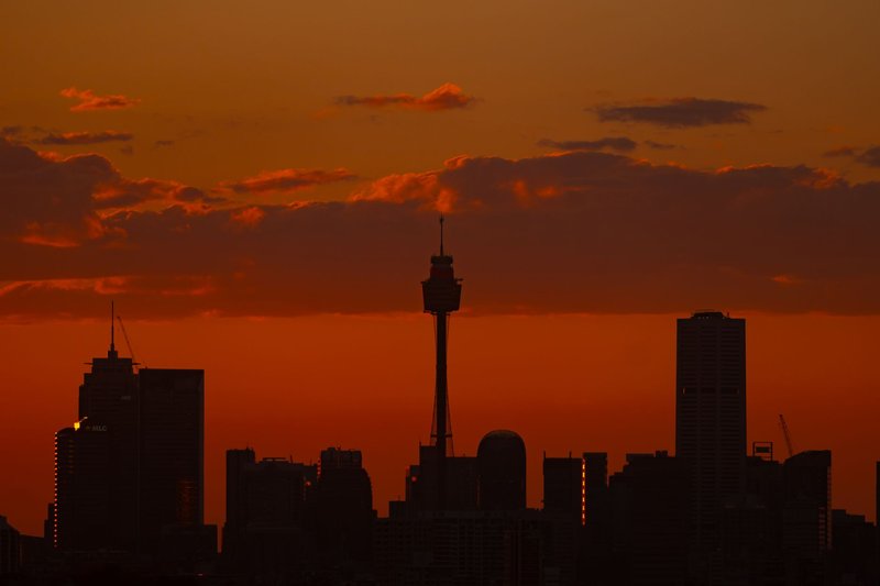
Greater Sydney covers about 12,368 km² according to the Australian Bureau of Statistics. Set against that:
- Ngerulmud, at about 0.07 km², is roughly 175,000 times smaller.
- Yaren is about 8,000 times smaller.
- Funafuti is about 5,000 times smaller.
- Honiara is about 560 times smaller.
A more human comparison: New York’s Central Park is about 3.4 km². Yaren fits inside it more than twice. Funafuti’s land, the whole capital of a UN member state, is a bit smaller than the park.
Greater Sydney is a fair choice for the top of the scale, but it’s an urban region, not a city proper. The City of Sydney itself is about 27 km², close to Honiara. Pick the definition before you compare.
Why the numbers disagree
Three things cause most of the conflicts you’ll see between sources.
Boundary choice. Is Funafuti the capital village (Vaiaku), the main islet (Fongafale) or the whole atoll’s land? Each gives a different area.
City proper versus urban area. City tables often use urban areas, which for a place like South Tarawa means the entire chain of connected islets. For Honiara, you’d get a bigger number if you included the surrounding settlements.
Year and method. Atolls change shape through reclamation and erosion, and older figures came from maps drawn before GPS. Population numbers from different census years also get mixed together, which is how listicles end up contradicting their own tables.
For this list, we used the most recent census or reference figure we could name, kept land and lagoon separate, and rounded to the precision the source supports. Where we couldn’t, we said so instead of picking a number that looks clean.