
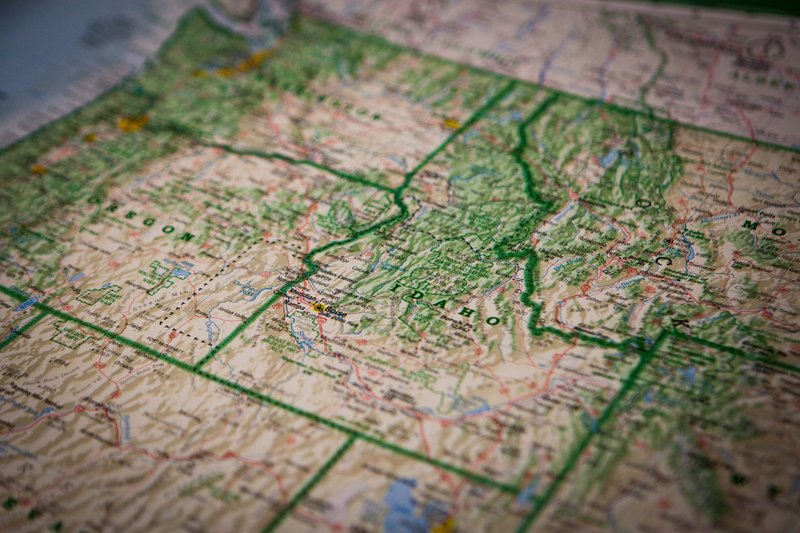
Six states border Idaho: Washington, Oregon, Nevada, Utah, Wyoming and Montana. Idaho also touches one country, Canada, along a roughly 45-mile stretch of British Columbia in the far north.
That makes seven neighbors in total, and it’s the number a lot of sources fumble. Some say “five states” and then list six. At least one puts Montana on Idaho’s north side. It’s east.
TLDR
- West: Washington (northwest) and Oregon
- South: Nevada and Utah
- East: Wyoming and Montana
- North: British Columbia, Canada
- No ocean coast. The nearest Pacific shoreline is across Oregon or Washington.
Contents
- Idaho’s neighbors at a glance
- Washington and Oregon: the western border
- Nevada and Utah: the southern border
- Wyoming and Montana: the eastern border
- Canada: the northern border
- Idaho’s time zone split
- FAQ
Idaho’s neighbors at a glance
| Neighbor | Direction | Main boundary | Border-area city or crossing |
|---|---|---|---|
| Washington | West / northwest | Straight lines on the north, Snake River near Lewiston | Coeur d’Alene / Spokane, Lewiston / Clarkston |
| Oregon | West | Snake River through Hells Canyon | Boise / Ontario |
| Nevada | South | 42nd parallel | Jackpot, NV, near Twin Falls |
| Utah | South / southeast | 42nd parallel, then a line north-south | Preston, ID / Logan, UT |
| Wyoming | East | Teton Range | Idaho Falls / Jackson |
| Montana | East / northeast | Bitterroot Range | Lookout Pass (I-90), Lolo Pass (US-12) |
| British Columbia (Canada) | North | 49th parallel | Eastport / Kingsgate (US-95) |
Idaho’s shape is often described as a boot, and the border explains the shape. The state was carved out of larger territory in 1863, and the lines follow mountains and rivers where they could and straight survey lines where they couldn’t.
Washington and Oregon: the western border
Washington sits to the northwest. Up north, the line runs straight along the survey boundary, which puts Coeur d’Alene about 30 miles from Spokane. The two cities share an airport market, a freeway (I-90) and a lot of commuters. Farther south, the border follows the Snake River, and Lewiston, Idaho and Clarkston, Washington are key border towns that sit across the water where the Snake meets the Clearwater.
Lewiston is also an inland seaport. Barges move grain down the Snake and Columbia rivers to the Pacific, roughly 465 river miles away. Idaho has no coast, but it has a port.
Oregon takes the rest of the western edge, and the Snake River does most of the work. South of Lewiston the river cuts through Hells Canyon, the deepest river gorge in North America, with the Seven Devils mountains on the Idaho rim and the Wallowas on the Oregon side. The U.S. Forest Service manages Hells Canyon as a national recreation area, and it’s one of the few places where the border itself is the attraction.
Farther south, Boise is about 45 minutes from Ontario, Oregon, along I-84. That’s where most Idaho-to-Oregon traffic crosses.
Nevada and Utah: the southern border
The southern edge is mostly a single line of latitude, the 42nd parallel. Nevada sits below the western half. The crossing most travelers know is Jackpot, a casino town sitting right on the line, about 45 miles south of Twin Falls on US-93. Idaho has no casinos of that scale, which explains why Jackpot exists where it does.
Utah takes the eastern half of the southern border, then turns north along a straight line to meet Wyoming. The Idaho towns on the Utah side, Preston and Franklin, are small farm communities that feel more like Cache Valley than the rest of Idaho. Franklin, founded in 1860, is generally considered Idaho’s oldest permanent settlement. Logan, Utah is the practical city for that corner.
Idaho, Nevada, Utah and Oregon all come close together near the 42nd parallel, so this is the section of the border that looks cleanest on a map.
Wyoming and Montana: the eastern border
Wyoming sits on the southeast side, and the border runs along the Teton Range. The famous side of the Tetons faces Wyoming, but the quieter Idaho side has the better crowds: Driggs and Victor are the doors to the range from the west. Teton Pass (WY-22 / ID-33) connects Victor to Jackson, a steep drive that closes regularly in winter.
A small slice of Yellowstone National Park extends into Idaho too, about 50 square miles in the northeast corner of the state. The National Park Service covers the park boundaries, and the Idaho piece is mostly backcountry with no major roads.
Montana shares the longest and most rugged part of the eastern border. The line follows the Bitterroot Range and the Continental Divide in places. Only a few highways cross it. I-90 goes over Lookout Pass near Wallace, ID, and US-12 crosses Lolo Pass on the road Lewis and Clark traveled in 1805 and 1806. Both are mountain passes with real winter conditions.
Canada: the northern border
Idaho is one of the states that border Canada. Its northern edge touches British Columbia for about 45 miles. It’s the shortest border of the seven, and it has one main crossing: Eastport, Idaho and Kingsgate, British Columbia, on US-95. U.S. Customs and Border Protection lists crossing hours and wait times. Check them before you go, because this is a small port.
The border follows the 49th parallel here, same as Washington and Montana to the west and east. It’s a fairly short drive from Bonners Ferry, the Idaho town nearest the crossing, so a day trip to Creston, BC is realistic.
Idaho’s time zone split
The border isn’t the only dividing line. Idaho runs on two time zones. The panhandle and everything north of the Salmon River use Pacific Time. The rest of the state, including Boise, uses Mountain Time.
That matters for a drive: heading south on US-95 from Coeur d’Alene, you gain an hour near the Salmon River. Neighbors line up by zone as well. Washington and Oregon’s Idaho-adjacent areas run on Pacific Time (most of Oregon, apart from the eastern edge at Ontario, which is Mountain). Nevada is Pacific except for a few border towns like West Wendover. Utah, Wyoming and Montana are Mountain.
FAQ
How many states border Idaho? Six: Washington, Oregon, Nevada, Utah, Wyoming and Montana.
Does Idaho border Canada? Yes. Idaho shares about 45 miles of border with British Columbia along its northern edge.
Does Idaho border the ocean? No. Idaho is landlocked. The Pacific is a few hours’ drive through Oregon or Washington.
What are Idaho’s neighboring states and their capitals? Washington (Olympia), Oregon (Salem), Nevada (Carson City), Utah (Salt Lake City), Wyoming (Cheyenne) and Montana (Helena). Idaho’s own capital is Boise.
Which state has the longest border with Idaho? Montana, along the Bitterroot Range and the Continental Divide.