TLDR
Tajikistan has roughly 947 rivers, and nearly all of them trace back to two systems: the Amu Darya (fed by the Panj) and the Syr Darya. The country generates around 60% of Central Asia’s water supply from its glaciers and mountains, yet uses only a sliver of its own hydropower potential. The longest rivers are the Panj (921 km), the Zarafshon (877 km), and the Vakhsh (786 km) — and that last one carries two of the tallest dams ever built.
Table of Contents
- Why one small country has almost a thousand rivers
- The two river systems that define the country
- Tajikistan’s major rivers, compared
- The Panj and the Amu Darya
- The Vakhsh: Tajikistan’s hardest-working river
- Kofarnihon and Zarafshon: the valleys people actually live in
- Bartang and Gunt: the Pamir rivers
- Water-rich, water-stressed
- Seeing the rivers for yourself
Why one small country has almost a thousand rivers
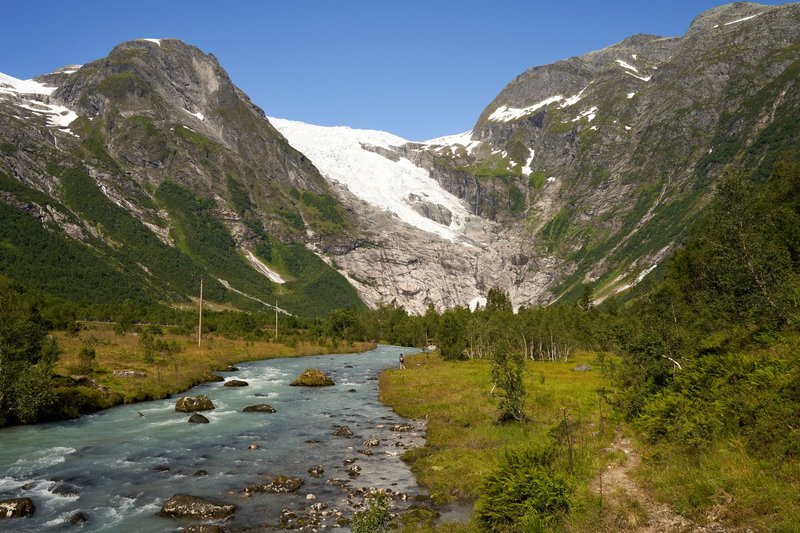
Tajikistan is more than 90% mountains, and more than half of that is the Pamir range — the “Roof of the World,” where several peaks top 6,000 meters and glaciers sit year-round. That combination of altitude and ice is why a country smaller than Wisconsin holds an outsized share of Central Asia’s fresh water: snowmelt and glacial runoff feed roughly 947 rivers, with a combined length near 28,500 kilometers, according to Tajikistan’s Ministry of Foreign Affairs.
None of this water stays put. It runs downhill through steep, narrow valleys, picks up sediment that turns it the color of milky jade or rust depending on the season, and eventually leaves the country to irrigate farmland in Uzbekistan, Turkmenistan, and beyond. Tajikistan produces the water; its neighbors mostly consume it. That imbalance shapes everything from regional politics to where dams get built.
The two river systems that define the country
Almost every river in Tajikistan eventually feeds one of two larger systems, both of which historically drained into the Aral Sea before Soviet-era irrigation diverted most of that flow into cotton fields.
The Amu Darya system dominates the south and east. It starts as the Panj, which forms most of the border with Afghanistan, and picks up the Vakhsh, Kofarnihon, and Bartang along the way before crossing into Uzbekistan and Turkmenistan.
The Syr Darya system clips the country’s north, through the Fergana Valley near Khujand. It’s a smaller presence inside Tajikistan itself but a major regional river once it reaches Uzbekistan and Kazakhstan.
Everything else — the Zarafshon, the Gunt, the dozens of smaller Pamir streams — either joins one of these two systems or, in a handful of cases, drains into closed basins that never reach the sea at all.
Tajikistan’s major rivers, compared
| River | Length | Basin | Feeds Into |
|---|---|---|---|
| Panj | 921 km | Amu Darya | Amu Darya (Afghanistan border) |
| Zarafshon | 877 km | Endorheic (does not reach the sea) | Terminates in Uzbekistan irrigation canals |
| Vakhsh | 786 km | Amu Darya | Panj/Amu Darya |
| Bartang | 528 km | Amu Darya | Panj (via the Pyanj) |
| Kofarnihon | 387 km | Amu Darya | Amu Darya near the Uzbek border |
| Gunt | 296 km | Amu Darya | Panj at Khorog |
The numbers alone tell you something the top search results don’t spell out clearly: Tajikistan’s “big” rivers are big by mountain-country standards, not by world standards. The Amu Darya itself, once the Panj and Vakhsh combine, stretches roughly 2,400 km before it’s done — but inside Tajikistan’s borders, you’re mostly looking at the headwaters and upper courses, not the wide lowland river most maps show.
The Panj and the Amu Darya
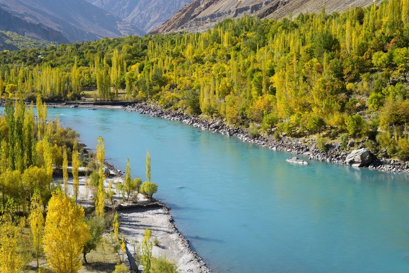
The Panj is the river most travelers actually see, because the Pamir Highway runs alongside it for long stretches between Khorog and Ishkashim. On the far bank is Afghanistan — close enough that you can watch farmers working terraced fields, and in some villages, close enough to wave at people crossing a footbridge to the twice-weekly border market.
The Panj forms at the confluence of two smaller rivers in the high Pamirs and runs roughly 921 km before merging with the Vakhsh to officially become the Amu Darya — known to classical geographers as the Oxus, a name that still shows up on older maps and in regional histories. From there it continues west and north, eventually reaching what’s left of the Aral Sea, though decades of upstream irrigation mean it rarely gets that far anymore.
The Vakhsh: Tajikistan’s hardest-working river
If the Panj is the scenic river, the Vakhsh is the industrial one. It runs 786 km through central Tajikistan and carries more installed hydropower than any other river in the country — including Nurek Dam, which held the record as the world’s tallest dam for over three decades, and Rogun Dam, currently under construction and designed to eventually surpass it at roughly 335 meters.
That matters beyond engineering trivia. Tajikistan gets about 95% of its electricity from hydropower, and the Vakhsh alone accounts for the majority of it. Every debate about Rogun — and there have been decades of them, involving Uzbekistan’s downstream water concerns as much as Tajikistan’s energy needs — is really a debate about this one river.
Kofarnihon and Zarafshon: the valleys people actually live in
The Kofarnihon flows past Dushanbe, the capital, which makes it the river most Tajikistanis interact with daily even though it’s shorter than several others on this list at 387 km. It’s the backbone of the country’s most densely populated valley.
The Zarafshon is the outlier on this list: at 877 km it’s the second-longest river associated with Tajikistan, but it never reaches an ocean. It flows west into Uzbekistan and effectively dies in irrigation canals and the desert near Bukhara — an endorheic river, in hydrology terms. Historically, though, it’s arguably the most important river on this list: Samarkand and Panjakent both grew up along its banks, and the name itself translates roughly to “gold-scattering,” a nod to alluvial gold once panned from its waters.
Bartang and Gunt: the Pamir rivers
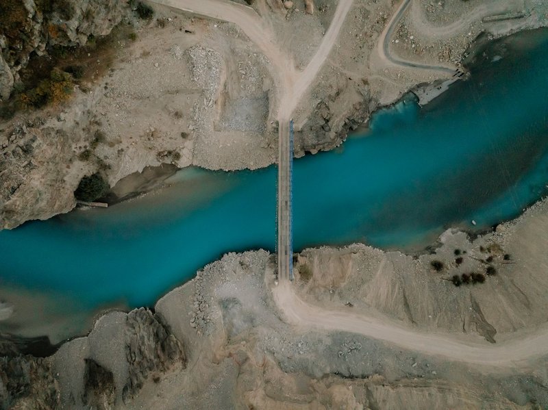
These two get less attention in general reference material, but they’re the rivers that define the Gorno-Badakhshan region — the wild, sparsely populated eastern half of the country.
The Gunt runs 296 km from Lake Yashilkul down to Khorog, where it joins the Panj. It’s the river the Pamir Highway follows for one of its most dramatic stretches, squeezed between canyon walls that rarely widen enough for more than a road and a village.
The Bartang is longer, at 528 km, and considerably wilder — a river valley with almost no paved road, reached mostly by 4×4. Its upper tributary, the Murghab, is also connected to one of the strangest features in the entire region: Lake Sarez, formed in 1911 when an earthquake triggered a landslide that dammed the valley overnight, creating the Usoi Dam — at over 500 meters, still the tallest dam of any kind on Earth, natural or built. The lake behind it holds an estimated 17 cubic kilometers of water, and geologists monitor the dam continuously because a full failure could send a flood downstream through several countries.
Water-rich, water-stressed
Tajikistan produces roughly 60% of Central Asia’s water resources and holds around 53% of the region’s hydropower potential, according to the International Hydropower Association. But it has developed only a small fraction of that potential — most estimates put it under 10% — which is a strange position for a country this dependent on hydropower for its own electricity.
The tension runs the other direction too. Downstream neighbors, particularly Uzbekistan and Turkmenistan, depend on Amu Darya and Syr Darya flow for irrigation-heavy agriculture, especially cotton. Every new dam Tajikistan builds upstream changes how much water arrives downstream and when, which is exactly why Rogun Dam has been a regional diplomatic flashpoint for most of the last two decades. Tajikistan’s own government frames its hydropower buildout as green energy development rather than a water-control issue — but from Tashkent or Ashgabat, those look like the same thing viewed from opposite ends of the same river.
Seeing the rivers for yourself
Most visitors experience these rivers from the Pamir Highway, which tracks the Panj and Gunt for the majority of its route between Dushanbe and Osh. That’s the easiest way to see dramatic river geography without technical trekking: switchbacks above the water, villages perched on narrow terraces, and Afghanistan close enough to photograph on the Panj stretch.
Reaching the Bartang or Sarez Lake requires more effort — a permit, a 4×4, and usually a local guide, since the road ends well before the lake does. It’s worth it if you have the time, but it’s not a casual detour.
For a shorter trip, the Zarafshon Valley between Panjakent and Dushanbe combines river scenery with some of the country’s oldest settled history, and it’s accessible without the altitude or permit requirements of the Pamirs. Whichever route you take, pack for temperature swings — river valleys at 2,000+ meters run cold at night even in summer, regardless of how warm the water looks in the afternoon sun.