
TLDR
Three countries border the Celebes Sea: Indonesia, the Philippines and Malaysia. The Philippines holds the northern shore (Mindanao and the Sulu Archipelago). Indonesia holds the south, east and west (northern Sulawesi, the Sangihe Islands and North Kalimantan). Malaysia has a small slice in the northwest, on the Sabah side of Borneo.
Table of contents
- Quick facts about the Celebes Sea
- The three bordering countries
- Philippines: the northern shore
- Indonesia: south, east and west
- Malaysia: the northwest corner
- Who owns which water: the boundary disputes
- Celebes Sea or Sulawesi Sea?
- Celebes Sea map
- FAQ
Quick facts about the Celebes Sea
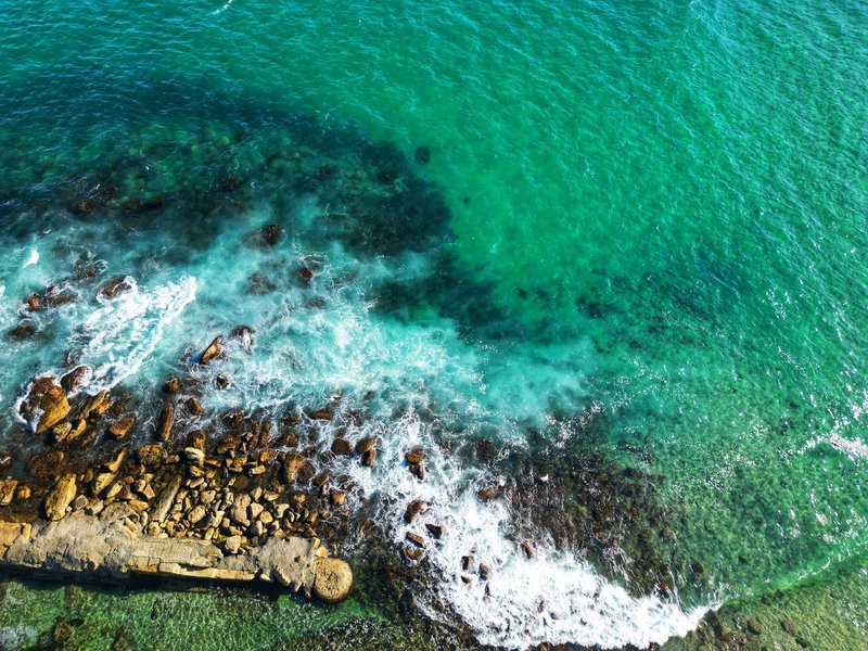
The Celebes Sea is a marginal sea of the western Pacific, tucked between Mindanao and Sulawesi. It’s deep for a sea this size, and it sits inside the Coral Triangle, which is why divers keep ending up on its edges.
| Fact | Detail |
|---|---|
| Area | About 472,000 km² |
| Maximum depth | 6,220 m |
| Size | Roughly 605 km north to south, 780 km east to west |
| Bordering countries | Indonesia, Malaysia, Philippines |
| Connects to | Sulu Sea (northwest), Makassar Strait (southwest), Molucca Sea (southeast), Pacific Ocean (east, via the Sangihe chain) |
The three bordering countries
Here’s the short version by country, with the regions and cities you’d actually look for on a map.
| Country | Side of the sea | Regions on the coast | Cities and ports |
|---|---|---|---|
| Philippines | North | Mindanao, Sulu Archipelago | General Santos, Zamboanga City |
| Indonesia | South, east and west | Minahasa Peninsula (North Sulawesi), Sangihe Islands, North Kalimantan | Manado, Tarakan |
| Malaysia | Northwest | Sabah (eastern Borneo) | Sandakan |
Philippines: the northern shore
The Philippines owns the longest continuous stretch of the northern edge. It runs along the south coast of Mindanao, from the Zamboanga Peninsula in the west to the Davao region in the east, and picks up the Sulu Archipelago strung out toward Borneo.
General Santos sits on Sarangani Bay, which opens straight onto the Celebes Sea. It’s known as the tuna capital of the country because the deep water just offshore holds yellowfin. Zamboanga City, on the western tip of Mindanao, is the other anchor, and the Sulu Archipelago islands beyond it mark the line where the Celebes Sea hands off to the Sulu Sea.
Indonesia: south, east and west
Indonesia touches the sea on three sides, which makes it the largest coastal player.
- South: the long arm of the Minahasa Peninsula, the northern tip of Sulawesi. Manado, the regional capital, faces the sea, and Bunaken marine park sits just off its coast.
- East: the Sangihe Islands, a volcanic chain curving north from Sulawesi toward Mindanao. They’re the stepping stones that separate the Celebes Sea from the open Pacific.
- West: the coast of North Kalimantan on Borneo, with Tarakan as its main port and oil town.
Indonesia calls its portion the Laut Sulawesi.
Malaysia: the northwest corner
Malaysia is the odd one out. Its coastline on the Celebes Sea is short and sits in the northwest, in Sabah, close to where the Sulu Archipelago ends. Sandakan is the best-known town in that part of the state, and the surrounding waters are shared with fishing boats from all three countries.
Don’t expect Malaysia to dominate the map. It doesn’t. But its presence matters for two reasons: it makes this a three-country sea, and it brings the Ambalat dispute (below) into the picture.
Who owns which water: the boundary disputes
A shared sea is rarely a settled one. Three issues come up whenever the Celebes Sea does.
The Indonesia-Philippines treaty. The two countries signed an exclusive economic zone agreement in 2014, covering a 1,162 km boundary line between Mindanao and the Sangihe-Talaud islands. It was adopted in 2019 after years of negotiation, and BenarNews reported that the deal ended a dispute that had stretched over two decades. The practical effect: fishermen and navies now know whose waters are whose.
Ambalat. Indonesia and Malaysia have not resolved the status of Ambalat, a seabed block off the coast of East and North Kalimantan with oil and gas potential. Both claim it, and naval standoffs have flared more than once. A Melbourne Asia Review analysis of the region’s maritime disputes goes through the legal arguments in detail if you want the academic version.
North Borneo. The Philippines has a historical claim to parts of Sabah, which feeds into how Manila and Kuala Lumpur treat the waters near the Sulu Archipelago. It’s a political dispute more than an operational one, but it explains why the borders in the northwest never feel quite final.
The security picture overlaps. Abu Sayyaf, a militant group based in the Sulu area, spent years kidnapping people at sea, and the three countries responded with coordinated patrols across the Celebes and Sulu seas. That’s why travel advisories for the southern Philippines and eastern Sabah coast tend to mention maritime risk.
Celebes Sea or Sulawesi Sea?
Same body of water, different names. “Celebes” is the older colonial-era spelling of Sulawesi, and it’s still the name used in most English-language atlases and the one people search. Indonesia uses Laut Sulawesi, and “Sulawesi Sea” is increasingly common in English.
The Philippines adds a third. In 2013 it officially renamed its portion of the sea the Mindanao Sea. That doesn’t change the map. It only means a Filipino source and an Indonesian source can describe the same stretch of water with different names.
One more mix-up worth clearing: the Celebes Sea is not the Sulu Sea. The Sulu Sea is the separate basin to the northwest, and the Sulu Archipelago is the chain of islands that divides the two.
Celebes Sea map
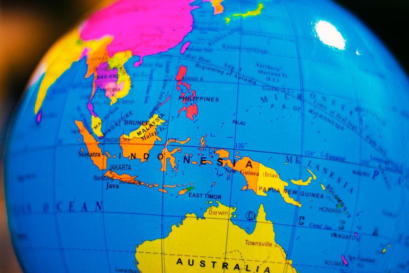
To read the map quickly, find Mindanao (the large southern Philippine island), then look south to the curled “K” shape of Sulawesi. The water between them is the Celebes Sea. Borneo closes it off on the west, and the Sangihe Islands close it off to the east.
FAQ
Which countries border the Celebes Sea?
Indonesia, Malaysia and the Philippines.
Which country has the most coastline on the Celebes Sea?
Indonesia, which borders the sea on its south, east and west sides through Sulawesi, the Sangihe Islands and North Kalimantan.
How deep is the Celebes Sea?
The maximum depth is 6,220 m.
Is the Celebes Sea part of the Pacific Ocean?
Yes. It’s a marginal sea of the western Pacific, connected through the Sangihe island chain and neighboring seas.
What is the largest city on the Celebes Sea?
Among the major cities listed on its shores are Manado, General Santos and Zamboanga City, each a regional hub for its country.
Are there active boundary disputes?
Yes. The Indonesia-Philippines boundary is settled by the 2014 treaty, adopted in 2019, but Indonesia and Malaysia still disagree over Ambalat, and the Philippines maintains a claim to North Borneo.