A gulf is a large inlet of the sea, partly enclosed by land, usually bigger and more deeply cut into the coast than a bay. The naming is inconsistent, though. The Bay of Bengal is larger than every gulf on this page, and the Arabian Sea is a gulf in everything but name. This guide covers the gulfs in Asia that actually carry the word, grouped by sub-region, with the figures that tend to get mangled elsewhere.
Contents
- TLDR
- The Main Gulfs in Asia at a Glance
- West Asia
- South Asia
- Southeast Asia
- East Asia
- Other Asian Gulfs Worth Knowing
- Largest Gulfs in Asia, Ranked
- FAQ
TLDR
- The Gulf of Thailand is the largest gulf wholly inside Asia by area (about 320,000 km²), with the Persian Gulf second (about 251,000 km²).
- The Persian Gulf matters most economically: oil, gas and the Strait of Hormuz.
- The Gulf of Aden sits on the Asia-Africa boundary. Its northern shore (Yemen) is Asian, its southern shore (Somalia, Djibouti) is African.
- Some “gulfs” are really straits or shallow seas. The Gulf of Tartary is the Tatar Strait, and the Bohai Gulf is a nearly enclosed arm of the Yellow Sea.
The Main Gulfs in Asia at a Glance
| Gulf | Sub-region | Bordering countries | Size marker | One fact |
|---|---|---|---|---|
| Persian Gulf | West Asia | Iran, Iraq, Kuwait, Saudi Arabia, Bahrain, Qatar, UAE, Oman | ~251,000 km² | Connects to the ocean only through the Strait of Hormuz |
| Gulf of Oman | West Asia | Iran, Pakistan, Oman, UAE | Over 3,000 m deep | Outside Hormuz, so it hosts the bypass oil ports |
| Gulf of Aqaba | West Asia | Egypt, Israel, Jordan, Saudi Arabia | ~160 km long | Four countries on a coastline you can cross in a few hours |
| Gulf of Aden | West Asia / Africa | Yemen, Somalia, Djibouti | ~900 km long | Gateway to the Red Sea and the Suez Canal |
| Gulf of Mannar | South Asia | India, Sri Lanka | Biosphere reserve ~10,500 km² | India’s richest marine biodiversity zone |
| Gulf of Khambhat | South Asia | India | ~200 km long | Tides above 10 m |
| Gulf of Kutch | South Asia | India | ~170 km long | Site of India’s first marine national park |
| Gulf of Thailand | Southeast Asia | Thailand, Cambodia, Vietnam, Malaysia | ~320,000 km² | Averages under 60 m deep |
| Gulf of Tonkin | Southeast Asia | Vietnam, China | ~126,000 km² | Known in China as Beibu Gulf |
| Gulf of Tomini | Southeast Asia | Indonesia | Several hundred km wide | The equator runs through it |
| Bohai Gulf | East Asia | China | ~77,000 km² | Averages only about 18 m deep |
| Gulf of Tartary | East Asia | Russia | 500+ km long | Narrows to about 7 km at its northern end |
Sizes are approximate. Published figures disagree depending on where each author draws the gulf’s mouth, so treat them as order-of-magnitude comparisons.
West Asia
Persian Gulf
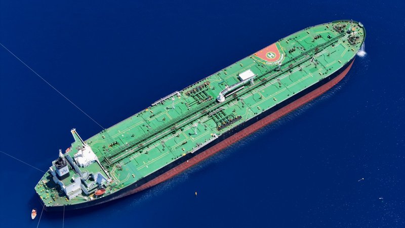
The Persian Gulf is the gulf most people mean when they say “the Gulf.” It is roughly 990 km long, covers about 251,000 km² (some sources say as low as 233,000), and is shallow: the average depth is around 50 m and the deepest point is about 90 m. Eight countries touch it: Iran, Iraq, Kuwait, Saudi Arabia, Bahrain, Qatar, the UAE and Oman, whose Musandam peninsula pokes into the strait at the mouth. Iran and most international maps call it the Persian Gulf. Arab states call it the Arabian Gulf.
Everything leaves through the Strait of Hormuz, which is only about 39 km across at its narrowest. The U.S. Energy Information Administration lists it as the world’s most important oil transit chokepoint, carrying roughly a fifth of global oil consumption. Add the gas: Qatar’s North Field and Iran’s South Pars are the same reservoir, split by a maritime border, and together they make up the largest natural gas field known.
The shallow water gets hot. Summer surface temperatures reach the mid-30s °C, which is why the corals here tolerate heat that bleaches reefs elsewhere. Before oil, the Gulf’s economy was pearls, and Bahrain’s oyster beds were the benchmark.
Gulf of Oman
The Gulf of Oman links the Arabian Sea to the Strait of Hormuz. It is far deeper than the Persian Gulf, dropping past 3,000 m, and it borders Iran and Pakistan on the north and Oman and the UAE on the south.
Its value is geographic. Ports on this side don’t need a ship to pass through Hormuz. Fujairah in the UAE is a major bunkering and oil storage hub, fed by a pipeline from the Abu Dhabi fields that bypasses the strait. Iran’s Chabahar, which India has helped develop, gives the region an ocean port outside the Persian Gulf. Muscat and Sohar sit on the Omani coast. The tanker attacks off Fujairah in 2019 showed why the bypass isn’t a perfect escape.
Gulf of Aqaba
The Gulf of Aqaba is a narrow arm of the northern Red Sea, about 160 km long and at most about 25 km wide, but it drops to roughly 1,850 m. Egypt, Israel, Jordan and Saudi Arabia all have coastline. Taba (Egypt), Eilat (Israel) and Aqaba (Jordan) sit within a few kilometres of each other at the head of the gulf.
Its coral reefs are among the most heat-tolerant studied. Researchers treat the northern Red Sea as a possible refuge for reefs as oceans warm. The Straits of Tiran at its mouth have a political history too: Egypt’s 1967 blockade of the strait was one of the triggers of the Six-Day War.
Gulf of Aden
The Gulf of Aden runs about 900 km between Yemen to the north and Somalia to the south, linking the Arabian Sea to the Red Sea through the Bab-el-Mandeb strait (about 30 km at its narrowest). Whether it counts as Asian depends on which shore you stand on, which is why Asian lists often include it with a footnote.
It is a shipping lane first. Almost everything moving between Asia and Europe through the Suez Canal crosses it. Somali piracy peaked here around 2009 to 2011, and Red Sea attacks on shipping from late 2023 pushed many carriers onto the longer route around southern Africa. Aden, the port on Yemen’s coast, sits in an extinct volcanic crater. Socotra, Yemen’s island of dragon’s blood trees, sits at the gulf’s mouth.
South Asia
Gulf of Mannar
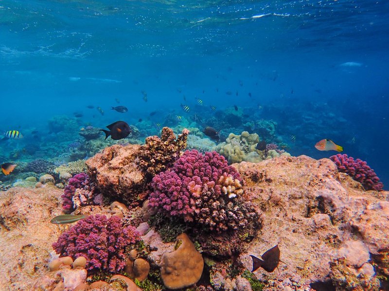
The Gulf of Mannar lies between India’s southeastern tip and western Sri Lanka. At its northern end, a chain of shoals called Adam’s Bridge nearly closes the gap to Sri Lanka. UNESCO recognizes it as a biosphere reserve of about 10,500 km², and 21 islands in the area make up India’s first marine national park.
Coral reefs, seagrass beds and mangroves here support one of India’s last dugong populations. Pearl fishing in the gulf goes back more than two thousand years, and the oyster beds off Tuticorin were a trade centre for pearls well before colonial rule.
Gulf of Khambhat
Also called the Gulf of Cambay, this funnel-shaped inlet on Gujarat’s coast is fed by the Narmada, Tapti, Mahi and Sabarmati rivers. The funnel shape concentrates the tide, and the range exceeds 10 m at places, among the largest in India. Currents are fast and the water is muddy.
Two things put it on the map. Alang, on the western shore, is one of the largest ship-breaking yards in the world, where retired tankers and cargo ships are beached and dismantled. And Lothal, on a tributary near the gulf’s head, is the site of a Harappan port town more than 4,000 years old.
Gulf of Kutch
The Gulf of Kutch is the smaller, western neighbour of Khambhat, about 170 km long, cutting inland north of the Kathiawar peninsula. Its southern shore holds India’s first marine national park, declared in 1982 near Jamnagar, with coral reefs, mudflats and mangroves exposed at low tide. The northern shore carries heavy industry: the ports of Kandla and Mundra handle a large share of India’s cargo, and the Jamnagar refinery complex nearby is among the largest in the world.
Southeast Asia
Gulf of Thailand
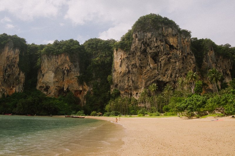
The Gulf of Thailand (formerly the Gulf of Siam) covers about 320,000 km² and is bordered by Thailand, Cambodia, Vietnam and Malaysia. It is shallow, with a maximum depth near 80 m and an average under 60 m. Sources disagree sharply on the length of Thailand’s coastline on the gulf, so we haven’t given a figure here.
Bangkok sits at the head of the gulf, where the Chao Phraya River drains into it, and the city is slowly sinking toward it. Laem Chabang, the country’s main deep-water port, is on the east side. The gulf also holds the offshore gas fields that feed much of Thailand’s power grid, and its fisheries supply a large part of the region’s catch. For visitors, it means Koh Samui, Koh Phangan and Koh Tao on the western side, and Vietnam’s Phu Quoc island on the eastern edge.
Gulf of Tonkin
The Gulf of Tonkin lies between northern Vietnam and southern China, with Hainan Island closing its eastern edge. It covers about 126,000 km². China calls it the Beibu Gulf. Ha Long Bay, a UNESCO World Heritage site, is an inlet on its Vietnamese coast, and Haiphong is the main port.
Most people know it for the 1964 Gulf of Tonkin incident, which led to the Tonkin Gulf Resolution and the escalation of U.S. involvement in the Vietnam War. The gulf’s own history is less dramatic: Vietnam and China only settled their boundary in it in a 2000 agreement.
Gulf of Tomini
The Gulf of Tomini is the large indentation on Sulawesi’s northern side, between the Minahasa peninsula in the north and the island’s eastern arm. The equator crosses it, so you can sail across the line without leaving Indonesian water.
The Togean Islands sit in its centre, and they are the draw: reefs, a national park and Bajau sea communities who live in stilt houses over the water. The Una-Una volcano, which erupted in 1983, is part of the same island group.
East Asia
Bohai Gulf
The Bohai Gulf (often called the Bohai Sea or Bohai Bay) is a nearly enclosed arm of the Yellow Sea, hemmed in by the Liaodong and Shandong peninsulas and linked to open water by the narrow Bohai Strait. It is about 77,000 km² and very shallow, averaging around 18 m. It has three sub-bays: Liaodong Bay, Bohai Bay and Laizhou Bay.
The Yellow River empties into it carrying heavy silt, which keeps the water murky and the delta growing. Tianjin and Dalian are among China’s busiest ports, Qinhuangdao is a major coal-export port, and offshore oil fields operate across the gulf. The 2011 Penglai 19-3 oil spill, one of China’s worst offshore spills, happened here, and the enclosed geography means pollution flushes out slowly.
Gulf of Tartary
The Gulf of Tartary is the older European name for what is now called the Tatar Strait, the water between Sakhalin Island and the Russian mainland. It stretches more than 500 km and narrows to about 7 km at the Nevelskoy Strait at its northern end.
That narrowness caused a famous mistake. French explorer La Pérouse sailed up the channel in 1787, found shallow water at the top, and concluded Sakhalin was a peninsula. Russian naval officer Gennady Nevelskoy proved otherwise in 1849. The strait still freezes over in winter.
Other Asian Gulfs Worth Knowing
Several smaller gulfs rarely make the lists but show up in exam questions and maps:
- Gulf of Martaban (Mottama), Myanmar: a muddy, strongly tidal inlet fed by the Salween, Sittang and Irrawaddy systems.
- Leyte Gulf, Philippines: site of the 1944 Battle of Leyte Gulf, widely considered the largest naval battle of World War II.
- Lingayen Gulf, Philippines: the 1945 U.S. landing site on Luzon and a major surf and beach area today.
- Gulf of Iskenderun, Turkey: the northeastern corner of the Mediterranean, and an oil export gateway via the nearby Ceyhan terminal.
- Gulf of Suez, Egypt: lies between Africa and the Sinai Peninsula, which is geographically in Asia, so it straddles the boundary like Aden.
- Siberian gulfs (Ob, Anadyr, Shelikhov): huge but ice-bound for much of the year, and rarely visited.
Largest Gulfs in Asia, Ranked
By surface area, among the gulfs whose boundaries are least disputed:
- Gulf of Thailand: about 320,000 km²
- Persian Gulf: about 251,000 km²
- Gulf of Tonkin: about 126,000 km²
- Bohai Gulf: about 77,000 km²
- Gulf of Mannar (biosphere reserve area): about 10,500 km²
The Gulf of Aden and the Gulf of Oman are left out of this ranking because published areas vary widely with where the mouth is drawn. The Gulf of Aden in particular can exceed the Gulf of Thailand under some definitions, and it is only half in Asia anyway.
If you only want the answer to “largest gulf in Asia,” most sources point to the Gulf of Thailand by area. If you mean the most consequential, it’s the Persian Gulf.
FAQ
How many gulfs are there in Asia? There is no fixed count. The Wikipedia list shows roughly 21 Asian entries. This guide covers twelve main ones plus a handful of smaller ones.
What is the largest gulf in Asia? The Gulf of Thailand, at about 320,000 km², followed by the Persian Gulf at about 251,000 km².
Is the Persian Gulf in Asia? Yes. It sits entirely in West Asia, bordered by Iran to the north and the Arabian Peninsula to the south.
Is the Gulf of Aden in Asia or Africa? Both. Yemen on the northern shore is in Asia. Somalia and Djibouti on the southern shore are in Africa.
Is the Bay of Bengal a gulf? No, by name. It is larger than any gulf on this list, but the name is historical rather than a technical distinction.
Which gulf has the most strategic importance? The Persian Gulf, because of Hormuz oil flows and Gulf gas exports. The Gulf of Aden is a close second for container shipping.