
TLDR
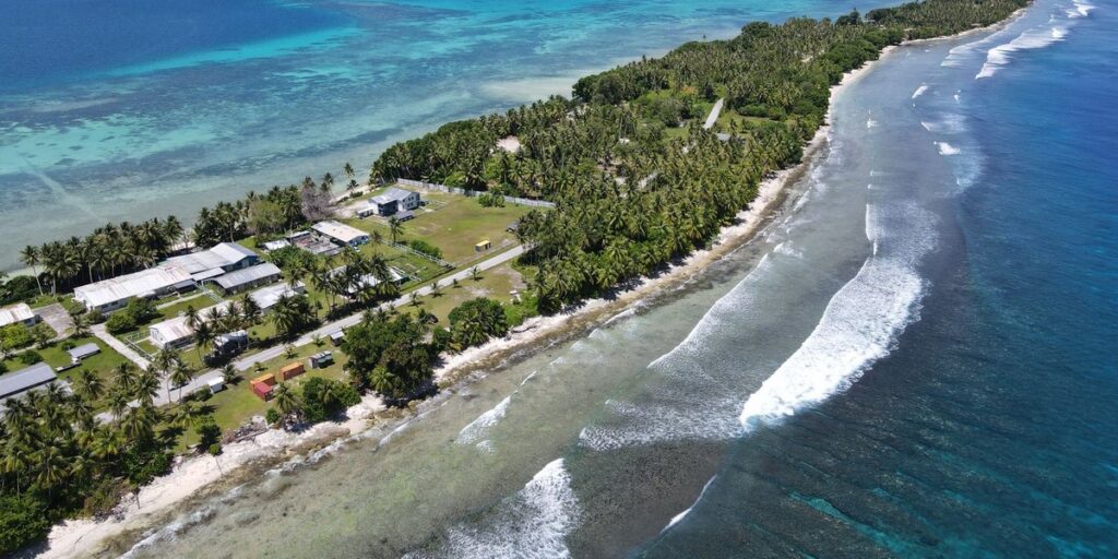
- Kiribati has no rivers, no streams and no permanent surface freshwater.
- The islands are tiny, flat coral atolls. Rain soaks into the sand instead of running off.
- Water comes from freshwater lenses under the islands, wells and rainwater tanks.
- The only “waterways” on record are about 5 km of canals in the Line Islands.
Contents
- Does Kiribati have any rivers?
- Why there are no rivers in Kiribati
- What replaces rivers
- Lagoons: water, but not for drinking
- Rising seas and the freshwater problem
- Kiribati water facts
- How Kiribati compares with other Pacific nations
- FAQ
Does Kiribati have any rivers?
No. Kiribati has no rivers, no streams and no permanent surface freshwater of any kind. If a quiz, a geography worksheet or a country-by-country river list is asking, the answer is zero.
The nearest thing on paper is a “small network of canals” in the Line Islands, which the CIA World Factbook puts at 5 km of waterways in total. Those are man-made channels, not rivers. For a country scattered across more than 3 million square kilometers of Pacific Ocean, 5 km is a rounding error.
Why there are no rivers in Kiribati
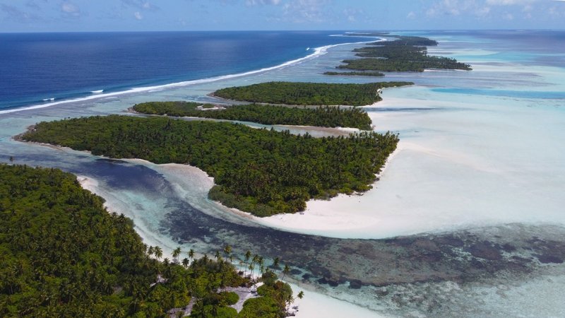
A river needs three things: enough land to collect rain, enough slope to move it, and ground that holds water on the surface. Kiribati’s islands fail all three.
There isn’t enough land. Kiribati’s 33 islands add up to roughly 800 square kilometers of land. Most of them are narrow strips of coral a few hundred meters across. Nothing on them is big enough to gather a catchment.
There’s no slope. Almost all of the land sits less than 2 m above sea level. A river needs a hill to run down, and the highest ground on most atolls is a dune or a road embankment. Banaba, a raised limestone island, reaches about 81 m, and it still has no rivers because it’s too small and too porous.
The ground is a sieve. Atolls are built from coral rubble and sand. Rain doesn’t pool or run off. It drops straight through to the water table, which is only a meter or two below the surface. Tarawa averages around 2,052 mm of rain a year, more than London gets, and not one drop of it forms a stream.
Put those together and you get a country that can be soaking wet and still have nowhere for surface water to gather.
What replaces rivers
Kiribati’s freshwater is underground, and it’s thin.
Freshwater lenses. Rain that soaks into an atoll floats on the denser seawater beneath it, forming a lens-shaped pocket of fresh or slightly brackish water. On a wide island the lens can be a few meters thick. On a narrow one it can be less than one. On South Tarawa, the Bonriki and Buota water reserves are lens-fed systems that supply much of the capital’s piped water.
Wells. Most households outside the main urban centers dig shallow wells down to the lens. The water is often brackish, and it gets worse in dry spells or when too many people pump from too small a lens.
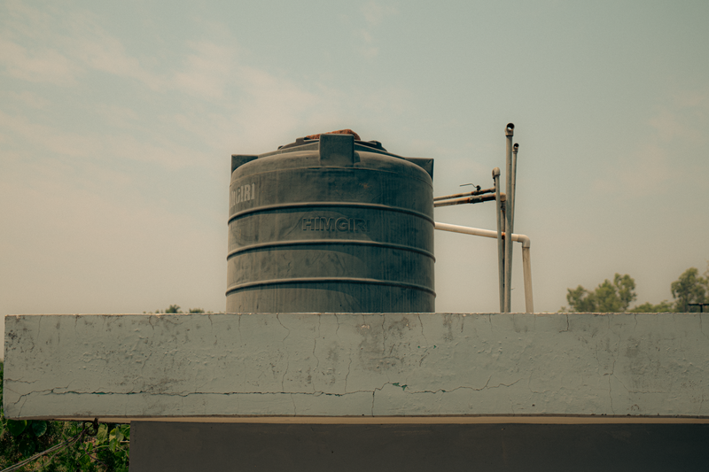
Rainwater tanks. Roof catchment fills tanks and cisterns. In places like South Tarawa, where the population is packed onto a thin strip of land, tank water is the cleanest supply many families have. It also runs out when a drought hits.
Pit gardens. On the driest southern atolls, people grow giant swamp taro (babai) in deep pits dug down to the lens. It’s a way of farming where there are no rivers to irrigate from.
Rainfall also swings by region. The northern Gilbert Islands near the equator are wetter, while atolls like Arorae in the south are prone to drought. Water security in Kiribati depends heavily on which island you’re standing on.
Lagoons: water, but not for drinking
Most of Kiribati’s atolls enclose a lagoon, and people sometimes mistake that for a source of fresh water. It isn’t. Lagoons are connected to the ocean and are salty, sometimes saltier than the sea where evaporation is high.
Kiritimati (Christmas Island) in the Line Islands is the largest coral atoll in the world by land area, and its lagoon is correspondingly large. Parts of it are shallow, hypersaline flats rather than anything you could drink or irrigate with. Tarawa’s lagoon is the center of life on the atoll: fishing, boat transport and, increasingly, a dumping ground for waste from crowded South Tarawa.
A few islands do have small inland ponds with fresher water, such as Teraina in the Line Islands. They’re ponds fed by rain and the lens, not rivers. You won’t find water flowing from one place to another anywhere in the country.
Rising seas and the freshwater problem
The lack of rivers is a geographic fact. The threat to the water that does exist is newer.
Because the lenses sit so close to sea level, they’re vulnerable from both sides. Storm surges and king tides wash seawater over the land and into the ground. Over time, a rising sea level pushes salt into the lens from below and the sides. The World Bank’s Climate Change Knowledge Portal lists Kiribati among the countries most exposed to sea level rise and its effects on land and water resources.
That’s why freshwater, not flooding alone, is central to Kiribati’s climate story. A lens that turns brackish can’t be refilled quickly, and an island with no rivers has no backup.
Kiribati water facts
| Fact | Detail |
|---|---|
| Rivers | None |
| Streams / permanent surface freshwater | None |
| Waterways (Factbook, 2012) | About 5 km, a small canal network in the Line Islands |
| Number of islands | 33, in the Gilbert, Phoenix and Line groups, plus Banaba |
| Typical elevation | Less than 2 m above sea level on most atolls |
| Highest point | About 81 m, on Banaba |
| Tarawa average rainfall | About 2,052 mm per year |
| Main freshwater sources | Freshwater lenses, shallow wells, rainwater tanks |
How Kiribati compares with other Pacific nations
Kiribati isn’t alone. The other low-lying coral nations of the Pacific, including Tuvalu, Nauru and the Marshall Islands, also have no real rivers, for the same reasons: tiny land area, almost no elevation and porous ground.
The high volcanic islands are a different story. Fiji, Samoa, the Solomon Islands and Papua New Guinea all have mountains that catch rain and send it down as rivers. Papua New Guinea has some of the largest in the Pacific. The dividing line isn’t location or rainfall. It’s whether an island is a volcanic peak or a coral ring.
FAQ
Does Kiribati have any rivers? No. Kiribati has no rivers or streams.
Why doesn’t Kiribati have rivers? The islands are small, almost flat and made of porous coral sand. Rain sinks into the ground before it can collect and flow.
Where does Kiribati get its drinking water? From freshwater lenses under the islands, shallow wells and rainwater tanks.
Does Kiribati have any freshwater lakes? There are a few small freshwater ponds on some islands, but no lakes of any real size.
What are the 5 km of waterways listed for Kiribati? A small network of canals in the Line Islands, recorded in 2012. They’re artificial channels, not natural rivers.
Is the water in Kiribati’s lagoons drinkable? No. Lagoons are saltwater and connected to the ocean.

