
TLDR
- The Paraná is the longest river in Argentina (about 4,880 km) and the biggest by discharge. The Paraguay and Uruguay rivers are the next big ones.
- Most of the country’s water leaves through the Río de la Plata, the estuary at Buenos Aires.
- Patagonian rivers (Colorado, Negro, Chubut, Santa Cruz) run west to east across dry steppe and empty into the Atlantic.
- Many rivers in Cuyo, the Andean wine region, never reach the sea. Irrigation and evaporation use them up first.
- A handful of rivers carry the trips: Iguazú for falls, Mendoza and Atuel for rafting, Limay and Chimehuin for trout, the Paraná Delta for boats.
Contents
- Rivers in Argentina at a glance
- The Río de la Plata basin
- Patagonian rivers
- Cuyo and the rivers that never reach the sea
- The Pacific side
- Rivers worth visiting
- Why the numbers disagree
Rivers in Argentina at a glance
Argentina has no single river system like the Amazon. It has three drainage slopes: a huge northeastern one that feeds the Río de la Plata, a string of Patagonian rivers that cross the steppe to the Atlantic, and a western belt of Andean rivers that fade into the desert. A few small ones slip across the Andes to the Pacific.
Lengths below are rounded and cover the whole river, not just the Argentine stretch. Where sources disagree, the section on figures explains the pick.
| River | Length (km) | Length (mi) | Basin | Provinces | Outflow |
|---|---|---|---|---|---|
| Paraná | 4,880 | 3,030 | Río de la Plata | Misiones, Corrientes, Chaco, Santa Fe, Entre Ríos, Buenos Aires | Río de la Plata |
| Paraguay | 2,620 | 1,630 | Río de la Plata | Formosa, Chaco (border with Paraguay) | Paraná |
| Uruguay | 1,840 | 1,140 | Río de la Plata | Misiones, Corrientes, Entre Ríos (border with Uruguay) | Río de la Plata |
| Iguazú | 1,320 | 820 | Río de la Plata | Misiones | Paraná |
| Pilcomayo | 1,100 | 680 | Río de la Plata | Salta, Formosa | Paraguay |
| Bermejo | 1,060 | 660 | Río de la Plata | Salta, Chaco, Formosa | Paraguay |
| Colorado | 1,000 | 620 | Atlantic | Mendoza, Neuquén, Río Negro, La Pampa, Buenos Aires | Atlantic |
| Chubut | 870 | 540 | Atlantic | Río Negro, Chubut | Atlantic |
| Negro | 635 | 395 | Atlantic | Neuquén, Río Negro | Atlantic |
| Santa Cruz | 385 | 240 | Atlantic | Santa Cruz | Atlantic |
| Mendoza | 350 | 220 | Endorheic (Cuyo) | Mendoza | Guanacache lagoons (now mostly dry) |
| Río de la Plata | 290 | 180 | Río de la Plata | Buenos Aires, Entre Ríos | Atlantic |
The Río de la Plata basin
The northeast is where Argentina’s big water is. Five of the six longest rivers on the list belong here, and every one of them ends in the same brown, shallow estuary.
Paraná
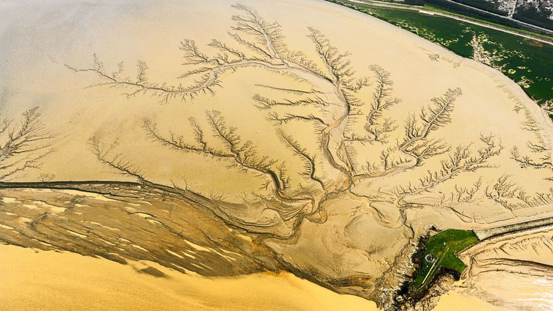
The Paraná is the second-longest river in South America after the Amazon, and its discharge at the mouth runs around 17,000 cubic meters per second. It enters Argentina where Brazil, Paraguay and Argentina meet near Puerto Iguazú, then runs south through Corrientes, Santa Fe and Entre Ríos.
North of Rosario it’s a working river: grain barges, ocean freighters going upriver to the soy ports, and sandbars that shift every season. Below Rosario it spreads into the Paraná Delta, a maze of islands and channels that ends about an hour north of Buenos Aires at Tigre. The delta is the one place where you can go from skyscrapers to stilt houses on a commuter boat.
Paraguay
The Paraguay rises in Brazil’s Pantanal, passes Asunción, and meets the Paraná above Corrientes. For Argentines it’s mostly a border: the river separates Formosa from Paraguay. It carries a lot of silt, which is why the Paraná below the junction turns the color of milky coffee.
Uruguay
The Uruguay River runs along Argentina’s eastern edge and marks the border with Uruguay for most of its course. It’s calmer and clearer than the Paraná. For the rivers on the Uruguayan side of the border, see the full list of rivers in Uruguay. Towns like Concordia, Colón and Gualeguaychú use the riverfront for beaches, thermal baths and carnival parades.
The river’s best detail sits far upstream in Misiones: the Saltos del Moconá, where the river drops about 3 km along its own length instead of across it. Water falls sideways into a canyon. It’s visible only when the river level is right, so check conditions before you go.
Iguazú
The Iguazú starts near Curitiba in Brazil, one of the rivers of Brazil that feed the Paraná system, and spends almost all of its 1,320 km as an unremarkable river. Then it hits a basalt edge near its mouth and splits into roughly 275 drops over about 2.7 km. The biggest is the Garganta del Diablo, the Devil’s Throat, a U-shaped horseshoe where the river falls about 80 meters into its own mist.
Most of the falls sit on the Argentine side. UNESCO protects the national park on both sides of the border, and the Argentine side has the longer trail network, including a walkway out to the Devil’s Throat.
Pilcomayo and Bermejo
These two are the wild ones of the north. Both rise in the Andes and cross the Gran Chaco, a flat, hot plain where the rivers drop their sediment, braid, and wander. The Pilcomayo is famous for shifting its channel and spreading into marshes, such as the Bañado La Estrella, before it reaches the Paraguay River. The Bermejo (Spanish for “reddish”) gets its color from the Andean clay it carries. Neither is a tourist river, but they define the Chaco’s wildlife and the livelihoods of its communities.
Río de la Plata
Technically it’s an estuary, not a river: about 290 km long and up to 220 km wide at the mouth, so wide that the far shore disappears from view at Buenos Aires. It’s the combined outflow of the Paraná and Uruguay, around 22,000 cubic meters per second together. The water is shallow, brown and not for swimming near the capital, but it’s the reason the city exists.
From Buenos Aires, ferries reach Colonia del Sacramento in Uruguay in about an hour.
Patagonian rivers
Patagonia is dry, but its rivers are big, because they start in the Andes and carry snowmelt across hundreds of kilometers of steppe. Almost every one runs west to east, cutting a green strip through gray-brown scrubland. That strip is where the towns, orchards and farms are.
Colorado
The Colorado forms the traditional northern limit of Patagonia. It starts where the Grande and Barrancas rivers meet on the Mendoza-Neuquén border and flows southeast to the Atlantic south of Bahía Blanca. It’s long (about 1,000 km) and muddy, and a big share of its water goes to irrigation in La Pampa and Buenos Aires provinces. It’s a river you cross on Route 22 more than one you visit.
Negro
The Negro is short (635 km) but it’s the largest Patagonian river by flow. It’s born at Neuquén city, where the Limay and the Neuquén rivers meet, and runs east through the Alto Valle, the apple and pear region that supplies a large part of Argentina’s fruit exports. It reaches the Atlantic near Viedma.
The Regata del Río Negro, a canoe and kayak race of about 500 km over several days, runs the river from Neuquén to Viedma every year. Upstream, the Limay leaves Lake Nahuel Huapi near Bariloche and is one of the country’s top trout rivers.
Chubut
The Chubut starts in the Andes and runs across the province of the same name to the Atlantic at Rawson. It’s the reason Welsh settlers could farm here in the 1860s: they dug irrigation canals from the river, and the valley still has Welsh tea houses in Gaiman. If you’ve seen a photo of green fields and poplars in the middle of the steppe, that’s likely the Chubut valley.
Santa Cruz
The Santa Cruz is short, but it has one of the best sources in the country. It drains Lago Argentino, the lake fed by the Perito Moreno Glacier and other ice from Los Glaciares National Park, and carries the glacial flour (pale blue-gray rock dust) 385 km to the Atlantic. The river is milky turquoise for much of its length.
Cuyo and the rivers that never reach the sea
Along the Andes from San Juan down to southern Mendoza, rivers rise in snowfields and run east. Then they disappear. This region is the answer to a question the main reference pages skip: why some rivers never reach the sea.
The reasons are simple. Rainfall on the plain is low, evaporation is high, and the rivers drain into closed basins with no outlet to the ocean (the term is endorheic). On top of that, farmers and wineries take nearly all the water first. The Mendoza, San Juan and Tunuyán rivers feed oasis irrigation systems, and what’s left sinks into salt flats or lagoons. The Guanacache lagoons, once the endpoint of the Mendoza and San Juan rivers, are mostly dry now.
Mendoza
The Mendoza River starts from meltwater around Aconcagua, the highest mountain in the Americas, where the Horcones, Vacas and Cuevas rivers join. It runs about 350 km down to the Mendoza oasis. Its water irrigates the vineyards of Luján de Cuyo and Maipú, which is why a Malbec bottle from Mendoza is partly a snowmelt product. Near the Potrerillos dam, the river has rafting runs for beginners (Class II to III).
Atuel
The Atuel runs through the Cañón del Atuel, a canyon of red and ochre rock of roughly 60 km between San Rafael and El Nihuil, with dams and reservoirs along the way. It’s the better-known rafting and kayak river in southern Mendoza. The river has also been the subject of a long legal dispute between Mendoza and La Pampa, because water used upstream no longer reaches the La Pampa wetlands downstream. It’s a rare case where a river’s end is a court case.
Dulce
Farther north, the Río Dulce crosses Santiago del Estero and ends in Mar Chiquita, a salt lake in Córdoba province. The lake has no outlet and gets saltier as water evaporates, which draws flamingos and other migratory birds.
The Pacific side
Argentina’s Pacific rivers are few and short, because the continental divide almost follows the Andes crest. In Patagonia, though, glaciers carved valleys across the range, and a few rivers cut through to the Chilean side.
Futaleufú and Manso
The Futaleufú rises near Trevelin in Chubut, flows through the Los Alerces region (the UNESCO-listed national park protects the alerce, a long-lived conifer) and crosses into Chile, where the country’s main rivers run west to the Pacific. The most famous whitewater of the Futaleufú is on the Chilean side. The Manso, near Bariloche, flows into Chile as the Puelo. Its lower Argentine stretch, the Manso Inferior, is a popular rafting run, and its water ends up in the Pacific.
Rivers worth visiting
Pick by what you want to do:
- Falls: Iguazú, in Misiones. Allow two days to cover both the upper and lower trails and the Devil’s Throat walkway. Saltos del Moconá is the quieter option farther south.
- Boat trips and islands: the Paraná Delta, from Tigre. Day trips take you to island restaurants and stilt-house neighborhoods.
- Wine country with a river view: the Mendoza River valley around Luján de Cuyo. Pair a vineyard lunch with a rafting trip near Potrerillos.
- Rafting: Atuel canyon near San Rafael for scenery, Mendoza near Potrerillos for first-timers, and Manso Inferior from Bariloche.
- Fly fishing: Limay, Traful and Chimehuin in Neuquén province, near Bariloche and Junín de los Andes. The main season runs from about November to April. In Tierra del Fuego, the Río Grande is known for sea-run brown trout.
- Paddling: the Regata del Río Negro, from Neuquén to Viedma. It’s a spectator event as much as a race.
- Beaches and carnival: the Uruguay River at Concordia, Colón and Gualeguaychú.
- Glacier-fed water: Lago Argentino and the head of the Santa Cruz River, from El Calafate.
- Welsh Patagonia: the Chubut valley, with tea houses in Gaiman.
Why the numbers disagree
River lengths shift by up to 10 percent between sources, and no single figure is the official one. A few reasons.
- Where the river starts. The Colorado is about 1,000 km if you count from the meeting of the Grande and Barrancas rivers. Some sources add the Grande’s length and reach about 1,100 km. WorldAtlas lists the Colorado at 505 miles in its text and 621 miles in its table, which shows how easily the same river gets two numbers.
- Whole river or Argentine stretch. The Paraná is 4,880 km in total, but only part of that flows through Argentina. The Paraguay, Uruguay and Iguazú are border or shared rivers, so the Argentine share is smaller.
- Moving channels. Rivers like the Pilcomayo change course through the Chaco, so any measured length ages quickly.
- Estuary versus river. The Río de la Plata gets counted as a river in some lists and as a gulf or estuary in others.
The figures here are rounded and follow the commonly cited values from the reference lists, such as Wikipedia’s list of rivers of Argentina, the WorldAtlas article, and the Sur del Sur hydrography overview. For anything that matters for planning, check the current river level too: the Paraná and Uruguay can swing by meters between wet and dry seasons, which changes what’s visible and what’s navigable.


