Latvia mixes compact medieval streets, coastal forests and scattered scientific landmarks into a small but varied cultural map. Whether you’re walking cobbled lanes or scanning a countryside trig point, the country’s heritage tells different stories in a short distance.
There are 2 World Heritage Sites in Latvia, ranging from Historic Centre of Riga to Struve Geodetic Arc (Latvian points). Each entry is presented with Inscription year,Location (city/region; coords),Significance (why listed, <=15 words); you'll find below.
What makes these two sites UNESCO-listed?
Riga’s Historic Centre represents urban planning and Hanseatic-era architecture with intact streetscapes and buildings, while the Struve Geodetic Arc is a transnational chain of survey points demonstrating a 19th-century scientific achievement in measuring the earth — together they show cultural and scientific value.
How do I visit both sites on a short itinerary?
Base yourself in Riga to explore the city centre on foot; visiting Struve points requires travel by car or local transport to rural markers (some are monuments or plaques). Check exact coordinates and local access notes in the entries below, and allow a half- to full-day for nearby Struve locations.
World Heritage Sites in Latvia
| Name | Inscription year | Location (city/region; coords) | Significance (why listed, <=15 words) |
|---|---|---|---|
| Historic Centre of Riga | 1997 | Rīga; 56.9496°N, 24.1052°E | Hanseatic medieval centre and exceptional Art Nouveau architecture |
| Struve Geodetic Arc (Latvian points) | 2005 | Multiple locations across Latvia; coordinates vary | 19th-century geodetic arc evidencing continental scientific cooperation |
Images and Descriptions
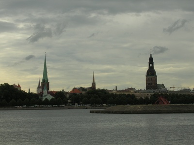
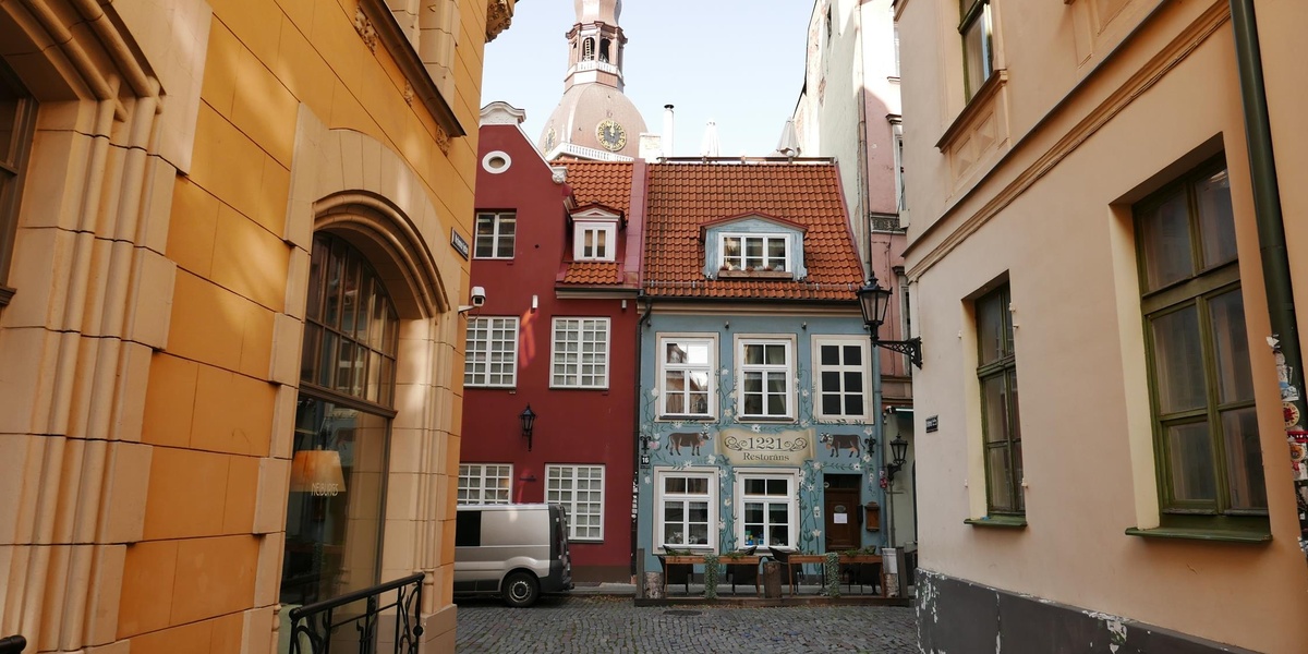
Historic Centre of Riga
Rīga’s medieval core and remarkable Art Nouveau ensemble reflect Hanseatic trade-era wealth and 19th–20th‑century growth. The compact old town, churches, museums, and promenades are easily visited on foot, offering architectural variety and cultural attractions for tourists.

Struve Geodetic Arc (Latvian points)
A chain of 19th-century triangulation points by F.G.W. Struve used to measure a meridian arc, showing scientific collaboration across countries. Latvian markers are preserved in landscapes, often signed with plaques; some are accessible to visitors and educational groups.