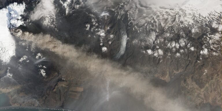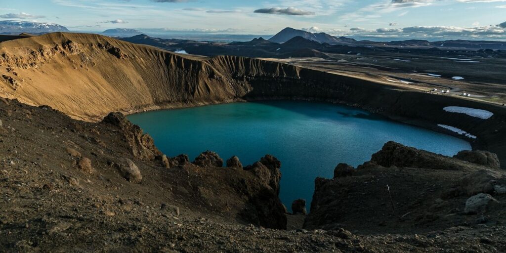
Most lists of lakes in Iceland mix real lakes with waterfalls, snorkeling fissures and tidal lagoons, then skip the questions you actually need answered. Can you swim there? Do you need a 4×4? Is the road even open in June? This guide sorts fifteen lakes by region, tells you what type each one is, and says what to do when you arrive.
TLDR
- Closest to Reykjavík: Elliðavatn (15 minutes) and Kleifarvatn (about 40 minutes).
- Golden Circle day: Þingvallavatn, Kerið and Laugarvatn fit into one loop.
- Most photogenic: Jökulsárlón and Fjallsárlón on the south coast.
- Best all-rounder in the north: Mývatn, for birds, lava and geothermal baths.
- Only lake you can really swim in: Víti, the warm crater at Askja. It needs a 4×4 and a summer visit.
- Largest natural lake: Þingvallavatn. Deepest true lake: Öskjuvatn.
Table of Contents
- Quick Reference: Lakes in Iceland at a Glance
- How Icelandic Lakes Form
- Reykjavík and the Southwest
- The Golden Circle
- The South Coast Glacier Lagoons
- North Iceland
- East Iceland
- The Highlands
- Swimming in Icelandic Lakes
- Fishing in Icelandic Lakes
- Putting Lakes on a Route
Quick Reference: Lakes in Iceland at a Glance
Drive times are approximate and assume summer conditions. “F-road” means a mountain track that legally requires a 4×4.
| Lake | Region | Origin | From Reykjavík | Swim? |
|---|---|---|---|---|
| Elliðavatn | Southwest | Glacial/lava basin | 15 min | No |
| Kleifarvatn | Reykjanes | Tectonic | 40 min | Cold, possible |
| Þingvallavatn | Golden Circle | Tectonic rift | 45 min | Guided snorkel at Silfra only |
| Kerið | Golden Circle | Volcanic crater | 1 h | No |
| Laugarvatn | Golden Circle | Glacial/volcanic | 1 h | Geothermal baths on shore |
| Fjallsárlón | South Coast | Glacial lagoon | 4.5 h | No |
| Jökulsárlón | South Coast | Glacial lagoon | 5 h | No |
| Mývatn | North | Lava-dammed | 6 h | Baths nearby, not the lake |
| Lögurinn | East | Glacial valley | 8.5 h | Cold, possible |
| Öskjuvatn | Highlands | Caldera collapse | 8+ h, F88 | Cold, rarely |
| Víti | Highlands | Explosion crater | 8+ h, F88 | Yes |
| Þórisvatn | Highlands | Reservoir | 3 h, F-road | No |
| Langisjór | Highlands | Glacial | 4 h, F235 | No |
| Hvítárvatn | Highlands | Glacial | 2.5 to 3 h, F35 | No |
How Icelandic Lakes Form
Iceland sits on top of a plate boundary and a hotspot, and has glaciers on top of both. That combination produces lakes of almost every origin, and the origin tells you what to expect when you get there.
Tectonic lakes fill gaps where the crust is pulling apart. The North American and Eurasian plates separate by roughly 2 cm a year, and Þingvallavatn sits in the sunken floor of that rift.
Crater lakes fill holes left by volcanic explosions. Kerið and Víti are the famous two. They are small, steep-sided and often vividly colored.
Lava-dammed lakes form when a lava flow blocks a drainage. Mývatn is the textbook case: shallow, warm in places and unusually productive.
Glacial lakes and lagoons are carved by ice or fed by melting outlet glaciers. Their milky color comes from rock flour suspended in the water. Jökulsárlón, Fjallsárlón, Langisjór and Hvítárvatn belong here.
Reservoirs are the human-made exception. Þórisvatn was a natural lake that was dammed and enlarged for hydropower.
Naming helps too. Vatn means water or lake, lón means lagoon, and -ið or -inn are definite articles stuck on the end.
Reykjavík and the Southwest
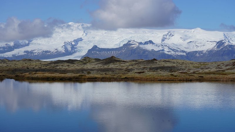
Elliðavatn
A 2 km² lake on the eastern edge of the capital, bordered by the Heiðmörk nature reserve. Nobody flies to Iceland for Elliðavatn, but it’s the one you can reach after work. The shoreline paths are flat, the birdlife is good in spring, and brown trout fishing is popular with locals. Bring a permit if you plan to cast a line (see the fishing section below).
Kleifarvatn
About 40 minutes south of the city on Route 42, Kleifarvatn is a 10 km² lake roughly 97 m deep, with black volcanic sand on the shore. After a 2000 earthquake opened cracks in the lakebed, the water level dropped by around a fifth, and hot springs became visible on the bottom. Local folklore gives it a lake monster, which is the only part of this paragraph you shouldn’t plan around.
The Reykjanes Peninsula has been volcanically active since 2021, and it’s one of Iceland’s active volcanic zones. Check Safetravel Iceland for current alerts before you drive out, and pair the lake with the Seltún geothermal area nearby.
The Golden Circle
The Golden Circle is the easiest lake route in the country, and three lakes sit on it.
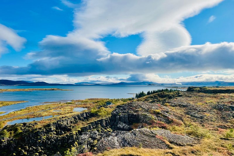
Þingvallavatn
Iceland’s largest natural lake covers roughly 84 km² and reaches about 114 m deep. It sits inside Þingvellir National Park, where the Alþingi, one of the world’s oldest parliaments, first met in 930. The park is on the UNESCO World Heritage list for that history and for the rift valley itself.
The lake is mostly fed by groundwater that has filtered through lava for decades, which is why its water is so clear. The most famous result is Silfra, a fissure at the north shore where certified operators run snorkeling and diving trips. Visibility exceeds 100 m. The water stays between 2 and 4 °C year round, and you wear a dry suit. Silfra is a fissure inside the lake, not a lake of its own, and it’s the only legal “swimming” most visitors do here.
Brown trout and Arctic char both live here. Fishing inside the national park needs a park permit.
Kerið
A crater roughly 55 m deep and 170 m wide, with a lake at the bottom whose water is 7 to 14 m deep. The color is the point: red-orange volcanic rock, green moss on the upper slopes and aquamarine water. It’s about an hour from Reykjavík, set back slightly off the main Golden Circle road, and there’s a small entry fee.
You can walk the rim in 15 minutes and down to the water in another 10. Nobody swims. Go early or late, since tour buses arrive in blocks.
Laugarvatn
Laugarvatn is shallow and unremarkable to look at. The reason to stop is the geothermal baths on its shore at Fontana, where staff dig rye bread out of hot sand and serve it still warm. The lake sits beside the village of the same name. A few minutes away, Apavatn is a quieter fishing lake with trout and char.
The South Coast Glacier Lagoons
The Ring Road runs alongside the southern edge of Vatnajökull. Two lagoons sit directly off it, both fed by the retreating Breiðamerkurjökull and Vatnajökull outlet glaciers.
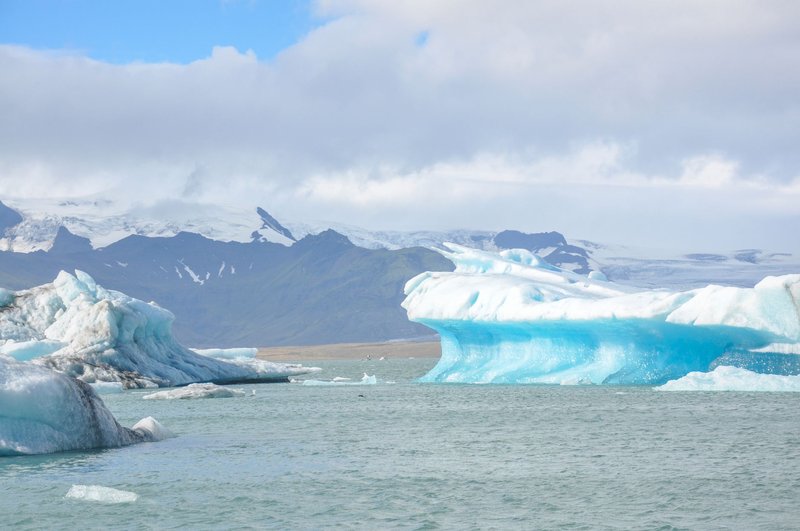
Jökulsárlón
The postcard one. Jökulsárlón has grown steadily since the 1930s as its glacier retreats, and today it covers nearly 20 km². It’s tidal: a short channel connects it to the sea, so seals follow herring in and icebergs drift out to Diamond Beach, where they wash up on black sand.
Depth figures vary by source, with most placing it above 200 m, and some measurements closer to 250 m. This is where the “deepest lake in Iceland” argument comes from. Because the lagoon is open to the ocean, many sources treat it as a different category from the fully enclosed lakes, which is why Öskjuvatn (below) holds the title for deepest lake in the strict sense.
Amphibious boat and Zodiac tours run in warmer months, and the lagoon is open to look at all year. Don’t climb on icebergs. They roll without warning. It’s roughly five hours from Reykjavík, so treat it as an overnight stop, not a day trip.
Fjallsárlón
Ten minutes west of Jökulsárlón, Fjallsárlón has fewer icebergs and far fewer people. The glacier front, Fjallsjökull, sits close enough that you can hear it creak. If Jökulsárlón’s car park is full, drive here and spend your hour on the shoreline instead.
North Iceland
Mývatn
Mývatn means “midge lake,” and the name is accurate. From June through August, clouds of non-biting midges hang over the shore. Bring a head net and keep your mouth closed on windy days.
The midges are also why the lake is rich. They feed Iceland’s densest concentration of breeding ducks, including Barrow’s goldeneye, which breeds nowhere else in Europe. The lake itself is only 2 to 4 m deep over most of its 37 km², and formed about 2,300 years ago when a lava flow dammed the valley.
Around it you get a cluster of sights within 30 minutes of each other: the Skútustaðagígar pseudocraters, which formed when lava rolled over wet ground and the steam burst through; the Hverfjall tephra ring; the Dimmuborgir lava formations; and the Mývatn Nature Baths, a geothermal pool that’s a calmer alternative to the Blue Lagoon. It’s a long drive from Reykjavík, about six hours, so most people fly into Akureyri or add it to a Ring Road loop.
East Iceland
Lögurinn
Lögurinn (also called Lagarfljót, after the river that feeds it) is about 53 km² and up to 112 m deep, making it one of the largest and deepest lakes in the country. It lies beside Egilsstaðir, the main town in the east, and its gray-green color comes from glacial silt. The Hallormsstaður forest along the southeast shore is Iceland’s largest woodland and has campsites and walking trails.
The lake’s resident monster, the Lagarfljótsormur, is a worm said to coil on the bottom. It’s folklore with no evidence behind it. The 650 km drive from Reykjavík takes around eight and a half hours, so most visitors reach it by flight (about an hour) or as part of a Ring Road trip.
The Highlands
The interior lakes are the ones that most lists skip, because getting there takes effort. F-roads are generally open from late June or early July through early September, depending on snow, and rental car insurance usually excludes river crossings. Check Road.is for conditions before every drive, and don’t rely on a map app to tell you which tracks are passable.
Öskjuvatn and Víti
Both lakes sit in the Askja caldera, in the Dyngjufjöll massif north of Vatnajökull. They’re reached via the F88 off the Ring Road, a rough track that takes two to three hours one way, followed by an F-road to the car park and a walk of about 2 km.
Öskjuvatn formed after a 1875 eruption collapsed the caldera floor, and at roughly 220 m deep it’s Iceland’s deepest lake in the strict sense. In 1907, two German scientists, Walther von Knebel and Max Rudloff, disappeared on its surface in a small boat. They were never found.
Víti is a smaller explosion crater beside it, about 300 m across, formed by the same eruption. The water is milky blue and warm, typically 20 to 30 °C. The clay slope down is slippery, so take shoes you don’t mind losing and don’t go in alone. This is the only lake in the guide where swimming is a standard visit activity.
Þórisvatn
Iceland’s largest lake by area if you count reservoirs. A natural lake of about 70 km² was dammed and enlarged for hydropower, and it now covers somewhere around 83 to 88 km² depending on the water level and the source. It’s a stark, treeless expanse of black sand and open sky. There are no facilities, and the main reason to visit is the drive: the lake lies in the same highland network as Veiðivötn and Landmannalaugar.
Langisjór
A narrow lake, roughly 27 km long and 20 km² in area, inside Vatnajökull National Park and flanked by a long green-mossed ridge, Fögrufjöll. It’s reached by the rough F235 and gets a fraction of the visitors that Landmannalaugar does. Walkers can hike along its western shore or climb Sveinstindur for a view over the whole lake. Come with a full tank, spare food and a reliable car.
Hvítárvatn
About 30 km² and fed by the Norðurjökull outlet of Langjökull, so small icebergs float in it year round. It’s reached along the Kjölur route (F35), which runs through the interior from near Gullfoss, and the drive takes about 2.5 to 3 hours from Reykjavík. A short hike from the Hvítárnes hut gets you to the shoreline. The lake is the source of the Hvítá river, the same water that drops over Gullfoss further downstream.
Swimming in Icelandic Lakes
There’s no blanket ban on swimming in Icelandic lakes, but few are inviting. Glacial lakes sit near freezing, and several of the best-looking ones, including Jökulsárlón and the Kerið crater, aren’t suitable or aren’t permitted. The realistic options are:
- Víti: warm and clay-bottomed, in summer only.
- Silfra at Þingvallavatn: guided and dry-suited, with certified operators.
- Geothermal pools beside lakes: Fontana at Laugarvatn and the Mývatn Nature Baths, which deliver the feeling of lake bathing without the temperature.
- Cold water swimming: possible at Lögurinn or Kleifarvatn, but it’s cold enough that you should stay near the shore and tell someone where you are.
Never swim near calving glaciers or in iceberg fields.
Fishing in Icelandic Lakes
Many Icelandic lakes hold brown trout and Arctic char. Access is regulated: most lakes are privately managed, and you need a permit for almost all of them.
The practical routes are:
- The Fishing Card (Veiðikortið): an annual pass covering several dozen lakes. Check its current list and each lake’s own rules, since a few permits are sold separately.
- Single-lake permits: sold at the lake, in nearby shops or online, including Veiðivötn in the highlands, which has a short season and limited permits.
- National park permits: needed for Þingvallavatn within the park.
Trout seasons generally run from April or May until September. Used fishing gear brought from abroad must be disinfected before you use it in Icelandic waters, and you may be asked for a certificate at customs.
Putting Lakes on a Route
One day from Reykjavík: Þingvallavatn, Kerið, Laugarvatn. Add Kleifarvatn on a second morning if you want a quieter stop.
Ring Road, south and east: Fjallsárlón and Jökulsárlón on day one; Lögurinn once you reach the east; Mývatn on the northern leg.
Highlands, 4×4 only: Hvítárvatn via Kjölur, then Þórisvatn and Langisjór from the Landmannalaugar side. Askja and Víti are best added from the north via Mývatn.
Summer is the sensible default. Most highland lakes are closed or hard to reach outside July to early September, midges peak at Mývatn in June and July, and Kerið and the glacier lagoons are the lakes that actually look better in winter.