Bosnia and Herzegovina’s poverty isn’t evenly spread, and it isn’t a mystery to anyone who’s driven the back roads between Sarajevo and the Republika Srpska border. It’s concentrated in specific municipalities: places that lost half their population to war and never got it back, places split down the middle by the inter-entity boundary line, places where the only local employer closed in the 1990s and nothing replaced it.
Roughly 18.6% of the country lives below the absolute poverty line nationally, but that number hides a wide gap — rural poverty runs close to 19%, urban poverty closer to 9%. This piece ranks the nine municipalities where that gap bites hardest, based on population loss, economic isolation, and what’s actually left of the local economy.
TLDR
The country’s deepest poverty sits in small, mountainous, or war-depopulated municipalities rather than its cities — Sarajevo, Banja Luka, and Mostar are not on this list. The poorest are:
- Istočni Drvar (Republika Srpska)
- Kalinovik (Republika Srpska)
- Berkovići (Republika Srpska)
- Rudo (Republika Srpska)
- Ravno (Federation of BiH)
- Bosansko Grahovo (Federation of BiH)
- Teočak (Federation of BiH)
- Sapna (Federation of BiH)
- Bosanski Petrovac (Federation of BiH)
Table of Contents
- Why This Is Hard to Rank Cleanly
- The Federation–Republika Srpska Divide, Briefly
- The 9 Poorest Municipalities in Bosnia and Herzegovina
- The Rural-Urban Poverty Gap
- What About the Richest Cities?
Why This Is Hard to Rank Cleanly
Nobody publishes a clean, municipality-by-municipality poverty index for Bosnia and Herzegovina, and that’s worth saying up front instead of pretending otherwise. The Agency for Statistics of Bosnia and Herzegovina (BHAS) does publish municipal GDP-per-capita figures, but at irregular intervals and with a lag of several years. Unemployment is tracked separately by two entity-level employment bureaus that don’t use identical methodologies, and cantonal offices inside the Federation add another layer. The last full population census was 2013 — over a decade old now, in a country that’s kept losing people to emigration since.
So this ranking leans on the metric that’s most reliably comparable across the whole country: population collapse since the last pre-war census, cross-referenced against BHAS’s municipal GDP-per-capita tables and what’s actually operating on the ground — factories, mines, farmland, tourism. That combination is a better proxy for lived poverty than any single official number, because in these municipalities the story isn’t “low income,” it’s “almost nobody left to earn one.”
The Federation–Republika Srpska Divide, Briefly
Bosnia and Herzegovina runs as two entities under one state: the Federation of Bosnia and Herzegovina (mostly Bosniak and Croat) and Republika Srpska (mostly Serb), plus the small, separately administered Brčko District. Each entity runs its own economy, tax system, and — critically for this list — its own statistics office. A municipality’s poverty often has less to do with which entity it sits in than with what happened to it between 1992 and 1995: whose population was displaced, whether the pre-war industry survived, and whether the town ended up on the losing side of the inter-entity boundary line, cut off from the market town or rail line it used to depend on.
The 9 Poorest Municipalities in Bosnia and Herzegovina
| Municipality | Entity | Population (2013 census, approx.) | What’s Driving the Poverty |
|---|---|---|---|
| Istočni Drvar | Republika Srpska | ~1,300 | Split from Drvar after Dayton; almost no economic base left |
| Kalinovik | Republika Srpska | ~2,900 | Isolated mountain terrain, minimal industry |
| Berkovići | Republika Srpska | ~2,200 | Created post-Dayton from a depopulated pre-war territory |
| Rudo | Republika Srpska | ~4,700 | Border town, lost its rail-linked industry |
| Ravno | Federation of BiH | ~3,100 | Karst terrain, agriculture-only economy |
| Bosansko Grahovo | Federation of BiH | ~2,300 | Near-total wartime exodus, still hasn’t recovered |
| Teočak | Federation of BiH | ~5,700 | Small, rural, boundary-line isolation |
| Sapna | Federation of BiH | ~11,300 | Agricultural, heavy outward labor migration |
| Bosanski Petrovac | Federation of BiH | ~7,200 | War-damaged industry never rebuilt |
1. Istočni Drvar
Before the war, Drvar was a single municipality built around a timber industry substantial enough to support a working railway. The war emptied it of its Serb population when Croatian and Bosnian forces retook the area in 1995, and Dayton then split what was left into two municipalities straddling the entity line: Drvar in the Federation, and Istočni Drvar (“Eastern Drvar”) in Republika Srpska. The Republika Srpska half got the smaller, more remote share of the old territory and almost none of the industrial base. What’s left today is a scatter of hamlets with a population that would fit in a mid-sized apartment building, no meaningful local employer, and a median age skewing well past retirement.
2. Kalinovik
Kalinovik sits in the Sarajevo-Romanija highlands, a couple of hours from the capital by road that feels much longer once the pavement narrows. It was never an industrial town — the pre-war economy ran on forestry, sheep farming, and a small tourism trade tied to the surrounding karst plateau. The war cut most of that off, and the postwar economy never replaced it with anything beyond subsistence agriculture. Winters here are long and the terrain limits what can actually be built or farmed, which keeps the working-age population thin.
3. Berkovići
Berkovići didn’t exist as a distinct municipality before Dayton — it was carved out of territory that belonged to Stolac, one of the more contested towns in eastern Herzegovina during the war. The area it inherited was already thinly populated and agriculturally marginal, mostly dry, terraced hillside unsuited to anything beyond small-scale livestock and orchards. Without a town center that had ever functioned as an economic hub, Berkovići started from close to zero and has stayed there.
4. Rudo
Rudo sits on the Drina River right at the border with Serbia, and its pre-war economy depended heavily on rail freight and a textile plant that gave the town actual factory jobs. Both effectively disappeared with the breakup of Yugoslavia and the war that followed. What’s left is a border-crossing town with a shrinking, aging population and an economy that runs mostly on small trade and remittances sent back from relatives working in Serbia or further west in the EU.
5. Ravno
Ravno is unusual on this list for being almost entirely Croat and largely untouched by direct combat — its poverty is geological and structural rather than war-driven. It sits on the Popovo Polje karst field near the Croatian border and Neum, Bosnia’s only stretch of coastline, and the terrain is classic Herzegovinian karst: thin soil over limestone, prone to both drought and flash flooding. Agriculture is the main livelihood, and it’s a hard one. Proximity to Neum’s tourist trade hasn’t translated into local jobs, since most of that traffic just passes through on the highway.
6. Bosansko Grahovo
Grahovo was overwhelmingly Serb before August 1995, when Croatian and Bosnian government forces took the town during Operation Storm and its population fled almost entirely — most never returned. What exists today is a returnee and resettlement patchwork sitting on a fraction of the pre-war population, in a remote, high-elevation part of Canton 10 with poor road connections and no industry to speak of. It’s one of the clearest examples in the country of a town where the demographic collapse itself is the economy’s main problem.
7. Teočak
Teočak is a small municipality carved from the edge of Tuzla Canton, tucked right against the inter-entity boundary line with Republika Srpska. It’s rural and agricultural, without the coal and chemical industry that historically anchored the wider Tuzla region’s economy. Being boxed in against the boundary line limits its natural trade catchment — the closest larger towns on the other side of the line function as separate economies entirely.
8. Sapna
Sapna is larger than most municipalities on this list, and its poverty looks different as a result: less about a town that emptied out, more about one that’s been steadily bleeding working-age people to emigration for two decades. Northeastern Tuzla Canton has some of the highest rates of labor migration to Germany, Austria, and Switzerland in the country, and Sapna is squarely in that belt. Agriculture, mostly small family farms, is what’s left for the people who stay, and remittances from relatives abroad prop up a meaningful share of household income.
9. Bosanski Petrovac
Petrovac sits in Una-Sana Canton, in a part of the country that saw some of the heaviest fighting and displacement of the entire war. Its pre-war economy included small manufacturing and forestry processing, most of which was destroyed or abandoned and never rebuilt at scale. The town center itself has more life than the smaller municipalities on this list, but the surrounding villages are sparsely populated and the canton as a whole carries some of the Federation’s higher unemployment.
The Rural-Urban Poverty Gap
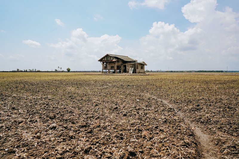
Every municipality on this list shares one trait that matters more than which entity it sits in: none of them is a city. Bosnia and Herzegovina’s poverty is a rural and small-town phenomenon far more than an urban one. According to a Borgen Project analysis drawing on national data, rural poverty sits around 19% against roughly 9% in urban areas — better than a two-to-one gap. Sarajevo, Banja Luka, Tuzla, and Mostar all have real unemployment and real economic strain, but they also have the state institutions, universities, and whatever foreign investment the country attracts. The municipalities on this list mostly have none of that. What they have is agriculture, distance from a market, and in several cases, a population that’s a fraction of what it was in 1991.
That gap also explains why almost nobody has built a clean comparative dataset for this exact question — the World Bank’s overview of Bosnia and Herzegovina tracks the national and entity-level picture well, but granular, municipality-level poverty tracking simply isn’t a data product anyone maintains for a country of roughly 3.3 million people split across 143 municipalities.
What About the Richest Cities?
The other side of this coin is worth a separate look on its own, since it isn’t a simple mirror image. The richest cities in Bosnia and Herzegovina cluster around Sarajevo, Banja Luka, and — increasingly — Široki Brijeg, a Herzegovina town that went from one of the poorer municipalities in the country to a genuine business hub built on private manufacturing and export-driven firms, largely without state help. It’s the clearest counter-example in the country: proof that geography and war history set the starting line, but they don’t have to set the finish. For the CIA World Factbook’s current snapshot of the national economy that both ends of this spectrum sit inside, the full country profile is a useful next stop if you’re digging further into how uneven Bosnia and Herzegovina’s recovery has actually been.