Between 1946 and 1958 the United States conducted 67 nuclear tests in the Marshall Islands, leaving a legacy that still shapes safety and health risks today (IAEA, US DOE, RMI government). That history sits alongside accelerating climate pressures: the country’s low-lying atolls face rising seas, more intense king tides, and stronger storm surges that already flood roads and contaminate freshwater lenses (IPCC, UN). For global readers, these compounding dangers matter because they show how climate change, historical contamination, and limited infrastructure combine to create risks that drive migration, affect fisheries and trade, and test international responsibilities. Because the Republic of the Marshall Islands has few formal cities, this piece uses “places” instead—population centers and atolls with distinct hazards. The list that follows highlights five locations and groups their risks into three categories: environmental (flooding and overcrowding), historical contamination (nuclear legacy), and infrastructure and public-health vulnerabilities. For readers searching for The most dangerous cities in the marshall islands, this guide explains why each place matters and what drives its specific dangers.
Environmental Hazards: Flooding, Storms, and Overcrowding
Many inhabited Marshall Islands are narrow reef islands or slender atolls a few meters above sea level, so even modest sea-level rise and storm surge cause frequent inundation. Low elevation concentrates water and salt, while limited land area forces housing, utilities, and clinics into tightly packed zones that flood together.
Sea-level monitoring and tide records show an upward trend in high-tide inundation, and the IPCC projects continued rises that will increase the frequency of king-tide and storm-driven flooding (IPCC, RMI government). Overcrowding amplifies the human cost: when homes, latrines, and wells sit inches above high water, waste management and potable supply are quickly compromised during events.
Two places illustrate these environmental drivers clearly: Majuro, the administrative and logistical hub where coastal erosion and critical infrastructure exposure have national consequences; and Ebeye, a tiny islet with severe population density and sanitation strain that magnifies routine health risks and complicates evacuations.
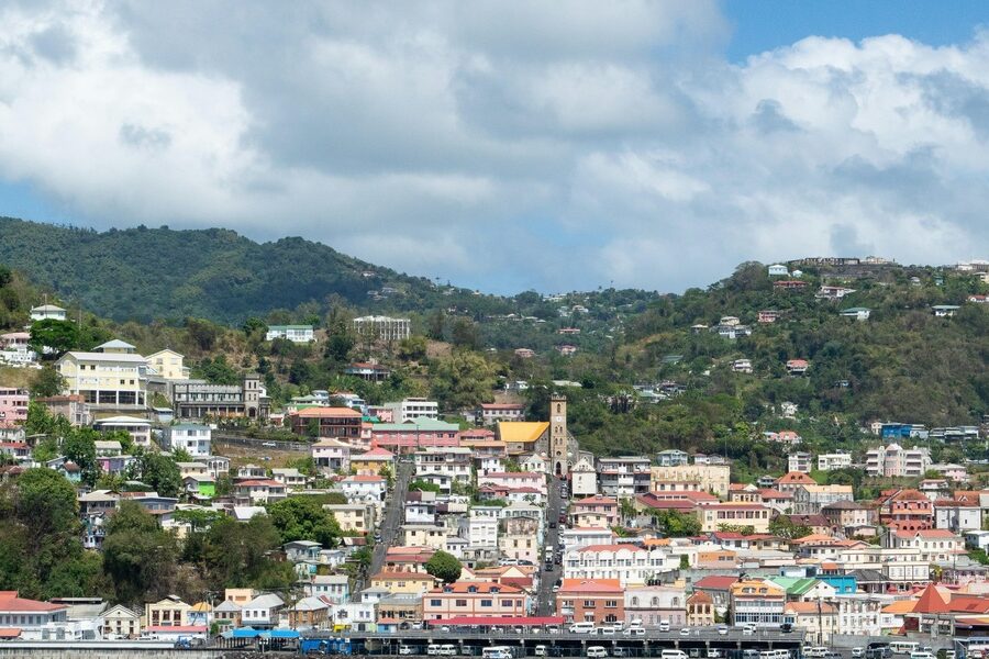
1. Majuro — Flooding, Coastal Erosion, and Critical Infrastructure Exposure
Majuro is the national capital and largest population center, with roughly 27,000–30,000 residents concentrated on the atoll’s lagoon and ocean sides. That concentration means chronic flooding and infrastructure strain have outsized national impacts.
King-tide events now flood streets and low-lying neighborhoods with increasing frequency, and documented saltwater intrusion has degraded shallow freshwater lenses used for drinking water (RMI government monitoring). The international airport and the main hospital sit near sea level, so disruptions there ripple across supply chains and emergency care.
Local responses have included seawall construction, raised roads, and contingency planning, but long-term options—managed retreat or major engineered protection—are costly and politically fraught. Recent flood events have closed major roads and strained clinic operations (UN reports, local government updates).
2. Ebeye — Density, Sanitation, and Public-Health Strain
Ebeye is a densely populated coral islet in Kwajalein Atoll, home to roughly 10,000–15,000 people crammed onto a few hectares. This extreme density creates acute sanitation and housing pressures.
Limited sewerage and waste-disposal capacity, combined with shallow groundwater vulnerable to salt contamination, raise the risk of waterborne diseases and make routine hygiene harder to maintain. Health agencies have reported outbreaks and persistent communicable-disease concerns tied to overcrowding and poor sanitation (WHO, RMI Ministry of Health).
Evacuation and emergency response are complicated by geography: Ebeye depends on scheduled boat and air links for supplies and medevac, so storms or transport disruptions can quickly delay care. Cramped housing increases fire-spread risk and concentrates vulnerability during heatwaves and floods.
Legacy Contamination and Historical Hazards
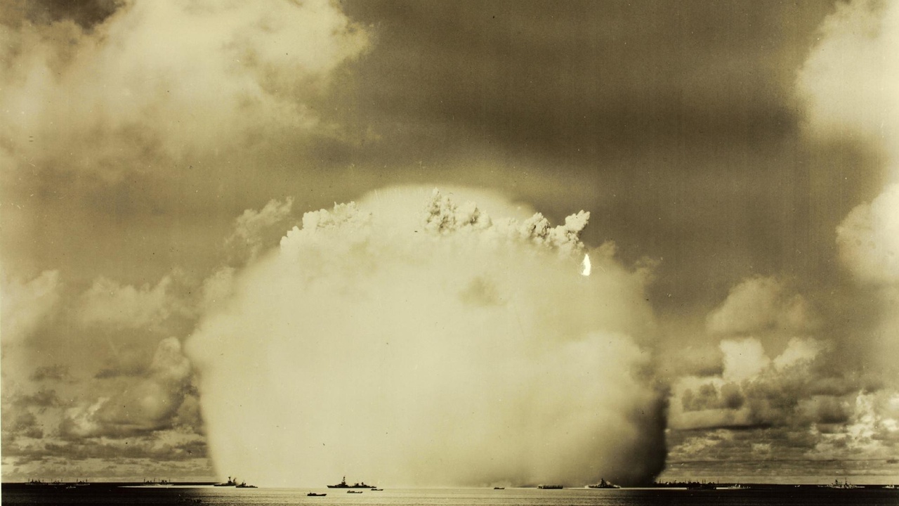
Wartime battles and 20th-century nuclear testing left long-lived hazards: contaminated land and seafood, displaced communities, and complex cleanup histories. Between 1946 and 1958, 67 US nuclear tests were carried out in the Marshall Islands, producing both immediate devastation and legacy contamination that affects resettlement and health monitoring decades later (US DOE, IAEA).
For readers using different search terms, including The most dangerous cities in the marshall islands, these nuclear-test sites often appear at the top of hazard lists because they combine scientific uncertainty, cultural loss, and visible ecological damage. Evacuations and contested resettlement efforts on several atolls show how historical hazards remain a present concern.
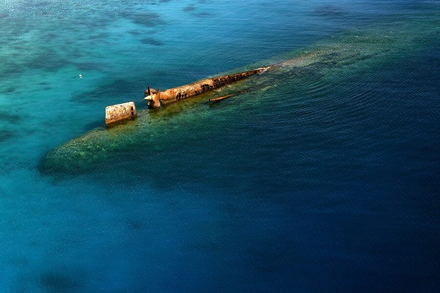
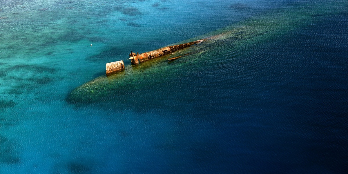
In addition to radioactivity, World War II wrecks and unexploded ordnance on some islands pose physical risks to fishers and visitors, while disturbed reef systems challenge food security. International assessments and local monitoring programs continue to guide safe access and consumption limits (IAEA, peer-reviewed studies, RMI government reports).
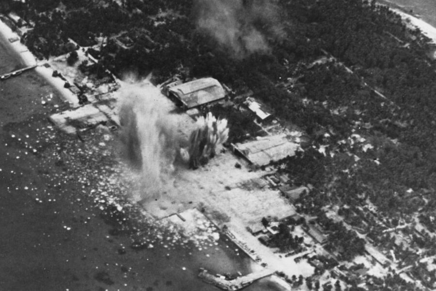
3. Bikini Atoll — Radioactive Legacy and Resettlement Risks
Bikini Atoll is one of the most well-known test sites: it was used for atmospheric nuclear detonations, including the Castle Bravo device in 1954, whose unexpected yield caused widespread fallout and forced large-scale relocations.
Measurements of radionuclides such as cesium-137 have shown lingering contamination in soil and some marine life, which historically made traditional diets unsafe and complicated return plans. Resettlement attempts have been limited and closely monitored; local authorities and international experts maintain consumption advisories and testing programs (IAEA, RMI government).
The island’s symbolic status as a nuclear-test site masks ongoing practical hazards: food-chain contamination, damaged lagoon ecosystems, and the social costs of displacement for Bikini communities that were moved to other atolls and remain dispersed across the country.
4. Enewetak (Eniwetok) — Disposal Sites and Long-Term Health Questions
Enewetak hosted multiple nuclear tests between 1948 and 1958 and later served as a repository for contaminated debris during large-scale cleanup efforts in the late 1970s and early 1980s (US DOE remediation reports).
The 1977–1980 capping and consolidation work reduced some immediate exposure pathways, but monitoring data and community health studies show lingering uncertainties. Some islands were used as disposal sites for contaminated soil and rubble, creating localized hotspots that require ongoing surveillance.
Community displacement and contested resettlement underline the human consequences: even when land is declared “remediated,” traditional food practices, trust in authorities, and long-term epidemiological research remain central to decisions about habitability (IAEA, RMI Ministry of Health).
Infrastructure, Health, and Everyday Safety Risks

Beyond dramatic events, everyday safety depends on infrastructure: reliable transport, clinic capacity, clean water, and housing quality. The Marshall Islands’ geography concentrates people on small land areas and creates single-point dependencies—one airport runway, one ferry schedule, a handful of clinic beds.
Noncommunicable diseases such as diabetes and cardiovascular conditions are prevalent in the RMI and increase vulnerability during acute incidents because they raise the need for consistent medication and acute-care access (WHO, RMI Ministry of Health). When supply chains are interrupted by storms or fuel shortages, routine care can become urgent care problems.
Limited emergency-response capacity—scarce ambulances, constrained medevac options, and small hospital wards—means accidents, outbreaks, or storm injuries are harder to absorb. Logistics, not just exposure, often determines outcomes in medical or disaster scenarios.
5. Kwajalein Atoll (including Ebeye spillover) — Logistics, Accidents, and Limited Emergency Capacity
Kwajalein Atoll illustrates how logistics and limited infrastructure create persistent safety risks. The U.S.-operated military facility on Kwajalein Island sits close to densely populated civilian islets like Ebeye, where many workers and families live.
Dependence on scheduled boats and small aircraft means medevacs and supplies can be delayed by weather or mechanical issues. There are documented cases where transport interruptions postponed urgent medical transfers and constrained access to medicines and specialized care (US Army Garrison records, local reports).
Industrial and military operations concentrate heavy infrastructure nearby, introducing unique hazards while creating a two-tier system of services that complicates local emergency planning. Worker housing patterns and commuter flows mean incidents on one islet can rapidly affect neighboring communities.
Summary
- Environmental, historical, and infrastructure risks intersect in the Marshall Islands: low elevation and sea-level rise cause frequent flooding, while overcrowding amplifies health and safety impacts.
- Nuclear testing (67 tests between 1946 and 1958) left lasting contamination and displacement issues on atolls such as Bikini and Enewetak, influencing resettlement and food-safety decisions (IAEA, US DOE).
- Majuro and Ebeye are population-concentrated risk points: Majuro’s coastal exposure threatens national infrastructure, and Ebeye’s density strains sanitation and emergency response (RMI government, WHO).
- Limited hospital capacity, single transport links, and supply-chain fragility mean routine incidents can become crises—Kwajalein/Ebeye logistics highlight these systemic vulnerabilities.
- Follow current resources (RMI government advisories, WHO, IAEA, IPCC) and support resilience and monitoring programs to address both immediate hazards and long-term legacies.