When the Lord’s Resistance Army insurgency peaked in northern Uganda in the early 2000s, towns such as Gulu and Kitgum became household names for insecurity and displacement.
Those wartime scars still shape perceptions, but today danger in Uganda takes many forms: rising urban crime, road fatalities tied to the ubiquity of boda-bodas, lingering post-conflict insecurity in the north, cross-border pressures, and environmental hazards in the highlands.
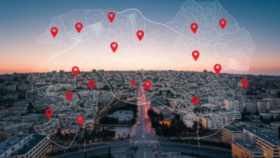
This article identifies the 10 most dangerous cities in Uganda today, explains the main causes of insecurity in each place, and offers practical context and safety advice for residents and visitors.
Readers — whether residents, aid workers, or business travelers — should pay attention to local advisories from the Uganda Police Force, WHO road-traffic data on fatalities, and dated incidents such as the June 2016 Kasese clashes when preparing travel or operations. Below we group the profiles into three categories and then walk through each city with concrete examples and safety tips.
First up: urban crime and traffic hotspots.
Urban crime and traffic hotspots
Uganda’s largest towns concentrate people, commerce, and transport — an efficient recipe for opportunistic crime and frequent road crashes. High population density, informal transport networks dominated by motorcycle taxis, and crowded markets create steady opportunities for pickpockets and snatch-and-run robberies.
National road-traffic statistics and WHO data repeatedly point to a higher-than-average fatality burden from motor-vehicle and motorcycle crashes, and Kampala’s role as the commerce hub concentrates both traffic risk and the kinds of crowded spaces where theft thrives. Below are four urban centres that regularly appear on local safety advisories.
1. Kampala — urban crime, theft, and traffic fatalities
Kampala is Uganda’s largest city (official estimates put the metropolitan population in the range of roughly 1.6–1.8 million) and the center of much of the country’s commercial life, so risk is concentrated.
Police summaries and local media regularly report clusters of robberies, street-level assaults, and pickpocketing in busy commercial zones. Hotspots include Kampala Central Market areas (Nakasero/Kalerwe), nightlife districts such as Kabalagala, and dense informal settlements like Kisenyi.
Road safety is an equal concern: boda-boda collisions and crashes involving vans and minibuses feature prominently in Uganda Police Force and WHO road-traffic notes. Commuters face daily trade-offs between speed and safety on narrow, congested arteries.
Practical tips: avoid walking alone late at night in Kisenyi and parts of the CBD, keep valuables out of sight in markets, use registered taxis or trusted ride-hailing services where available, and give extra time for daytime travel rather than speeding. For up-to-date figures, consult recent Uganda Police Force crime reports and WHO road-traffic summaries for Kampala-specific data.
2. Jinja — traffic corridors and opportunistic crime
Jinja’s location along the busy Kampala–Jinja corridor makes it a transit magnet and, with that, a node for traffic crashes and opportunistic theft near transport hubs.
Accident clusters are commonly reported around the Nile bridge and on stretches of the highway approaching the city, where mixed traffic — buses, trucks, cars and boda-bodas — compete on limited road space. District-level incident summaries note frequent motorcycle-related injuries.
Tourists visiting source-of-the-Nile sites should be mindful of petty theft around crowded viewing points and bus stations. Peak commuter hours create congestion and increase the chance of collisions at junctions cited in local traffic briefs.
Safety advice: plan journeys outside peak rush, use helmeted riders and reputable transport providers, secure bags when at markets or tourist sites, and heed local traffic police directions during heavy traffic or roadworks.
3. Mbale — market crime and road safety on eastern routes
Mbale is a regional commercial hub whose busy central market and long-distance roads make it vulnerable to pickpocketing and traffic incidents.
Market theft is frequently reported in Mbale central market, where the crush of traders and shoppers provides cover for snatch-theft and pickpockets. The Mbale–Tororo and Mbale–Kampala corridors are known for heavy truck traffic and a history of collisions cited in transport safety briefs.
Night-time vulnerability increases where street lighting is poor, and many long-haul drivers report collision risk from punctures, poor signage, and unpredictable pedestrians or animals on the road.
Practical steps: vendors should keep small amounts of cash on hand and use mobile money where possible, travelers should avoid walking in poorly lit streets after dark, and drivers must observe rest intervals and vehicle checks on long eastern routes.
4. Mbarara — transport hub risks and rising urban crime
Mbarara’s growth as a western transport and commercial hub has brought more people and, with that, an uptick in petty crime and highway-targeted incidents.
Highways radiating from Mbarara — including the routes toward Kabale and Kampala — see occasional rest-stop robberies and vehicle break-ins, often reported in regional media and district police briefs. Urban expansion also creates peri-urban settlements where policing is thin.
For traders and business travelers, this means planning secure transport, avoiding isolated stops at night, and being aware of reports of highway ambushes or theft near known rest areas.
Quick precautions: travel daylight hours when possible, keep vehicles locked and valuables concealed, and share travel plans with a local contact if driving between towns.
Post-conflict northern insecurity
The Lord’s Resistance Army insurgency and related conflicts left deep social, economic, and security legacies in northern Uganda. Demobilization gaps, small-arms proliferation, and trauma have created localized vulnerabilities even as large-scale hostilities subsided.
Although major battles are largely in the past, banditry, cattle raiding, and sudden spikes in intercommunal tensions persist in ways that affect travel, commerce, and everyday safety. Below are three northern towns where those legacies still matter.
5. Gulu — lingering post-conflict vulnerabilities
Gulu remains central to the narrative of northern recovery. The city and surrounding districts hosted large IDP populations during the LRA’s peak decades and are still working through economic and social rehabilitation.
Local security summaries and NGO reports describe issues such as nights with limited lighting, occasional small-arms incidents in outlying areas, and economic strain that raises petty-crime rates. Community policing and NGO programs have been central to rebuilding trust.
Residents sometimes mention particular neighborhoods and market zones where they avoid walking alone after dark, and returning IDP camp sites that have been converted to urban use can still have gaps in infrastructure and policing coverage.
Advice: use community contacts or vetted guides when traveling outside the main urban area, register with local police posts if based in the district for extended stays, and tap into local NGO resources for information on safe routes and services.
6. Lira — flashpoints of intercommunal and criminal tension
Lira experiences occasional spikes of violence tied to local land or resource disputes, cattle raiding, and clashes between groups — triggers that can turn a calm market day into a combustible situation.
District incident reports and local press have documented market clashes and targeted attacks on travelers during periods of heightened tension, often linked to seasonal migrations or disputes over grazing land.
For traders and visitors, the key risks are transport ambushes on rural roads and sudden market disturbances. Local authorities sometimes issue advisories during seasonal peaks to reduce exposure.
Practical guidance: avoid rural routes at night, consult local officials or trusted contacts about current flashpoints before travel, and plan for alternative routes during the dry-season migration period.
7. Kitgum — remote hotspots and the shadow of past insurgency
Kitgum’s remoteness and history as an LRA-affected district contribute to a security picture in which slow response times and limited infrastructure raise the stakes of any incident.
Although large-scale LRA operations faded after the early 2000s, memories and small-arms circulation remain part of local security calculus. Occasional banditry or intercommunal raids have been recorded in surrounding rural areas.
Residents note longer travel times to reach emergency services and police posts, which makes daylight travel and local coordination essential for safety. Community early-warning mechanisms are active in some sub-counties.
Safety measures: travel during daylight, share itineraries with local contacts, and use community channels to confirm the security of rural routes before setting out.
Border flashpoints, resource conflicts and environmental hazards
Towns near international frontiers or resource frontiers face a mix of security drivers: cross-border criminality, refugee flows, competition over land and minerals, and environmental hazards such as floods and landslides in hilly areas.
These drivers can make relatively small towns suddenly dangerous: think of sudden curfews after clashes, service disruptions during heavy rains, or tensions sparked by an influx of displaced people. A dated example is the June 2016 clashes in Kasese, which illustrate how governance disputes and local grievances can quickly escalate.
8. Kasese — clashes and resource-driven volatility
Kasese has experienced episodic violence linked to resource competition, land disputes, and tensions between local authorities and traditional institutions. The June 2016 clashes between security forces and local royal guards are a concrete reminder of how quickly unrest can unfold.
Media coverage and government statements from that period show how curfews and security operations can disrupt markets and daily life. Mining areas and disputed land parcels remain recurring sources of friction in the district.
For residents, that means preparedness for sudden restrictions and the possibility of temporary service interruptions. Visitors should avoid demonstrations, stay informed through local radio or police advisories, and register with their accommodation for security updates.
9. Arua — border pressures and refugee-related tensions
Arua sits close to the Democratic Republic of Congo border and has long absorbed cross-border trade, smuggling activity, and waves of refugees during regional crises. That mix places strains on services and raises occasional security tensions.
UNHCR statistics document significant refugee populations in the West Nile region during recent years, and district incident reports point to increases in petty crime around bus stations and crowded markets, especially during sudden influxes.
Travelers should be vigilant at transport hubs, where theft and bag snatching are more common, and aid workers should coordinate closely with UNHCR and local authorities when operating in border zones.
Practical tips: keep travel documents secure, use secure storage at hotels, and monitor UNHCR and district security notices when there are regional disturbances.
10. Fort Portal — environmental hazards and localized risks
Fort Portal’s beautiful highland setting also brings vulnerability to heavy rains, floods, and landslides. Environmental hazards can quickly turn into security problems when roads are cut, services fail, and displaced people congregate.
Western Uganda has seen rainy-season landslides and flash-flooding in recent years; local emergency-response capacity can be stretched during such events, increasing the risk of opportunistic crime and complicating evacuations.
Tourists and residents should plan for route disruptions on key tourist corridors, keep an eye on seasonal weather advisories, and have emergency contacts programmed into phones. During heavy rains, avoid unstable slopes and riverside paths.
Brief preparedness tips: check weather and road conditions before travel, allow extra time for detours, and follow local authorities’ evacuation instructions if issued.
Summary
- Different towns are risky for different reasons — urban theft and traffic in cities like Kampala and Jinja, post-conflict legacies in northern centres such as Gulu and Kitgum, and resource or environmental flashpoints in places like Kasese and Fort Portal.
- Data and dated events help explain patterns: consult Uganda Police Force crime reports and WHO road-traffic data for numbers, remember the June 2016 Kasese clashes as an example of sudden local unrest, and factor in the LRA-era legacy across the north.
- Practical precautions reduce risk — choose daylight travel where possible, secure valuables in busy markets and transport hubs, register with local contacts or hotels, and follow local advisories and UNHCR/Police updates when operating near borders or during humanitarian influxes.
- Situational awareness matters most: check the latest Uganda Police Force or district advisories before moving, keep emergency numbers handy, and coordinate with community or NGO contacts for real-time safety information.