Urban neighborhoods in Benin have grown rapidly over the past decade, and some city districts now concentrate most reported violent incidents and traffic fatalities. A city-by-city view matters because national averages mask where day-to-day risk is actually concentrated: a single busy market, junction, or low-lying neighborhood can drive local statistics far above a provincial mean. This article identifies eight urban centers where residents and visitors should be especially attentive, and it explains the dominant hazards in each place while staying practical and non-alarmist. If you travel, work for an NGO, live as an expat, or simply move between towns for business, this granular approach helps you plan routes, housing, and emergency contingencies. For context, Cotonou’s commonly cited population estimate is around 700,000 (2013 census: 679,012) — please verify city-level population figures with the national statistics office or UN data when citing specific numbers. The piece lists 8 cities and groups them by the dominant hazard so you can quickly see whether crime, transport, or environmental/health risks are the main concern in each location.
Crime and Public-Safety Hotspots
Dense markets, nightlife districts and busy transport nodes concentrate both opportunistic thieves and the occasional violent incident. Violent crime and petty theft follow different patterns: assaults and robberies are rarer but more serious, while pickpocketing and bag-snatching happen frequently in crowded places. Contributing factors include high foot traffic, informal evening economies with late hours, limited street lighting in peri-urban neighborhoods, and stretched local policing resources. Regionally, urban centers tend to report a disproportionate share of incidents because more people and more valuable goods are concentrated there; always check the latest local police notices or government travel advisories for current patterns before you move or visit.
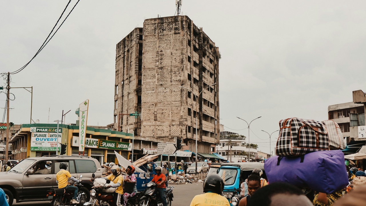
1. Cotonou — Urban crime and petty theft
Cotonou is the country’s largest city and a frequent location for both opportunistic theft and occasional violent incidents. The city’s population is commonly estimated near 700,000 (2013 census: 679,012) — update that figure from the national statistics office or UN sources when citing. As Benin’s economic hub, Cotonou concentrates night markets, bars, beaches and several busy transport nodes that create steady targets for pickpockets and bag-snatchers.
Practical implications: keep valuables in front-facing, zipped bags; avoid withdrawing large sums at ATMs in public view; travel in groups after dark and favor registered taxis over unmarked vehicles. Watch areas such as the Fidjrosse beach strip at night, the Port of Cotonou transport corridors where luggage theft has been reported, and moto-taxi (zemidjan) pickup spots that can become chaotic when multiple riders converge.
2. Abomey-Calavi — Rapid growth, strained services
Abomey-Calavi has expanded quickly since 2010, and in some peri-urban neighborhoods growth has outpaced basic services like lighting and community policing. That creates pockets where opportunistic theft and street crime are easier to carry out, especially after dark.
New residents and families should assess neighborhood safety before signing leases, ask neighbors about routine incidents, and join local community groups. Pay attention to peri-urban settlements along major commuter routes and informal evening markets, and avoid moving large items alone at night where possible.
3. Porto-Novo — Political capital with localized risks
Porto-Novo’s role as the official capital does not eliminate localized safety gaps. Market zones and transport hubs draw heavy pedestrian traffic and occasional pickpocketing, while periodic demonstrations can temporarily raise the risk environment.
Visitors should exercise caution in busy marketplaces (check current local names and patterns), avoid large demonstrations and stay clear of crowded transport terminals at night. Verify any reported spikes in incidents (dates and sources) before relying on a specific year’s data when planning travel.
Roads, Transport Corridors, and Accident Hotspots
Transport-related hazards — poorly maintained roads, mixed traffic, and widespread motorcycle taxis — cause a disproportionate share of injuries and fatalities in Benin. Junction towns on major north–south routes and heavy-truck corridors are particularly prone to crashes. Include at least one national road-safety statistic from a reputable source (for example, a World Health Organization or UN report) when finalizing figures and cite it. This category focuses on towns where transport risk, rather than violent crime, is the principal safety concern.
4. Bohicon — Major junction, frequent crashes
Bohicon sits at a busy intersection where intercity buses, freight trucks and local traffic converge, which concentrates crash risk. Many crashes involve overloaded vehicles, poor signage and drivers pushing long shifts.
Mitigation steps: avoid night travel through Bohicon when possible, choose daytime bus services from reputable companies, and keep an eye out for overtaking on narrow stretches. Typical accident scenarios include overtaking on blind curves, overloaded minibuses, and fatigued drivers on long-haul routes.
5. Parakou — Northern transport hub with heavy freight
Parakou functions as a northern logistics node with substantial freight and long-distance bus traffic, so pedestrian–vehicle conflicts rise, particularly on market days. Freight-heavy streets and mixed vehicle types increase casualty risk.
Practical advice: wear visible clothing when walking near main roads, insist on helmet use for moto-taxis, use seat belts on buses when available, and avoid standing near truck loading areas. Watch for crowded bus terminals and truck turning points during peak market activity.
Environmental, Health and Nightlife Risks

Beyond crime and transport, some towns face seasonal or structural hazards: flooding, limited emergency medical access, and concentrated nightlife where alcohol-related incidents occur. Poor drainage and proximity to rivers or the coast make certain neighborhoods vulnerable to inundation, and limited clinic capacity outside city centers can turn otherwise survivable events into emergencies. If available, include a citable figure on flood frequency or local health-service response times to back up local claims. This category groups places where environmental or public-health factors are the dominant safety driver.
6. Djougou — Limited emergency services outside the city center
In Djougou, peripheral neighborhoods often lack rapid access to emergency medical care, which raises risk after road accidents or assaults. Hospital numbers and ambulance response times are typically lower than in coastal urban centers.
Prepare by carrying a basic first-aid kit, knowing the nearest clinic and hospital routes, and keeping emergency contacts handy. Scenarios to plan for include delayed transfers after motorcycle crashes and limited surgical capacity for severe trauma.
7. Natitingou — Border-adjacent market dynamics and low lighting
Natitingou’s active cross-border trade and late-running markets concentrate people and valuables, while some streets and market approaches have poor lighting. The mix of traders, long hours and limited visibility increases opportunistic theft and makes solo night travel risky.
Safety measures: travel in groups after dark, stick to well-lit main routes, and avoid unregulated minibuses at night. Be especially cautious around main market districts and border trade points where informal trading draws crowds and pockets of cash.
8. Lokossa — Flooding and seasonal risks
Lokossa and similar low-lying towns face seasonal flooding that can block roads, damage property and isolate neighborhoods. Floods also raise waterborne disease risks and can delay emergency response.
Plan ahead for the rainy season: avoid low-lying routes during heavy rain, secure sleeping areas above ground level if possible, and keep emergency numbers and a flashlight ready. Note which neighborhoods have a history of inundation and check local notices about road closures in wet months.
Summary
Across these eight urban centers, three clear patterns emerge: some towns are chiefly crime and public-safety hotspots, others are dangerous because of transport corridors and mixed traffic, and a final group faces environmental or health-service constraints that magnify everyday risks. The practical takeaway is simple: know which hazard dominates the town you’ll be in, and plan around that reality rather than relying on national averages.
Concrete actions you can take immediately include these steps:
- Prefer daytime travel on high-risk corridors and use reputable bus companies when passing junction towns.
- Secure valuables in zipped, front-facing bags in busy markets and beaches; avoid exposing cash at ATMs.
- Use helmets on motorcycle taxis, wear visible clothing near freight routes, and keep a basic first-aid kit and emergency contacts handy.
- Monitor local weather and flood alerts during the rainy season, and choose accommodation above known flood lines where possible.
These measures will help whether you’re watching Beninese urban hotspots for day-to-day safety or planning a longer stay; always double-check current local advisories (police, embassies or official government sources) before traveling and consider supporting community safety initiatives that improve lighting, policing and health access over time.