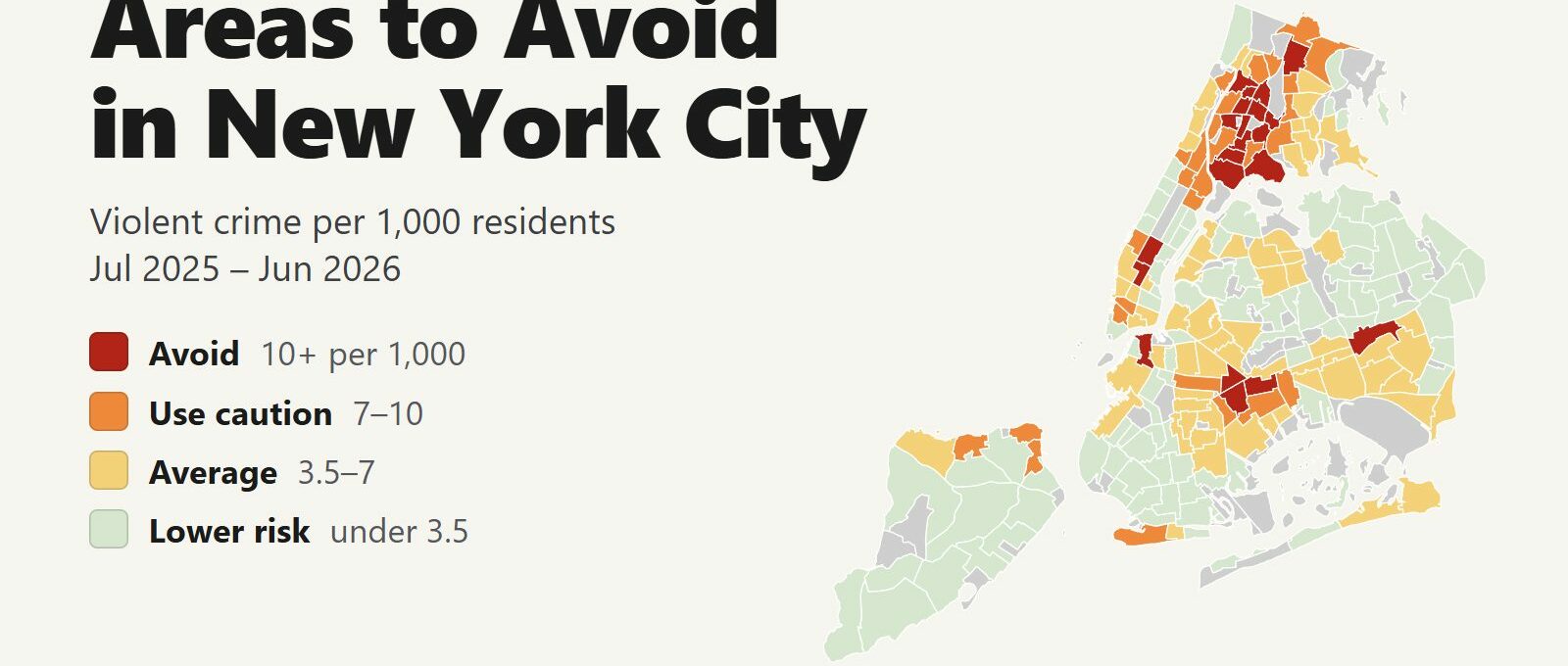
The areas to avoid in New York City are in the South and central Bronx and in eastern Brooklyn, away from the places most visitors go. Between July 2025 and June 2026, 21 of the city’s 197 residential neighborhoods recorded 10 or more violent crimes per 1,000 residents, about double the city average of 5.1. Those neighborhoods are home to 10% of New Yorkers and account for 22% of the city’s homicides and 26% of its shooting victims.
Areas to avoid: Mott Haven, Melrose, Hunts Point, Morrisania, Crotona Park East, Claremont, Mount Eden, Mount Hope, Tremont, West Farms, Fordham Heights, University Heights, Belmont and Williamsbridge in the Bronx. Brownsville, Ocean Hill and East New York in Brooklyn. Jamaica in Queens.
Three more neighborhoods reach the same tier because the crowds that pass through them every day far outnumber the people who live there: Times Square, Midtown South (Penn Station, the Empire State Building and Union Square) and Downtown Brooklyn. The risk there is theft. The Upper West Side, the Upper East Side, brownstone Brooklyn and most of Queens and Staten Island have violent crime rates well below the city average. Citywide, homicides fell 26% and violent crime fell 3% compared with the 12 months before.
New York City safety map
Red areas are the ones to avoid and orange areas call for caution. Grey areas are parks, airports and cemeteries with few or no residents. Use the borough buttons to zoom in, and switch the map to Theft & robbery to see where pickpocketing and phone snatching happen, which is mostly where the crowds are. Tap or hover over a neighborhood for its numbers.
Violent crimes per 1,000 residents
Thefts & robberies per area
Tap or hover a neighborhood to see its numbers.
Table of Contents
- Areas to avoid in New York City
- Areas to be careful in
- Is Manhattan safe?
- Is the Bronx dangerous?
- Is the subway safe?
- Safest neighborhoods to stay in NYC
- NYC safety tips for visitors
- How this map was made
- FAQ
Areas to avoid in New York City
These are the 21 neighborhoods with at least double the city’s violent crime rate. Each one is a large neighborhood with thousands of residents, and its violence is concentrated on particular blocks. There is no visitor reason to walk through most of them, especially at night.
| Neighborhood | Borough | Violent crimes per 1,000 | vs. city avg | Homicides | Shooting victims | Thefts + robberies |
|---|---|---|---|---|---|---|
| Midtown-Times Square | Manhattan | 25.4 | 5.0x | 7 | 4 | 6,123 |
| Hunts Point | Bronx | 25.2 | 4.9x | 0 | 3 | 485 |
| Melrose | Bronx | 17.5 | 3.4x | 3 | 7 | 1,592 |
| Mott Haven-Port Morris | Bronx | 15.0 | 2.9x | 6 | 17 | 1,549 |
| Downtown Brooklyn-DUMBO-Boerum Hill | Brooklyn | 13.9 | 2.7x | 2 | 4 | 2,122 |
| Jamaica | Queens | 13.8 | 2.7x | 2 | 6 | 2,422 |
| Morrisania | Bronx | 13.3 | 2.6x | 4 | 13 | 720 |
| Fordham Heights | Bronx | 12.8 | 2.5x | 2 | 5 | 496 |
| Tremont | Bronx | 12.8 | 2.5x | 1 | 6 | 739 |
| Mount Hope | Bronx | 12.6 | 2.5x | 5 | 6 | 773 |
| Midtown South-Flatiron-Union Square | Manhattan | 12.0 | 2.4x | 0 | 2 | 3,952 |
| Mount Eden-Claremont (West) | Bronx | 11.7 | 2.3x | 2 | 15 | 855 |
| West Farms | Bronx | 11.6 | 2.3x | 1 | 6 | 476 |
| University Heights (North)-Fordham | Bronx | 11.5 | 2.3x | 1 | 7 | 1,108 |
| Brownsville | Brooklyn | 11.3 | 2.2x | 6 | 17 | 1,265 |
| East New York (North) | Brooklyn | 11.3 | 2.2x | 5 | 8 | 762 |
| Crotona Park East | Bronx | 10.9 | 2.1x | 3 | 3 | 783 |
| Belmont | Bronx | 10.8 | 2.1x | 3 | 12 | 970 |
| Claremont Village-Claremont (East) | Bronx | 10.8 | 2.1x | 2 | 9 | 398 |
| Williamsbridge-Olinville | Bronx | 10.5 | 2.1x | 2 | 15 | 1,098 |
| Ocean Hill | Brooklyn | 10.2 | 2.0x | 1 | 9 | 798 |
The South Bronx and central Bronx
Fourteen of the 21 are in the Bronx, in a band that runs from Mott Haven at the borough’s southern tip north to Fordham Road. Melrose, around the shopping district called The Hub at 149th Street and Third Avenue, has the highest rate of any neighborhood where more than 30,000 people live: 17.5 per 1,000 residents, 3.4 times the city average. Mott Haven-Port Morris recorded 17 shooting victims, among the most in the city. Hunts Point’s rate is almost as high as Times Square’s, but it is an industrial peninsula of wholesale food markets with 15,131 residents.
Visitors meet the Bronx in three places:
- Yankee Stadium. The stadium sits next to Concourse, a caution area. Take the 4, B or D train to 161st Street-Yankee Stadium, which lets out at the stadium, or Metro-North to Yankees-East 153rd Street. Leave with the crowd the same way.
- Bronx Zoo and New York Botanical Garden. Both are inside Bronx Park, bordered by West Farms, Belmont and Tremont. Take the 2 or 5 train to West Farms Square-East Tremont Avenue for the zoo’s Asia Gate, or Metro-North’s Harlem Line to Botanical Garden station, which stops across from the garden’s entrance. Go during the day.
- Arthur Avenue. The Bronx’s Little Italy is in Belmont. Go at lunchtime and arrive by car or taxi. The zoo and the Botanical Garden are a short ride away.
Eastern Brooklyn: Brownsville, Ocean Hill and East New York
Brownsville (11.3 per 1,000) and Ocean Hill (10.2) sit side by side east of Crown Heights, and East New York (11.3) continues the cluster toward the Queens line. Brownsville recorded 17 shooting victims and 6 homicides in 12 months. None of the three has anything that draws visitors. The A train from Manhattan to the JFK AirTrain at Howard Beach runs through Ocean Hill and East New York. Stay on the train, and if you change at Broadway Junction, stay inside the station.
Jamaica, Queens
Jamaica (13.8 per 1,000) is where the AirTrain from JFK meets the E, J and Z subway lines and the Long Island Rail Road. Thousands of airport travelers change trains at Sutphin Boulevard-Archer Avenue every day. Make the transfer inside the station complex and don’t explore the surrounding streets at night.
Times Square, Midtown South and Downtown Brooklyn
Midtown-Times Square has the highest per-resident rate in the city, 25.4 per 1,000, and that number overstates the risk. Only 25,575 people live there, while hundreds of thousands of workers and visitors pass through on a typical day, so a per-resident rate divides its crimes by a small share of the people present. Its real problem is theft: 6,123 thefts and robberies in 12 months, more than any other neighborhood in New York. Midtown South, which includes Penn Station, Madison Square Garden, the Empire State Building and Union Square, is second with 3,952.
Downtown Brooklyn (13.9 per 1,000) follows the same pattern. It holds Brooklyn’s offices, courts and the Fulton Mall shopping street, plus DUMBO and the approach to the Brooklyn Bridge, with 40,968 residents. DUMBO’s waterfront and Brooklyn Bridge Park are busy from morning until late evening.
Areas to be careful in
Another 28 neighborhoods have between 7 and 10 violent crimes per 1,000 residents. Most are in the Bronx and in Harlem, with a few in Brooklyn and on Staten Island’s North Shore. Visitors go to several of them.
| Neighborhood | Borough | Violent crimes per 1,000 | vs. city avg | Homicides | Shooting victims | Thefts + robberies |
|---|---|---|---|---|---|---|
| Concourse-Concourse Village | Bronx | 9.9 | 1.9x | 2 | 16 | 1,486 |
| East Harlem (North) | Manhattan | 9.9 | 1.9x | 1 | 12 | 1,506 |
| Norwood | Bronx | 9.8 | 1.9x | 3 | 4 | 746 |
| Bedford Park | Bronx | 9.6 | 1.9x | 2 | 3 | 838 |
| Allerton | Bronx | 9.5 | 1.9x | 3 | 4 | 891 |
| University Heights (South)-Morris Heights | Bronx | 9.5 | 1.9x | 5 | 11 | 731 |
| East New York-New Lots | Brooklyn | 9.3 | 1.8x | 4 | 12 | 996 |
| Longwood | Bronx | 8.9 | 1.7x | 3 | 8 | 837 |
| St. George-New Brighton | Staten Island | 8.8 | 1.7x | 0 | 1 | 407 |
| Wakefield-Woodlawn | Bronx | 8.8 | 1.7x | 3 | 13 | 742 |
| Highbridge | Bronx | 8.7 | 1.7x | 1 | 4 | 449 |
| Pelham Parkway-Van Nest | Bronx | 8.6 | 1.7x | 2 | 2 | 637 |
| Coney Island-Sea Gate | Brooklyn | 8.5 | 1.7x | 2 | 10 | 976 |
| Manhattanville-West Harlem | Manhattan | 8.5 | 1.7x | 1 | 4 | 533 |
| Harlem (North) | Manhattan | 8.3 | 1.6x | 7 | 17 | 1,642 |
| Crown Heights (North) | Brooklyn | 8.1 | 1.6x | 5 | 17 | 1,524 |
| Tribeca-Civic Center | Manhattan | 8.1 | 1.6x | 0 | 0 | 1,332 |
| Harlem (South) | Manhattan | 7.9 | 1.6x | 3 | 9 | 1,813 |
| Hell's Kitchen | Manhattan | 7.9 | 1.6x | 4 | 5 | 1,876 |
| Tompkinsville-Stapleton-Clifton-Fox Hills | Staten Island | 7.9 | 1.6x | 0 | 6 | 266 |
| Soundview-Bruckner-Bronx River | Bronx | 7.7 | 1.5x | 5 | 17 | 1,302 |
| East Flatbush-Remsen Village | Brooklyn | 7.5 | 1.5x | 3 | 6 | 595 |
| SoHo-Little Italy-Hudson Square | Manhattan | 7.5 | 1.5x | 0 | 0 | 2,530 |
| East Harlem (South) | Manhattan | 7.4 | 1.5x | 1 | 8 | 1,226 |
| Eastchester-Edenwald-Baychester | Bronx | 7.2 | 1.4x | 6 | 7 | 969 |
| Inwood | Manhattan | 7.1 | 1.4x | 2 | 8 | 650 |
| East New York-City Line | Brooklyn | 7.0 | 1.4x | 3 | 8 | 629 |
| Port Richmond | Staten Island | 7.0 | 1.4x | 0 | 4 | 450 |
Harlem and East Harlem
Harlem (South) (7.9 per 1,000) and Harlem (North) (8.3) draw visitors to the Apollo Theater on 125th Street, the restaurants on Malcolm X Boulevard and the gospel services on Sunday mornings. Go during the day or for dinner and a show, stay on 125th Street and the main avenues, and take a taxi late at night. East Harlem (South) (7.4) has El Museo del Barrio and the Museum of the City of New York on Fifth Avenue, facing Central Park. Morningside Heights, home to Columbia University on Harlem’s western edge, is below the city average at 3.1.
Hell’s Kitchen, SoHo and Tribeca
These three are on the list for the same reason as Times Square: their daytime crowds are much larger than their resident population. Hell’s Kitchen (7.9) has many of the Theater District hotels and the Port Authority Bus Terminal on Eighth Avenue, the place to be most alert. SoHo (7.5) recorded 2,530 thefts and robberies, mostly from shoppers on Broadway. Tribeca-Civic Center (8.1) takes in City Hall, the courts and the Manhattan end of the Brooklyn Bridge, a government district that empties at night.
Coney Island and the Staten Island Ferry
Coney Island (8.5) is crowded on summer days on the boardwalk, at Luna Park and at the New York Aquarium. Go then, and leave with the crowds by the D, F, N or Q train at Stillwell Avenue. On Staten Island, St. George (8.8) is where the free ferry from Lower Manhattan lands. The terminal, the waterfront and the Empire Outlets are busy. Staten Island as a whole has the lowest violent crime rate of the five boroughs, 2.7 per 1,000.
Is Manhattan safe?
Manhattan is safe for visitors who watch their phones and take a taxi after midnight. Its violent crime rate is 5.2 per 1,000, about the city average, and most of what visitors use is below it: the Upper West Side, the Upper East Side, Museum Mile, Grand Central, the Financial District and the East Village. Times Square and Midtown South look worse only because of their crowds.
The three Midtown neighborhoods (Times Square, Midtown South and East Midtown) recorded 1,181 violent crimes in 12 months, and 17% of them happened between midnight and 3 a.m. Theft follows the crowds instead: 45% of Midtown thefts and robberies happened between noon and 6 p.m., peaking around 5 p.m.
- Keep your phone in a front pocket in Times Square, at subway doors and at sidewalk tables. Snatch-and-run thefts happen in those spots.
- Costumed characters in Times Square expect a tip for photos. Agree on the amount first or skip it. Don’t take a free CD or bracelet someone pushes into your hand.
- At Penn Station, the Port Authority Bus Terminal and the airports, take a taxi from the official line or book a ride in an app. Ignore drivers who approach you inside.
- After midnight, take a taxi or rideshare instead of walking long distances.
Is the Bronx dangerous?
The Bronx has the highest violent crime rate of the five boroughs, 9.2 per 1,000, almost double the city average, and 14 of the 21 areas to avoid. It also has Yankee Stadium, the Bronx Zoo, the New York Botanical Garden, Arthur Avenue and City Island, and Riverdale in its northwest corner is one of the safest neighborhoods in the city at 1.4 per 1,000. Visit those places directly and leave the same way. Check a specific address on the map before booking a stay. Calling a place the Bronx tells you very little.
Is the subway safe?
In 12 months, police recorded 1,019 violent crimes on the subway, 2.2% of the city’s total, in a system that carries millions of riders a day. Another 1,734 thefts were reported on trains and in stations.
- Ride in the conductor’s car, in the middle of the train. A black-and-white striped board above the platform marks where it stops.
- Late at night, wait in the Off-Hours Waiting Area, marked by yellow signs near the station booth. Trains stop beside it.
- Avoid an empty car on a crowded train. It is usually empty for a reason.
- Stand back from the platform edge until the train has stopped.
- Pay by tapping your card or phone on the OMNY reader. Don’t buy a swipe from someone at the turnstiles.
Safest neighborhoods to stay in NYC
These are the neighborhoods visitors stay in, with the same 12-month figures.
| Neighborhood | Borough | Violent crimes per 1,000 | vs. city avg | Homicides | Shooting victims | Thefts + robberies |
|---|---|---|---|---|---|---|
| Upper West Side (Central) | Manhattan | 2.2 | 0.4x | 0 | 2 | 1,999 |
| Upper East Side-Yorkville | Manhattan | 1.3 | 0.3x | 0 | 1 | 1,032 |
| Upper East Side-Lenox Hill-Roosevelt Island | Manhattan | 1.5 | 0.3x | 0 | 0 | 1,033 |
| East Midtown-Turtle Bay | Manhattan | 2.9 | 0.6x | 0 | 0 | 1,006 |
| Financial District-Battery Park City | Manhattan | 3.0 | 0.6x | 0 | 1 | 1,691 |
| East Village | Manhattan | 3.2 | 0.6x | 1 | 3 | 1,543 |
| West Village | Manhattan | 4.0 | 0.8x | 1 | 1 | 1,325 |
| Brooklyn Heights | Brooklyn | 2.0 | 0.4x | 0 | 0 | 430 |
| Park Slope | Brooklyn | 2.1 | 0.4x | 1 | 2 | 633 |
| Williamsburg | Brooklyn | 3.5 | 0.7x | 0 | 2 | 1,454 |
| Astoria (North)-Ditmars-Steinway | Queens | 2.1 | 0.4x | 0 | 1 | 962 |
| Long Island City-Hunters Point | Queens | 5.4 | 1.1x | 0 | 0 | 999 |
- Upper West Side (2.2 per 1,000) and Upper East Side (1.3 in Yorkville) have the lowest rates of any Manhattan neighborhoods visitors stay in. They border Central Park, the American Museum of Natural History and the Met, and Midtown is 10 to 15 minutes away by subway.
- East Midtown and Murray Hill (2.9) are a walk from Grand Central and Times Square and quieter at night.
- Financial District (3.0) is close to the 9/11 Memorial, the Statue of Liberty ferries and the Staten Island Ferry. Hotels are often cheaper on weekends, and the streets are quiet after office hours.
- East Village (3.2) and West Village (4.0) are the restaurant and bar neighborhoods of downtown Manhattan.
- Brooklyn Heights (2.0) and Park Slope (2.1) are brownstone neighborhoods a short subway ride from Lower Manhattan. Williamsburg (3.5) is one stop from Manhattan on the L train.
- Astoria (2.1) and Long Island City (5.4) in Queens have cheaper hotels. Long Island City is one stop from Grand Central on the 7 train.
- Times Square and Midtown South are the most convenient base for a first visit. Most of the crime there is theft, so watch your phone and bag.
NYC safety tips for visitors
- Check a rental’s exact address on the map before you book. A listing described as near Yankee Stadium or a short ride from Manhattan can be in an avoid area.
- Use yellow taxis, green outer-borough taxis or app rides. Never get into an unmarked car that offers you a ride.
- City parks close from 1 a.m. to 6 a.m. Stay out of them after dark unless the paths are busy and lit.
- Call 911 for emergencies and 311 for non-emergency city services.
How this map was made
Crime counts come from the NYPD Complaint Data Historic and Year to Date datasets on NYC Open Data, which list every felony, misdemeanor and violation reported to the New York City Police Department, for July 2025 through June 2026, the most recent 12 months published. Violent crime means the four violent offenses among the NYPD’s seven major felonies: murder and non-negligent manslaughter, rape, robbery and felony assault. Shooting victims come from the NYPD Shooting Incident Data and include fatal and non-fatal shootings. Population is the 2020 Census count, the most recent full count, grouped into neighborhoods with the Department of City Planning’s tract-to-neighborhood table.
The neighborhoods are the Department of City Planning’s 2020 Neighborhood Tabulation Areas: 197 residential areas plus 65 parks, cemeteries, airports and other areas with few or no residents, which are shown in grey and not ranked. The tiers are Avoid (10 or more violent crimes per 1,000 residents), Use caution (7 to 10), Average (3.5 to 7) and Lower risk (under 3.5). The theft layer counts grand larceny, petit larceny and robbery, not rates, because a per-resident rate means little where most of the people present live elsewhere.
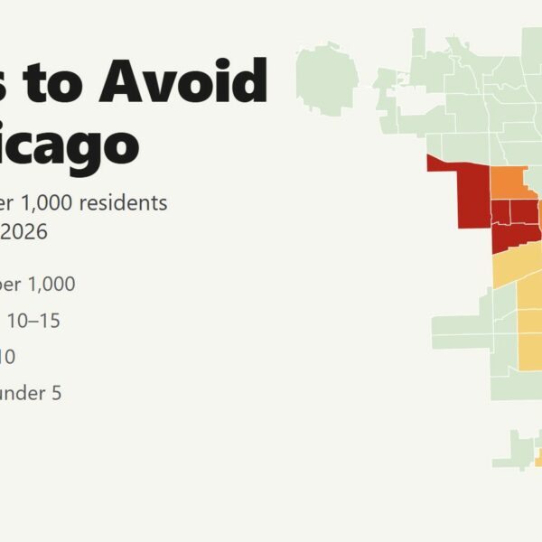
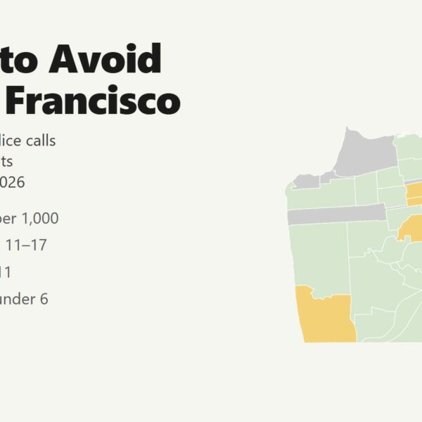
Each neighborhood is large, and conditions change from block to block. Per-resident rates overstate risk where few people live and many visit, which applies to Times Square, Midtown South, Downtown Brooklyn, SoHo and Tribeca. We built the same map for the areas to avoid in Chicago, the areas to avoid in San Francisco, the areas to avoid in Los Angeles and the areas to avoid in Miami.
FAQ
Is New York City safe to visit?
Yes. New York's violent crime rate was 5.1 per 1,000 residents between July 2025 and June 2026, and homicides fell 26% compared with the 12 months before. The neighborhoods with the most violence are in the South and central Bronx and eastern Brooklyn, away from the places visitors go. In Midtown and the other tourist areas, the most common crime is theft.
What areas of New York City should you avoid?
The 21 neighborhoods with at least double the city's violent crime rate are mostly in the Bronx (Mott Haven, Melrose, Hunts Point, Morrisania, Tremont, West Farms, Fordham, Belmont and others), plus Brownsville, Ocean Hill and East New York in Brooklyn and Jamaica in Queens. Times Square, Midtown South and Downtown Brooklyn reach the same tier because the crowds that pass through them far outnumber their residents.
Is the Bronx dangerous?
The Bronx has the highest violent crime rate of the five boroughs, 9.2 per 1,000 residents, and 14 of the city's 21 areas to avoid. Yankee Stadium, the Bronx Zoo, the New York Botanical Garden and Arthur Avenue are fine to visit by day if you go there directly. Riverdale, in the northwest Bronx, has one of the lowest rates in the city.
Is Times Square safe at night?
Times Square stays crowded until after midnight and is safe in the evening. Theft is the main risk, so keep your phone in a front pocket. In the three Midtown neighborhoods, 17% of violent crimes happened between midnight and 3 a.m., so take a taxi or rideshare late at night.
What is the safest neighborhood to stay in New York City?
Among the neighborhoods visitors stay in, the Upper East Side (1.3 violent crimes per 1,000 residents in Yorkville) and the Upper West Side (2.2) have the lowest rates in Manhattan. Brooklyn Heights (2.0) and Park Slope (2.1) are the safest choices in Brooklyn.
Is the NYC subway safe?
The subway accounted for 2.2% of the city's violent crime in 12 months, 1,019 incidents in a system that carries millions of riders a day. Ride in the conductor's car in the middle of the train, wait in the Off-Hours Waiting Area late at night and avoid empty cars on crowded trains.
Is Harlem safe?
Harlem is safe to visit by day and for dinner or a show. Harlem (South) had 7.9 violent crimes per 1,000 residents and Harlem (North) had 8.3, above the city average of 5.1 but below the avoid tier. Stay on 125th Street and the main avenues and take a taxi late at night.