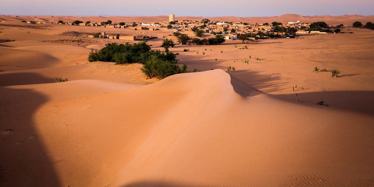
Mauritania’s wide-open deserts and rocky plateaus hide layers of human history: ancient trade routes, fortified settlements, and remnants of past communities shaped by shifting climates. Many sites are subtle on the landscape but reveal connections between West African kingdoms and trans-Saharan commerce.
There are 5 Ruins in Mauritania, ranging from Azougui to Tichitt. For each, the details are organized as Location,Coordinates (lat, long),Era — you’ll find below.
How safe and accessible are these ruins for travelers?
Most sites are remote and often require a 4×4, local guide, and flexible timing; road conditions and services are limited, so plan for fuel, water, and spare parts, and check current travel advisories or local permissions before you go.
What should I know or bring to make the visit useful and respectful?
Bring good maps or GPS with the coordinates, sun and wind protection, plenty of water, and a way to document observations; follow local rules, avoid removing artifacts, and consider hiring a local guide to ensure both safety and culturally respectful visits.
Ruins in Mauritania
| Name | Location | Coordinates (lat, long) | Era |
|---|---|---|---|
| Chinguetti | Adrar Region | 20.62, -11.41 | 11th–17th century |
| Ouadane | Adrar Region | 20.50, -11.87 | 12th–17th century |
| Oualata | Hodh Ech Chargui Region | 16.47, -7.98 | 13th–17th century |
| Tichitt | Tagant Region | 18.10, -9.85 | 2nd millennium BCE–14th century |
| Azougui | Adrar/Trarza border area | 19.88, -12.45 | 11th century |
Images and Descriptions
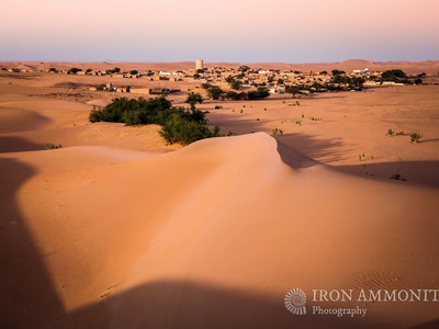
Chinguetti
A medieval Saharan trading town and pilgrimage center famed for manuscript libraries and its distinctive stone mosque. The compact ksar and sand‑encroached streets evoke trans‑Saharan commerce; visitors can see ancient libraries and explore nearby dunes, usually reached by 4×4 from Atar.
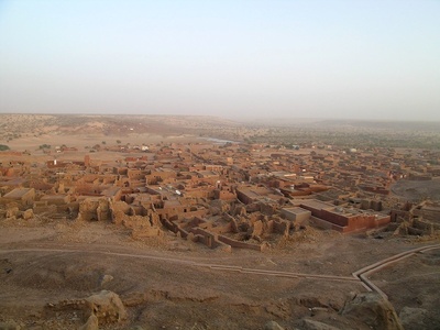
Ouadane
Perched on a rocky plateau, Ouadane is an ancient oasis ksar that once anchored major caravan routes. Ruined houses, mosque remains and narrow alleys offer dramatic desert views; access is remote and best done with a guided desert convoy.
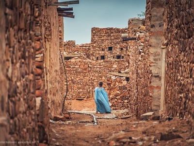
Oualata
Red‑mud walled Oualata preserves painted facades, narrow lanes and ruined clay architecture from medieval caravan trade. It marks eastern trans‑Saharan routes and offers richly decorated houses; visiting requires travel from Nema and respectful, low‑impact access to fragile structures.

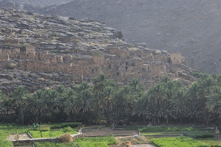
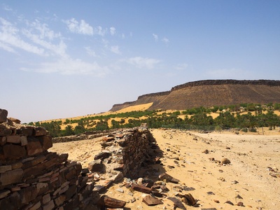
Tichitt
Tichitt comprises stone villages, ruined dwellings and ancient field systems spanning the 2nd millennium BCE to medieval times. Its multilayered ruins illuminate early Sahelian urbanism and pastoral life; sites are remote and often visited with archaeologists or experienced guides.
Azougui
Azougui’s ruined fortress and cemeteries recall an Almoravid‑era political center of the 11th century. Scattered stone walls and tombs mark a strategic hilltop site; it’s remote, historically significant for Islamic expansion in the Sahara and best seen with local guides.