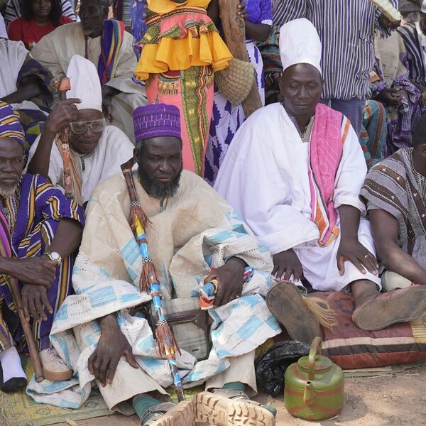
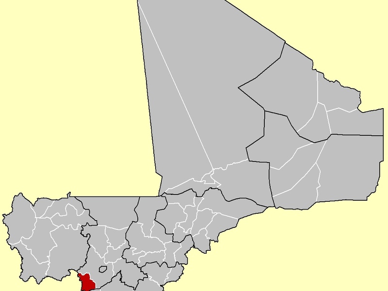
Mali’s landscape holds layers of history: ancient trade routes, mud‑brick cities, and rock art carved by early desert communities. From the bustling manuscripts of Timbuktu to remote Saharan sites, the country’s heritage tells stories of empire, religion, and daily life across centuries.
There are 16 Historical Places in Mali, ranging from Adrar des Ifoghas rock art to Tomb of Askia. For each entry you’ll find below Location (nearest town/region),UNESCO status,Significance (max 15 words) so you can quickly compare where a site is, whether it’s recognized, and why it matters — you’ll find below.
Which sites on the list are UNESCO World Heritage properties?
Several entries are inscribed or on UNESCO’s tentative list (for example, Timbuktu’s manuscript sites and Tomb of Askia); check the UNESCO status column below for current designation and notes on inscription or tentative status.
How should I prepare to visit these historical places?
Plan for remote travel: hire local guides, confirm security advisories, arrange permits where required, respect local customs and conservation rules, and allow extra time for transport between dispersed sites.
Historical Places in Mali
| Name | Location (nearest town/region) | UNESCO status | Significance (max 15 words) |
|---|---|---|---|
| Timbuktu | Timbuktu Region; Timbuktu (16.77°N,3.00°W) | World Heritage Site – 1988 | Medieval Islamic learning center, famous manuscripts, historic mosques. |
| Djenné | Mopti Region; Djenné (13.91°N,4.55°W) | World Heritage Site – 1988 | City of Great Mosque, outstanding Sudano‑Sahelian adobe architecture, historic market town. |
| Tomb of Askia | Gao Region; Gao (16.27°N,0.04°E) | World Heritage Site – 2004 | Songhai emperor’s mud‑brick mausoleum; monumental 15th‑century funerary pyramid. |
| Cliff of Bandiagara (Land of the Dogon) | Mopti Region; Bandiagara Escarpment near Sangha (14.35°N,3.60°W) | World Heritage Site – 1989 | Cliff villages, Tellem caves, Dogon culture and millennia‑old traditions. |
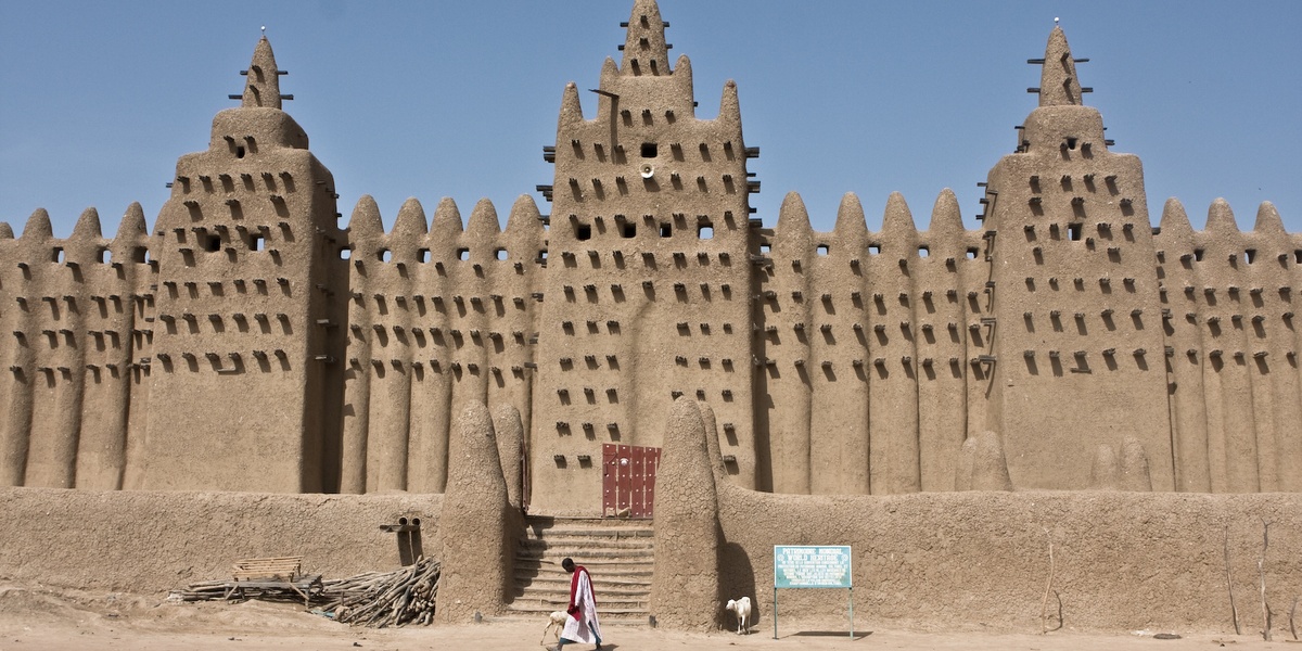
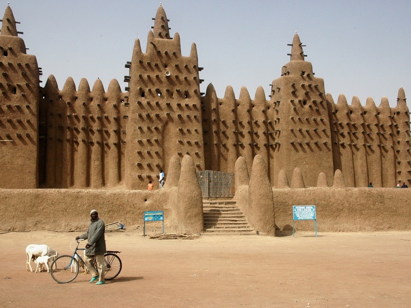
| Great Mosque of Djenné | Mopti Region; Djenné (13.91°N,4.55°W) | World Heritage Site – 1988 | World’s largest adobe mosque; annual replastering festival preserves traditional craft. |
| Djinguereber Mosque | Timbuktu Region; Timbuktu (16.77°N,3.00°W) | World Heritage Site – 1988 | 14th‑century mosque; historic center of Islamic scholarship and learning. |
| Sankore Mosque | Timbuktu Region; Timbuktu (16.77°N,3.00°W) | World Heritage Site – 1988 | Medieval university mosque that housed extensive manuscript collections. |
| Sidi Yahya Mosque | Timbuktu Region; Timbuktu (16.77°N,3.00°W) | World Heritage Site – 1988 | Important mosque and mausoleum, central to Timbuktu’s religious history. |
| Djenné‑Jeno | Mopti Region; near Djenné (13.91°N,4.55°W) | Not listed | One of West Africa’s earliest urban centers; extensive archaeological evidence. |
| Gao‑Saney | Gao Region; near Gao (16.25°N,0.05°E) | Not listed | Archaeological ruins of early Gao; Songhai‑era remains and royal cemeteries. |
| Tellem Caves | Mopti Region; Bandiagara Escarpment (14.35°N,3.60°W) | Not listed | Cliff burial caves of the Tellem people; pre‑Dogon archaeological deposits. |
| Hombori Tondo | Mopti Region; Hombori (15.38°N,1.50°W) | Not listed | Sandstone massif with prehistoric rock art and archaeological shelters; dramatic landscape. |
| Adrar des Ifoghas rock art | Kidal Region; Adrar des Ifoghas massif (19.00°N,1.50°E) | Not listed | Extensive prehistoric rock paintings and archaeological remains in northeastern Mali. |
| Tata of Sikasso | Sikasso Region; Sikasso (11.32°N,5.67°W) | Not listed | 19th‑century defensive earthworks protecting the Kénédougou kingdom. |
| Kangaba | Koulikoro Region; Kangaba (11.46°N,8.24°W) | Not listed | Historic Manden kingdom center; associated with Sundiata Keita and Mali Empire origins. |
| Ségou | Ségou Region; Ségou (13.44°N,6.27°W) | Not listed | Bambara capital with river port, colonial architecture, pottery and cultural heritage. |
Images and Descriptions
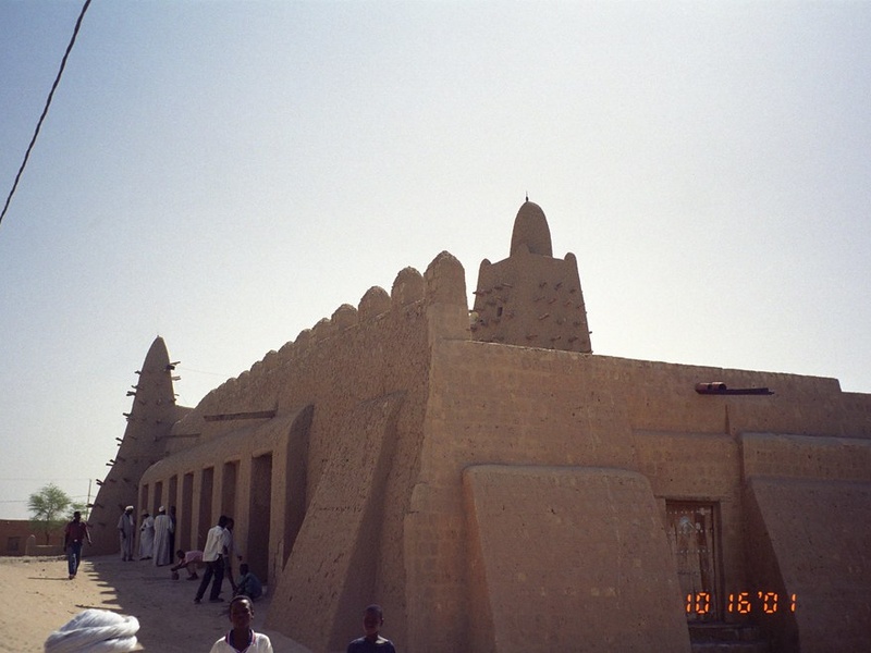
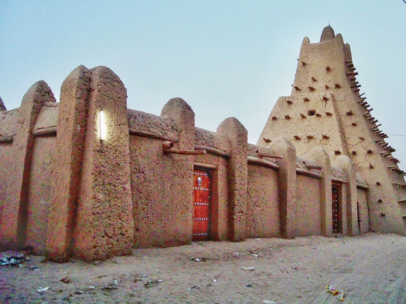
Timbuktu
Timbuktu is a historic desert city on the southern edge of the Sahara. It serves as a symbol of medieval West African trade and Islamic learning. It houses famous manuscript collections and several ancient madrasas. It appears on many lists of Mali’s most important historical places.
Djenné
Djenné is a riverside town known for its mud-brick buildings and lively market. It is a long-standing center of commerce and craft on the Niger floodplain. Its architecture and urban layout show traditional Sahelian building methods and community life.
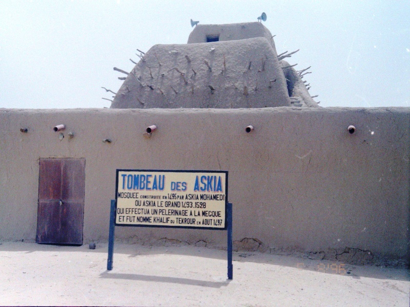
Tomb of Askia
The Tomb of Askia is a large mud-brick funerary monument in Gao. It dates to the Songhai Empire and honors Emperor Askia Mohammad I. It stands as an early Islamic pilgrimage site and an important African imperial grave.
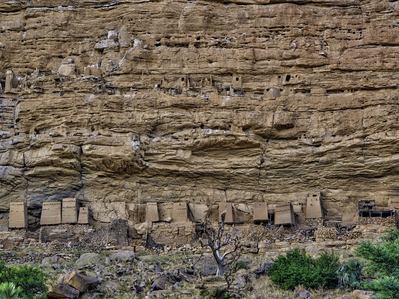
Cliff of Bandiagara (Land of the Dogon)
The Bandiagara Escarpment is a sandstone cliff region home to the Dogon people. It contains villages, granaries, and ritual sites built into cliffs. It forms a cultural landscape that preserves centuries of Dogon architecture and traditions.
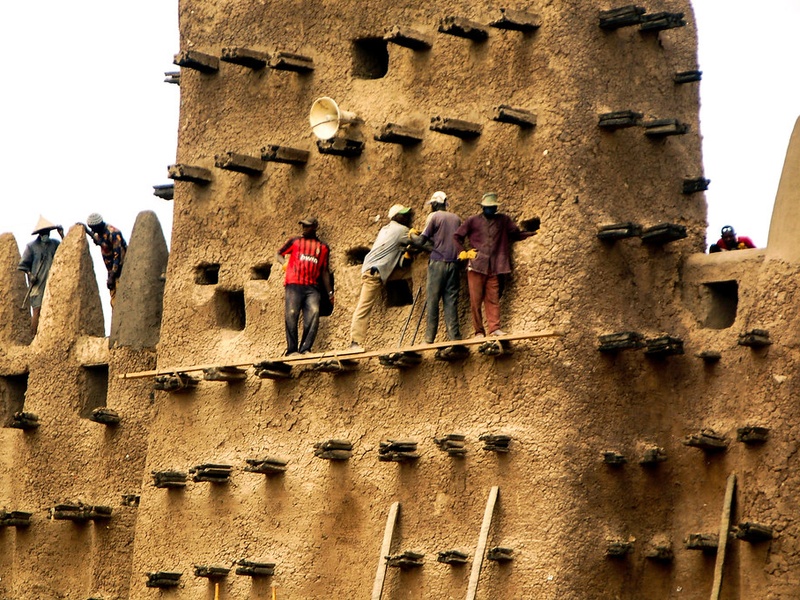
Great Mosque of Djenné
The Great Mosque of Djenné is the world’s largest mud-brick building. It anchors the town’s spiritual and social life. The mosque’s annual replastering shows communal building skills and Sahelian architectural heritage.
Djinguereber Mosque
Djinguereber Mosque sits in Timbuktu and functions as a historic center of Islamic learning. It dates back to the 14th century and links to Mali’s famous scholarship era. It remains a key example of Saharan mosque architecture.
Sankore Mosque
Sankore Mosque in Timbuktu is a medieval university and mosque complex. It houses libraries and many ancient manuscripts. It represents the city’s role as a scholarly hub for West Africa.
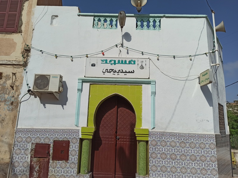
Sidi Yahya Mosque
Sidi Yahya Mosque is one of Timbuktu’s three great mosques. It serves as a community religious site with historic scholarly ties. It also has significance from recent restoration and protection efforts.

Djenné‑Jeno
Djenné-Jeno is an ancient urban site near Djenné that dates back over a thousand years. It shows early city planning, pottery, and trade in sub-Saharan West Africa. It provides archaeological proof of long-term urban life before widespread Islam.
Gao‑Saney
Gao-Saney is an archaeological area near Gao with old cemetery and settlement remains. It links to early Gao and Songhai urban development. It sheds light on trans-Saharan trade and regional power in the first millennium CE.
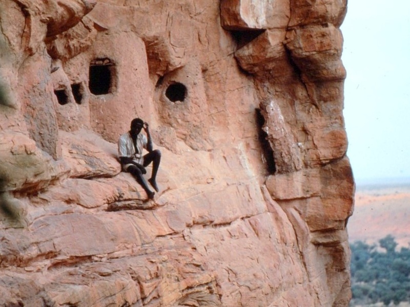
Tellem Caves
The Tellem caves sit along the Bandiagara Escarpment and contain cliff dwellings and artifacts. They reflect a pre-Dogon people and their burial traditions. The sites help trace population and cultural change in the Sahel.
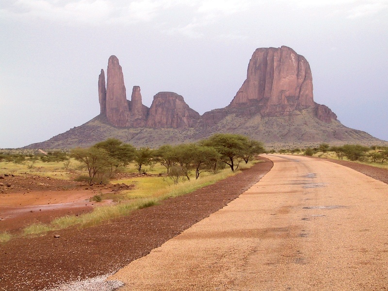
Hombori Tondo
Hombori Tondo is Mali’s highest rock peak and a rugged massif near Hombori town. It contains rock shelters, narrow passes, and traditional seasonal camps. It acts as a landmark for local history and old travel routes.
Adrar des Ifoghas rock art
The Adrar des Ifoghas massif holds ancient rock paintings and engravings in northeastern Mali. The images record hunter-gatherer and pastoral life over millennia. They provide a long view of human presence in the Sahara.
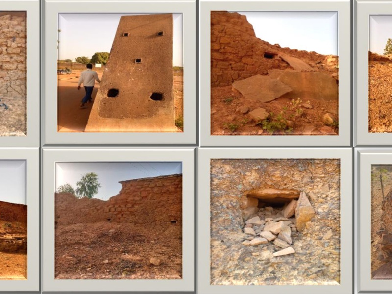
Tata of Sikasso
The Tata of Sikasso is a 19th-century defensive wall system built by the Kénédougou kingdom. It protected the city of Sikasso against invaders and colonial forces. Its remaining earthworks recall pre-colonial military architecture.
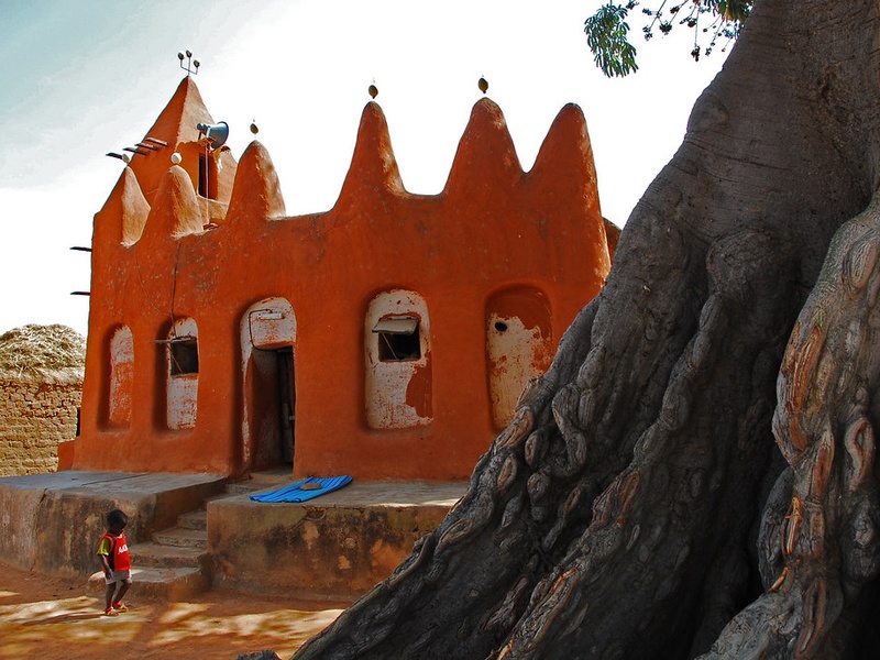
Kangaba
Kangaba is a small town near Bamako tied to the origins of the Mali Empire. It holds royal traditions, sacred sites, and the Mande cultural charter. It serves as a living symbol of Manding political and oral history.
Ségou
Ségou is a historic riverside town on the Niger known for its Bambara kingdom heritage and colonial-era buildings. It combines market life, pottery craft, and riverfront forts. It stands as a regional cultural and historical center.