South Korea’s landscape is threaded with rivers that have helped shape its cities, farmland and coastal settlements—flowing from inland ranges out to the Yellow and Korea Seas. Whether you enjoy hiking along riverbanks, studying watershed maps, or just wonder how waterways connect provinces, this list brings the network into focus.
There are 27 Rivers in South Korea, ranging from Anseong to Yeongsan — for each entry you’ll find below Length (km),Basin area (km2),Provinces / Mouth / Meaning — you’ll find below.
How can I use the length and basin columns to compare rivers?
Length (km) shows a river’s linear scale while Basin area (km2) indicates the land area draining into it; together they help you compare flow potential and regional impact. For example, a shorter river with a large basin can still carry substantial water during rains, so look at both columns to judge size and hydrological importance.
Which column tells me where each river fits geographically or culturally?
The Provinces / Mouth / Meaning column locates a river by administrative region and outlet, and often explains local names or historical significance. Use that field to connect rivers to cities, coastal mouths, and cultural context while consulting length and basin data for physical scale.
Rivers in South Korea
| Name | Length (km) | Basin area (km2) | Provinces / Mouth / Meaning |
|---|---|---|---|
| Nakdong | 510 | 23,384 | Gyeongbuk,Gyeongnam,Busan / Korea Strait / S Korea’s longest river |
| Han | 514 | 26,219 | Seoul,Gyeonggi,Incheon / Yellow Sea estuary / Flows through Seoul |
| Geum | 397 | 9,958 | Chungbuk,Chungnam / Yellow Sea / Central-west fertile basin |
| Seomjin | 212 | 4,896 | Jeonbuk,Jeonnam / South Sea / Between Jeolla provinces |
| Yeongsan | 130 | 3,504 | Jeonnam / Yellow Sea / Gwangju plain river |
| Imjin | 273 | 7,900 | Gangwon,Gyeonggi / Joins Han estuary / Crosses DMZ, historic site |
| Bukhan | 482 | 10,150 | Gangwon,Gyeonggi / Joins Namhan to form Han / North Han branch |
| Namhan | 263 | 16,300 | Gangwon,Gyeonggi,Chungbuk / Joins Bukhan to form Han / South Han |
| Mangyeong | 214 | 3,968 | Jeonbuk / Yellow Sea / Flows through Gimje plains |
| Dongjin | 51 | 908 | Jeollabuk / Yellow Sea / West Jeolla river (“East-Ford” name) |
| Tamjin | 107 | 2,144 | Jeonnam / South Sea / Southwestern peninsula river |
| Hyeongsan | 62 | 1,167 | Gyeongbuk / East Sea / Pohang and Gyeongju area |
| Taehwa | 36 | 645 | Ulsan / South Sea / Ulsan’s main urban river |
| Geumho | 116 | 4,025 | Daegu,Gyeongbuk / Joins Nakdong at Daegu / Important urban tributary |
| Miryang | 75 | 1,620 | Gyeongnam / Joins Nakdong / Named for Miryang city |
| Soyang | 112 | 2,680 | Gangwon,Gyeonggi / Joins Bukhan / Soyang Reservoir upper basin |
| Hongcheon | 78 | 1,330 | Gangwon / Joins Bukhan / Popular rafting and scenic valley |
| Anseong | 91 | 1,870 | Gyeonggi / Joins Namhan / Rural Gyeonggi tributary |
| Anyang | 38 | 576 | Gyeonggi,Seoul / Joins Han / Urban stream through Seoul suburbs |
| Jungnang | 39 | 632 | Seoul / Joins Han / Eastern Seoul tributary |
| Gokgyo (Gokgye) | 88 | 1,250 | Jeonnam / South Sea / Regional river in South Jeolla |
| Mankyeong | 132 | 2,450 | Jeonbuk / Yellow Sea / Western Jeolla agricultural river |
| Donggang | 74 | 1,140 | Gangwon / East Sea / Mountain river in northeastern Gangwon |
| Hantan | 82 | 2,404 | Gangwon,Gyeonggi / Joins Imjin / Scenic valley, Hantan River National Park |
| Yeocheon | 49 | 760 | Jeonnam / South Sea / Yeosu area river |
| Jangheung (Tamjin tributary) | 64 | 1,020 | Jeonnam / South Sea / Tributary on southern Jeolla coast |
| Guryong | 58 | 915 | Gyeongnam / South Sea / Coastal river in South Gyeongsang |
Images and Descriptions
Nakdong
Stand as South Korea’s longest and largest river. Rise in the Taebaek Mountains and flow south through major cities like Daegu. Empty into the Korea Strait near Busan. Serve as a key waterway for farming, industry, and ecology, so appear first in this list.

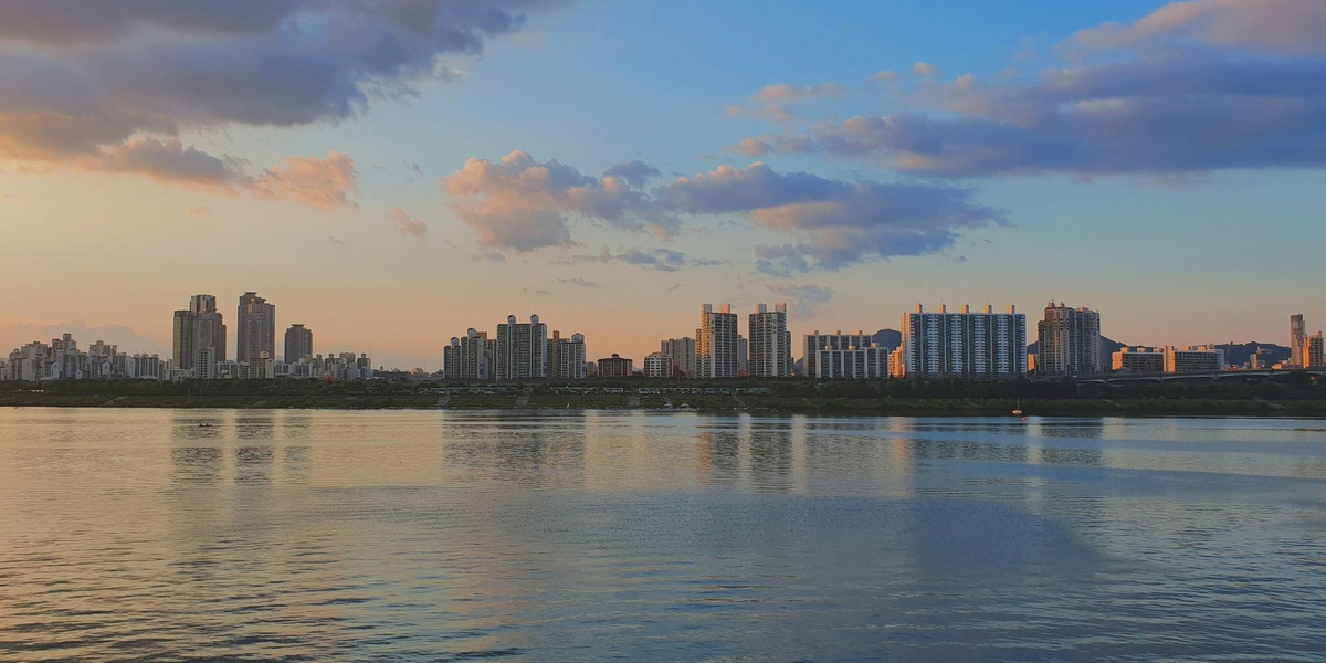
Han
Form the central river that runs through Seoul. Join from the Namhan and Bukhan branches and flow west to the Yellow Sea. Support cities, transport, and recreation. Include as one of the country’s most known rivers.
Geum
Flow across the central-western plain toward the Yellow Sea. Pass through agricultural regions and several provincial centers. Affect farming and local industry. Feature as a major western river in the list.
Seomjin
Run along the southern border between North and South Jeolla and South Gyeongsang provinces. Empty into the South Sea (Korea Strait). Support fisheries and local towns. Include for its role on the southern coast.
Yeongsan
Flow in the southwest Jeolla region toward the Yellow Sea. Pass near urban and agricultural areas. Influence regional irrigation and wetlands. Include as an important river for the Jeolla plain.
Imjin
Cross the border area from North Korea into the south and flow toward the Han estuary. Hold strong historical and military significance. Join the coastal river system at the west coast. Include for its cross-border importance.
Bukhan
Serve as the North Han River branch. Rise in the mountains of the north and flow toward Seoul. Form one half of the main Han River system. Include because it supplies water and reservoirs for the capital region.
Namhan
Serve as the South Han River branch. Run from eastern mountains toward the Han system. Pass through valleys used for farming and settlements. Include for its role in forming the Han River.
Mangyeong
Flow in the western Jeolla region toward the Yellow Sea. Pass through plains used for rice and crops. Influence local coasts and wetlands. Include as a notable west coast river.
Dongjin
Run in the Jeolla provinces toward the southwest coast. Support local agriculture and small ports. Feature as a regional river on the southern plains.
Tamjin
Flow in the southwestern part of the peninsula toward the South Sea. Serve local towns and farmlands. Include as a notable southern river system.
Hyeongsan
Run through the Pohang area and flow into the East Sea. Pass industrial and coastal zones. Support local fisheries and cities. Include for its coastal and regional importance.
Taehwa
Flow through the Ulsan area to the East Sea. Pass industrial zones and urban parks. Support recreation and local ecology, such as riverside green spaces. Include for its urban and environmental role.
Geumho
Act as a tributary of the Nakdong River near Daegu. Carry water from eastern hills into the main Nakdong channel. Affect city waterways and flood control. Include as an important Nakdong tributary.
Miryang
Serve as a regional tributary of the Nakdong system near Miryang city. Run through valleys used for farming and towns. Support local agriculture and transport routes. Include for regional coverage of Nakdong tributaries.
Soyang
Form one of the major northern reservoirs and river systems. Feed large dams and reservoirs used for water supply. Flow from the mountains into the Han basin. Include because of its role in water storage and recreation.
Hongcheon
Run in Gangwon province as a clear mountain river. Feed into larger Han tributaries. Support rafting, fishing, and local tourism. Include for its recreational and headwater significance.
Anseong
Flow through Gyeonggi province as a smaller river or stream. Feed local farmland and towns south of Seoul. Affect regional drainage and local ecosystems. Include for local river coverage in the central region.
Anyang
Act as an urban tributary running through Gyeonggi and Seoul areas. Join the Han river system near the capital. Pass through parks and built-up areas. Include as a key urban stream in the Han basin.
Jungnang
Serve as a short but important tributary in eastern Seoul. Flow into the Han near the city. Pass through urban greenways and parks. Include for its role in Seoul’s river network.
Gokgyo (Gokgye)
Represent a smaller stream or local tributary noted in regional lists. Run in a specific local watershed rather than across many provinces. Feature for thorough coverage of named rivers and tributaries.
Mankyeong
Flow along the west coast region toward the Yellow Sea. Pass through coastal plains and wetlands. Support local fishing and agriculture. Include as a west coast river of regional importance.
Donggang
Run as a clear mountain river in Gangwon province. Offer rafting, fishing, and scenic valleys. Feed larger river systems downstream. Include for its recreational use and mountain waters.
Hantan
Flow along the northern central region and join the Imjin River. Cross landscapes used for agriculture and geopark sites. Hold geological and historical interest. Include because it links to the Imjin and border region.
Yeocheon
Act as a coastal river or stream in the South Jeolla/Yeosu area. Flow toward the southern seas and support nearby towns. Influence local harbors and wetlands. Include to cover southern coastal waterways.
Jangheung (Tamjin tributary)
Serve as a named tributary of the Tamjin River. Feed the Tamjin watershed from local hills. Support local agriculture and small communities. Include to map tributary networks in the south.
Guryong
Appear as a small river or stream with local importance. Run within a limited watershed and feed larger systems or coastal zones. Feature in the list to capture named minor rivers and local geography.