Nauru’s compact coastline and phosphate-era history pack surprisingly rich layers of heritage into a tiny island. From coastal villages to inland relics, the sites tell stories of traditional life, colonial contact, and wartime events that shaped the island’s identity.
There are 19 Historical Places in Nauru, ranging from Anibare Bay to WWII Plane Wreckage. For each entry, information is organized as Location (village; GPS),Era (year/century),Significance (max 15 words) so you can quickly compare places and plan visits — you’ll find below.
Do I need permission or a guide to visit Nauru’s historical places?
Many sites are accessible without formal permits, but some are on private or restricted land and local guidance is recommended; contact local authorities or your accommodation for site-specific advice and respectful access.
How reliable are the Location (village; GPS) entries and Era estimates?
Coordinates and era notes are compiled from official records and field surveys where available; treat GPS as precise for planning but verify with local signage or guides, and expect some variation for oral-history–based sites.
Historical Places in Nauru
| Name | Location (village; GPS) | Era (year/century) | Significance (max 15 words) |
|---|---|---|---|
| Command Ridge | Aiwo; -0.531, 166.915 | 1942-1945 | Highest point on Nauru; site of Japanese WWII command post and bunkers. |
| Phosphate Cantilever Loaders | Aiwo; -0.532, 166.910 | 20th century | Iconic industrial relics from Nauru’s boom era of phosphate mining on the coast. |
| Buada Lagoon | Buada; -0.538, 166.924 | Pre-colonial | The traditional, cultural, and agricultural heartland of inland Nauruan life for centuries. |
| Japanese Guns (Yaren) | Yaren; -0.543, 166.917 | 1942-1945 | Well-preserved WWII 127mm coastal defense guns overlooking the southern coast and airstrip. |
| Topside / The Pinnacles | Central Plateau; -0.535, 166.930 | 20th century | Surreal landscape of limestone pinnacles created by a century of phosphate strip mining. |
| Japanese Prison (Buada) | Buada; -0.537, 166.928 | 1943 | WWII concrete cell where Japanese forces imprisoned and executed five Australian administrators. |
| Anti-Aircraft Gun (Command Ridge) | Aiwo; -0.531, 166.914 | 1942-1945 | Large Japanese Type 88 75mm anti-aircraft gun, part of WWII island defenses. |
| Nauru Airfield | Yaren; -0.547, 166.919 | 1943 | Originally built by Japanese forces using forced labor during their WWII occupation. |
| The Location Cemetery | Denigomodu; -0.522, 166.915 | 20th century | Burial ground for foreign phosphate industry workers, primarily of Chinese and Pacific Islander descent. |
| Orro Congregational Church | Aiwo; -0.528, 166.915 | Early 20th century | One of the oldest and most significant churches, representing the arrival of Christianity. |
| Old Phosphate Railway | Aiwo / Topside; -0.532, 166.920 | 20th century | Remnants of the narrow-gauge railway used to transport phosphate from Topside to the coast. |
| Anibare Bay | Anibare; -0.534, 166.949 | Pre-colonial – WWII | Site of traditional village life and where Japanese forces established coastal defenses. |
| Japanese Coastal Pillbox | Anibare; -0.532, 166.951 | 1942-1945 | One of several surviving concrete defensive machine-gun posts built along the coast. |
| Moqua Well | Yaren; -0.548, 166.924 | Pre-colonial | A traditional underground freshwater source for the Nauruan people, located near the airport. |
| German Wireless Station Site | Aiwo; -0.530, 166.916 | 1914 | Site of the German-era communication station destroyed by Australian forces during WWI. |
| Nauru Parliament House | Yaren; -0.545, 166.917 | 1968 | Seat of government since independence, symbolizing Nauru’s sovereignty and modern political history. |
| Japanese Shinto Shrine Remains | Command Ridge, Aiwo; -0.531, 166.915 | 1942-1945 | The concrete base and steps are all that remain of a WWII Shinto shrine. |
| WWII Plane Wreckage | Topside; -0.533, 166.928 | 1943-1945 | Scattered remains of Japanese and Allied aircraft from aerial battles during WWII. |
| Old Nauru Government House Site | Yaren; -0.544, 166.916 | 20th century | Site of the original colonial and mandate-era administrative center, destroyed during WWII. |
Images and Descriptions

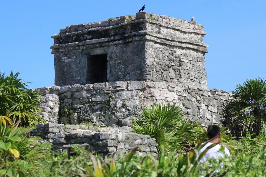
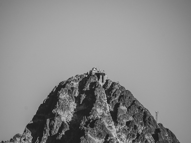
Command Ridge
Command Ridge is Nauru’s highest point and a main World War II site. Japanese forces used it as a command post and observation point. Remains of fortifications and relics stand on the ridge. Include it for its clear wartime role and island-wide views.
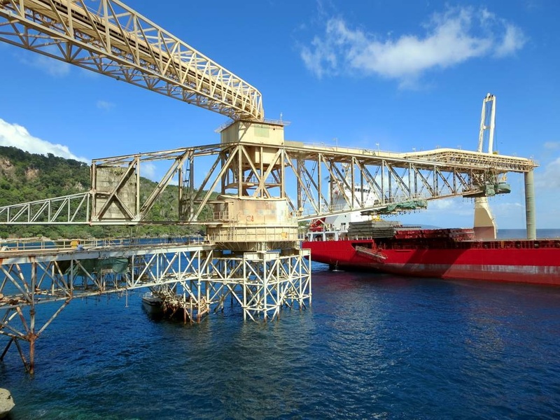
Phosphate Cantilever Loaders
Phosphate cantilever loaders are large machines once used to load phosphate onto ships. They date to the 20th-century export era that shaped Nauru’s economy. Remains and foundations mark the old wharf areas. Include them as symbols of the island’s industrial history.
Buada Lagoon
Buada Lagoon is a freshwater lake surrounded by forest and village land. It holds cultural importance and long-term settlement history. Japanese wartime activity occurred nearby and some ruins sit at the edges. Include it for both natural beauty and local history.
Japanese Guns (Yaren)
Japanese guns in Yaren are surviving artillery pieces from World War II. They mark defensive positions used during the occupation. Many stand near roads or open areas as concrete relics. Include them as visible evidence of wartime defenses.
Topside / The Pinnacles
Topside, called the Pinnacles, is Nauru’s mined interior of limestone pillars. Decades of phosphate mining created a scarred, rocky landscape. The area holds industrial ruins and wartime tracks. Include it because mining defines much of Nauru’s modern history.
Japanese Prison (Buada)
The Japanese prison in Buada is a wartime detention site with remaining structures or foundations. It served during World War II under the occupying forces. Ruins and local memory mark the spot. Include it for its human and historical significance.
Anti-Aircraft Gun (Command Ridge)
The anti-aircraft gun on Command Ridge is a WWII coastal defense piece. It sits near other military installations used by Japanese forces. The gun remains in situ as a clear military relic. Include it as a specific wartime artifact on the ridge.
Nauru Airfield
Nauru Airfield began as a military strip and became the island’s main airport. It played a role in wartime movement and later connected Nauru to the world. The current airport traces that history. Include it for transport and wartime context.
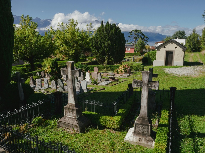
The Location Cemetery
The Location Cemetery is an historic burial ground with graves from different eras. It contains markers from colonial times and wartime deaths. The site records the island’s changing communities. Include it as a place of memory and local history.
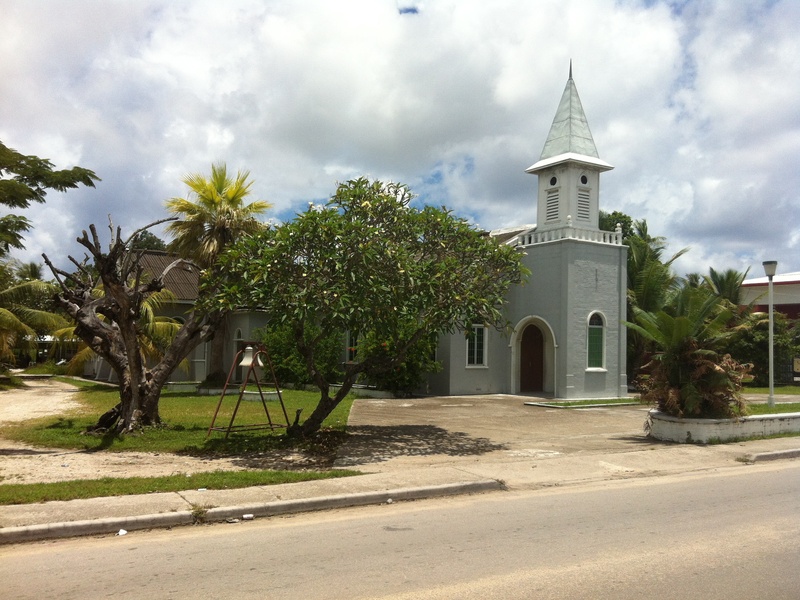
Orro Congregational Church
Orro Congregational Church is an early church tied to missionary and community life. It reflects religious and social history from the colonial and post-colonial periods. The building and its grounds serve as a local landmark. Include it for cultural heritage.
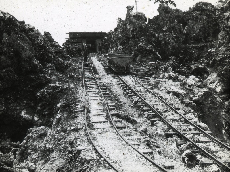
Old Phosphate Railway
The old phosphate railway carried ore from inland to the jetties. Rails and ties remain in parts of the island. The line shows how mining shaped daily life and transport routes. Include it as key industrial heritage infrastructure.
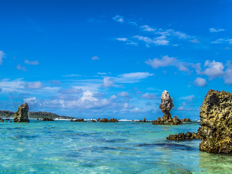
Anibare Bay
Anibare Bay is a large bay with village settlements, traditional fishing sites, and wartime shore defenses nearby. It combines natural beauty with historical shoreline features. Shipwrecks and pillboxes appear in local stories. Include it for coastal history and landscape.
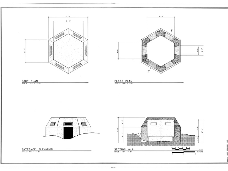
Japanese Coastal Pillbox
A Japanese coastal pillbox is a small concrete bunker used in World War II. It sits along the shoreline or near access points. The structure served as a lookout and firing position. Include it as a common and tangible wartime remnant.
Moqua Well
Moqua Well is a natural freshwater well inside a cave near the coast. It has long served as a vital water source for locals and visitors. The site also played a role during wartime survival. Include it for natural importance and practical history.
German Wireless Station Site
The German wireless station site dates to early 20th-century colonial communications. It formed part of German administration on the island before World War I. Foundations or markers indicate its former location. Include it as evidence of early colonial infrastructure.
Nauru Parliament House
Nauru Parliament House is the seat of government and a symbol of independence. The building and site represent political history since independence in 1968. It hosts national ceremonies and public business. Include it for modern civic and historical relevance.
Japanese Shinto Shrine Remains
Remains of a Japanese Shinto shrine reflect the cultural presence of occupying forces in World War II. Stone bases, torii fragments, or cleared sites mark the shrine locations. They offer insight into daily life under occupation. Include them as cultural and religious traces of history.
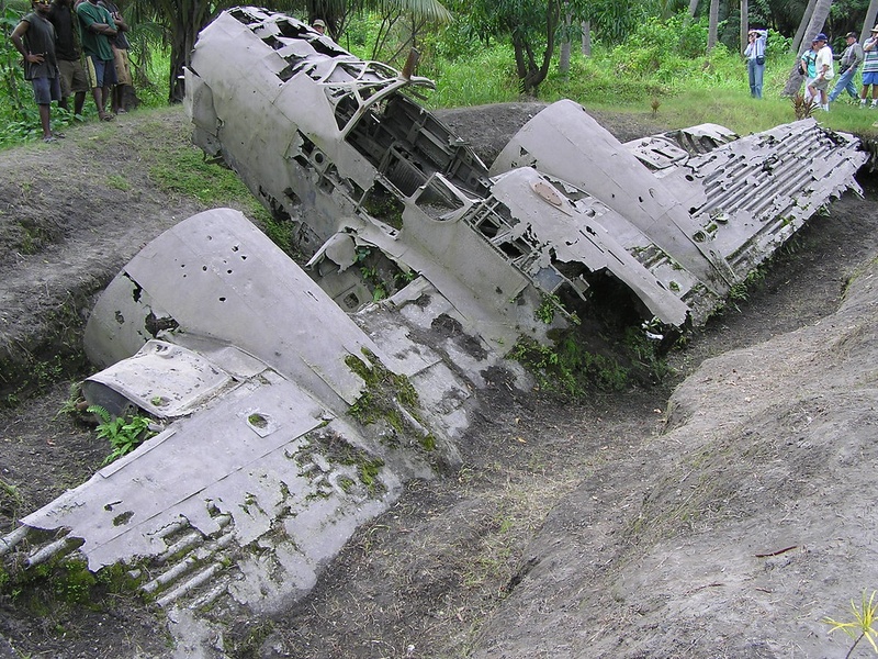
WWII Plane Wreckage
WWII plane wreckage appears in several places on and near Nauru. Crashed aircraft from the conflict leave metal fragments and fuselage pieces. These wrecks serve as stark reminders of wartime air battles. Include them as dramatic physical evidence of the war.
Old Nauru Government House Site
The old Nauru Government House site marks former colonial administration premises. Ruins, foundations, or plaques indicate where officials once lived and worked. The location reflects shifts from colonial rule to independence. Include it for administrative and historical context.