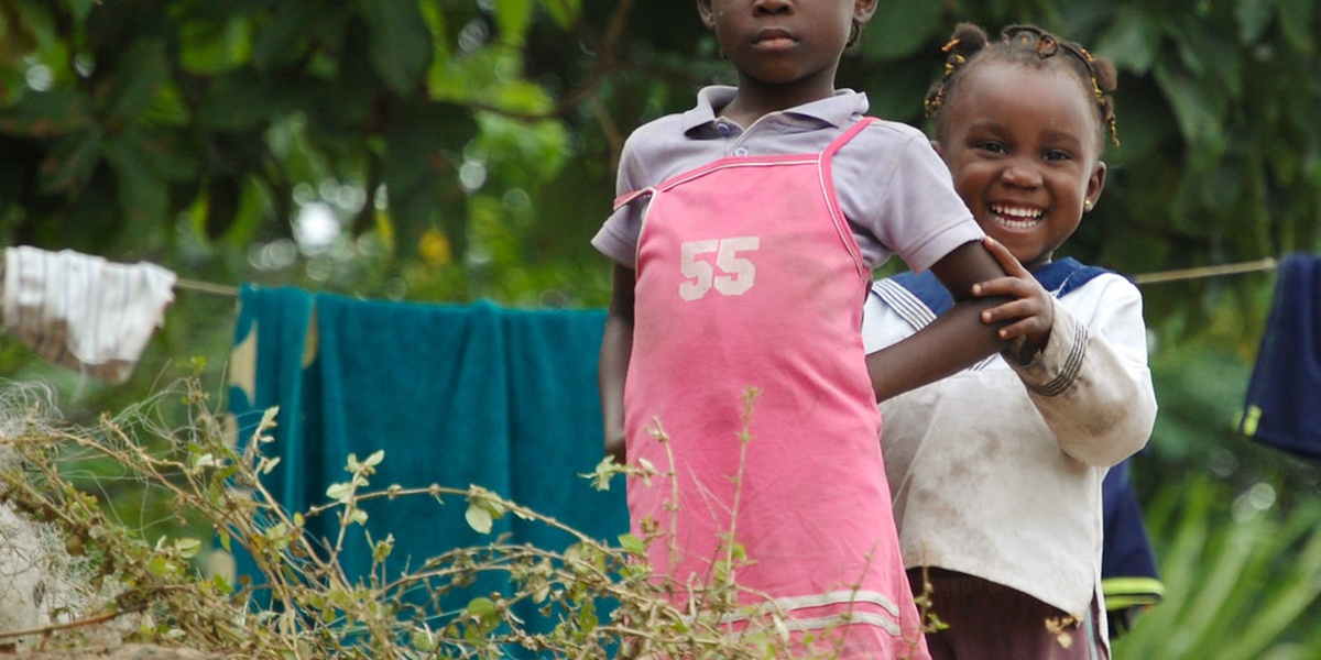
Gabon sits on Africa’s central west coast and is threaded by waterways that flow from inland plateaus through dense rainforest to the Atlantic. These rivers shape transport routes, support fishing and small-scale farming, and sustain habitats for primates, fish and migratory birds.
There are 15 Rivers in Gabon, ranging from Abanga to Sébé. For each river you’ll find Length (km), Basin/Tributary, Notable features — concise details to help you compare size, drainage connections, and any standout characteristics; you’ll find them below.
Which Gabon rivers are navigable for boats?
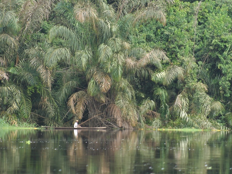
The main navigable waterway is the Ogooué, which supports river traffic on long stretches; other rivers like portions of the Ivindo and a few lower-basins are navigable by small boats or canoes, often seasonally. Most tributaries are shallow or rapid-filled and suit local transport rather than commercial navigation.
How do these rivers affect local communities and wildlife?
Rivers provide freshwater, fish, and transport for remote settlements and underpin local economies, while also creating forest wetlands and corridors that sustain high biodiversity; threats include deforestation, mining runoff and proposed dams, so understanding each river’s basin helps prioritize conservation and community planning.
Rivers in Gabon
| Name | Length (km) | Basin/Tributary | Notable features |
|---|---|---|---|
| Ogooué | 1,200 | Atlantic coast (main basin) | Gabon’s largest river, drains most of the country |
| Ivindo | 600 | Ogooué | Flows through Ivindo National Park; famous waterfalls |
| Ngounié | 550 | Ogooué | Major southern tributary; flows past Mouila |
| Nyanga | 600 | Atlantic coast | Southern Gabon river, reaches the Atlantic Ocean |
| Komo | 230 | Atlantic coast | Coastal river near Libreville with navigable estuary |
| Ntem (Campo) | 350 | Atlantic coast | Forms border with Cameroon and Equatorial Guinea |
| Mpassa | 300 | Ogooué | Eastern tributary; flows past Franceville |
| Lékoni | 150 | Mpassa | Tributary near Franceville; scenic valley |
| Sébé | 250 | Ogooué | Central tributary important for local communities |
| Louetsié | 180 | Ngounié | Southern tributary; regional economic importance |
| Bouenguidi | 200 | Ngounié | Runs near Koulamoutou; supports fisheries and transport |
| Abanga | 220 | Ogooué | Upper Ogooué tributary influencing local wetlands |
| Mvoung | 250 | Ogooué | Northern tributary feeding central Ogooué system |
| Djoua | 200 | Nyanga | Cross-border tributary in the Nyanga basin |
| Lolo | 140 | Ogooué | Eastern tributary serving rural settlements |
Images and Descriptions

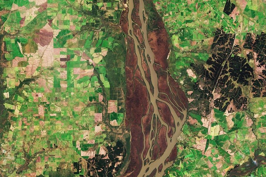
Ogooué
Ogooué is the longest and main river of Gabon. It flows west across the country to the Atlantic and drains most of Gabon. It forms the backbone of the national hydrographic network and supports transport, fishing, and large rainforest basins. Include it as the primary river and basin for many tributaries listed in the post.
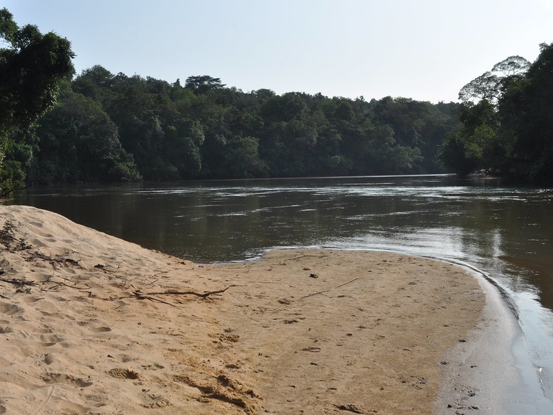
Ivindo
Ivindo is a major eastern tributary of the Ogooué. It rises in the rainforest highlands and runs through protected areas and famous waterfalls. It supports high biodiversity and links remote forest areas to the main Ogooué route.
Ngounié
Ngounié is a large southern river in the Ogooué system. It flows through savanna and forest and passes several towns. It serves local agriculture and small-scale transport and is a key tributary feeding the central basin.

Nyanga
Nyanga is a major river in southern Gabon that flows to the Atlantic. It drains a broad southern basin with forests and coastal wetlands. It supports fisheries, mangroves near its mouth, and distinct ecosystems from the Ogooué basin.
Komo
Komo is a coastal river near western Gabon. It empties toward the Atlantic in the Libreville/Komono area and feeds local estuaries and mangroves. It is important for nearby towns and coastal transport.
Ntem (Campo)
Ntem, also called Campo, is a transboundary river at Gabon’s northern/southern border zones and flows to the Atlantic. It forms parts of international borders and drains coastal forests. Include it for its cross-border and coastal role.
Mpassa
Mpassa is an eastern tributary in the Ogooué basin. It runs near regional towns and links upland areas to larger waterways. It supports local farming, fishing, and connects inland settlements to the main river network.
Lékoni
Lékoni is a smaller river in southeastern Gabon and part of the Ogooué basin. It flows from hilly country into larger tributaries. It is notable for local valleys, villages, and forested river corridors.
Sébé
Sébé is a central tributary within the greater Ogooué system. It drains mixed forest and savanna areas and helps feed larger downstream rivers. It matters for regional hydrology and local communities.
Louetsié
Louetsié is a southern tributary feeding the Ngounié and the Ogooué network. It runs through rural areas and supports small fishing and transport. Include it to show the network of smaller southern rivers.
Bouenguidi
Bouenguidi is an eastern river that joins larger Ogooué tributaries. It flows through forested lowlands and supplies freshwater to local towns. It is notable for its role in the eastern drainage system.
Abanga
Abanga is a northern/central tributary of the Ogooué. It runs through forested plateaus and joins the main river system. It helps illustrate the extent of the central basin and local waterways.
Mvoung
Mvoung is a central tributary of the Ogooué basin. It flows through protected forest areas and connects remote habitats to the main river. It is relevant for ecology and regional river mapping.
Djoua
Djoua belongs to the southern river systems and feeds coastal basins such as the Nyanga. It flows through dense forest and supports riverine communities. Include it as part of the southern drainage network.
Lolo
Lolo is an eastern tributary that links to rivers like the Bouenguidi before reaching the Ogooué. It drains upland forest areas and supplies water to local villages. Include it to complete the map of eastern tributaries.