Algeria’s geography stretches from a narrow Mediterranean plain into the vast Sahara, and its rivers — though concentrated in the north — play a key role in feeding towns, irrigation and local ecosystems. Understanding these waterways helps make sense of settlement patterns and regional resources across the country.
There are 15 Rivers in Algeria, ranging from Chelif,Tafna. For each river you’ll find below the columns Length (km),Basin area (km2),Mouth / main provinces to compare size, drainage and where they flow — you’ll find the full list and data below.
Which river is generally considered the longest in Algeria?
The Chelif is widely regarded as Algeria’s longest river, running across the northern plains and supplying irrigation and reservoirs; it’s the most significant for regional agriculture and settlements, though exact lengths vary by source.
Are Algeria’s rivers permanent or seasonal, and what does that mean for water use?
Many Algerian rivers are seasonal or have reduced flow in dry months, so water storage, dams and irrigation infrastructure are essential for reliable supply; coastal and upland catchments retain more consistent flow than streams feeding directly from the Saharan edge.
Rivers in Algeria
| Name | Length (km) | Basin area (km2) | Mouth / main provinces |
|---|---|---|---|
| Chelif | 725 | 23,000 | Mediterranean Sea (Mostaganem, Relizane, Mascara, Tiaret) (largely seasonal; some perennial reaches) |
| Seybouse | 225 | 6,600 | Mediterranean Sea – Gulf of Annaba (Guelma, Annaba, Oum El Bouaghi) (seasonal) |
| Rhumel | 320 | unknown | Joins Seybouse / Mediterranean (Constantine, Oum El Bouaghi) (seasonal) |
| Soummam | 65 | 4,000 | Mediterranean Sea (Béjaïa province) (seasonal/wadi) |
| Tafna | 200 | 9,000 | Mediterranean Sea (Tlemcen, Aïn Témouchent) (seasonal) |
| Macta | 120 | 4,000 | Mediterranean Sea (Oran, Mascara, Aïn Témouchent) (seasonal/wetland at mouth) |
| Mazafran | 100 | 1,900 | Mediterranean Sea (Tipaza, Blida) (seasonal) |
| Sebaou | 140 | 3,600 | Mediterranean Sea (Tizi Ouzou, Boumerdès) (seasonal) |
| Isser | 90 | 2,300 | Mediterranean Sea (Boumerdès, Bouira) (seasonal) |
| Harrach | 67 | 1,200 | Mediterranean Sea (Algiers) (seasonal; flows through Algiers) |
| Oued El Kebir | 160 | 2,500 | Mediterranean Sea (Annaba, Guelma) (seasonal) |
| Oued Mina | 110 | 1,500 | Mediterranean Sea (Skikda, Jijel) (seasonal) |
| Saoura | 480 | 64,000 | Ends in endorheic sebkha (Béchar) (ephemeral/seasonal desert river) |
| Guir | 300 | 24,000 | Contributes to Saoura (Béchar; Morocco–Algeria border region) (seasonal) |
| Mekerra | 290 | 6,000 | Tributary of Chelif (Mascara, Relizane) (seasonal) |
Images and Descriptions

Chelif
Chelif is Algeria’s longest river. It rises in the Tell Atlas and runs west across northern Algeria. It reaches the Mediterranean near Mostaganem. It supplies water for irrigation and hydro projects and defines a large agricultural plain.
Seybouse
Seybouse flows in eastern Algeria toward the Mediterranean near Annaba. It drains high plateaus and mountain slopes in the Aurès and surrounding regions. It supports local farming and towns and is a major eastern watershed.
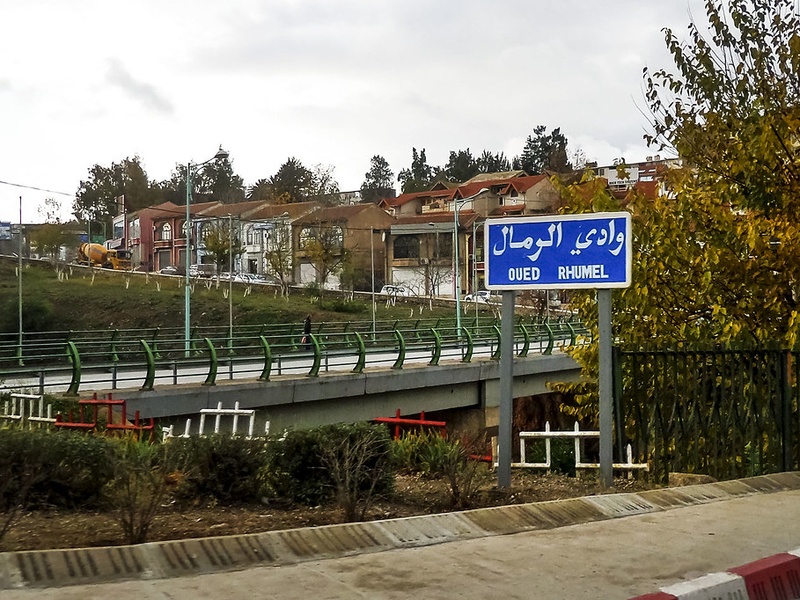
Rhumel
Rhumel runs through the city of Constantine and carves the city’s famous gorges. It is a key river in the Constantine region and connects local valleys to larger eastern river systems. It shapes local geography and history.
Soummam
Soummam drains the Kabylie mountains and flows north to the Mediterranean near Béjaïa. It forms a fertile valley used for farming and transport. It is a main river of the central coastal mountains.
Tafna
Tafna runs in northwest Algeria toward the Mediterranean close to the Moroccan border. It drains parts of the Tell Atlas and feeds coastal plains near Tlemcen and Oran provinces. It is important for local agriculture and wetlands.
Macta
Macta is a coastal wadi between Oran and Mostaganem. It forms the Macta marshes and coastal wetlands near its mouth. It is seasonal but important for birdlife and local grazing lands.
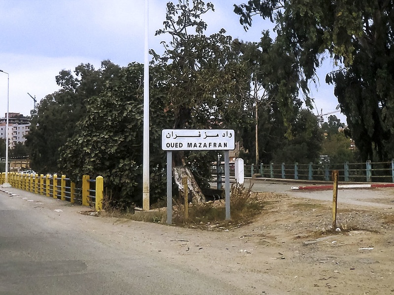
Mazafran
Mazafran is a short coastal river west of Algiers. It flows from the Tell Atlas to the Mediterranean near the town of Mazafran. It serves local irrigation and marks a coastal drainage basin near the capital region.
Sebaou
Sebaou (Oued Sebaou) drains parts of the Djurdjura massif in central Kabylie. It flows north toward the coast and shapes a wide valley used for orchards and cereals. It is a main watercourse for the Kabylie region.
Isser
Isser runs in the northern Tell region and reaches the Mediterranean coast in the Boumerdès/Algiers area. It drains mountain slopes and supports farms on its valley floor. It is a notable coastal watershed east of Algiers.
Harrach
Harrach (Oued El Harrach) flows through the Algiers urban area into the Bay of Algiers. It is an urban river used historically for mills and now affected by city development. It is short but significant to the capital region.
Oued El Kebir
Oued El Kebir means “big river” and names several large wadis in Algeria. Each Oued El Kebir serves as a main local drainage channel. Include this name because it appears on regional maps and in local water records.
Oued Mina
Oued Mina is a coastal wadi in northeastern Algeria that drains nearby mountain slopes to the sea. It functions as a local river channel for small towns and farms. It appears in regional lists of Mediterranean coastal streams.
Saoura
Saoura is a major inland river in southwestern Algeria. It forms from the joining of upstream wadis and flows through the Béchar oasis region. It supports date palms, towns, and agriculture in an otherwise dry desert area.
Guir
Guir is a transboundary wadi that rises near Morocco and enters Algeria. It helps form the Saoura system by supplying headwater flow. It supports oases and local irrigation in the southwestern plains.
Mekerra
Mekerra runs in northwestern Algeria across Tell Atlas foothills and plains. It drains local highlands and supplies water for towns and farms. It is a regional river in the western Tell zone and appears on provincial maps.