Chile’s narrow span between the Andes and the Pacific is shaped by countless waterways that carve valleys, feed farms and connect coastal cities to mountain sources. Rivers here run through deserts, temperate forests and glacial highlands, creating a varied network that reflects the country’s long, thin geography.
There are 20 Rivers in Chile, ranging from Aconcagua to Valdivia. For each entry, the list below is organized as Region(s),Length (km),Mouth & notable so you can quickly compare where each river runs, how long it is and any important features—you’ll find below.
Which rivers are the longest in Chile and where do they flow?
The longest rivers typically originate in the Andes and flow westward to the Pacific, often crossing several administrative regions; the Length (km) column in the table below shows exact rankings. Look at the Mouth & notable column for whether a river ends in a coastal estuary, lagoon or directly on the shore.
Why do reported lengths or regional attributions sometimes vary between sources?
Differences come from measurement methods (meander vs. straight-line), seasonal channels, and differing definitions of a river’s source or mouth, plus administrative boundary changes; check the notes and sources included with each row below to see how each figure was determined.
Rivers in Chile
| Name | Region(s) | Length (km) | Mouth & notable |
|---|---|---|---|
| Loa | Antofagasta | 440 | Pacific; longest river in Chile, flows through the Atacama Desert |
| Biobío | Biobío | 380 | Pacific; historically significant boundary, major hydroelectric resources |
| Baker | Aysén | 370 | Pacific; Chile’s largest discharge, carved deep glacial valleys |
| Maipo | Metropolitana,Valparaíso | 250 | Pacific; supplies Santiago’s water, originates in the Andes |
| Maule | Maule | 240 | Pacific; central agricultural region, important for irrigation and history |
| Aconcagua | Valparaíso | 142 | Pacific; drains the Aconcagua valley, key irrigation source |
| Mapocho | Metropolitana | 110 | Pacific; runs through Santiago, heavily managed urban river |
| Itata | Ñuble,Biobío | 140 | Pacific; supports regional agriculture and forestry industries |
| Palena | LosLagos,Aysén | 240 | Pacific; fjord-like lower course crossing regional border |
| Futaleufú | LosLagos,Aysén | 105 | Lake (Yelcho); internationally renowned whitewater rafting destination |
| Toltén | LaAraucanía | 123 | Pacific; drains Villarrica Lake, supports fisheries and agriculture |
| Bueno | LosRíos,LosLagos | 130 | Pacific; flows from Ranco Lake through a wide estuary to sea |
| Valdivia | LosRíos | 15 | Pacific; short mainstem formed near city of Valdivia |
| Rapel | O’Higgins | 120 | Pacific; dammed to form Rapel Reservoir, vital for hydropower |
| Cachapoal | O’Higgins | 180 | River (Rapel); major Rapel tributary feeding irrigation networks |
| Copiapó | Atacama | 162 | Pacific; critical lifeline for Copiapó city in very arid Atacama |
| Elqui | Coquimbo | 165 | Pacific; famed wine region river, clear skies attract observatories |
| Petorca | Valparaíso | 120 | Pacific; small coastal river, basin severely affected by drought |
| Aisén | Aysén | 26 | Pacific (Aisén Fjord); forms estuary at the town of Aisén |
| Serrano | Magallanes | 55 | Pacific; glacial-fed, flows into Última Esperanza Sound near Torres del Paine |
Images and Descriptions

Loa
Ranked as the longest river in Chile. It runs across the arid north through the Atacama area. It flows from high Andean streams toward the coast and passes through desert oases. Include because it defines northern drainage and human settlements in the desert.
Biobío
A major river in south-central Chile. It runs from the Andes to the Pacific near Concepción. It drains a large basin and powers hydroelectric plants. Include because it is one of the country’s most important rivers for people and industry.
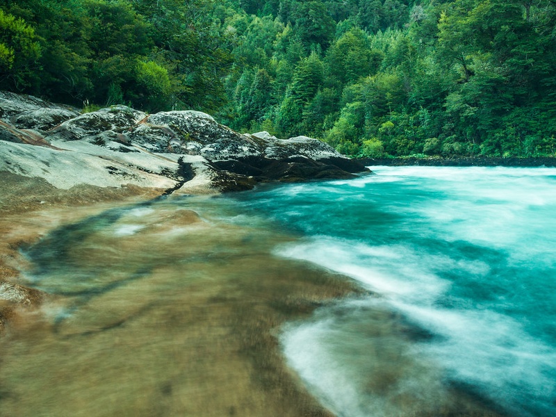
Baker
A powerful Patagonian river in the Aysén area. It carries large glacial flow and shows bright, turquoise water. It runs from Andean lakes toward the Pacific and crosses wild landscapes. Note its high flow and interest for recreation and hydropower debates.
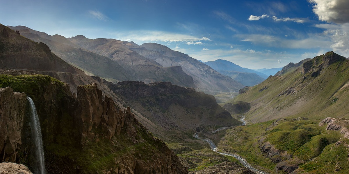
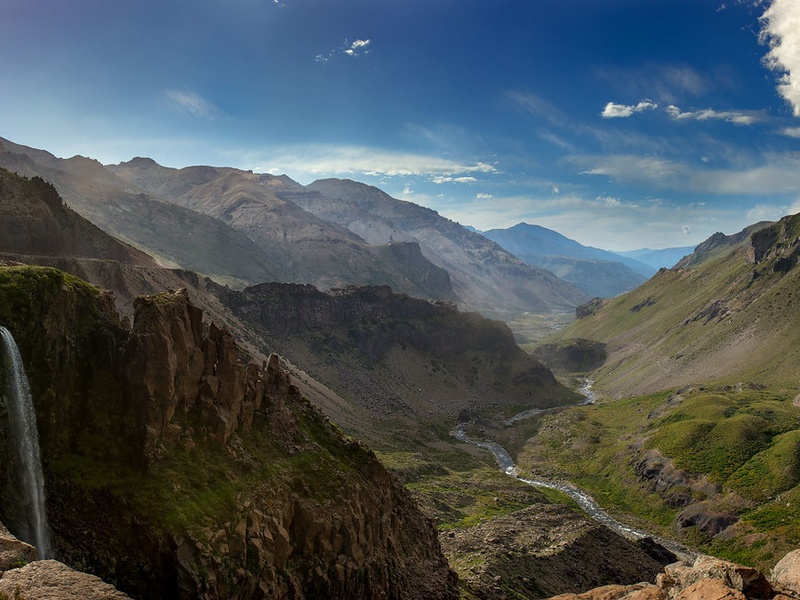
Maipo
A key river for the Santiago region. It starts in the Andes and drains the Santiago valley toward the coast. It supplies water for drinking, irrigation, and cities. It anchors central Chile’s main metropolitan watershed.
Maule
A central Chile river that drains the Maule region. It flows from Andean sources toward the Pacific. It supports farming, irrigation, and regional towns. It appears often in historical and regional maps.
Aconcagua
A river in the Aconcagua valley west of the Andes. It runs through agricultural areas and vineyards toward the coast. It supplies water to towns and farms in central Chile. It shapes a well-known valley that shares the river’s name.
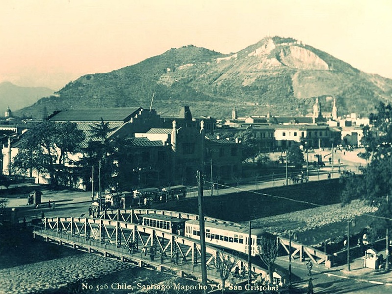
Mapocho
A small Andean river that crosses Santiago city. It runs west from the mountains through urban neighborhoods. It feeds into the larger Maipo basin. Include because it forms Santiago’s main urban river corridor.
Itata
A south-central river that reaches the Pacific. It drains fertile valleys and supports local agriculture. It shows seasonal flow changes and feeds coastal plains. It is part of Bío Bío and Ñuble landscapes.
Palena
A Patagonian river flowing through forested valleys. It runs from Andean zones toward the Pacific coast. It supports salmon habitat and remote communities. It highlights southern Chile’s rain-soaked river systems.
Futaleufú
A wild river in northern Patagonia near the Argentina border. It shows strong rapids and clear, cold water. It is famous worldwide for whitewater rafting and kayaking. Include because of its recreation and conservation value.
Toltén
A river in the Araucanía region that drains Andean lakes toward the sea. It cuts through agricultural valleys and coastal plains. It supplies local towns and supports fisheries. It is a notable river in southern-central Chile.
Bueno
A large southern river that drains Andean lakes to the Pacific. It runs through lowland valleys and coastal wetlands. It supports fisheries, transport history, and rural communities. It is a key river in the Los Ríos/Los Lagos area.
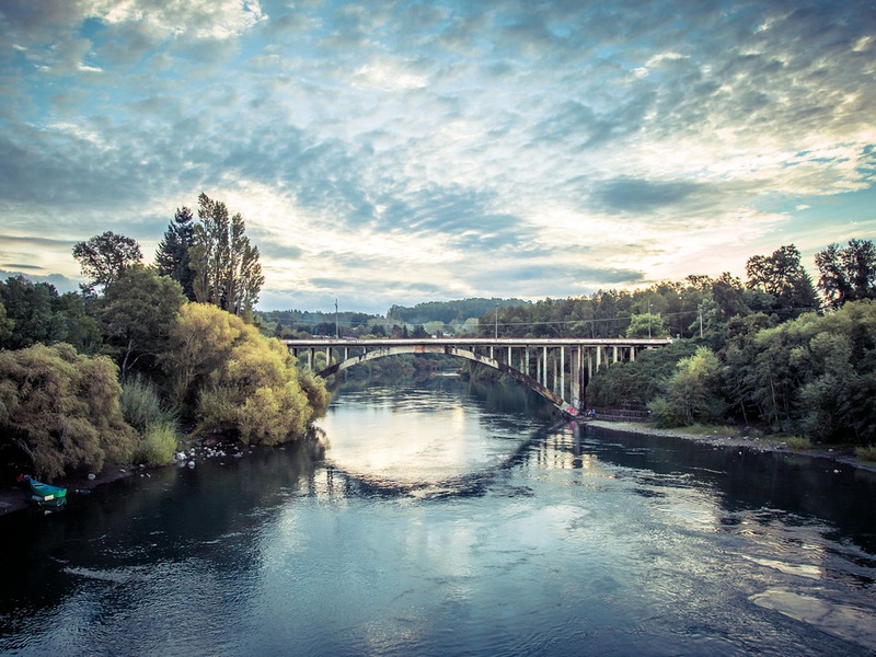
Valdivia
A river system around the city of Valdivia in southern Chile. It forms from several tributaries and flows to the ocean through coastal channels. It supports port activity, fisheries, and rich wetlands. It shapes a major estuarine landscape.
Rapel
A central river that forms an important reservoir and irrigation zone. It includes the Rapel Lake used for hydropower and farming. It drains valleys in O’Higgins and nearby regions toward the coast. It matters for regional water use and energy.
Cachapoal
A river in the O’Higgins region and a main tributary of the Rapel system. It runs from the Andes through productive valleys. It supplies irrigation for vineyards and crops. Include because it forms part of a major central Chile basin.
Copiapó
A desert river in the Atacama region with seasonal flow. It runs from Andean snow and glaciers down to lower plains. It supplies scarce water for mining towns and desert agriculture. It is essential to understanding northern Chile’s water limits.
Elqui
A river in the Coquimbo region that drains the Elqui Valley. It feeds vineyards, pisco distilleries, and tourism areas. It runs from the Andes toward the coastal plain. It is central to local culture and agriculture.
Petorca
A small river in central-northern Chile known for water stress. It runs from the Andes toward the Pacific and supplies local farms. It appears in studies of water use and conflicts. Include because it highlights social and environmental issues.
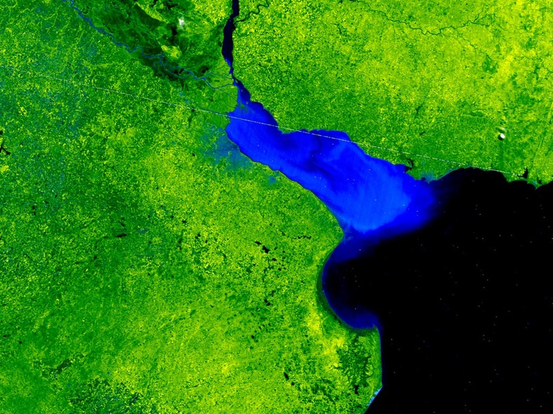
Aisén
A river system in the Aysén Region of Patagonia. It drains glaciers and mountain lakes toward coastal fjords. It runs through very rugged and sparsely populated terrain. It shows how southern river networks connect glaciers, lakes, and the sea.
Serrano
A Patagonian river near Torres del Paine and Última Esperanza Sound. It flows from glaciers through steep valleys to coastal inlets. It supports boat trips, glacier viewing, and wild ecosystems. It represents southern Chile’s fjord and glacier rivers.