South Africa’s waterways cut across mountains, plains and coastlines, shaping regional climates, agriculture and urban life. From hiking trails and game reserves to irrigation networks and municipal supplies, rivers are central to how people live and work across the country’s provinces.
There are 29 Rivers in South Africa, ranging from the coastal Berg River to the inland Vaal River. For each entry you’ll find below the details organized with Length (km),Provinces,Quick note so you can quickly compare sizes, locations and any special features you’ll want to know.
Which rivers are the longest and where do they flow?
The longest systems include the Orange (Gariep), which drains west to the Atlantic, and the Limpopo, flowing northeast toward the Indian Ocean; the Vaal is a major inland tributary supplying Gauteng. Use the Length (km) and Provinces columns below to see exact stretches and which regions each river serves.
How can I use this list for travel, study or planning?
Sort or scan the list by province to find nearby rivers for day trips, check the Quick note for recreation or access tips, and use Length (km) to judge scale for research or water-resource planning—then follow links or local sources for current conditions.
Rivers in South Africa
| Name | Length (km) | Provinces | Quick note |
|---|---|---|---|
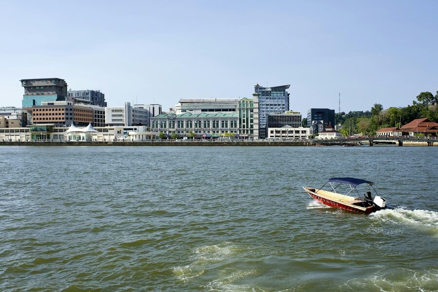
| Orange River | 2,200 km | Free State;Northern Cape;Western Cape | Atlantic Ocean at Alexander Bay; South Africa’s longest river |
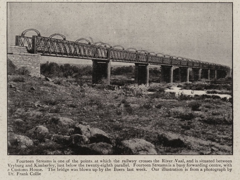
| Vaal River | 1,210 km | Gauteng;Free State;North West;Mpumalanga | Largest Orange tributary; key Gauteng water source |
| Limpopo River | 1,750 km | Limpopo;Mpumalanga;North West | Flows east, forming borders with Botswana, Zimbabwe, Mozambique |
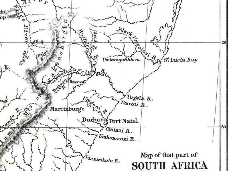
| Tugela River | 502 km | KwaZulu-Natal | Drakensberg-fed; falls to Indian Ocean at Tugela Mouth |
| Olifants (Mpumalanga) | 615 km | Mpumalanga;Limpopo | Major Limpopo tributary draining Kruger National Park region |
| Breede River | 337 km | Western Cape | Drains Winelands; empties into Indian Ocean near Witsand |
| Berg River | 294 km | Western Cape | Empties into Saldanha Bay; important regional water supply |
| Gouritz River | 416 km | Western Cape | Drains Little Karoo to the Gouritsmond estuary |
| Sundays River | 250 km | Eastern Cape | Empties into Algoa Bay near Gqeberha (Port Elizabeth) |
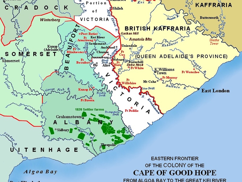
| Great Fish River | 644 km | Eastern Cape | Historic frontier river; reaches the Indian Ocean near Kenton-on-Sea |
| Great Kei River | 320 km | Eastern Cape | Enters the Indian Ocean at Kei Mouth; sizeable eastern estuary |
| Umzimvubu | 320 km | Eastern Cape | Mountain-fed river emptying into the sea at Port St Johns |
| Umgeni | 232 km | KwaZulu-Natal | Supplies Durban area; mouth at the uMgeni estuary |
| Mzimkulu | 230 km | KwaZulu-Natal;Eastern Cape | Drains southern Drakensberg to the Indian Ocean near Port Shepstone |
| Komati | 480 km | Mpumalanga;KwaZulu-Natal | Flows into Mozambique; used for irrigation and hydro projects |
| Crocodile (Limpopo) | 400 km | Gauteng;North West;Limpopo | Lowveld river that joins the Limpopo system |
| Luvuvhu | 200 km | Limpopo | Kruger Park tributary entering Limpopo near Pafuri |
| Letaba | 400 km | Limpopo | Major Kruger National Park tributary joining the Olifants system |
| Olifants (Western Cape) | 160 km | Western Cape | Cederberg river flowing to the Atlantic near Clanwilliam |
| Gamtoos | 160 km | Eastern Cape | Important agricultural river east of Gqeberha |
| Mhlathuze | 100 km | KwaZulu-Natal | Empties near Richards Bay; industrialised estuary |
| Mkuze | 130 km | KwaZulu-Natal | Flows through game reserves into the St Lucia estuary |
| Buffalo River | 126 km | Eastern Cape | Flows through East London to the Indian Ocean |
| Keiskamma | 128 km | Eastern Cape | Enters the Indian Ocean near Hamburg; historic boundary river |
| Swartkops | 150 km | Eastern Cape | Flows into Algoa Bay near Port Elizabeth |
| Kowie | 94 km | Eastern Cape | Mouth at Port Alfred; popular estuary and boating area |
| Harts River | 370 km | North West;Northern Cape | Vaal tributary in the interior with important irrigation dams |
| Molopo | 800 km | North West;Northern Cape | Ephemeral border river; joins Orange in very wet years |
| Blyde | 50 km | Mpumalanga | Scenic river carving Blyde River Canyon; joins the Olifants |
Images and Descriptions
Orange River
A major river that flows west across South Africa to the Atlantic Ocean. It starts in the Drakensberg/Lesotho highlands and crosses the Free State and Northern Cape. It is the country’s longest river and helps irrigate farms and feed dams. It forms part of the border with Namibia and has important mines and towns along its course.
Vaal River
A large tributary of the Orange River that runs through the Highveld. It flows across Gauteng and the Free State and joins the Orange downstream. It supplies water to cities and industries and forms key dams and recreation areas. It is central to South Africa’s industrial heartland.
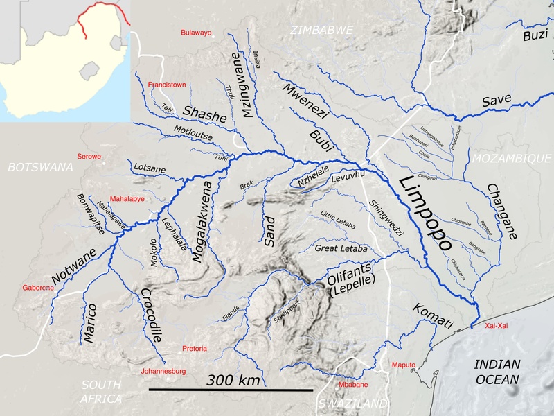
Limpopo River
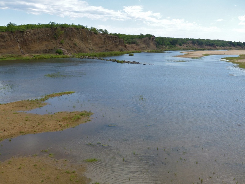
A transboundary river that flows northeast from South Africa into Mozambique and the Indian Ocean. It runs along or near Limpopo and Mpumalanga provinces and forms borders with Botswana and Zimbabwe in places. It is a major regional river that supports wildlife, irrigation and cross-border water use.

Tugela River
A major river in KwaZulu‑Natal that rises in the Drakensberg and flows to the Indian Ocean. It supplies water to towns and farms and feeds the famous Tugela Falls in the highlands. It is an important river for local water supply and has several dams.

Olifants (Mpumalanga)
A large eastern river that flows from Mpumalanga through Limpopo province toward Mozambique. It runs through national parks and farmland and joins the Limpopo basin. It is known for its role in irrigation and for water quality issues from mining and agriculture.
Breede River
A wide river in the Western Cape that flows to the Indian Ocean. It drains fertile valleys used for fruit and wine growing. It supports irrigation, local towns and outdoor activities like boating and fishing. It is a key river for Western Cape agriculture.
Berg River
A Western Cape river that flows from the mountains to the Atlantic Ocean near the Cape Town region. It supplies water to towns and farms and feeds the Berg River Dam. It is important for local agriculture and water security.
Gouritz River
A river in the southern Western Cape that flows to the Indian Ocean. It drains a semi‑arid region and supports irrigation and small towns. It has a wide estuary near its mouth and is important for local farming and biodiversity.
Sundays River
An Eastern Cape river that flows into Algoa Bay. It runs through the Sundays River Valley, which is a major citrus growing area. It supplies irrigation water and has an important estuary near the coast.
Great Fish River
A large Eastern Cape river that flows to the Indian Ocean near Kenton‑on‑Sea. It has historical importance and feeds irrigation for farms. It also forms wide floodplains and supports birdlife and local towns.
Great Kei River
An Eastern Cape river that flows to the Indian Ocean near Kei Mouth. It drains inland areas and forms a notable estuary. It marks regional boundaries and supports local agriculture and fishing.
Umzimvubu
A river in the Eastern Cape that flows from the highlands to the Indian Ocean near Port St Johns. It drains rugged terrain and supports rural communities. It is included for its size and role in coastal ecology and local water supply.

Umgeni
A KwaZulu‑Natal river that flows to the Indian Ocean near Durban. It supplies water to the Durban metro and surrounding towns. It passes through dams and urban areas and supports industry and recreation.
Mzimkulu
A river on the eastern seaboard that flows to the Indian Ocean near Port Shepstone. It drains parts of the highlands and coastal plains. It supports irrigation and local communities and forms scenic valleys.
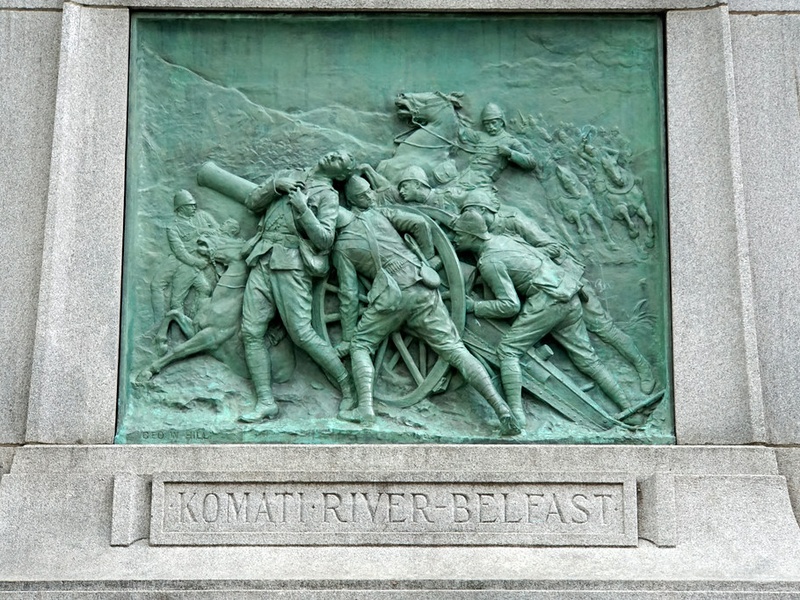
Komati
A river that rises in Mpumalanga, passes through Eswatini, and flows to Mozambique. It supplies water for irrigation and power generation. It is notable for cross‑border water use and varied landscapes along its course.
Crocodile (Limpopo)
A Crocodile River that feeds the Limpopo basin and runs through Limpopo and neighboring areas. It supports irrigation and wildlife and joins larger rivers en route to the Limpopo. It is distinct from other Crocodile rivers in the country.
Luvuvhu
A river in northern Limpopo that flows through parks and into the Limpopo near the Pafuri area. It supplies water to wild landscapes and supports rich biodiversity inside protected areas. It is included for its role in northern river systems.
Letaba
A major river in Limpopo province that drains into lowland regions and supports farming and wildlife. It feeds dams and runs through areas used for irrigation and conservation. It is part of the network of rivers feeding the northern lowveld.
Olifants (Western Cape)
A separate Olifants River in the Western Cape that flows northwest to the Atlantic. It drains parts of the Western Cape mountains and supports agriculture and towns. It is listed to avoid confusion with the larger Olifants in the northeast.
Gamtoos
An Eastern Cape river formed by joining smaller rivers and flowing to the Indian Ocean near Humansdorp. It drains fertile valleys and supports large irrigation projects. It has an important estuary and serves local agriculture.
Mhlathuze
A KwaZulu‑Natal river that flows to the coast near Richards Bay. It supports one of South Africa’s major harbours and heavy industry. It supplies water to towns, farms and industrial plants and has large associated wetlands.
Mkuze
A river in northern KwaZulu‑Natal that runs through conservation areas toward the Indian Ocean. It feeds wetlands and estuaries that support diverse wildlife. It is important for conservation and local communities in the Maputaland region.
Buffalo River
An Eastern Cape river that flows through East London to the Indian Ocean. It supplies city water and has a broad estuary. It is used for recreation, drinking water and supports local industry and wildlife.
Keiskamma
An Eastern Cape river that empties into the Indian Ocean south of East London. It forms a natural estuary and supports local fishing and farming. It is included for its regional importance and coastal ecology.
Swartkops
A river in the Eastern Cape that flows into Algoa Bay near Gqeberha (Port Elizabeth). It drains urban and rural areas and supplies water to local towns. It has an estuary used by birds and fish and faces urban water pressures.
Kowie
A small to medium river in the Eastern Cape that flows into the sea at Port Alfred. It has a tidal estuary that supports recreation and local fisheries. It is included for its coastal town and estuary value.
Harts River
A northern river that flows through parts of North West and Northern Cape to join the Vaal system. It feeds dams and supports farming in arid regions. It is notable as a Vaal tributary and for seasonal flows.
Molopo
An intermittent river in the dry northwest that forms part of borders with Botswana. It rarely reaches the Orange River and is often dry. It is notable for its ephemeral nature and border role.
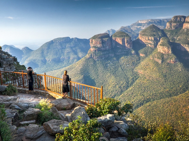
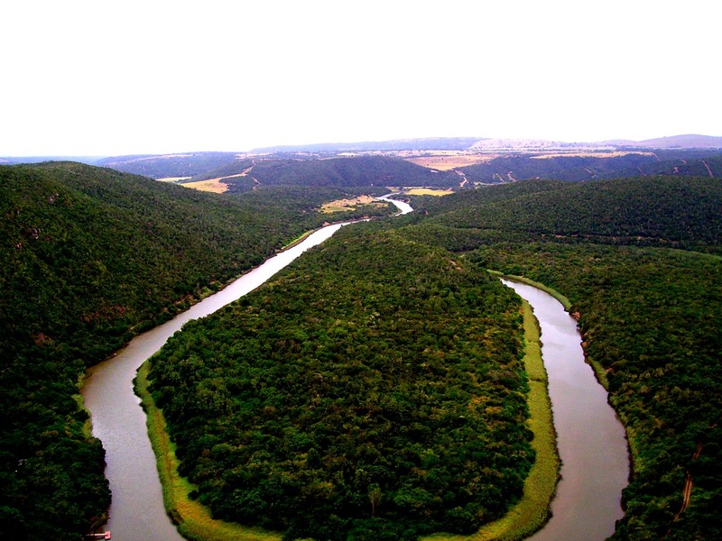
Blyde
A river in Mpumalanga known for the scenic Blyde River Canyon. It flows through mountainous terrain and joins the Olifants system. It is included for its striking landscapes, tourism value and river scenery.